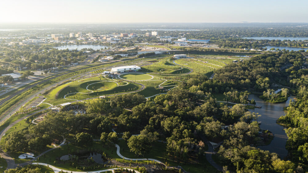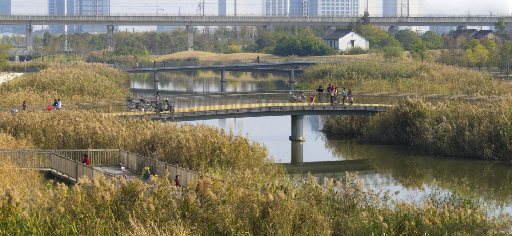
嘉定中央公园
中国上海
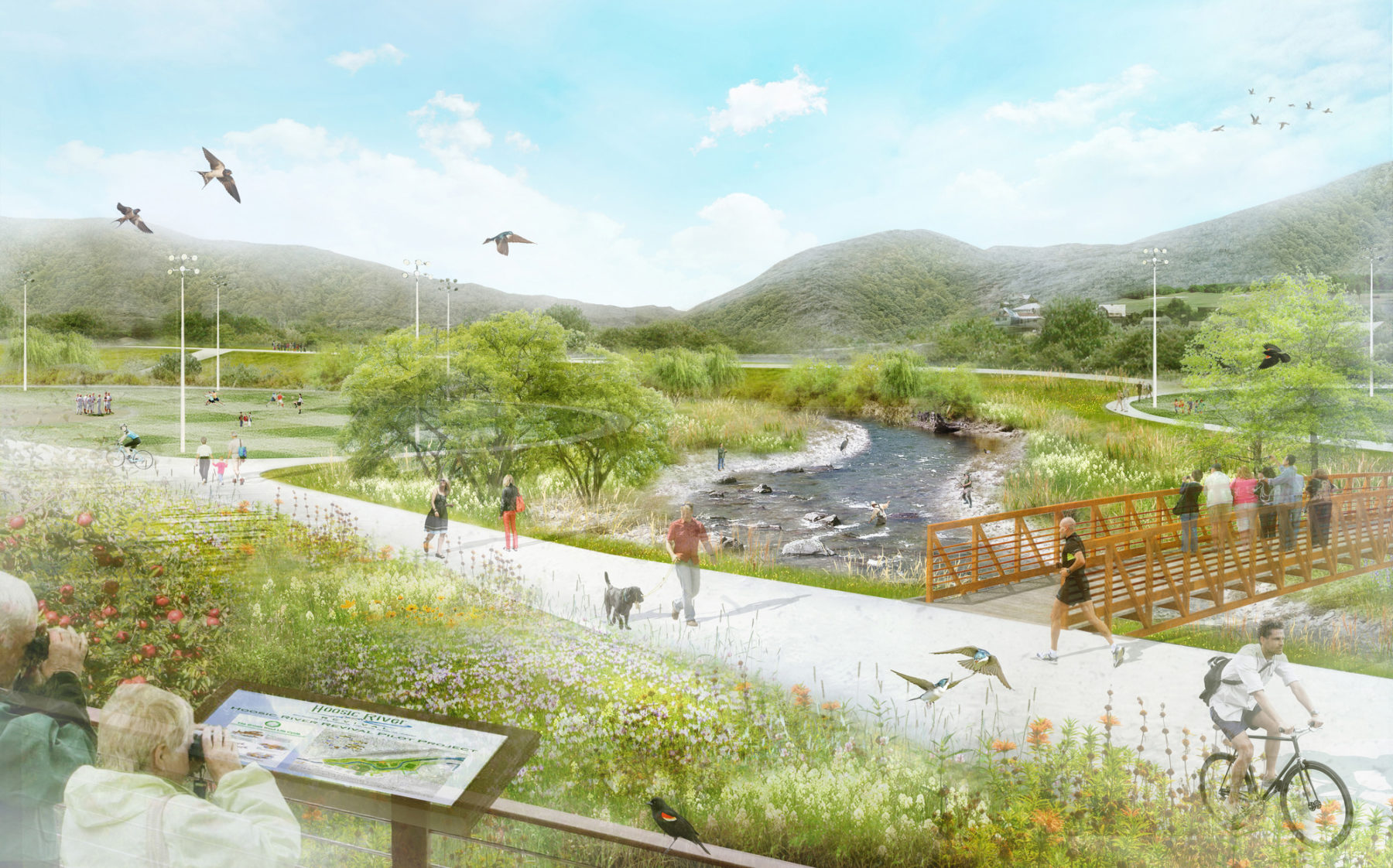
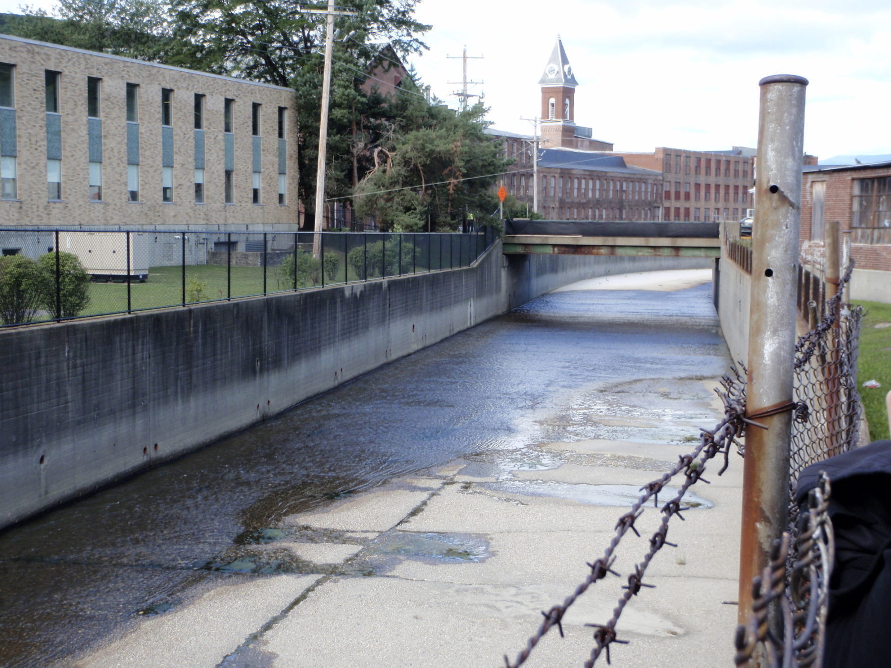
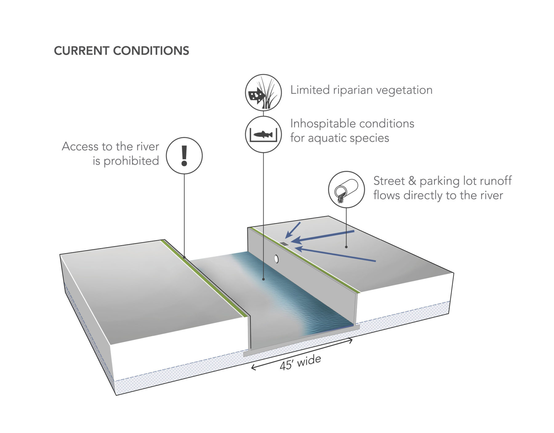
坐落于伯克夏尔山北侧的胡塞克河谷,是新英格兰南部风光最秀美的地区之一。与其他历史悠久的工业城镇一样,马萨诸塞州北亚当斯市从前是兴旺的工业中心,这某程度上可归因于其两河汇流的地理位置。胡塞克河南北两条支流过往虽担当着推动城市经济发展的角色,但是偶有泛滥的河水却涌向城市,造成破坏。上世纪二十到四十年代期间,由于河水频频泛滥,居民向美国陆军工程兵部队寻求协助,得出的解决办法是建造十五尺高的混凝土防洪墙和巩固墙体,以保护城市免受洪水侵袭。过去六十多年来,这些防洪措施虽然起了作用,但这唯一的作用却窒碍了当地的河流生态,也令居民与属于他们的重要资源分隔开来。
北亚当斯市是全美国最大的当代艺术馆马萨诸塞州当代艺术博物馆(MASS MoCA)的所在地,当地在近年成为了旅游、文化与休闲活动的集中地。不过,流经市中心的胡塞克河却妨碍了城市的重生。随着防洪墙日渐老化,是时候审视解决办法,务求修复河道、鼓励市民再次亲近滨河地带以及重新构思防洪策略。Sasaki与屡获殊荣、致力于河道修复工程的Inter-Fluve公司协作,并联同当地的非盈利社区组织”胡塞克河河道复兴组织(Hoosic River Revival)”及马萨诸塞州政府生态恢复部门,一同重新构想胡塞克河在北亚当斯市中心区的发展前景,并且带领居民实现他们对河流的愿景。
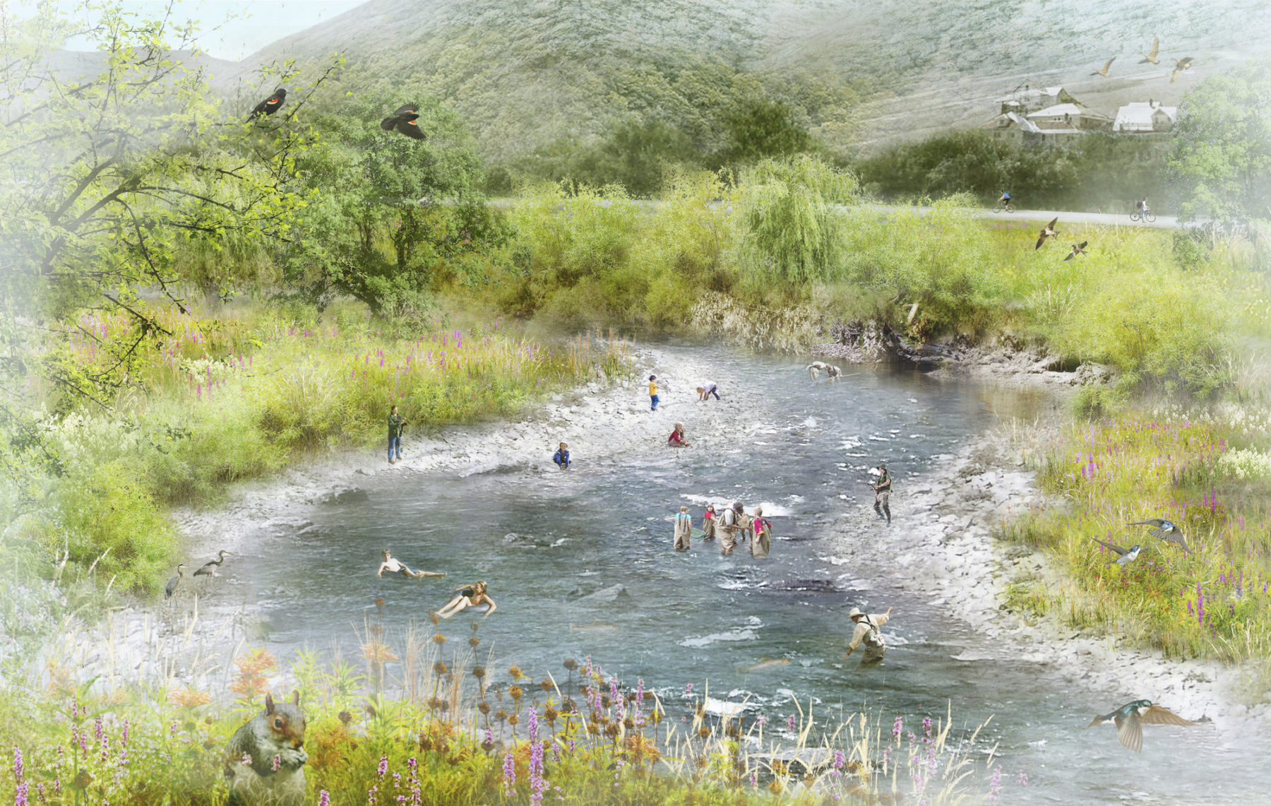
我们的修复策略以自然引领设计,并凭借自然过程创造优势,例如重建河流与以前的洪泛平原之间的关系,使洪水能以自然的方式疏导而不致被白白浪费掉;改善河道两岸的生境;以及提高居民享用河流的机会。胡塞克河经过重新塑造后,不论水中或岸上都将充满生命力。我们的方案为原生冷水物种(如红点鲑和褐鳟)改善生境,同时带来经过重新构思的休闲设施、规划完善的路径以及其他一连串供居民和游客享用的设施。这些改善措施不但为该区带来改变,也能同时维持甚或提升原有的防洪水平。以河道上流较佳的状况为基础,河水修复策略的目标在于发展、提升及重建稳定的河流生境、改善水质以及修复河流内在的连接性。由此策略得出的设计拥有很高的自维护功能,从而减低长远的维护成本。
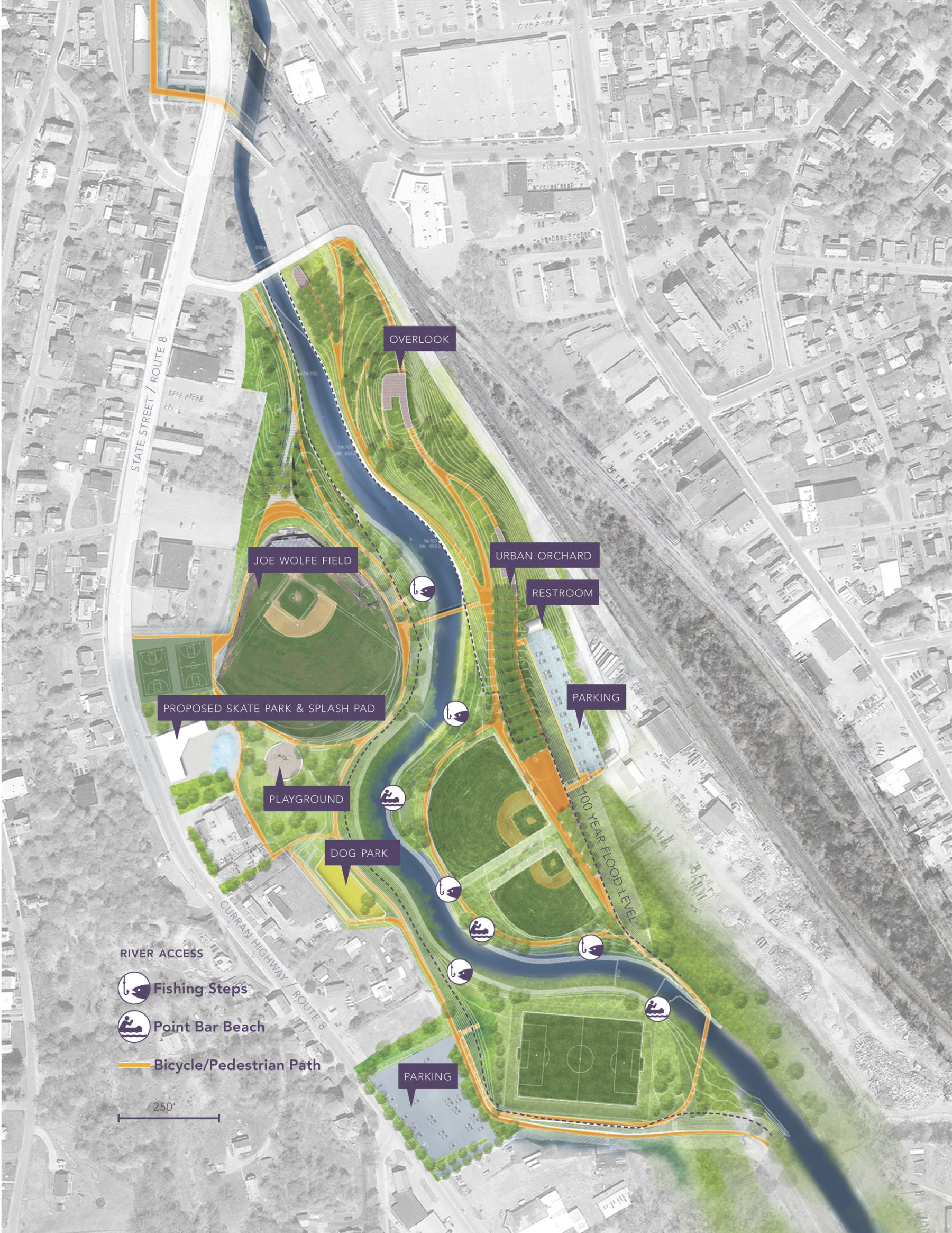
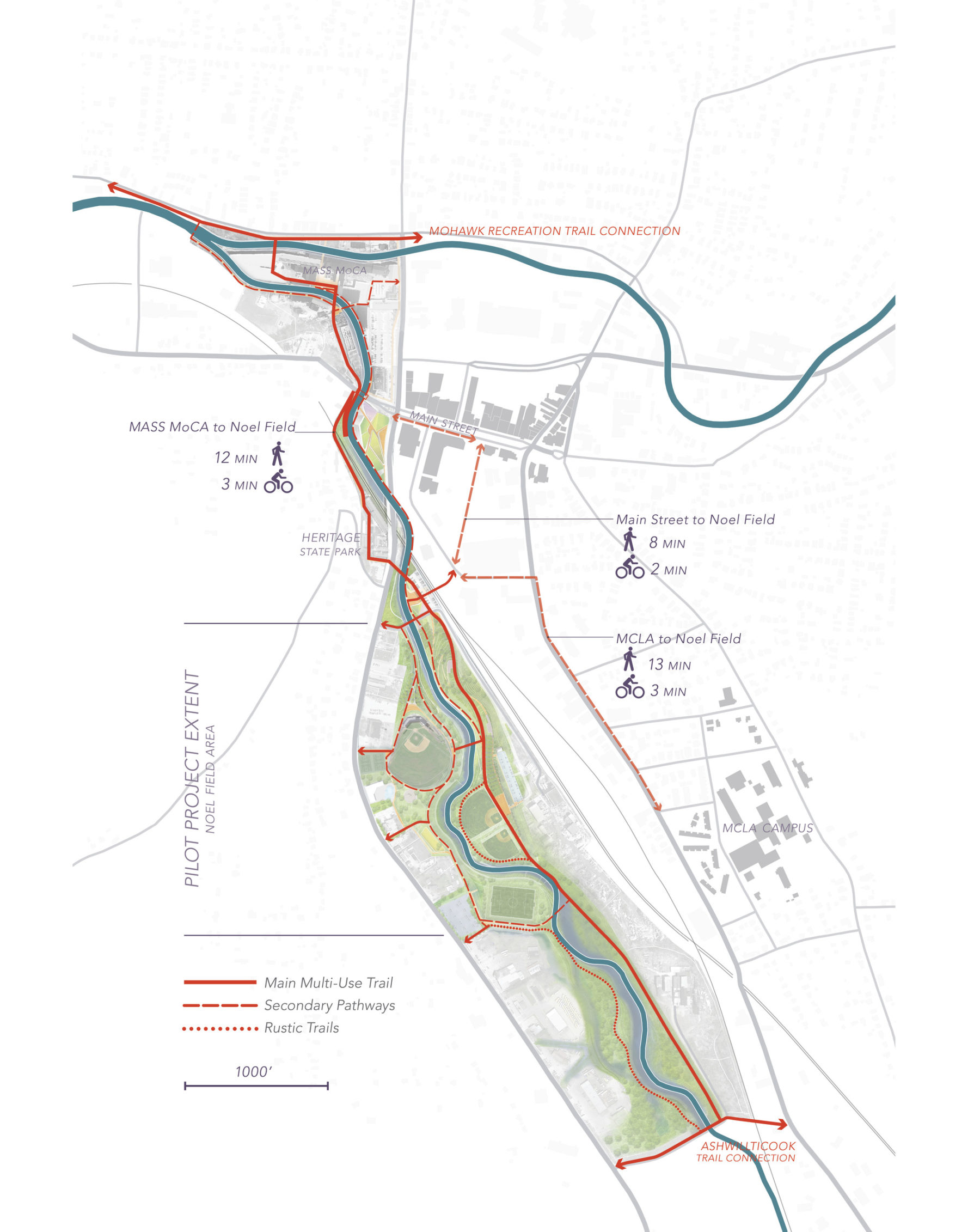
此初步试验项目的成功与否取决于执行。由于土地大多为公有,其约束也最少,因此我们选址南面支流沿岸的草木区和一些由市政府所有的空置地块,进行设计研究和绘制审批用的施工图纸。设计团队早前与北亚当斯市居民进行了多次对话,了解到他们对城市的发展意念和梦想,从而在试验范围注入了许多由居民辨别为须优先关注的元素。本计划凭借凸显胡塞克河在城市里所发挥的联系贯通作用,以改善主街道、马萨诸塞州当代艺术博物馆、州立遗址公园和马萨诸塞州文理学院之间的通行情况。从北到南、长2.4公里的多用途步道沿着整条南面支流而建,沿途景色宜人,并与莫霍克(Mohawk)和阿苏韦提库克(Ashuwillticook)两条休闲步道计划中的延伸部分相接。作为北亚当斯市发展愿景的其中一环,上述措施与市内其他一系列进行中的规划和重建工作相辅相成。自本项目伊始,胡塞克河河道复兴组织与美国陆军工程兵部队人员一直紧密合作,以加快审批程序。配合周密的设计过程以及各设计阶段的水利模型制作,河道修复工作预计在2020年完成。
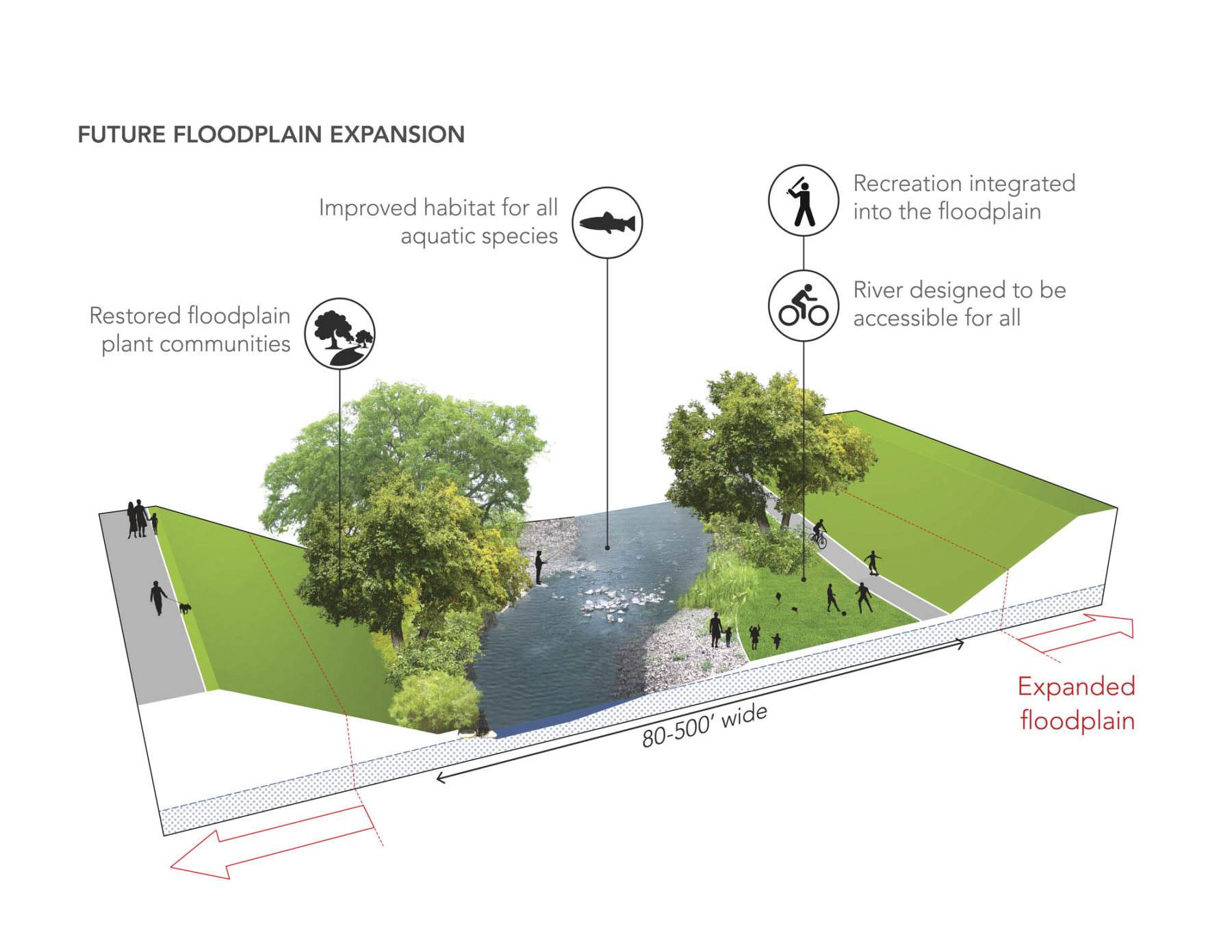
Allowing nature to inform design, our restoration strategies capitalize on natural processes—such as reestablishing the river’s connection to its historic floodplain, providing a natural ‘relief value’ for flood waters, improving the riparian habitat, and enhancing access to the river. Reinvented as a river filled with life, both in the channel and along its banks, the plan includes improved habitats for native cold-water species, like brook and brown trout, reimagined recreational facilities, well-planned paths, and a host of other amenities for residents and visitors. These improvements will transform the area while maintaining or exceeding the existing level of flood protection. Based on more ideal river conditions upstream, the goal of the in-channel restoration is to develop, enhance, and reestablish stable riverine habitats, improve water quality, and restore in-stream connectivity. This strategy results in a design that is largely self-maintaining, reducing overall long-term maintenance costs.
The plan for the initial pilot project is rooted in implementation. With the largest amount of publicly owned land available, and the fewest constraints, existing parkland and several vacant city-owned parcels along the South Branch were selected for the design study and permit drawings. The pilot area incorporates many key elements identified as priorities by the community from earlier conversations held to solicit the ideas and dreams of North Adams’ residents. The plan celebrates the Hoosic River as a connecting feature through the city, improving access between Main Street, MASS MoCA, Heritage State Park, and the Massachusetts College of Liberal Arts campus. The scenic multi-use trail runs north-south along the entire 1.5 mile length of the South Branch, tying into proposed extensions of the Mohawk and Ashuwillticook recreation trails. As part of a greater vision for North Adams, these efforts complement the numerous, on-going planning and redevelopment efforts throughout the city. Since the inception of this project, Hoosic River Revival has been working closely with the U.S. Army Corps of Engineers officials to facilitate the authorization process. Coupled with a thorough design process and hydraulic modeling of each design phase, the river restoration is expected to be completed in 2020.

想了解更多项目细节,请联系 迈克尔・格罗福.