Skip to content

From Runway to Greenway: How Santa Monica is Co-Creating its Airport’s Future

How can a municipal airport transform into a place for people and nature? In Santa Monica, the answer lies within its diverse community. With the announcement of the Santa Monica Airport’s closure, an opportunity to develop a new public space emerged. In 2014, Santa Monica voters approved a measure that would allow parks, public open spaces, recreational facilities, and other supporting uses on the site until voters approve limits on the uses and development of the land. The Santa Monica Airport Conversion Project is guided by Measure LC, centered on a “great park.” 

Sasaki’s team of landscape architects, planners, urban designers, and architects are leading the planning effort. For the last year, they have spent time getting to know the city, its community members, its history, and its landscape. In January 2025, with ongoing community input, the City Council instructed the project team to expand the program to include development options while continuing to focus on a “great park” with community-supported uses. 

After months of public engagement, the design team revealed three test-fit scenarios for public comment. To develop these three options, the team designed a multi-modal engagement process that leverages in-person and online tools. Community members’ collective voices are creating a roadmap for designing a vibrant, accessible, and sustainable new green space for Santa Monica.

Within each phase of engagement, the team has collected, analyzed, and summarized the findings for the City Council and the community. Comments collected from these presentations are then integrated into the next phase of engagement. This ensures a collaborative process that encourages participation and allows the community to see their ideas reflected in the final vision. 

The Process

Laying the Groundwork: Site Analysis and Historical Context

In order to understand the opportunities and equip respondents with a shared baseline from which they can share their aspirations, the team studied the site’s historical context, current conditions, and its connection to the urban and natural environment. Casting a wide net, the first phase was designed to be an investigation into the site and the community’s diverse goals. The airport is situated within Santa Monica’s dense urban fabric, positioning the future park as a well-connected resource. Its location also offers views of the mountains and the ocean, becoming an important ecological stepping stone for local species to adapt to new habitats as the climate changes. 

Located west of downtown Los Angeles, Santa Monica lies on the unceded territory of Kuruvungna and is the ancestral home of the Gabrieleño/Tongva. The airport, located about two miles inland from the Pacific Ocean, was built on a barley field. It began operation as the Santa Monica Airdome in the 1920s and served as a base for the US Army Air Service reserve during the second world. After World War II, the airport became a “reliever” airport to mitigate air traffic for Greater Los Angeles, primarily used for business, training, and personal flights. As a result, 80% of the site is covered by impervious surfaces. 

Phase One: Charting the Course

During the project’s first phase in the spring and summer of 2024, the design team led six in-person events and spoke to hundreds of community members. These events highlighted the site’s features and context, provided an overview of the planning process, and included interactive voting on questions designed to understand the different aspirations within the community. Participants shared how they would like to access the site from their homes and what types of programming they wanted to see. Many viewed the site’s size as a rare opportunity to prioritize passive recreation and landscape uses, which they felt were lacking in Santa Monica. Results from this phase also indicated a strong desire to reduce noise and pollution from air traffic while increasing recreational opportunities, such as new sports fields and courts.

Phase Two: Discovering Place & Setting the Scene

Using the assessments and feedback from Phase 1, the second phase expanded the team’s analysis to include an existing conditions summary and an exploration of funding strategies. The end of this phase concluded with a draft set of guiding principles that would provide the foundation for the three possible scenarios.

One of the goals of this phase was to communicate the balance between benefits and trade-offs for the different programming elements the community wanted to see. The team designed an online and in-person game called Balance Builder, in which respondents were asked to balance the top 50 potential program uses based on their anticipated climate impact, effect on the site’s future financial self-sustainability, and site inclusivity and accessibility. 

Moving beyond merely asking the public for their ideas, Balance Builder invited participants into the decision-making process on a conceptual level. Playing the game revealed the considerations designers must weigh when designing a public park.

Online Engagement

Throughout all three phases, the dedicated project engagement website—designed in-house by Sasaki’s Strategies team—has played a key role in keeping the community informed about the project’s progress and collecting feedback. Community members can easily access more information about the history of the project and airport and find updates on the process. 

The website hosted online surveys and Balance Builder, allowing the City, Sasaki, and community members to easily share these tools and generate interest in the effort. Resources collected on the website include virtual educational sessions, summaries of engagement sessions, and the history of previous engagement efforts that led to this project. The engagement reports and other online resources create more transparency in the process, so the community can see how each step informs the next.

The Results

Defining Guiding Principles Collectively

With early engagement results in hand, the Sasaki team solidified the five guiding principles that summarized respondents’ aspirations and were approved by the City Council. While the summary below presents a broad picture, more detailed information can be found on the Santa Monica Airport Conversion Project engagement website.

Start with Nature 

This project will transform aviation land into a regenerative urban ecosystem through habitat creation and indigenous planting. The park will serve as a model for ecological urban development.

Inspire Wonder 

The park creates an inclusive sanctuary where people can connect and tap into wonder through integrated spaces for art, play, and gathering. The park should spark creativity and foster belonging for visitors of all ages, abilities, and backgrounds.

Balance Economics 

The project will establish a self-sustaining model by balancing revenue-generating activities with community amenities, ensuring long-term operational sustainability. It embraces circular economy principles while allowing for incremental development based on funding availability.

Amplify Versatility 

The project will offer flexible spaces that serve both daily individual needs and larger community gatherings. The framework prioritizes sustainable transportation and consistent community engagement, ensuring the space remains relevant across generations.

Celebrate Place 

The project honors Santa Monica’s layered history while creating a distinctive contemporary identity through thoughtful integration of pre-colonial heritage and aviation history. 

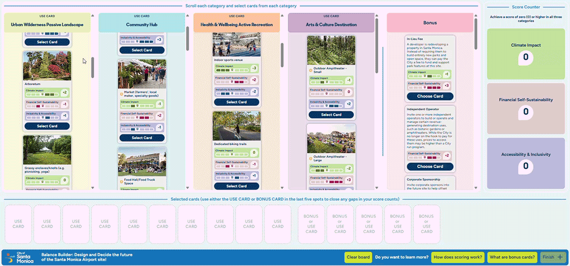
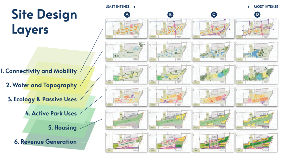
From Site Design Layers to Test-Fit Scenarios

In Phase 3A, the team shared six overlapping layers that helped establish three potential visions for the site. Each layer has a gradient of intervention—Option A within a given layer represents the least intense expression of the system while Option D represents the most intense. 

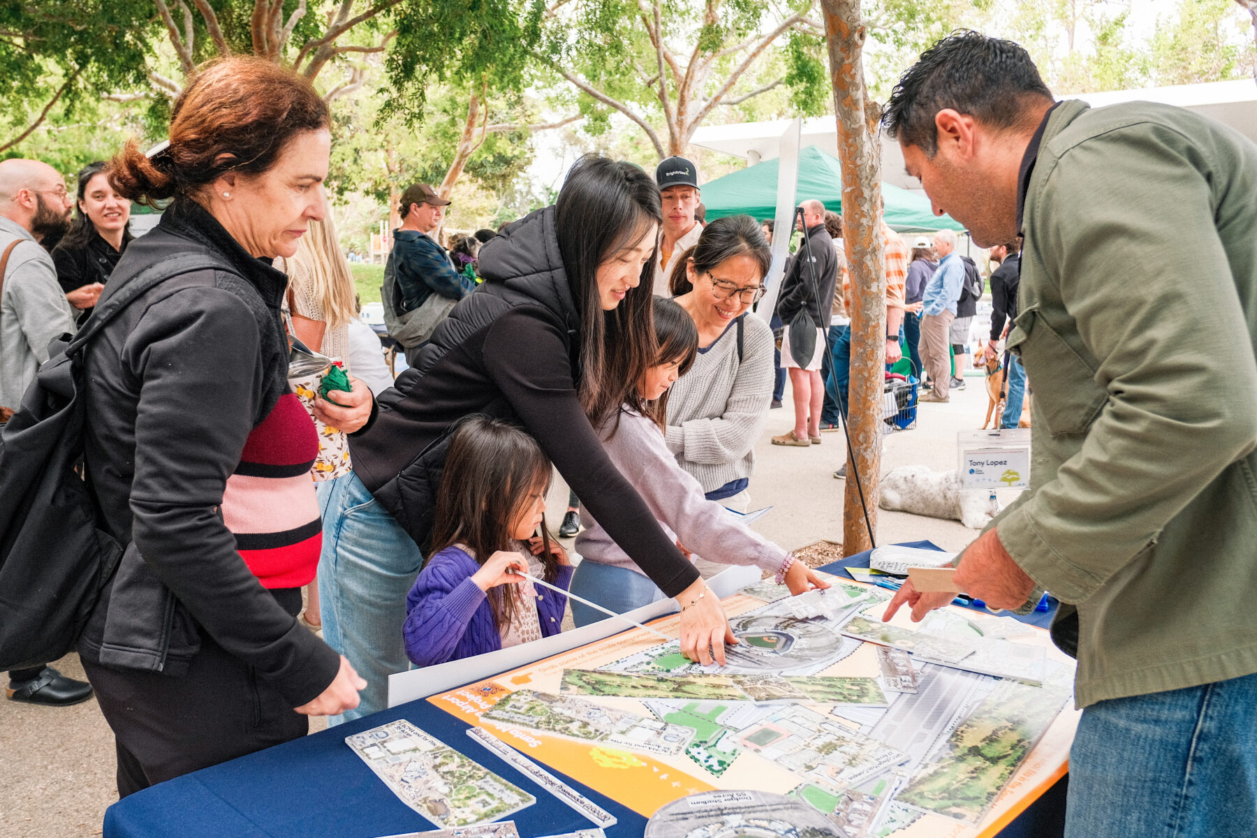
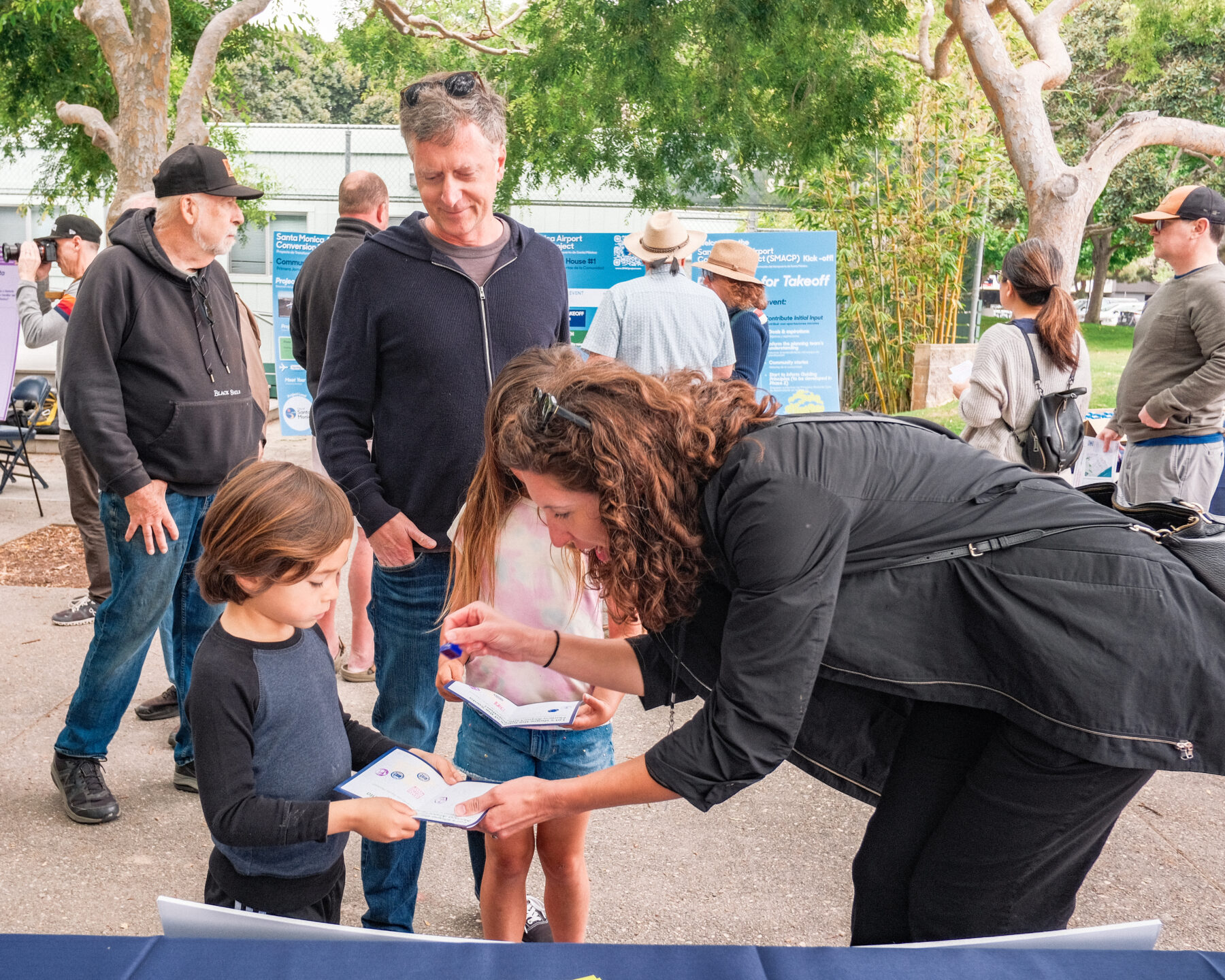
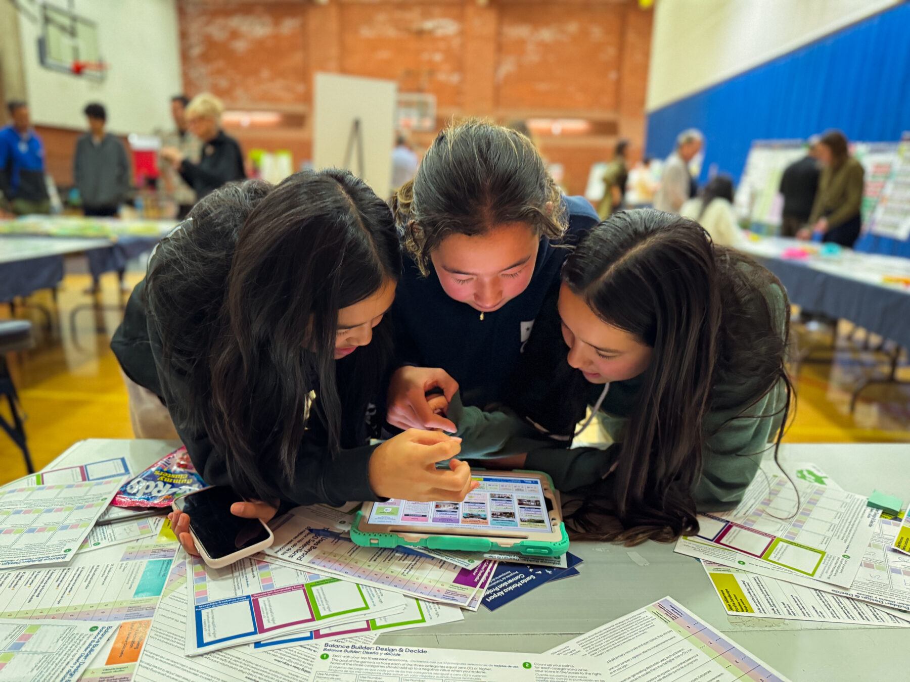
The layers allow the team to explore the feasibility, potential benefit, trade-offs and impact of each decision. Through an online survey, the team collected input on each of the layers, providing a foundation for the three test-fit scenarios. The layers are not design proposals, but rather possibilities that carry their own benefits and trade-offs.

The site design layers include:

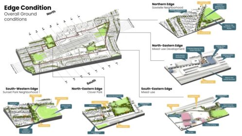
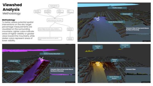
Connectivity and Mobility considers the ways of movement to, around, and within the site, as well as site thresholds and gateways to the surrounding neighborhoods.

Water and Topography looks at the way earth and water can either drive the design work or be shaped by it to influence the experience of a place. 

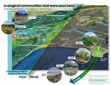
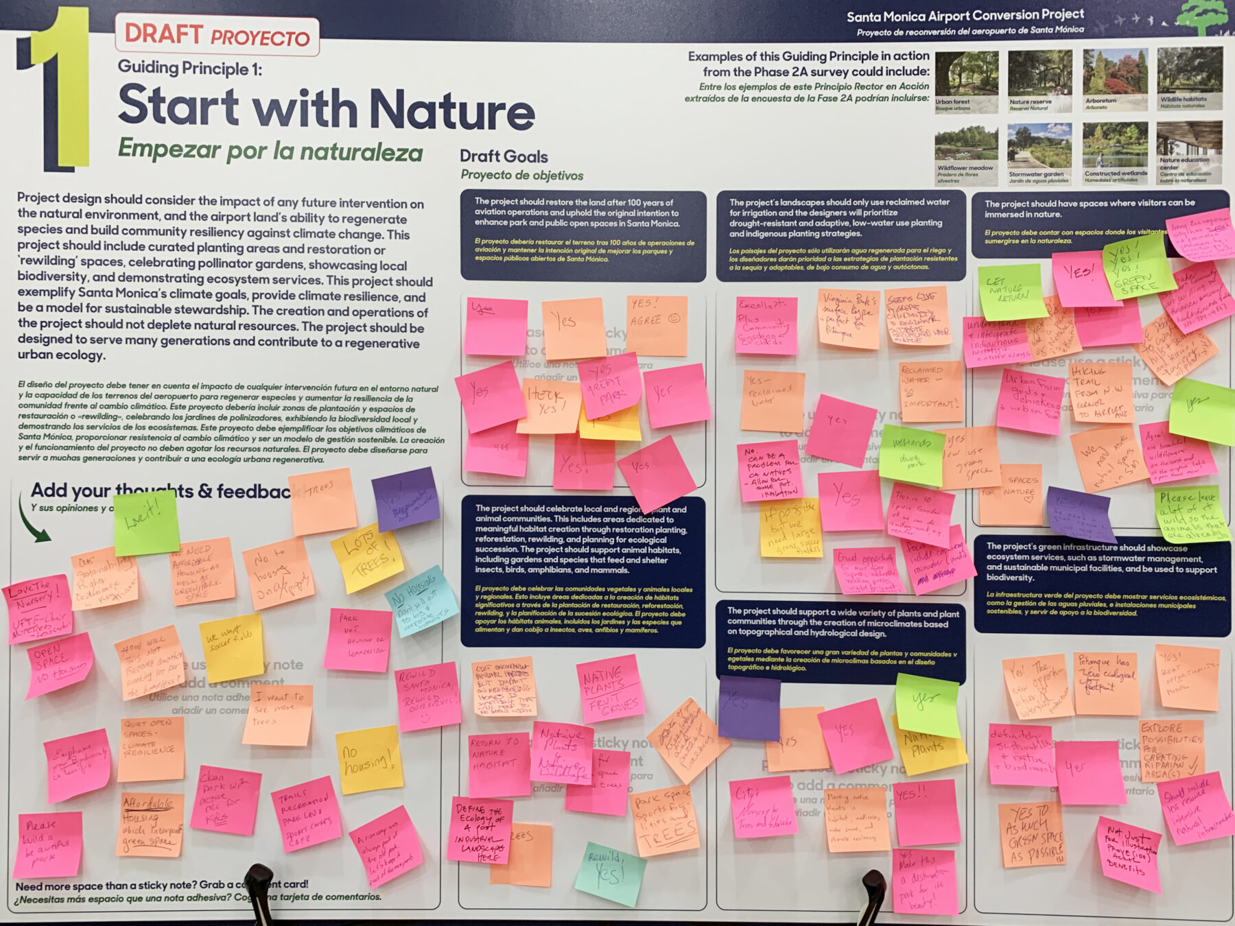
Ecology and Passive Uses covers the ways ecology can thrive and how passive park uses could create enriching and distinctive experiences in Santa Monica. 

Active Park Uses examines ways in which the future site can be a community resource and destination for active park, sport, and recreation uses.

Housing, which was added at the direction of the City Council, looks at different approaches to including housing and creating great neighborhoods on site. The planning team is looking to understand what types of housing may be supported by the community. Any housing development would require a vote pursuant to Measure LC.

Revenue Generation looks at different approaches to including revenue-generating uses and models on site.

Envisioning the Future of the Santa Monica Airport Site Together

As Santa Monica prepares for this historic transformation, the collaborative planning process between Sasaki, the City, and community members demonstrates how complex urban redevelopment can be guided by community voices. The conversion of the airport represents more than a change in land use—it embodies a collective vision for a sustainable, inclusive, and vibrant future. As the project moves forward, the process of co-creating a significant community-serving project will serve as a model for how cities can reimagine their infrastructure to better serve people and the planet.

Sasaki colorful logo Sasaki English