Changing Course Competition: A Sustainable Delta for All
Lower Mississippi River Delta
Following catastrophic flooding, HUD awarded $60.4 million to Shelby County to embark on implementing four resilience projects. Three of the four projects are led by Sasaki.
Due to the catastrophic flooding in the Memphis metropolitan area in 2011, Shelby County was selected as an eligible applicant to the National Disaster Resilience Competition, a program sponsored by the US Department of Housing and Urban Development (HUD). Sasaki partnered closely with Shelby County to craft a winning proposal that outlines resiliency strategies that will prepare the area for future natural disasters. As a result of the proposal, HUD awarded $60.4 million to the County.
Four projects were funded with the award money. Sasaki is involved with three of those four projects:
Having secured funding, the team has worked with Shelby County to develop all of the projects in unison. Planning and implementation recommendations focus on nature-based solutions and multi-benefit proposals in alignment with the Mid-South Regional Greenprint, an award-winning plan to connect the four-county region’s green spaces as one of the largest green infrastructure amenities in the nation.
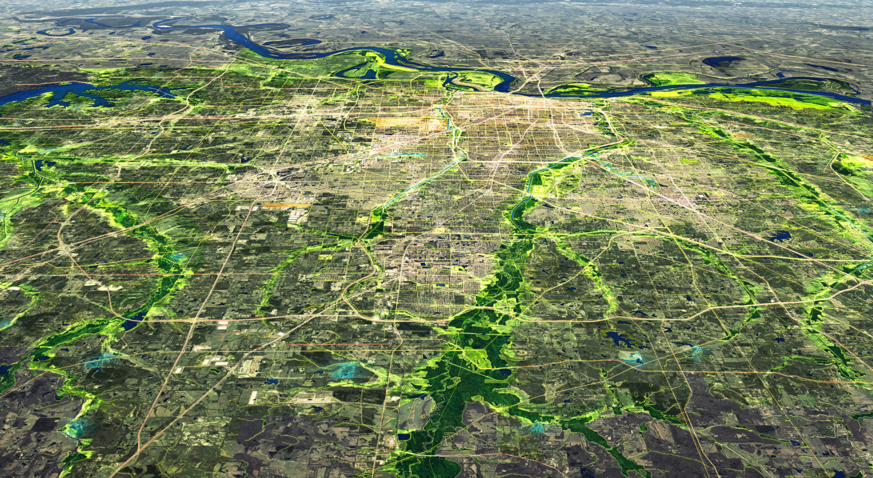
The Mid-South Region, bordered by the Mississippi River to the west and home to several of its tributaries, struggles with significant flooding challenges. While three areas within the Mid-South were awarded funds to implement flood resilience projects to protect some of the region’s low-to-moderate income communities, recovery needs are still pervasive across the region. The Mid-South Regional Resilience Master Plan serves as a toolkit of projects and implementation strategies to help the 18 municipalities and four counties that comprise the region recover from the 2011 floods while also providing protection from other natural hazards that threaten the region and increasing the environmental quality and socio-economic opportunity for all residents of the region.
Effective resilience planning in the Mid-South lies at the intersection of social, ecological and infrastructural systems. Each is an element that refers to the holistic capacity of communities to resist and recover in the face of natural disasters.
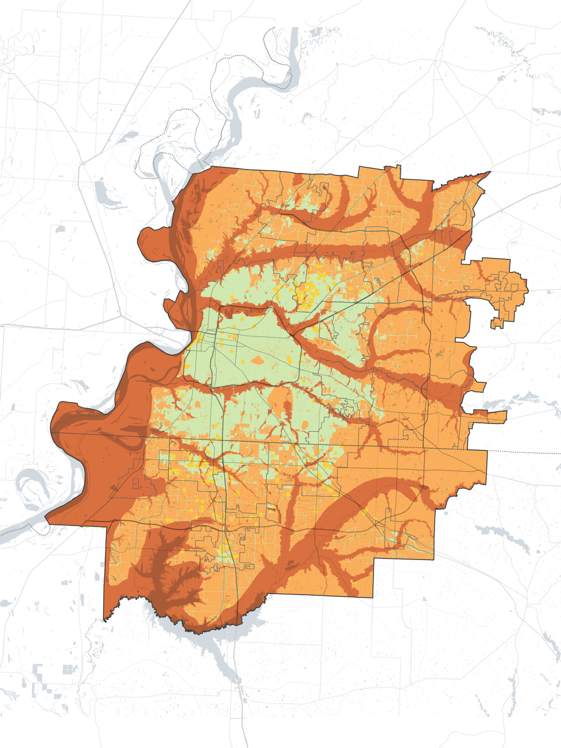
All of the land within the Mid-South was categorized according to its resilience attributes. Areas in green have the lowest level of development risk, avoiding floodplains and sensitive ecological areas. Areas in red have the highest level of development risk, including riparian corridors and floodplains where building would be high risk.
The planning process included local officials, residents, and business owners from across the Mid-South. Together, community goals were identified based on documented hazards and community priorities. The toolkit includes recommendations to improve resilience across multiple hazards in support of the community goals and existing plans. The plan identifies areas of relatively high risk and relatively low risk, with appropriate strategies for development, restoration, and conservation in each zone. In higher risk areas, the team adapted conventional best practices to address the complexities of multiple hazards, for example, flood resilience in an earthquake hazard area.
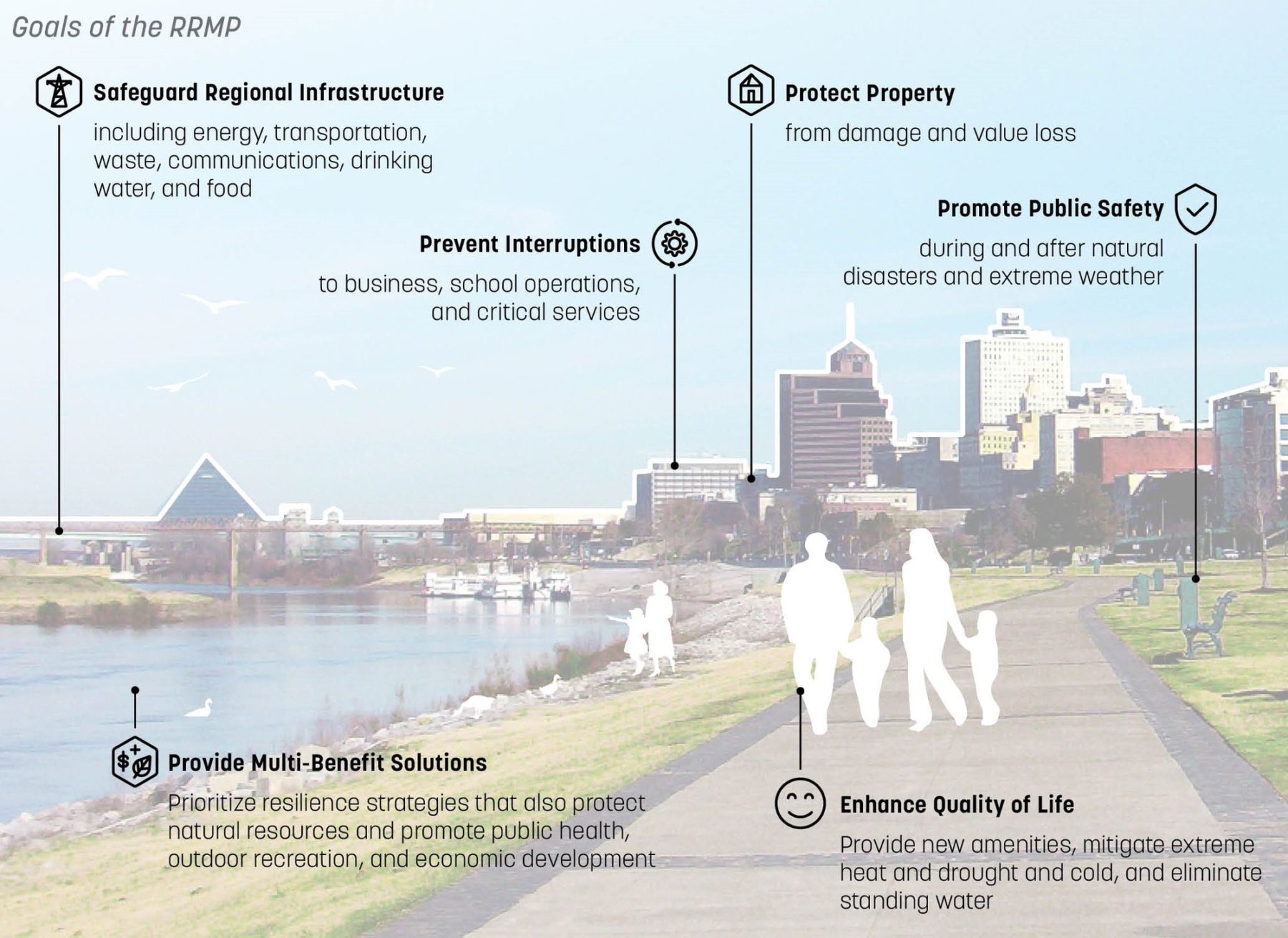
Six community goals were identified during the planning process to guide the development of planning recommendations and implementation strategies
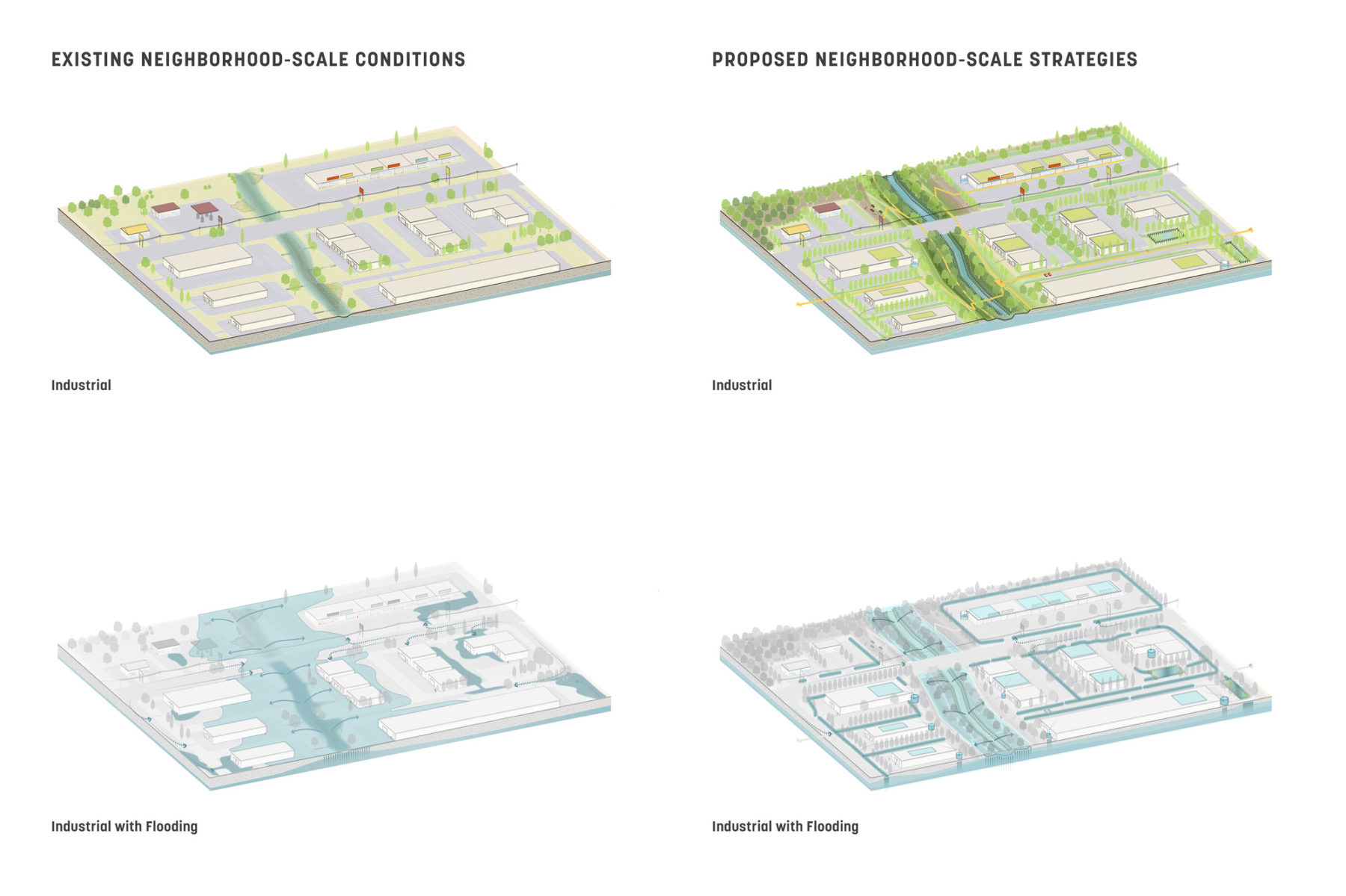
Neighborhood scale strategies aggregate riparian corridor recommendations, land use recommendations, and building recommendations to create a layered approach to resilience. Collectively, these strategies provide enhanced protection than any one strategy on its own. The depicted industrial typology is characteristic of many locations in the region.
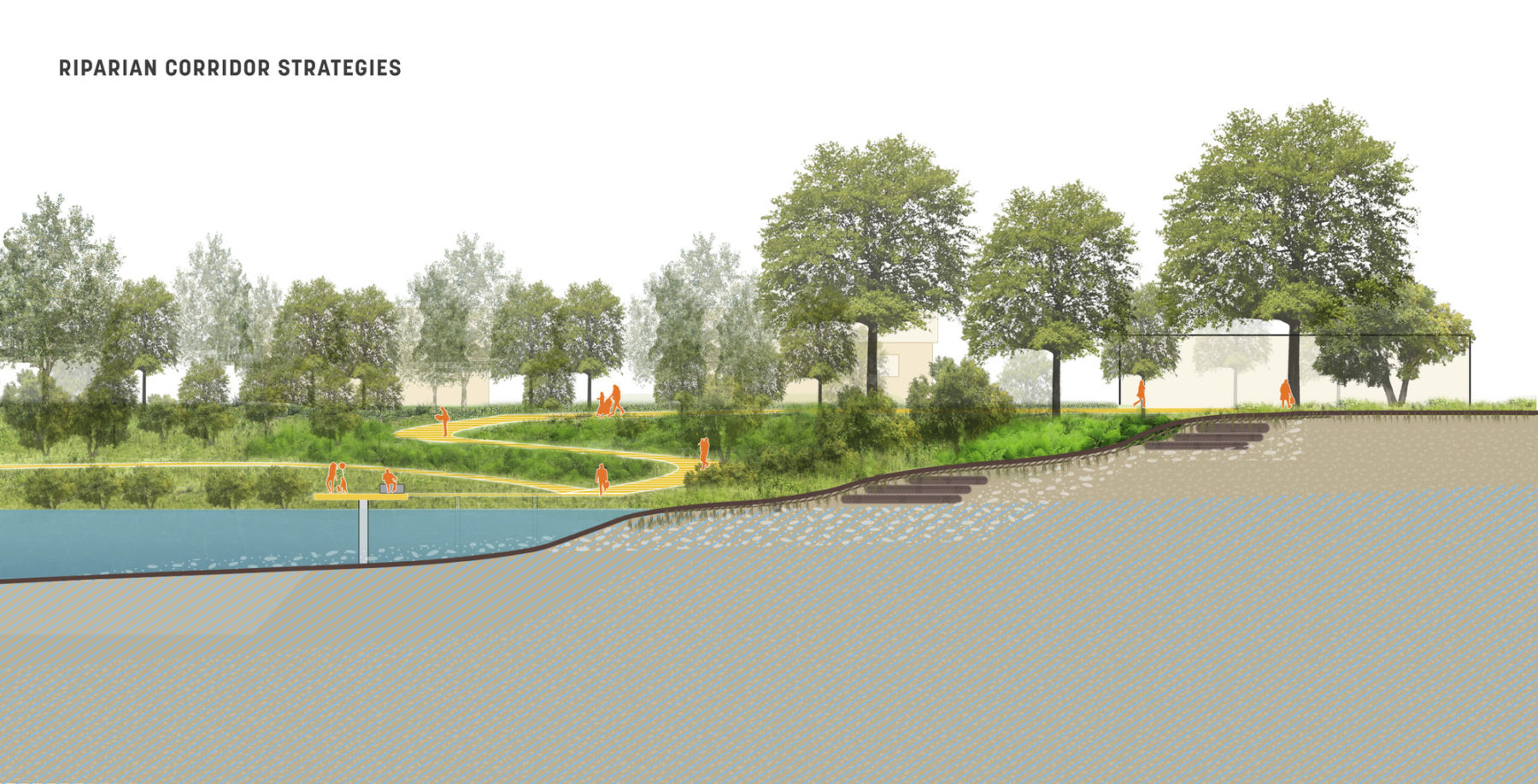
Restoring riparian corridors is a vital strategy for resilience due to the direct reduction in flood risk and the benefits to the local community. Priority sites for riparian restoration were identified because of their proximity to areas that frequently flood, have degraded stream length, proximity to high density population areas, and proximity to available land.
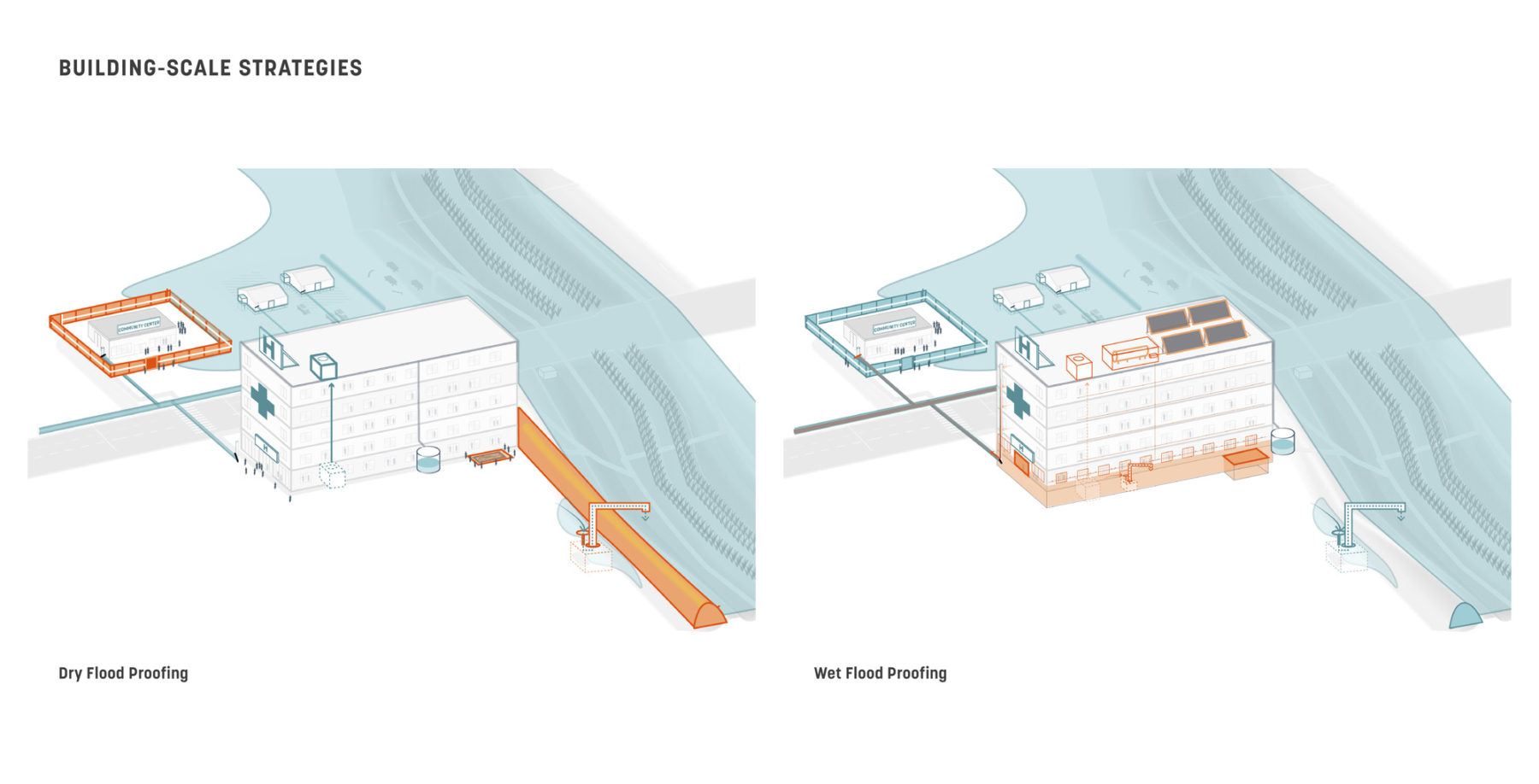
There are no “no risk” areas in the Mid-South region, and there are significant existing population centers located in high risk areas today. Given these challenges, building scale resilience strategies can offer some protection against the region’s natural hazards. A variety of strategies offers owners choices to address their specific requirements based on risk tolerance and level of risk.
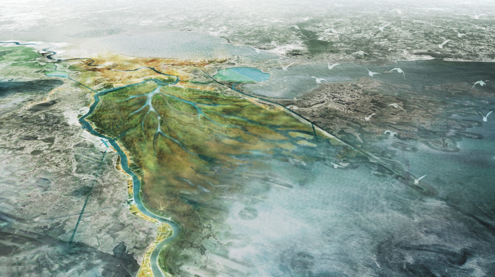
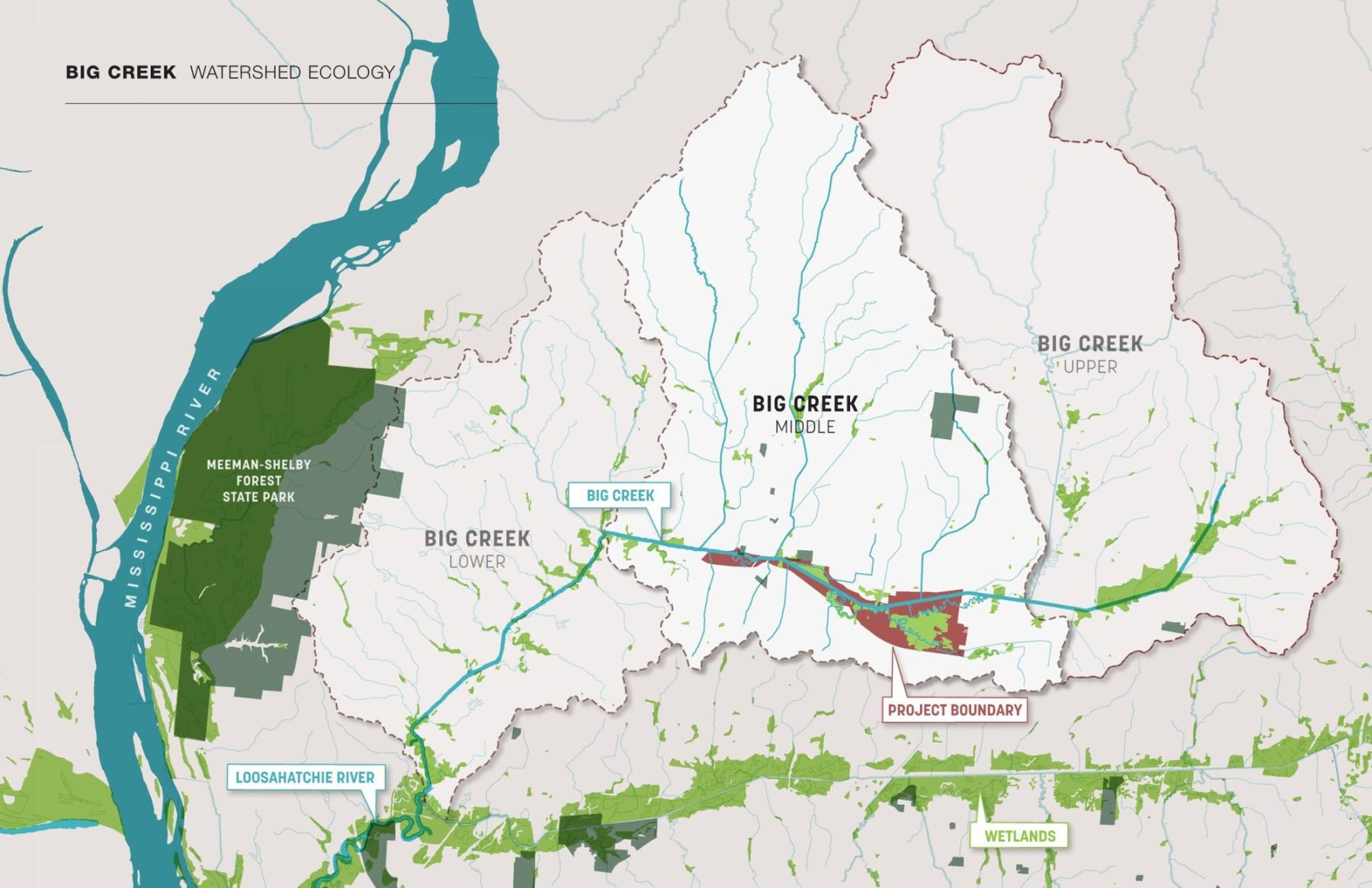
The Big Creek Implementation Plan calls for flood mitigation strategies that protect the Naval Support Activity Mid-South, a major federal airbase that was significantly damaged in the 2011 floods. Additionally, the plan makes way for recreational, economic, and other environmental goals.
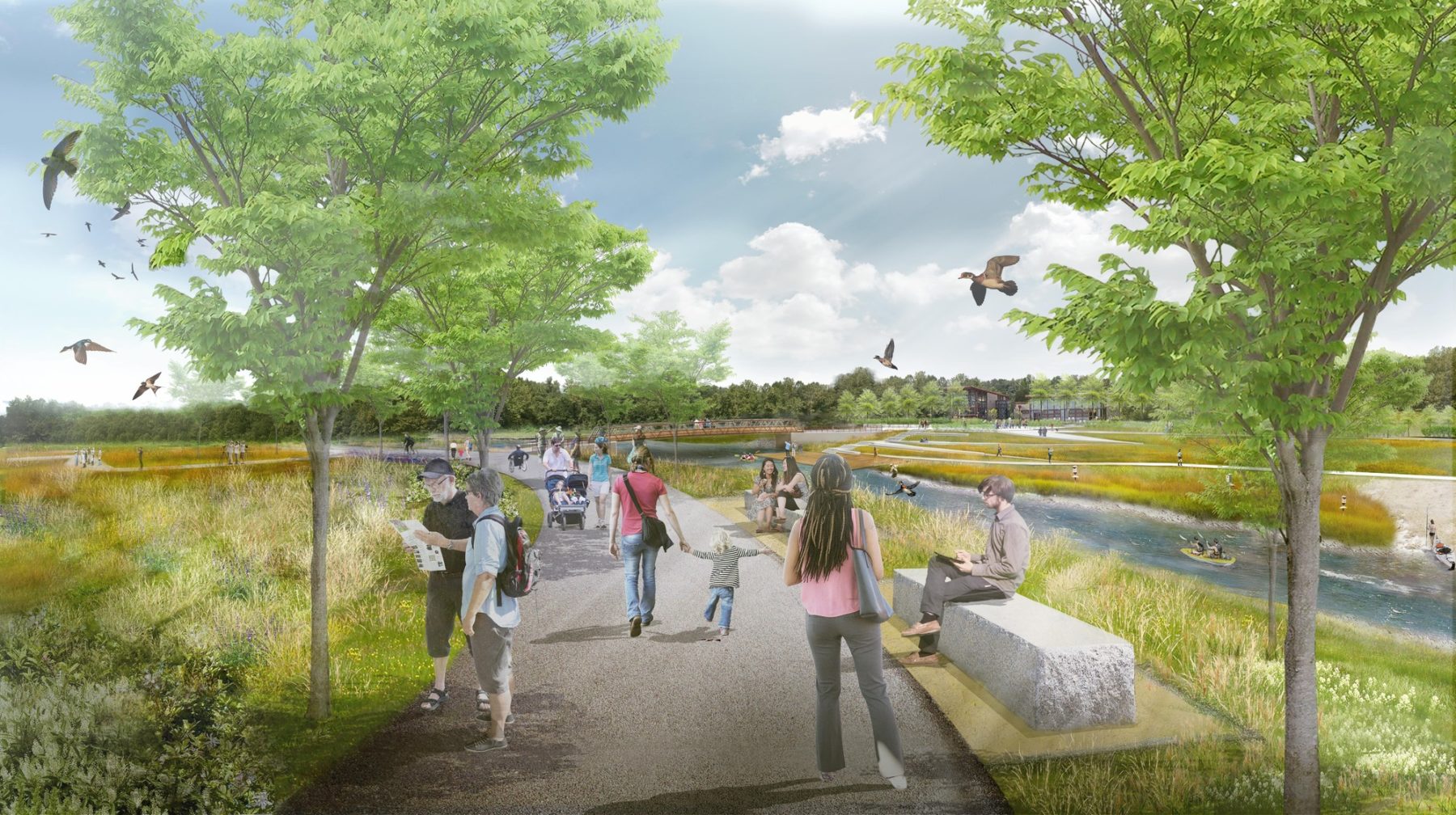
The main facet of the plan is a major park that doubles as a floodway. This floodway will redirect and retain flood waters, protecting the airbase and surrounding community from inundation. Upon completion in 2022, this park will provide recreational and educational amenities in a natural setting, and serve as a critical link in regional hydrology and greenway systems.
The plan and implementation of these projects will help the Shelby County community rebuild from 2011 flood damages and to weather future storms with less damage
Multi-benefit solutions are integrated throughout the design of the Big Creek Implementation Plan
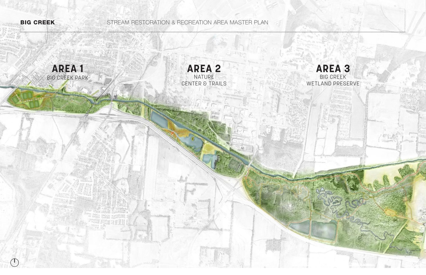
The design team envisions the park will have three distinct areas
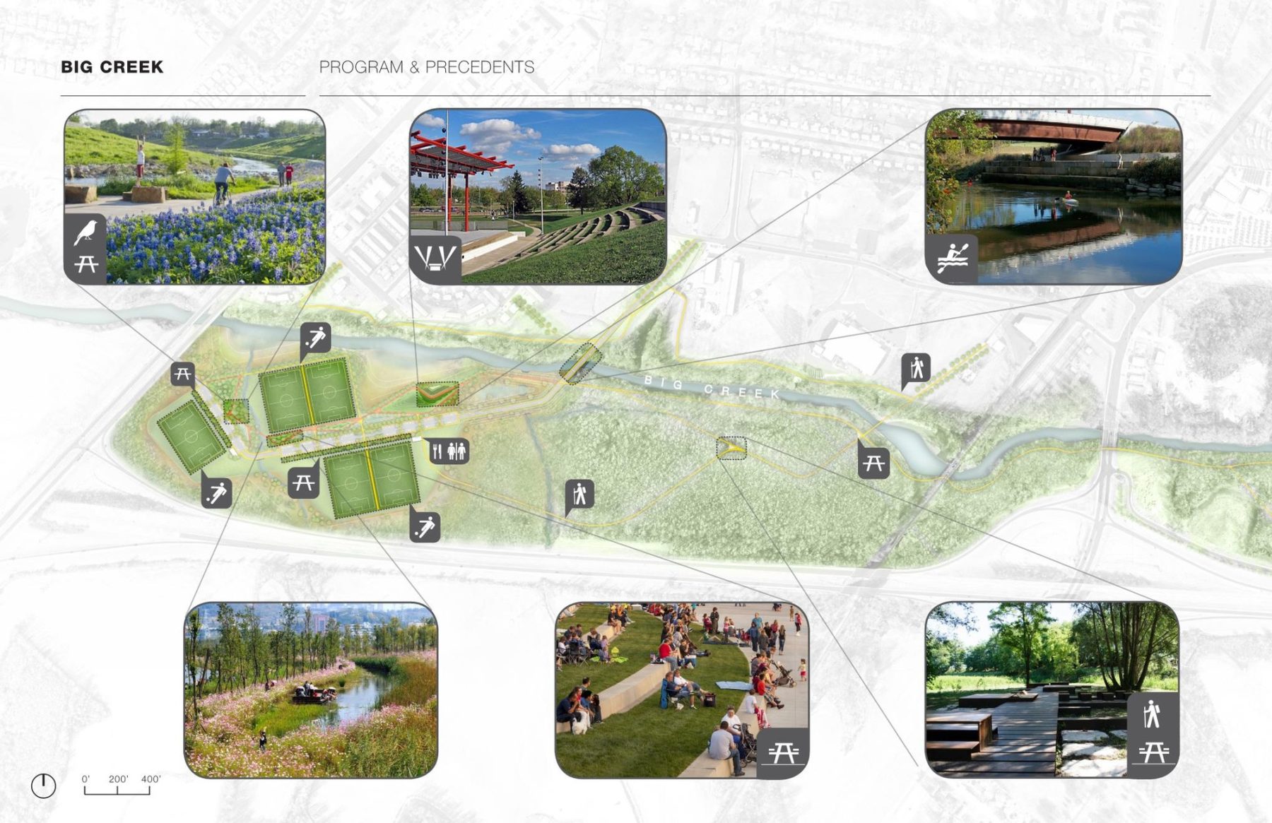
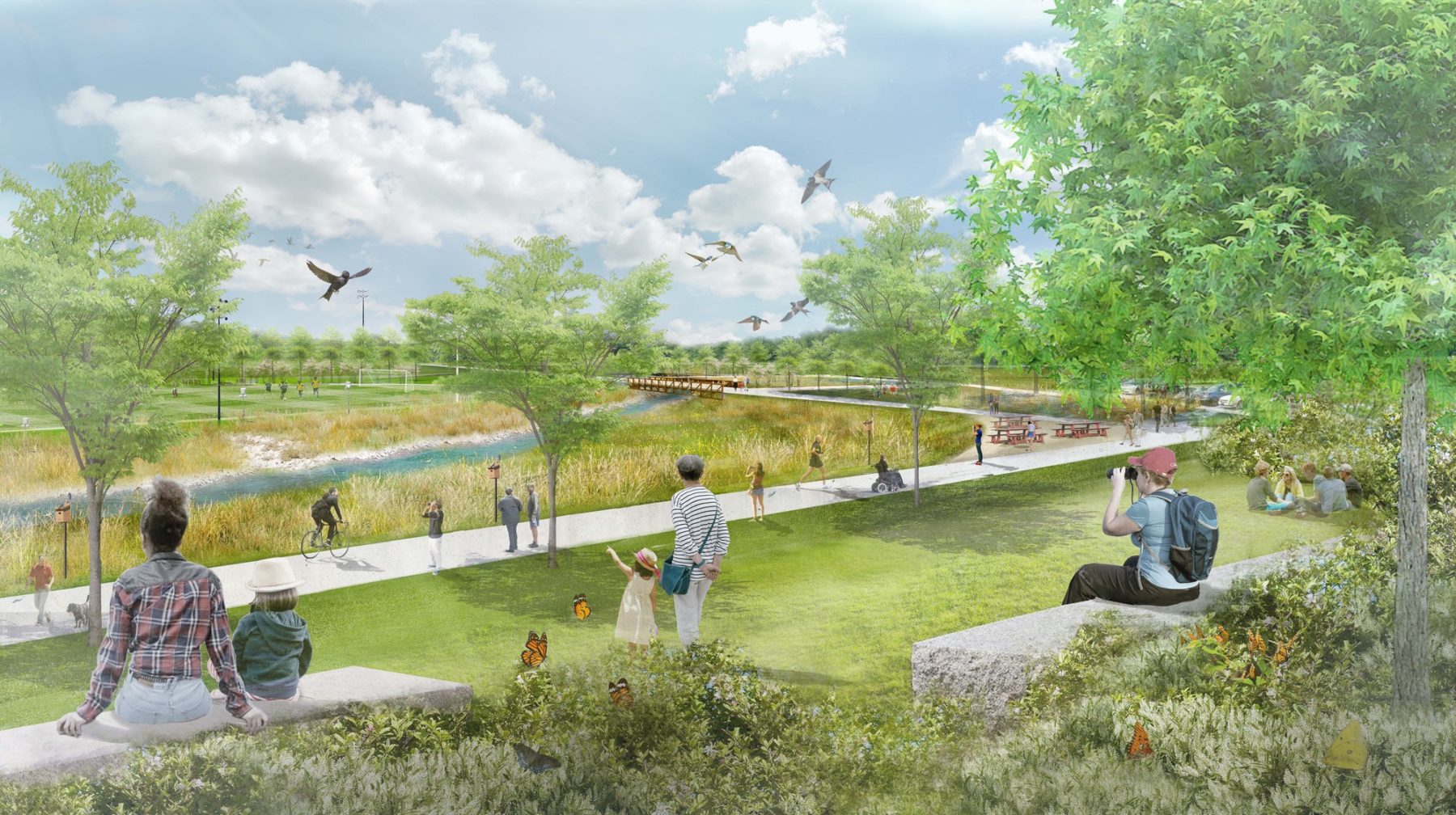
Diverse program elements will be distributed across the park for the community benefit while also serving as a floodplain to mitigate flooding effects
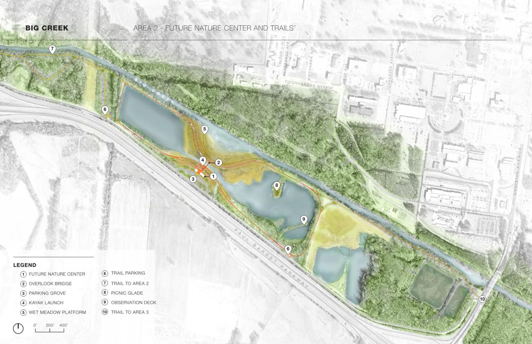
Area 2 features a nature center, network of trails, a kayak launch, and observation deck
The West Junction neighborhood, located near the confluence of the Mississippi River and the South Cypress Creek, was profoundly affected by the 2011 flooding. Over 150 properties within the neighborhood are within the 100-year flood zone; many houses were severely damaged or destroyed in the flood. Continued risk from flooding threatens the stability of an already-vulnerable neighborhood. West Junction has a high vacancy rate – 68% of properties are vacant or abandoned. Median household income is 40% lower than in the county ($28,000 vs $46,000). Food access, a socio-economic indicator of well-being, is also a challenge – based on the USDA’s definition, West Junction qualifies as a food desert. The neighborhood also struggles with high utility costs and frequent power outages during and after storm events.
The South Cypress Creek Neighborhood Action Plan includes recommendations for flood resilience that also address the other challenges facing neighborhood residents. Working with residents of the neighborhood, the team developed a toolkit of strategies for vacant lots, including a local food strategy, side lots adopted by adjacent homeowners, pocket parks, stormwater lots, a community solar installation, and infill housing. The plan synthesizes these strategies into a formal vision for the neighborhood, identifying appropriate strategies for specific sites.
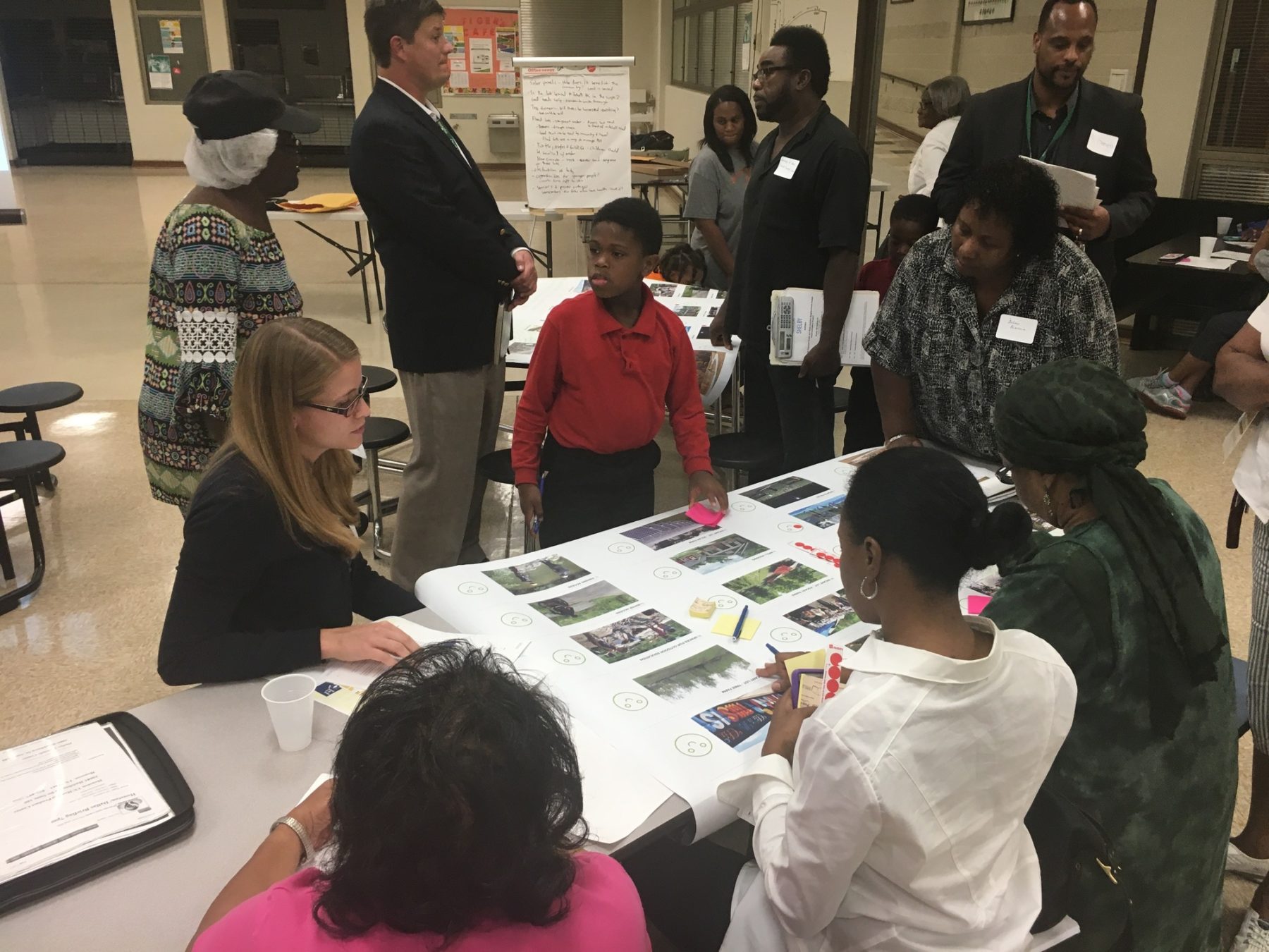
Several neighborhood workshops were held to ensure community members were guiding the vision for their neighborhood. A visual preference survey allowed the children in attendance to share their ideas, and enabled their caregivers to fully engage in the evening’s activities.
Residents were surveyed about the kinds of amenities and uses they would like to see in their neighborhood. These preferences were included in the vacant lot reuse strategy and the design for the Cypress Creek flood resilience project.
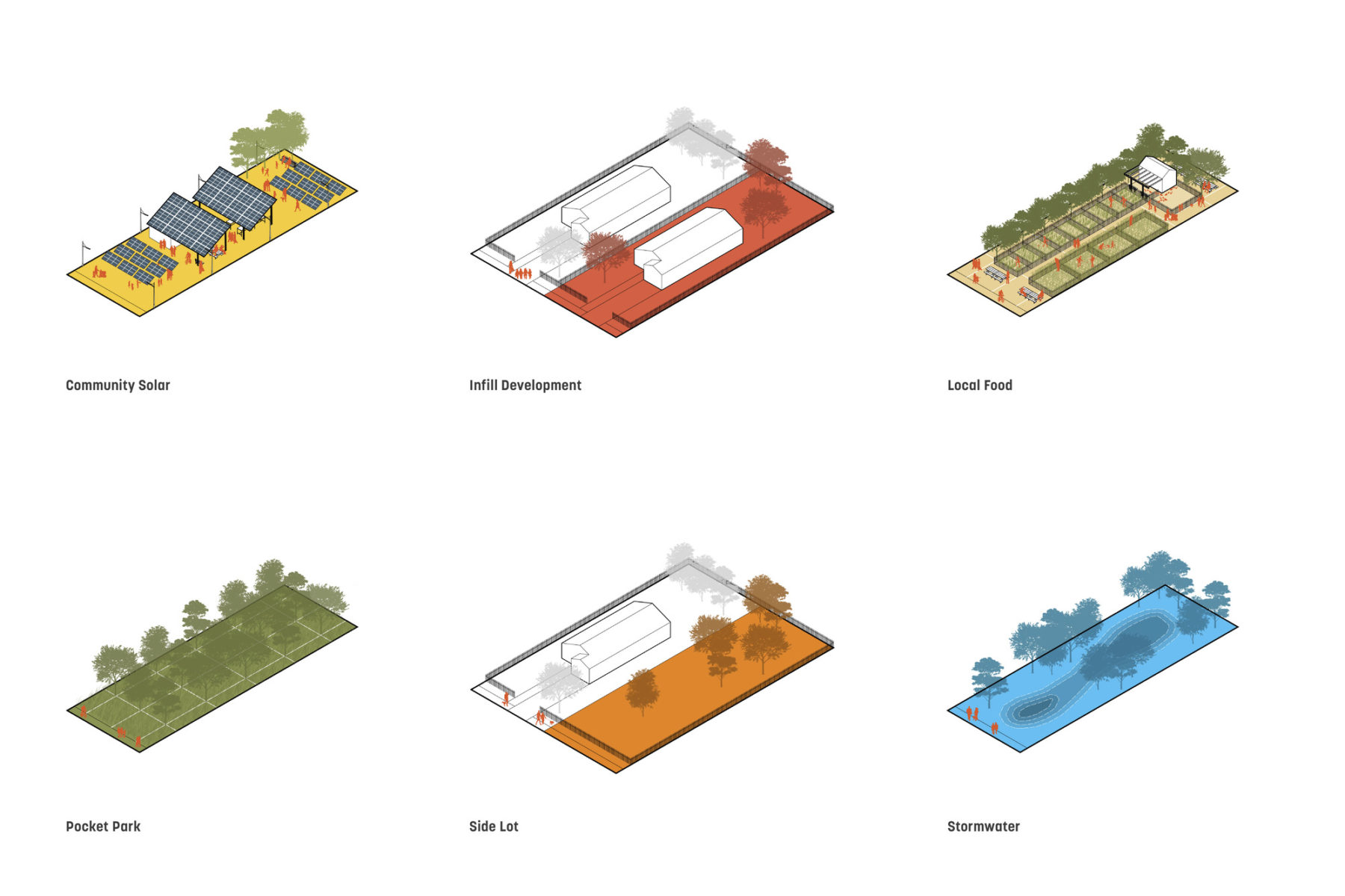
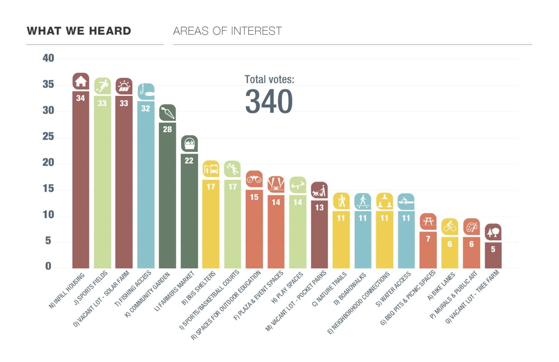
The community identified six preferred typologies to address vacant lots in their neighborhood. Vacant lots will be redeveloped with one of these uses and the neighborhood will evolve in a manner aligned with community goals.
Following the Neighborhood Action Plan, the team developed an Implementation Plan to help mitigate the flooding from South Cypress Creek. The concept design was grounded by input from the community and technical guidance from engineering partners and the U.S. Army Corps. Connections to the water, missing from the neighborhood for years, will be restored with a series of trail network connections. Raised land provides a physical barrier between the water and residential areas. Native plants, storage for rainwater, and a wider creek bed are nature-based solutions that help mitigate flooding while improving community access to recreation and enhancing local ecology.
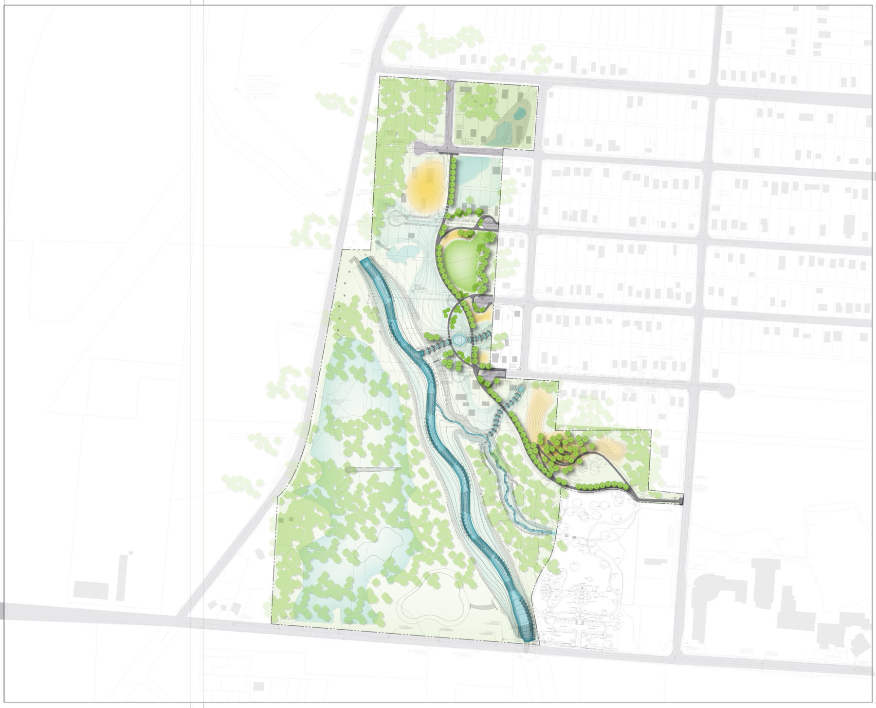
The design plan for the South Cypress Creek Implementation Plan includes riparian corridor widening, bank stabilization, native planting, a berm, and recreational amenities as advocated for by the West Junction neighborhood residents.
Sasaki worked with Barge Design Solutions and Dalhoff Thomas Design studio to develop the visioning and master plan for the project. We will continue to work with these firms through implementation to ensure continuity between master plan and built work. The project is currently in the design documentation phase.
For more information contact Mark Dawson.