Climate Ready Boston
Boston, MA
Once a symbol of industrial neglect, Boston’s waterfront has undergone a remarkable transformation, evolving from one of the nation’s most polluted harbors into a vibrant hub of public spaces, restaurants, parks, and climate-resilient design.
In order to activate the water’s edge and the public spaces along them, today’s designers must balance rising sea levels with public access. Taking a look at Sasaki’s impact on Boston’s waterfront, we can see how a comprehensive vision eventually gave way to a clean, accessible, and thriving waterfront.
In the 1960s, Boston Harbor was one of the most polluted in the country. The water was toxic, and industrial zones and parking lots lined the shoreline instead of the vibrant restaurants, hotels, parks, and pedestrian paths that define the area today. The turning point came with the Clean Water Act of 1972, spurring Boston to launch a long-term harbor cleanup. Over the next few decades, billions of dollars were invested in restoring the harbor. Today, Boston boasts one of the cleanest harbors in the nation, with a waterfront that emphasizes public access, open spaces, and climate resilience.
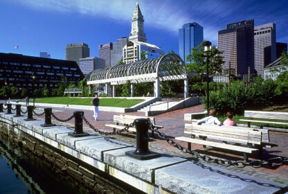
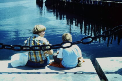
Sasaki joined the effort to revitalize the harbor in 1974 with the completion of Boston Waterfront Park. What was once a parking lot soon became a frequented and beloved seaside park, connecting the historic North End back to the sea.
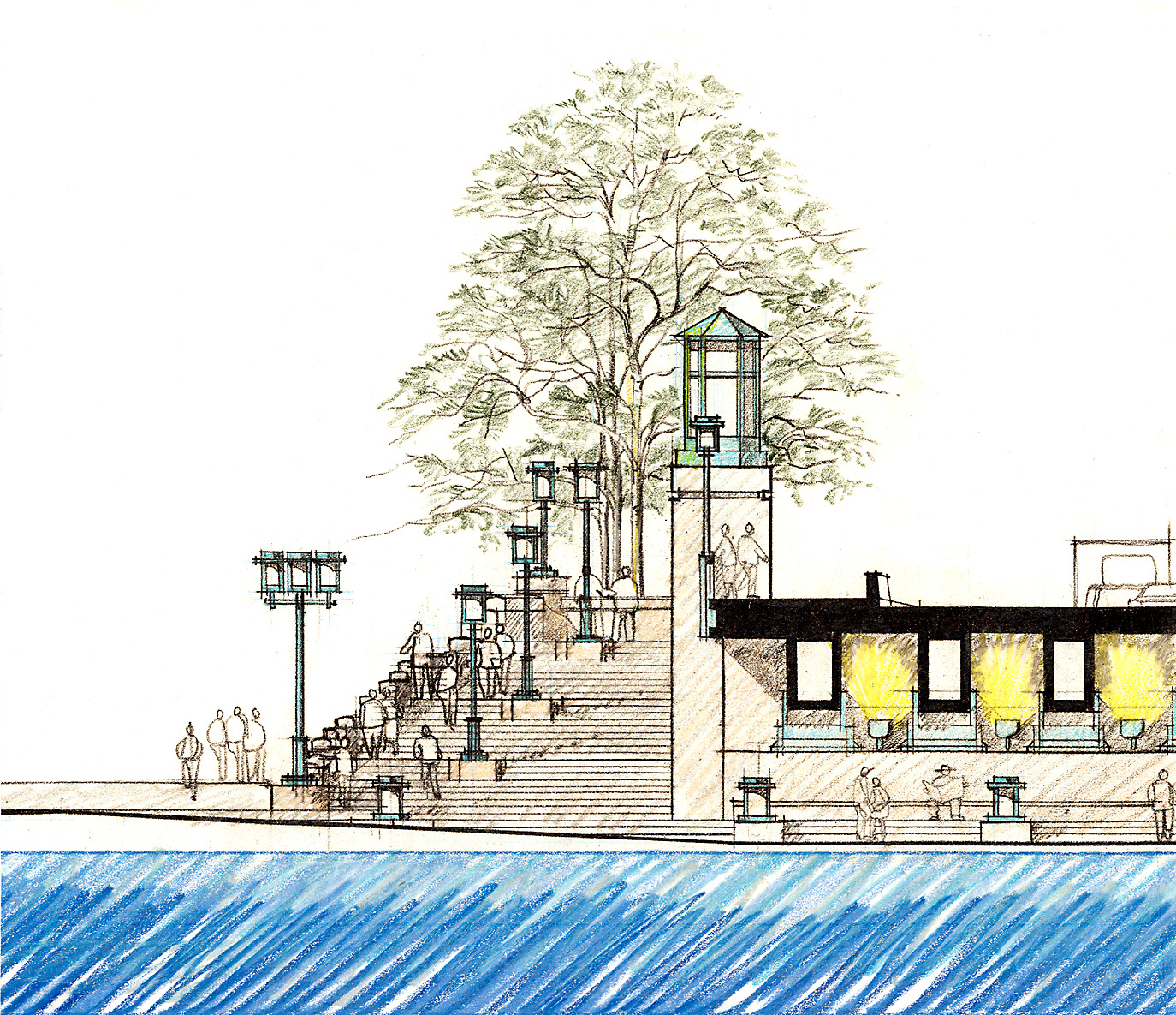
Drawing study for Boston Waterfront Park, courtesy of Sasaki Library and Archives
With the success of this project, the Boston Redevelopment Authority chose Sasaki for the contract of a comprehensive plan for the future of the entire Boston waterfront.
The Boston Redevelopment Authority (BRA) had set its sights on waterfront redevelopment by the 1960s, as part of an ambitious plan to reshape the entire city. However, the BRA faced public backlash, with some initiatives—particularly in Charlestown—drawing protests for prioritizing developers over residents.
With the passage of the Clean Water Act, the BRA commissioned Sasaki to develop a visionary report for the waterfront. Sasaki’s approach emphasized community involvement, conducting interviews and questionnaires with local residents, fishermen, and workers to ensure the waterfront would benefit everyone—not just developers. Sasaki’s public engagement strategy transformed the perception of the BRA, showing that thoughtful design could align with public interests.
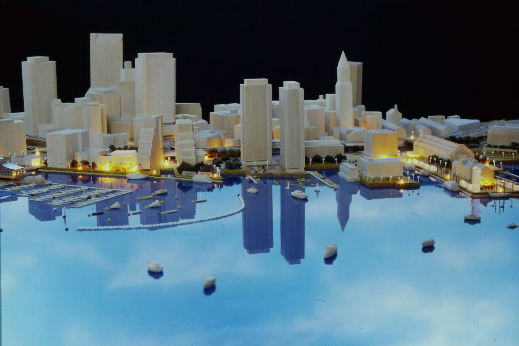
Boston Waterfront South Model by Sasaki, 1979
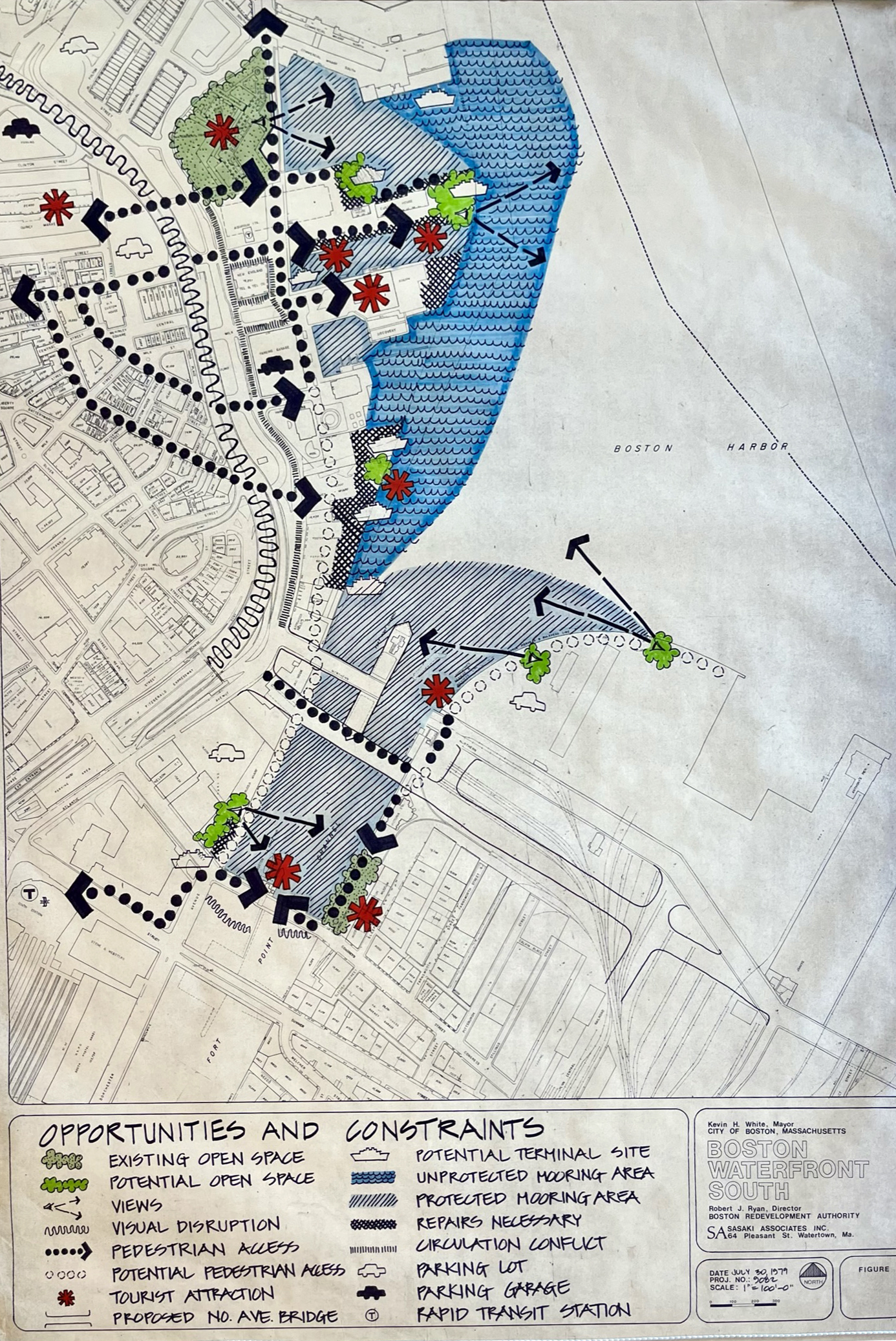
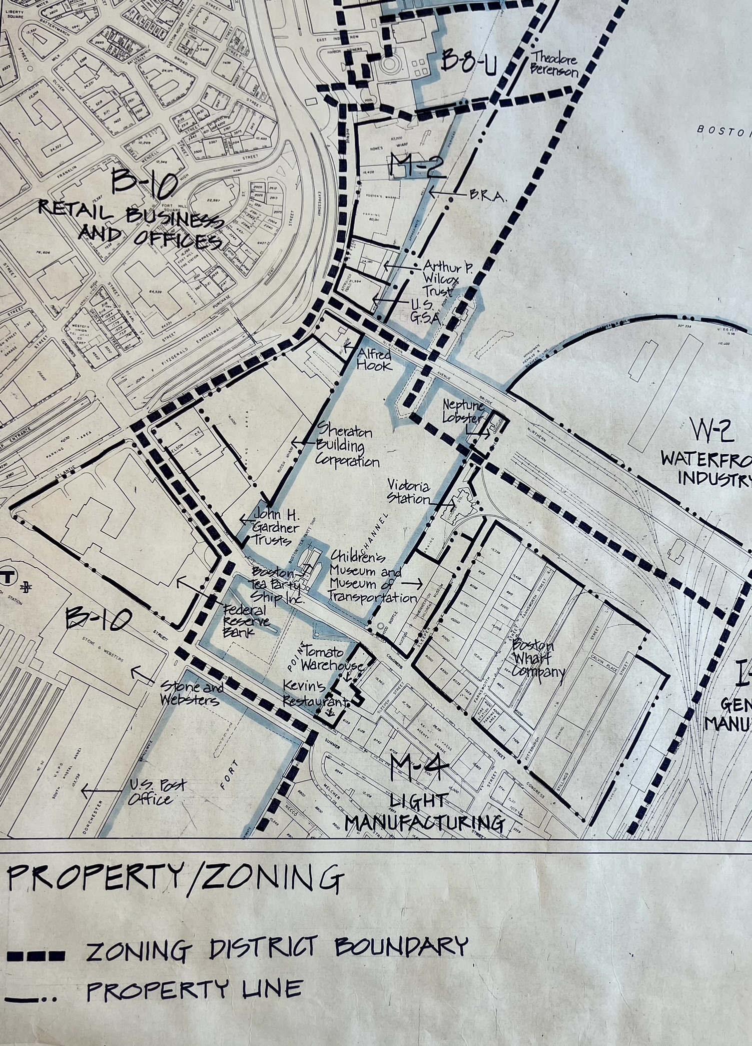
Boston Waterfront South Study by Sasaki
The outcome of this collaboration was a groundbreaking report that laid the foundation for the 1990 Harborpark Plan—one of the most influential urban development strategies in Boston’s history.
The final report, “Boston Harbor: Challenges and Opportunities for the 1980’s”, was completed in 1979, and was incredibly influential on the future development of the waterfront. Many of the proposals suggested have evolved into some of the most beloved aspects of public space in Boston. The report provided guidelines for future projects, suggestions of how to direct private and public investment, and noted difficulties like the predictions of rising sea levels.
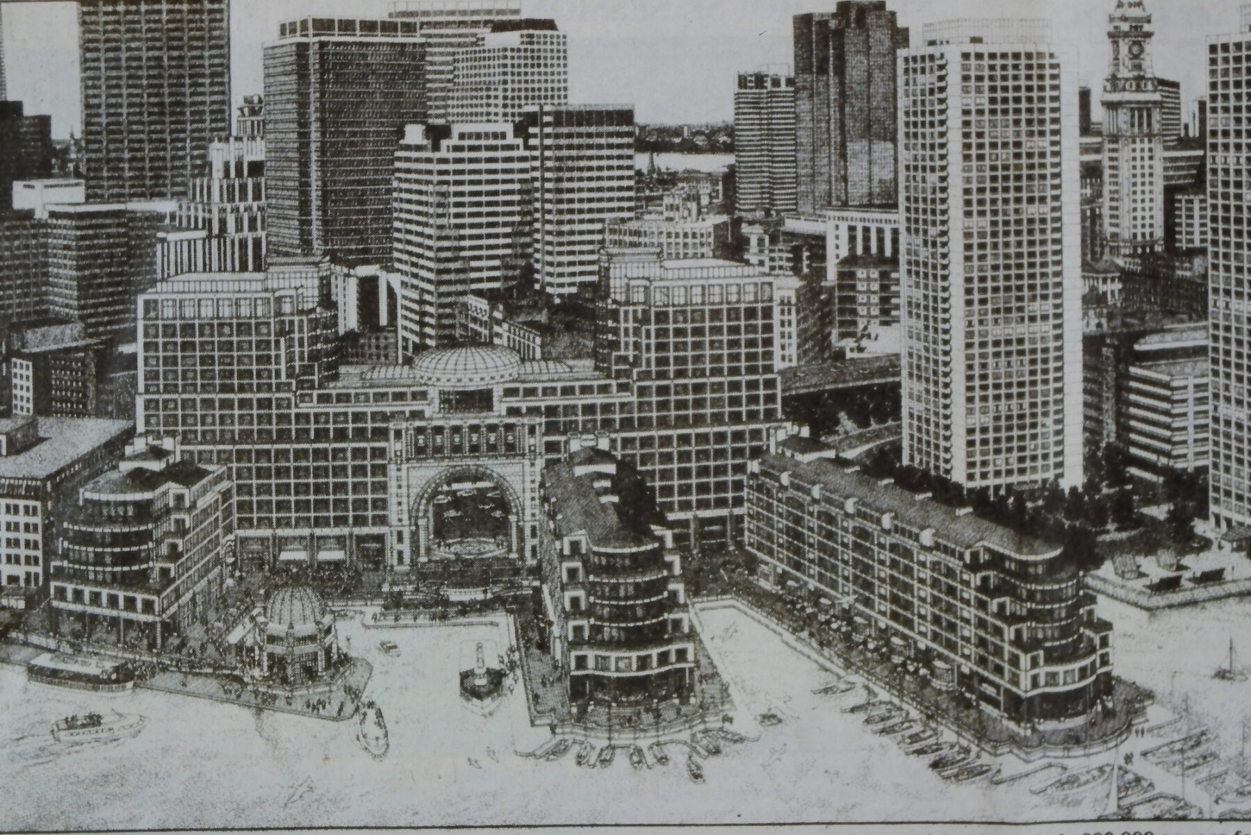
The Rowes Wharf site along the Boston waterfront, now the Boston Harbor Hotel, courtesy of Sasaki Library and Archives
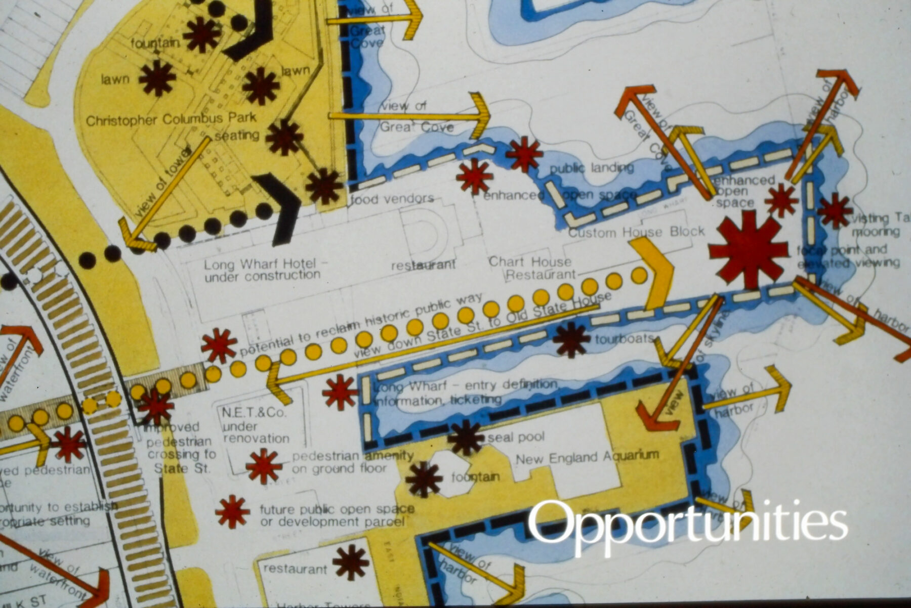
One of the main facets of the proposals Sasaki discussed in the report was that of public space and pedestrian access. The noted opportunities and constraints from the project showcased existing pedestrian areas along the Fort Point Channel and opportunities of additional sections to be created, forming one uninterrupted public pathway with amazing views along the waterfront.
These proposed pedestrian pathways eventually became known as the Harbor Walk in the 1990 city plan. By championing the importance of public access to the waterfront, Sasaki was able to prove its necessity to the BRA, and thus prevented developers from sectioning off private waterfront property in areas that were yet to be redeveloped. One major site, which is now the Boston Harbor Hotel at Rowes Wharf, was redeveloped by the BRA, and is one of the most successful examples of preserved public access.
Courtesy of Sasaki Library and Archives
The drawings also showcased a huge opportunity in one of the parking lots on the corner of the Fort Point Channel for a pedestrian walkway, one which would eventually become Fan Pier. For the resounding success and influence of the harbor study, the project was nominated by the Boston Society of Architects for an Urban Design Citation in 1985.
The development of this study was not the end of Sasaki’s involvement. In 1990, the results of the study were set in motion, and the waterfront was brought to life in yet another section, the Long Wharf project. Here, public space surrounded the Marriott Long Wharf Hotel as part of the Harbor Walk expansion. The granite plaza of Long Wharf connected to the previous project at Boston Waterfront Park, and paid homage to the seafaring history of the area.
Boston Waterfront in 1980, courtesy of Sasaki Library and Archives
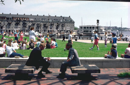
As with the harbor study, this project was also undertaken with input from the community. A working model and yarn was used to have passerby mark their usual walking routes, green spaces, and other kinds of circulation and access to the area. With the addition of perspective sketches and graphics to help the public understand the concepts, substantial feedback from the surrounding community bolstered design and engineering choices. Long Wharf’s unveiling was met with excited crowds ready to use the new space.
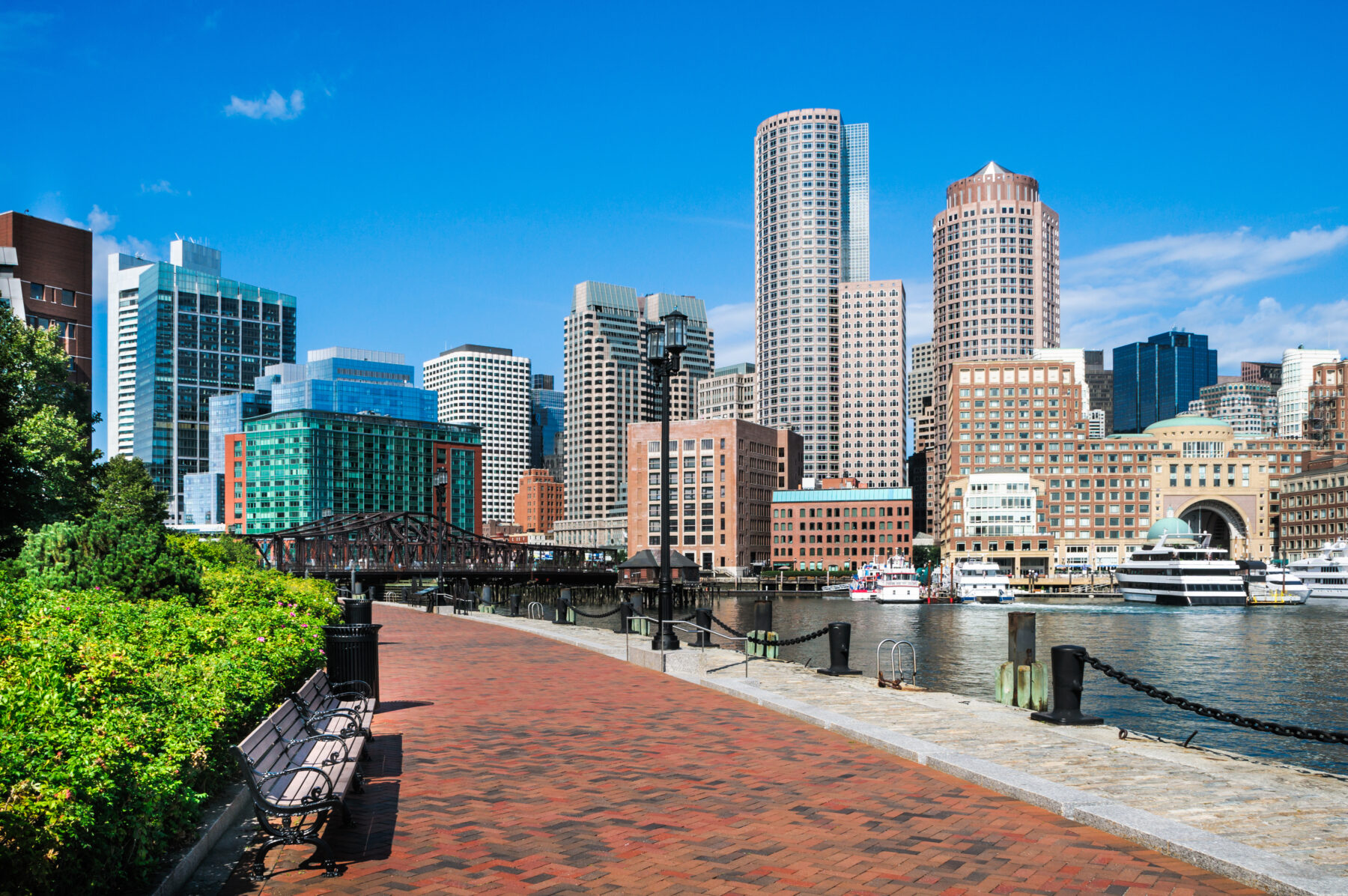
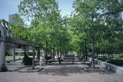
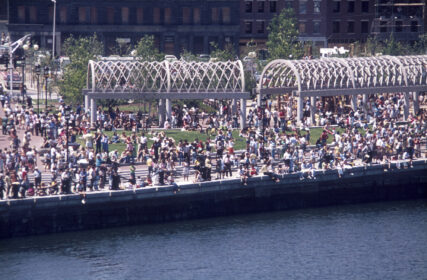
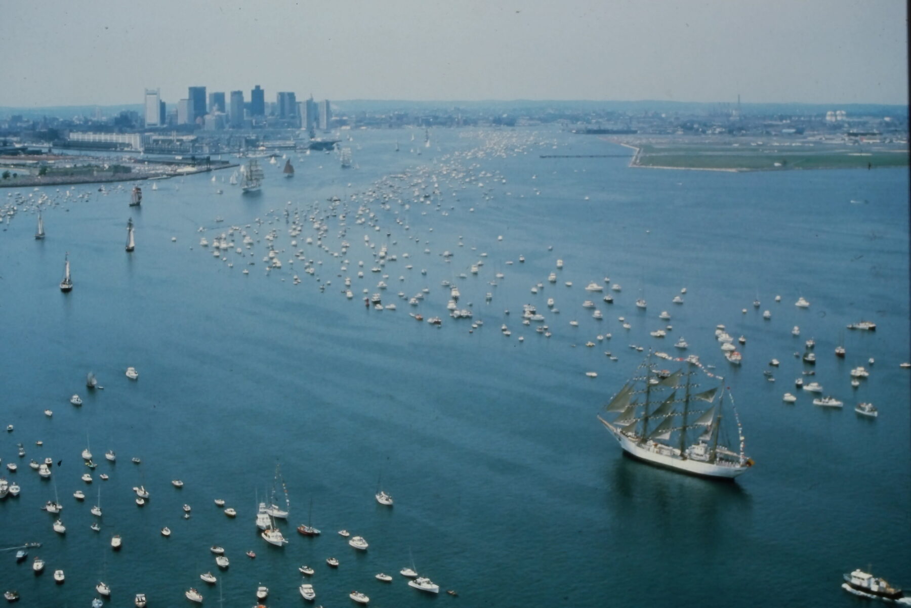
Today, Boston’s waterfront is one of its crown jewels. The abundance of seaside restaurants, hotels, and public parks is a stark contrast to the industrial and polluted city of the 1950’s and 60’s. Countless people populate the parks, particularly during the summer months when the paths are filled with tourists snapping pictures of the views. The Harbor Walk, once merely a few circles and a suggestion, is now a magnificent 43 mile park celebrating 40 years of connecting the neighborhoods of Boston with the sea. The revitalization of the Boston waterfront is a major success story.
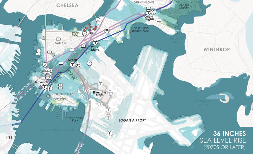
However, in the next few decades it faces a new threat through climate change. In the environmental analysis conducted by Sasaki in 1979, the 100 year flooding was an aspect to be aware of and to prepare for. It was a very innovative acknowledgement for the 1970’s, but one which still stands today as the waterfront’s biggest issue.
Today, projects like Climate Ready Boston take the forefront of these initiatives, and build on the realizations of decades old planning. Just as with the redevelopment of Boston’s Waterfront, the only way to accomplish these objectives and to protect our city is a joint effort between city, state, and private development. Boston’s waterfront story is one of resilience and renewal. What was once an environmental disaster has become a vibrant public space—an enduring symbol of how thoughtful design, public engagement, and smart policy can transform a city.