An environmentally progressive vision for a new central business district adjacent to Wuhan’s high-speed rail station
Wuhan Yangchun Lake Business District
The 1,800 hectare district includes 368 hectares of public open space that provides diverse recreational amenities and a host of ecological benefits
Wuhan’s strategic location on the banks of the Yangtze River in central China has led to its sustained success as a trade hub for centuries. Heralded as the “crossroads of nine provinces,” Wuhan continues to build on this legacy of economic vitality and mobility. Boosted by a series of national policies and already revered as one of the world’s fastest growing hubs for technology and innovation, the city is advancing its ambition to be at the vanguard of China’s next wave of progress.
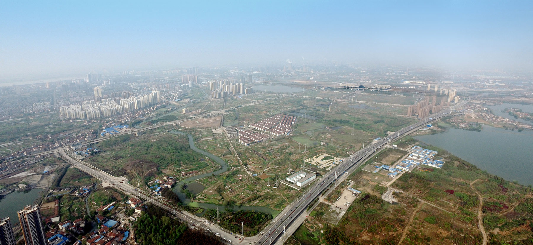
Existing conditions on the site include the high-speed rail station, significant roadway infrastructure, channelized canals, and a solid waste landfill
The rapid expansion of China’s High Speed Railway network has been instrumental in driving economic growth throughout the country at both the city and regional scale. Evidence of this initiative’s success is the pairing of the Wuhan High Speed Railway station and the new Yangchun Lake Business District. Designed by Sasaki in collaboration with a diverse interdisciplinary team including Arup, JLL, and the Wuhan Planning & Design Institute, the master plan was recently approved by the city, marking a major step forward as Wuhan embraces a progressive yet realistic vision for the district.
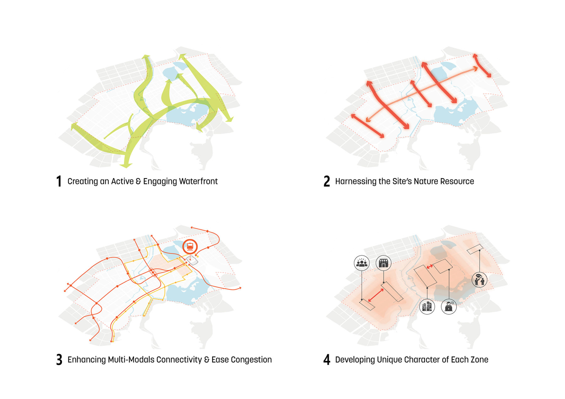
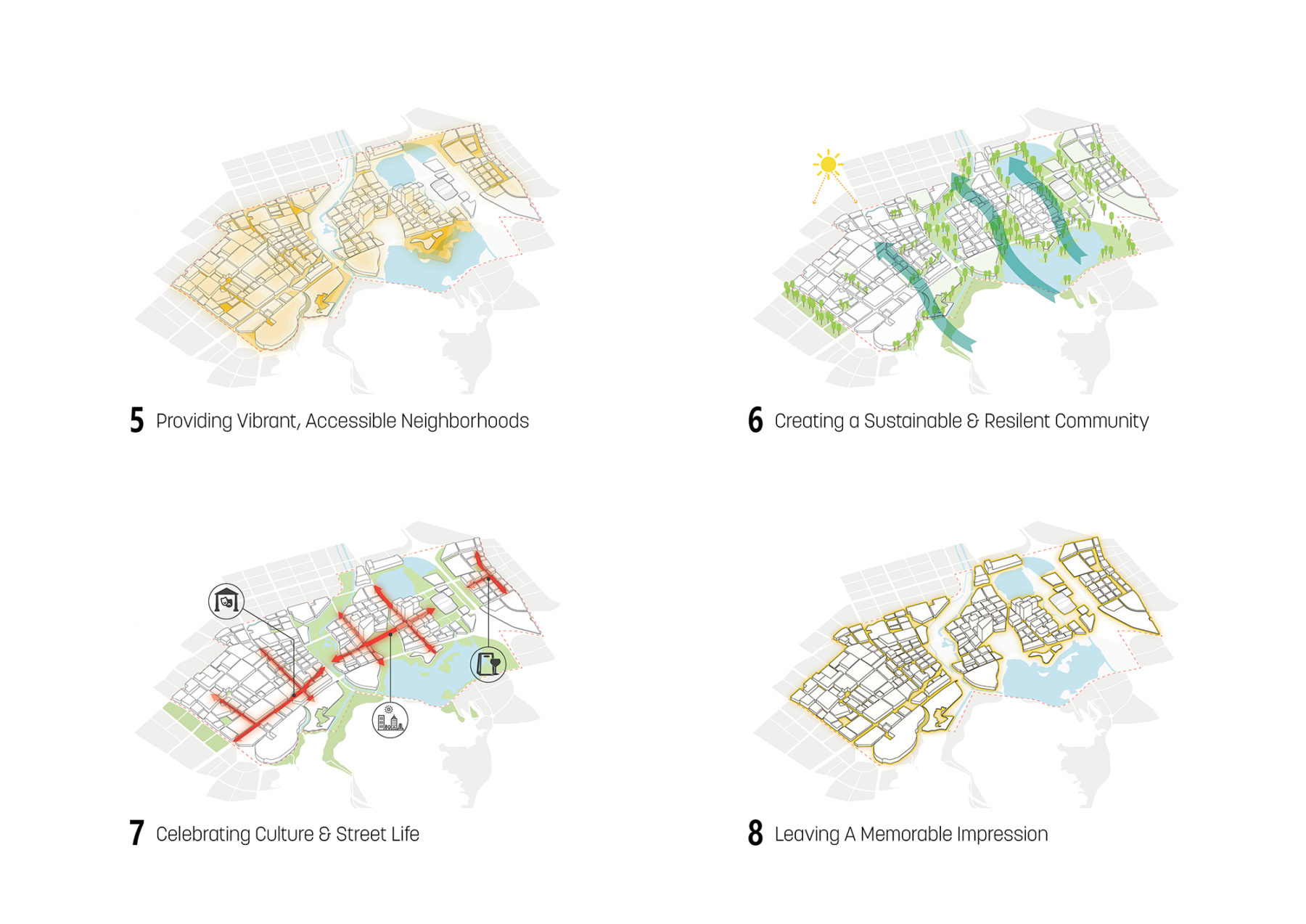
A series of organizing principles summarize the issues impacting the district and define key design strategies
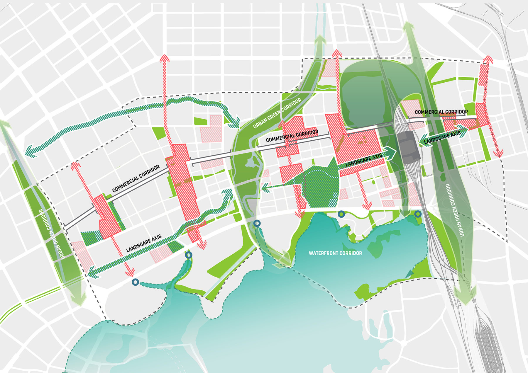
Major landscape interventions establish an armature of connected open spaces and development parcels
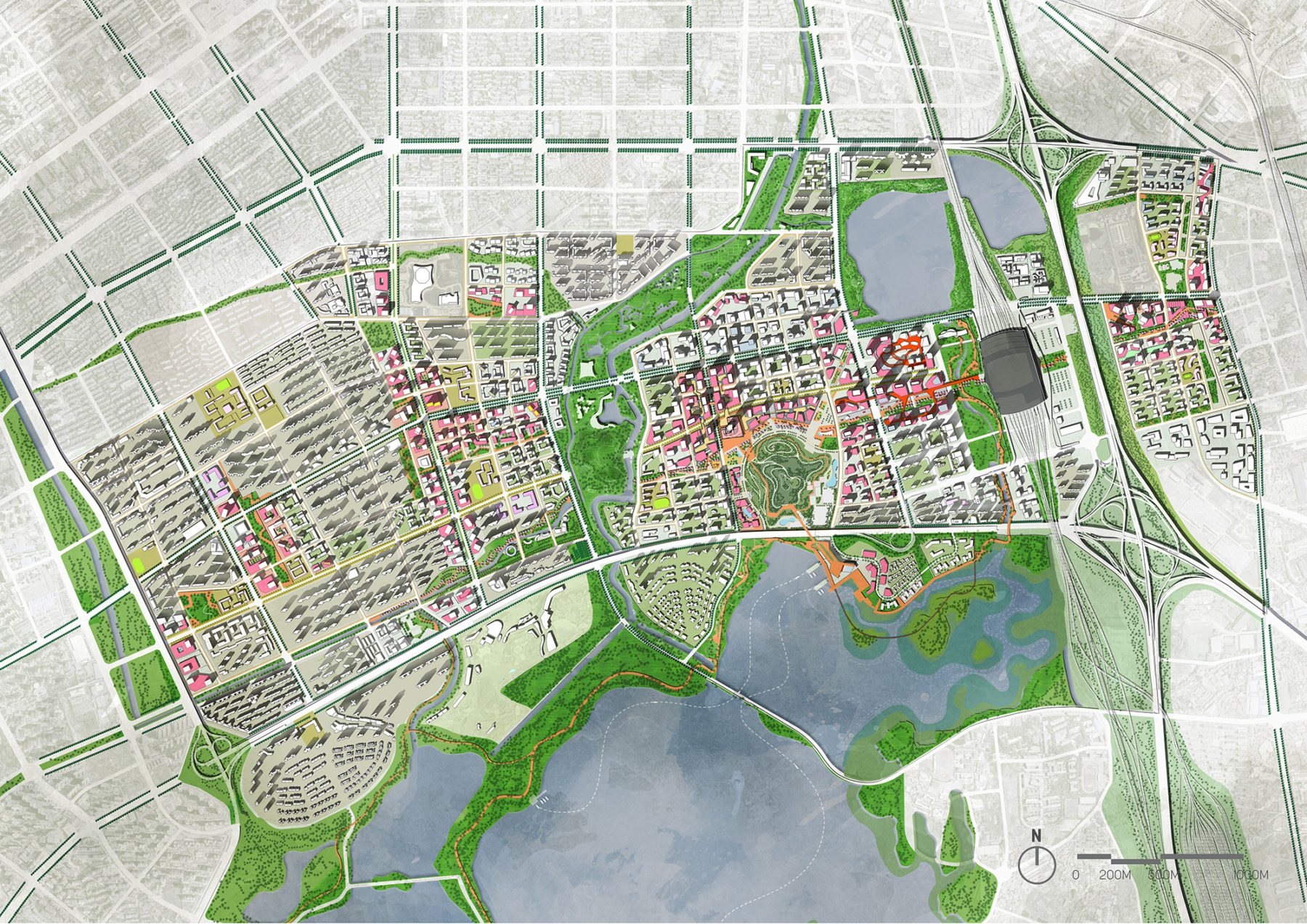
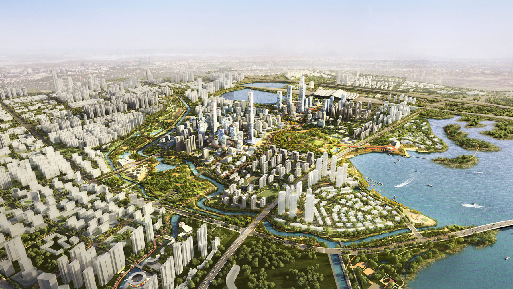
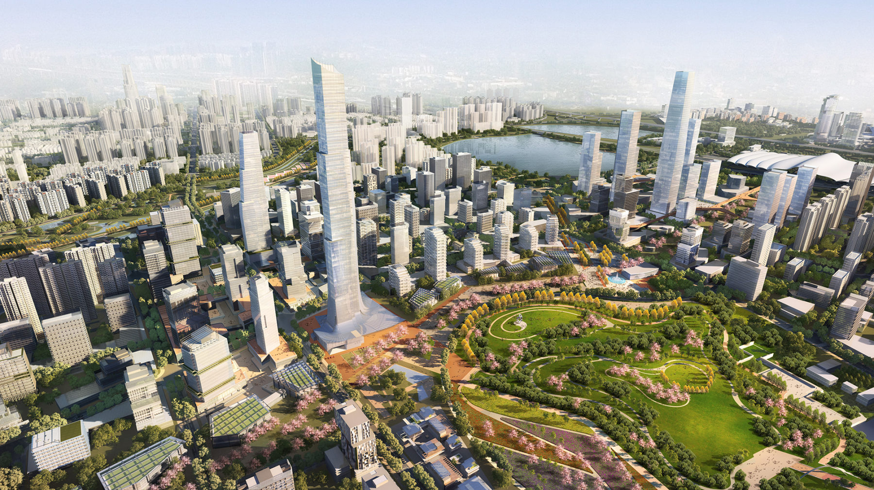
Illustrative Master Plan of the entire district
Once on the periphery of the urban core, a recent influx in population to Wuhan led to the rapid densification of the district, but absent a planning vision to accommodate for this growth. Reclamation of the lake’s edge provided necessary land to respond to development pressures, but resulted in a detrimental impact to the water quality. Another significant environmental concern was a large solid waste landfill near the waterfront. These existing conditions inspired the Sasaki team to develop a series of five key remediation strategies that respond to these environmental challenges.
The mixed-use core fronts onto a central park and with a commercial spine linking to the high-speed rail station
Smaller urban blocks promote walkability and arcades facilitate pedestrian connectivity to the central park
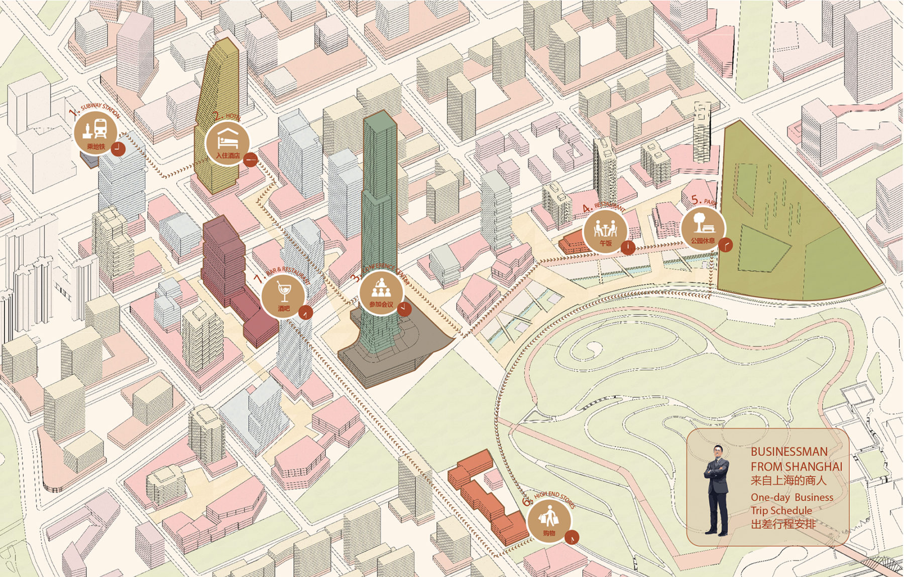
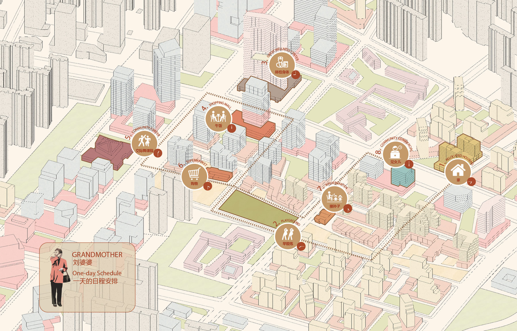
Hypothetical itineraries indicate how different groups of people might move through the district and the amenities that they would use
The first strategy was the naturalization of the existing canal network throughout the district, along with the ongoing implementation of the wetland park. The formerly channelized waterways are restored to mimic natural processes including reestablishing their connection to the floodplain of the lake, managing stormwater to reduce impacts from flooding, improving the riparian habitat, and enhancing connectivity to the lake for both humans and wildlife.
Buildings are organized to take advantage of views and to create landmarks within the district
Second, a strategy of constructed wetlands along the lake’s edge filters urban runoff while providing critical habitat for a variety of avian, amphibian, aquatic, and terrestrial species. Designed with a series of boardwalks and trails that link to other recreational pedestrian routes throughout the district, the wetland establishes contiguous public access along the once privatized waterfront.
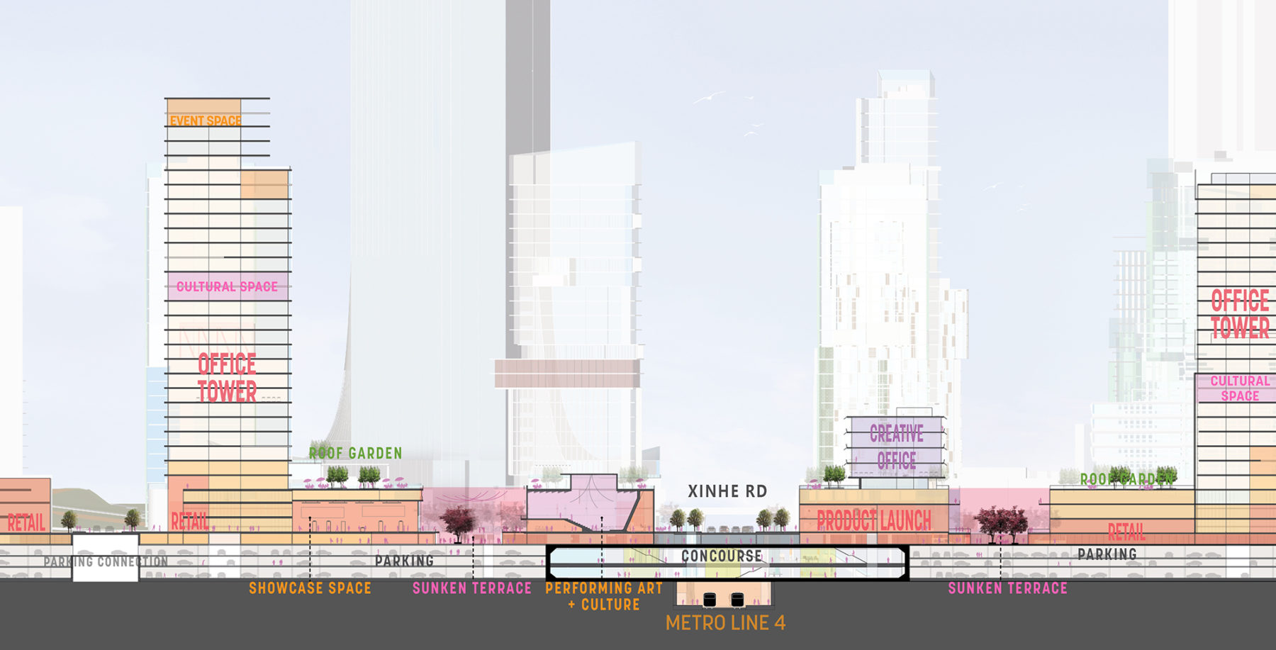
Section through the main commercial spine
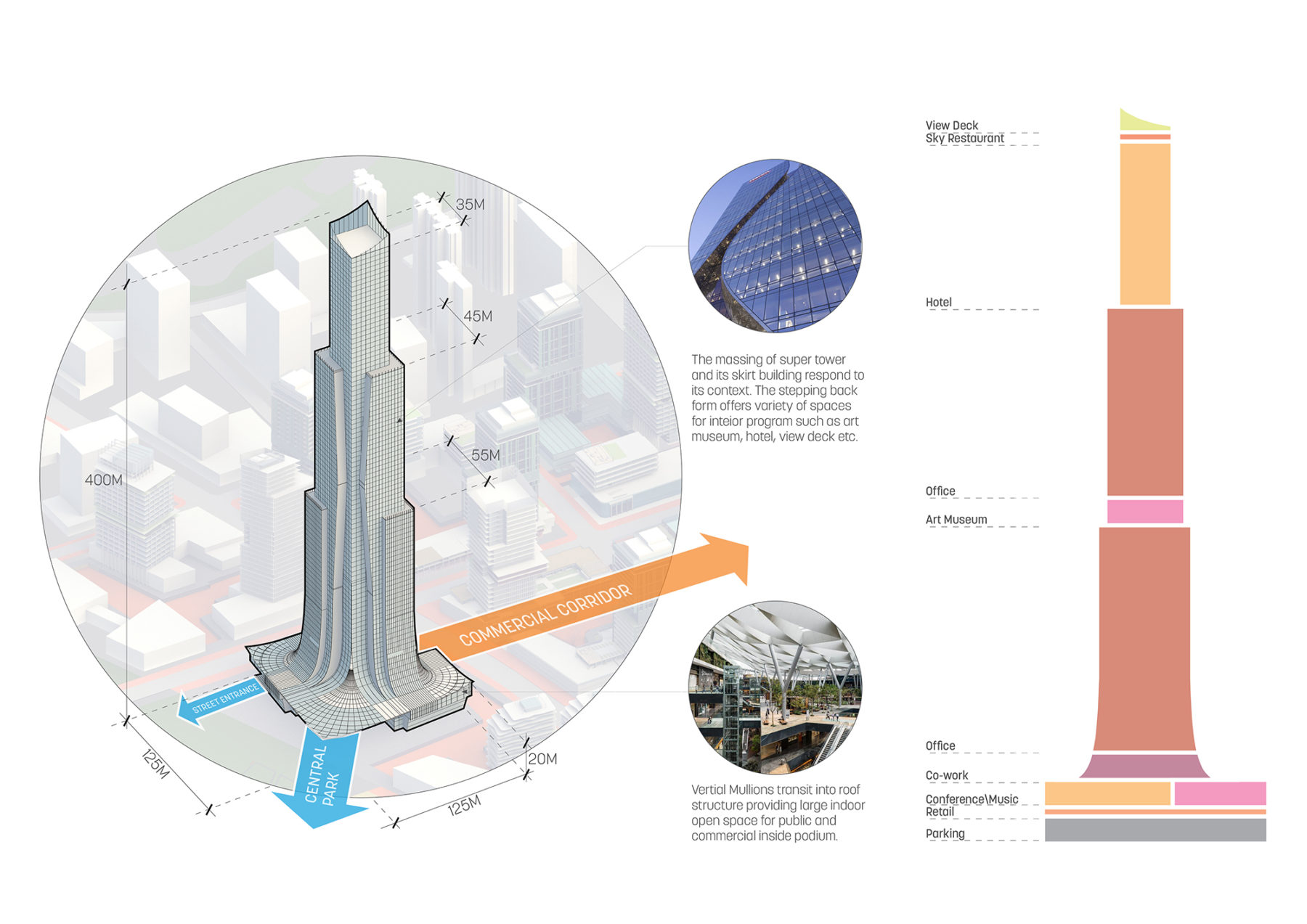
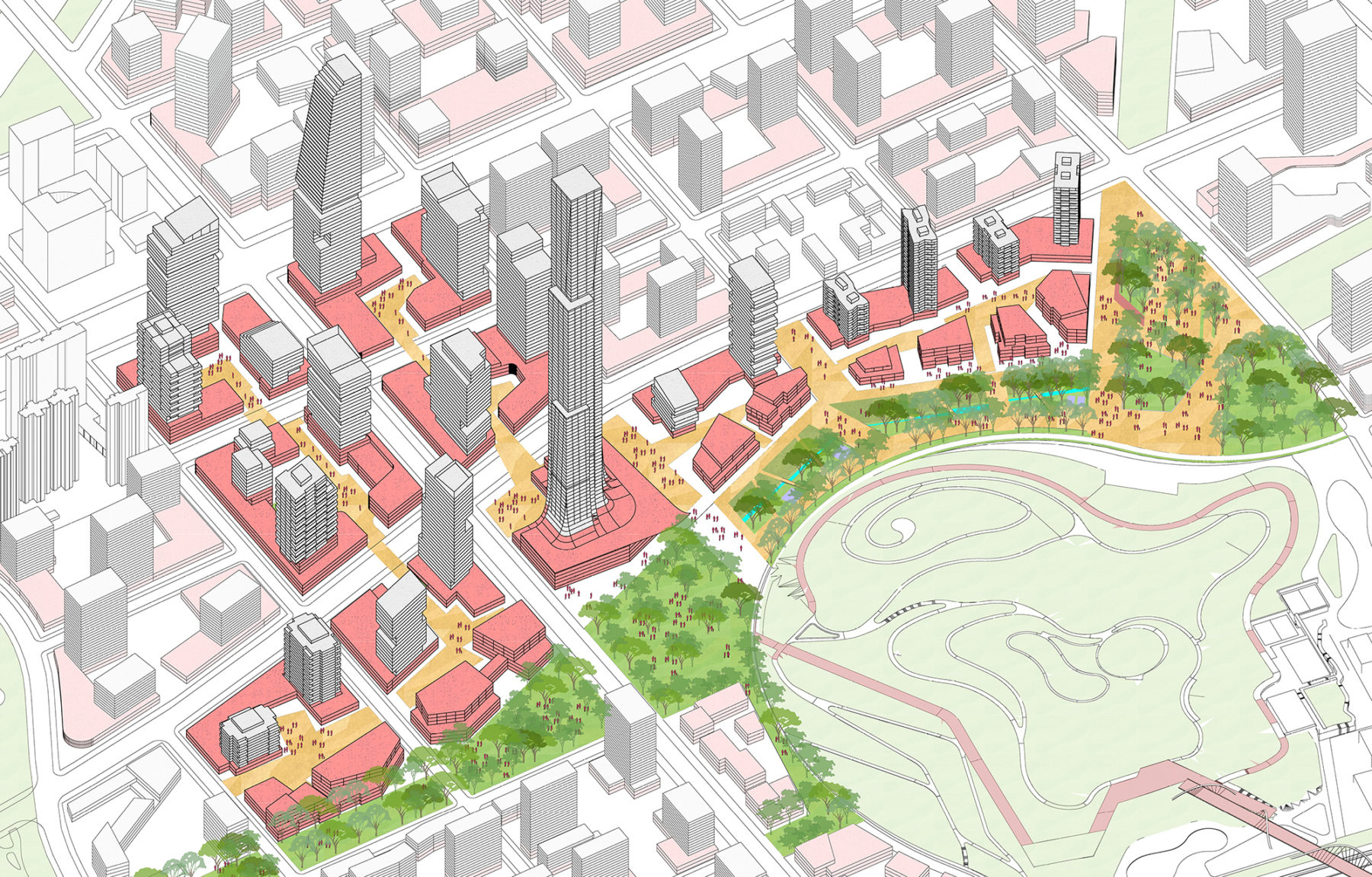
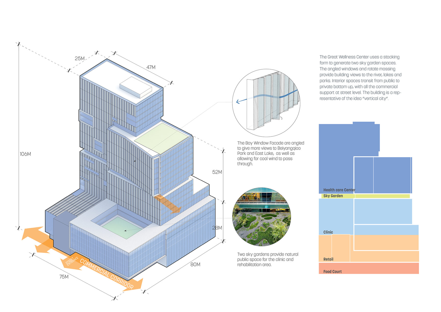
The massing of the supertall tower was organized to correspond to it interior uses
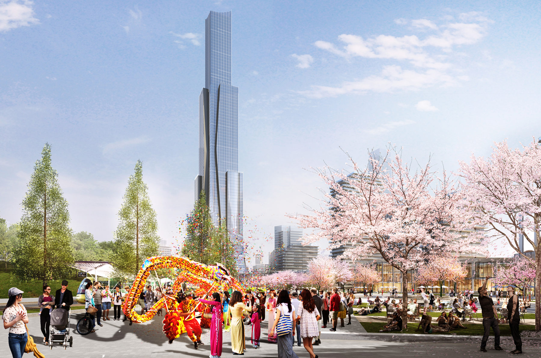
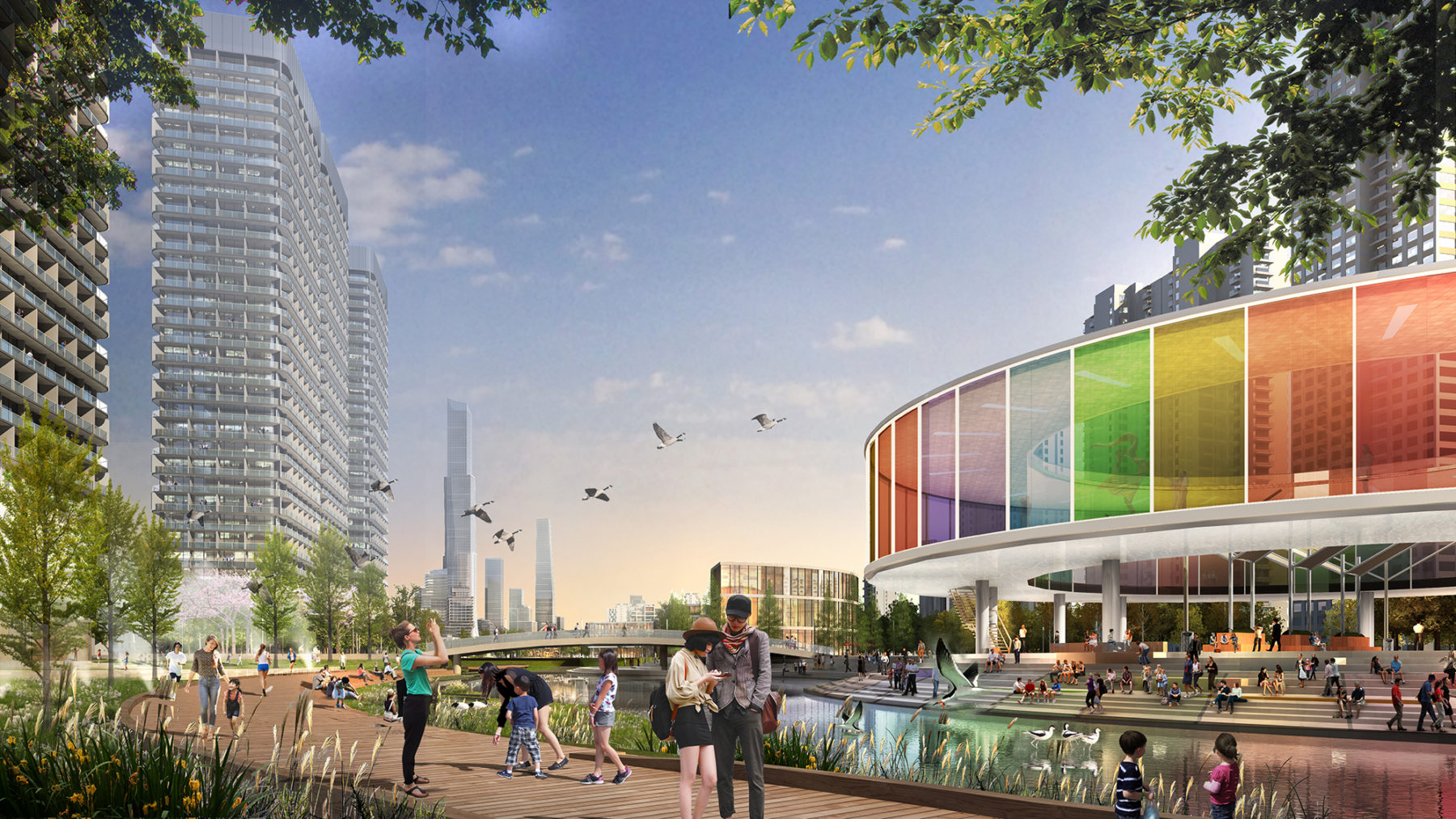
The central park provides a destination open space where outdoor concerts, festivals, and other gatherings can be held
Section through the main commercial spine
The massing of the supertall tower was organized to correspond to it interior uses
The central park provides a destination open space where outdoor concerts, festivals, and other gatherings can be held
The third strategy was the creation of an extended East Lake Greenway system throughout the entire district that follows existing drainage patterns and major roadways. This system provides an urban tree canopy that offers numerous benefits including habitat creation, energy reduction by shading adjacent buildings, and a comfortable microclimate for pedestrians.
Fourth, a series of pocket parks are interspersed in each of the district’s neighborhoods, allowing for all residents to live within a 10 minute walk of a public landscape. These pocket parks provide daily amenities such as playgrounds and sports fields while also incorporating rain gardens to collect, filter, and replenish groundwater while reducing the impacts of urban flooding. Finally, the fifth strategy was the creation of a new central park. Built upon a former solid waste landfill, the central park repurposes this once noxious use into a vibrant recreational and ecological amenity. When combined, these strategies provide a total of 368 hectares of new open space throughout the district in a variety of typologies that enhance the urban experience.
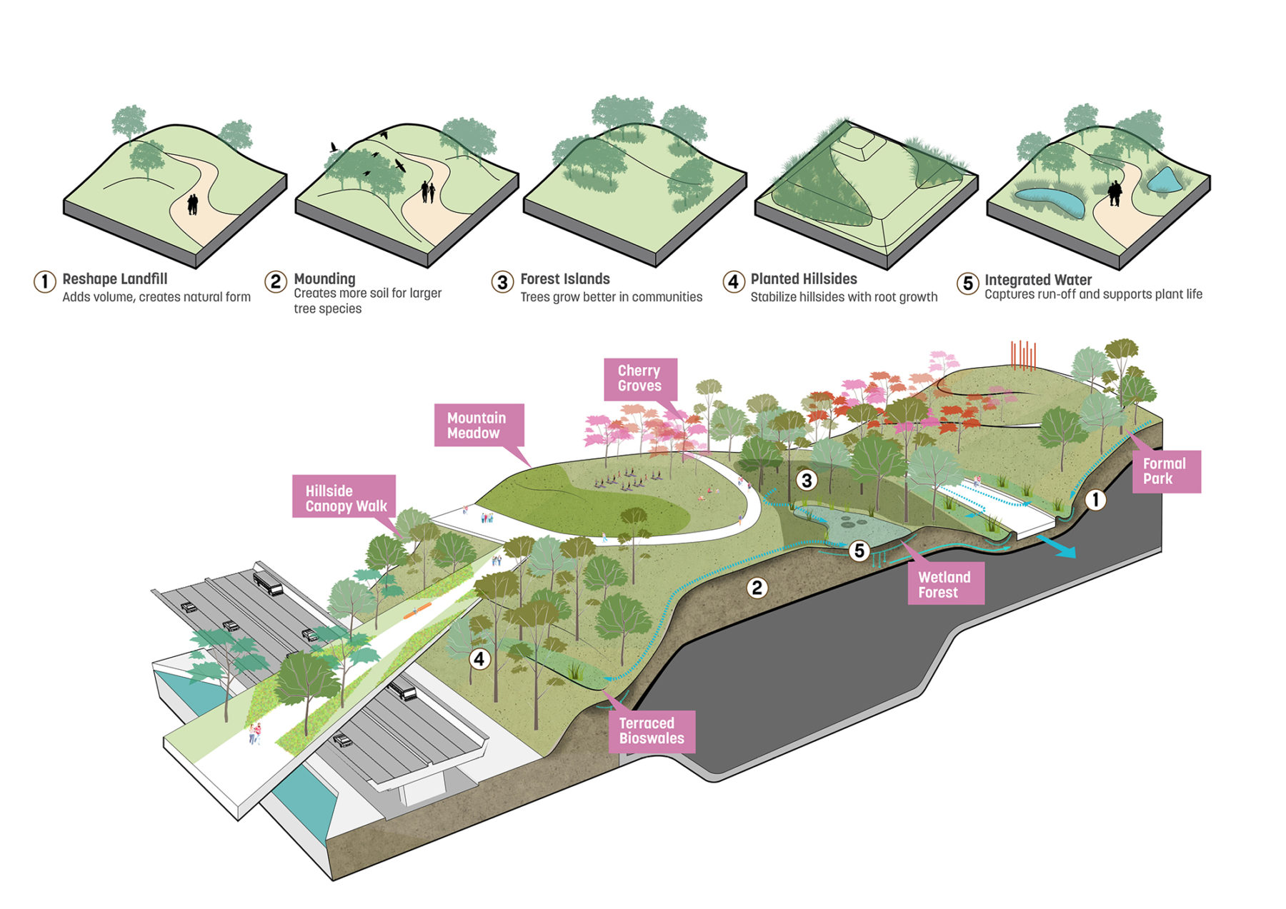
The park is built over an existing solid waste landfill after being capped, turning an eyesore into an amenity. The park is also one of the rare opportunities experience some topography within the otherwise flat district
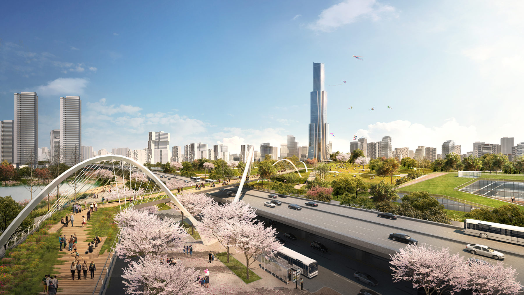
A landmark pedestrian bridge spans over the existing waterfront roadway and links the central park to the lake
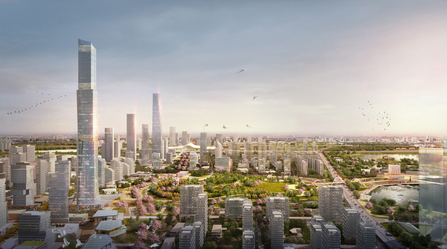
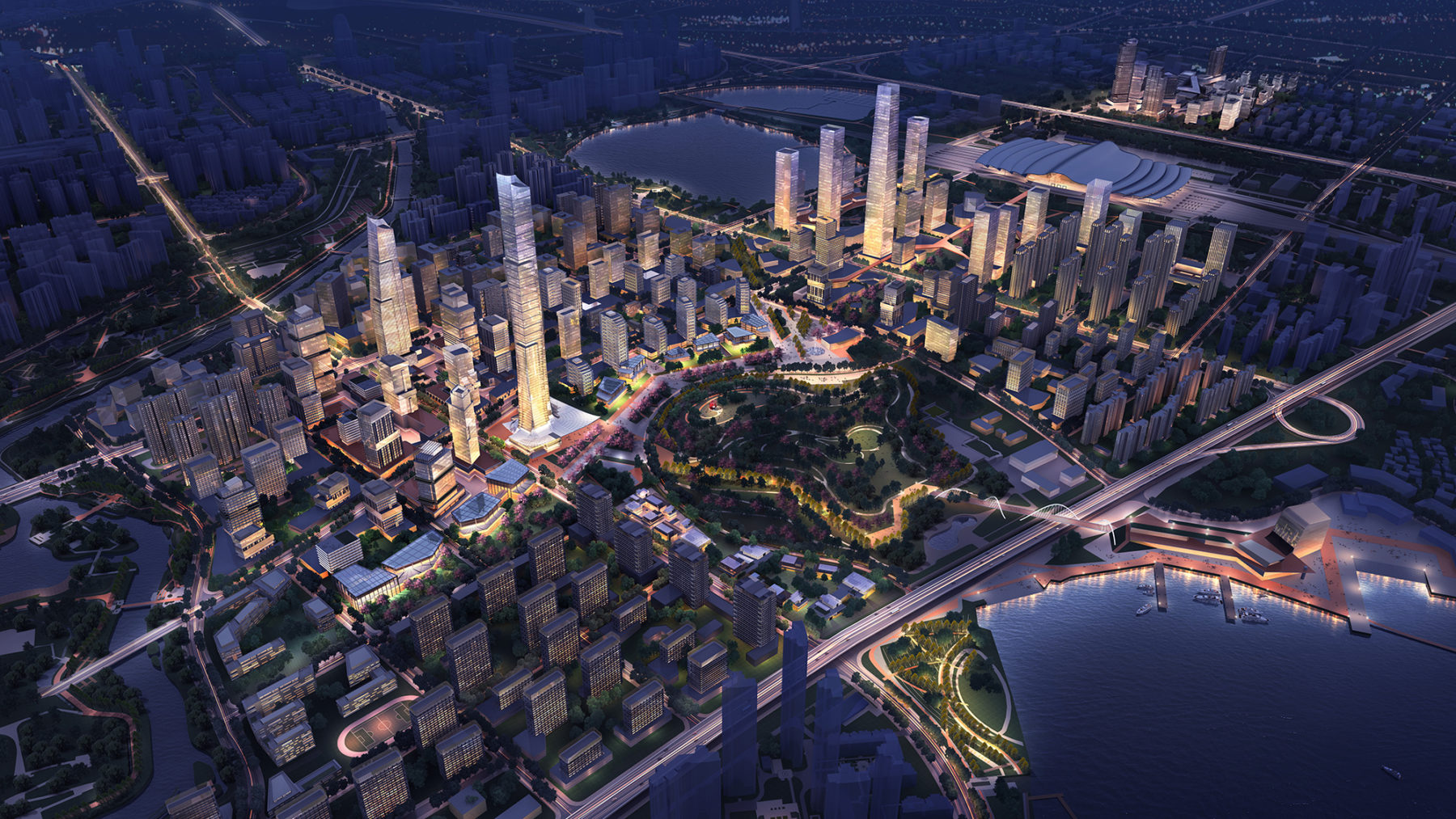
Aerial view of the development surrounding the central park
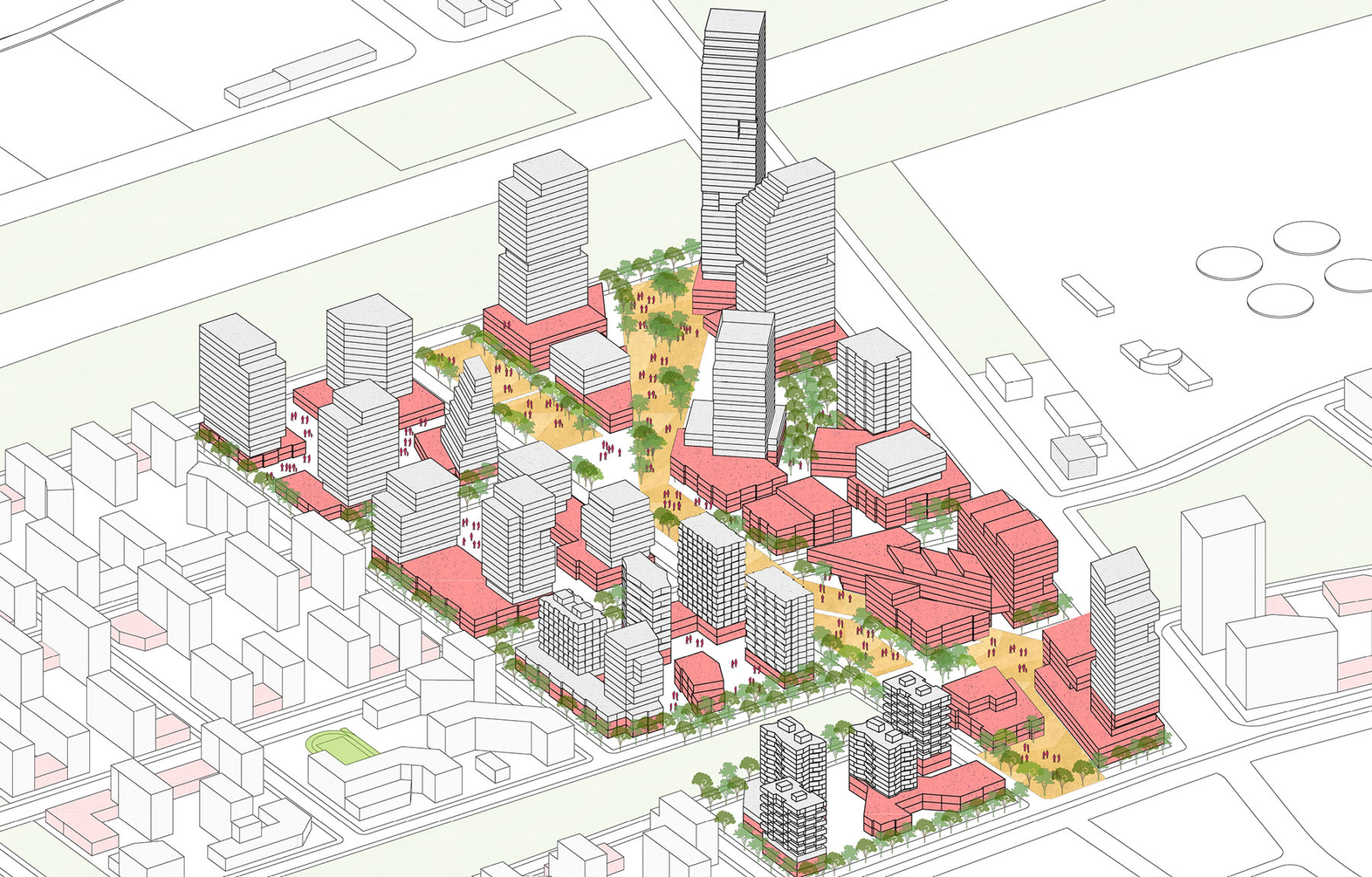
Urban blocks that radiate outwards from the central park prioritize pedestrian connectivity, linking the outer neighborhoods to the commercial core
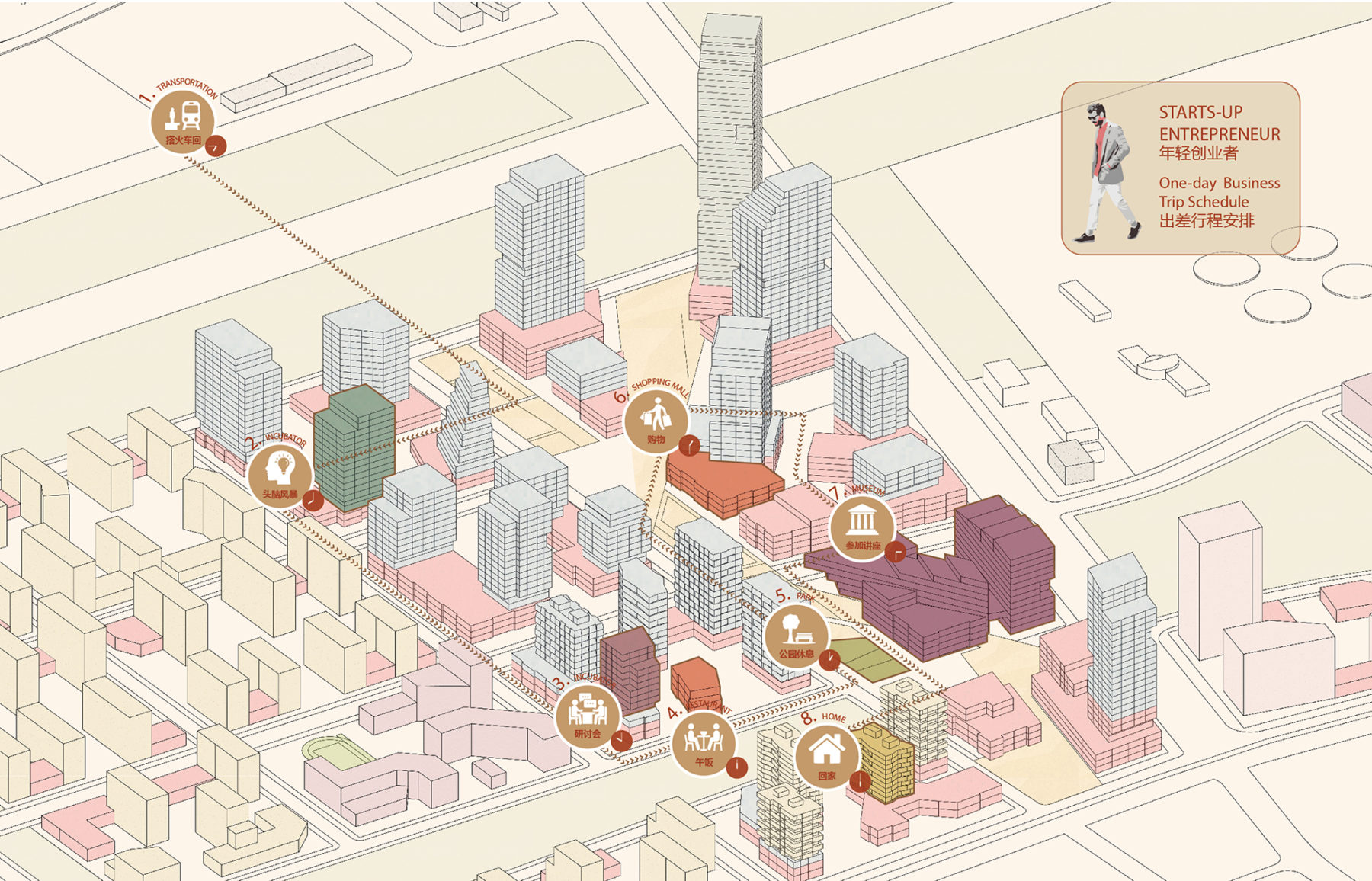
An itinerary illustrating how an entrepreneur might spend a day in the district
With the environmental improvements and landscape interventions providing the initial armature for the new district, the plan was then organized around a comprehensive pedestrian network to promote walkability and a safer, human-scaled environment that links the district’s parks, plazas, and streetscapes. A series of north-south streets and linear open spaces connect interior landscapes to the lake, providing accessibility and establishing view corridors.

The commercial spine emphasizes the connection to the high-speed rail station and prioritizes pedestrian routes
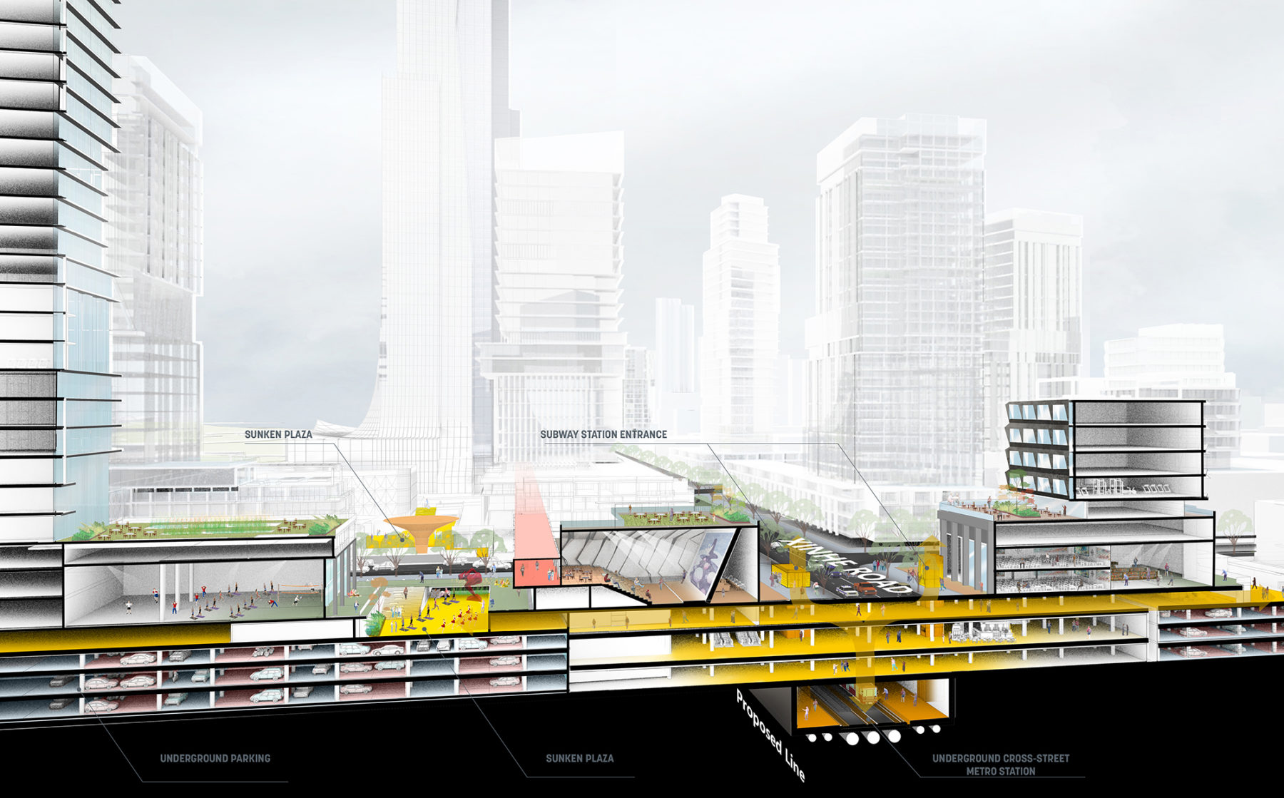
Underground commercial space seamlessly link the subway stations to the activity above ground
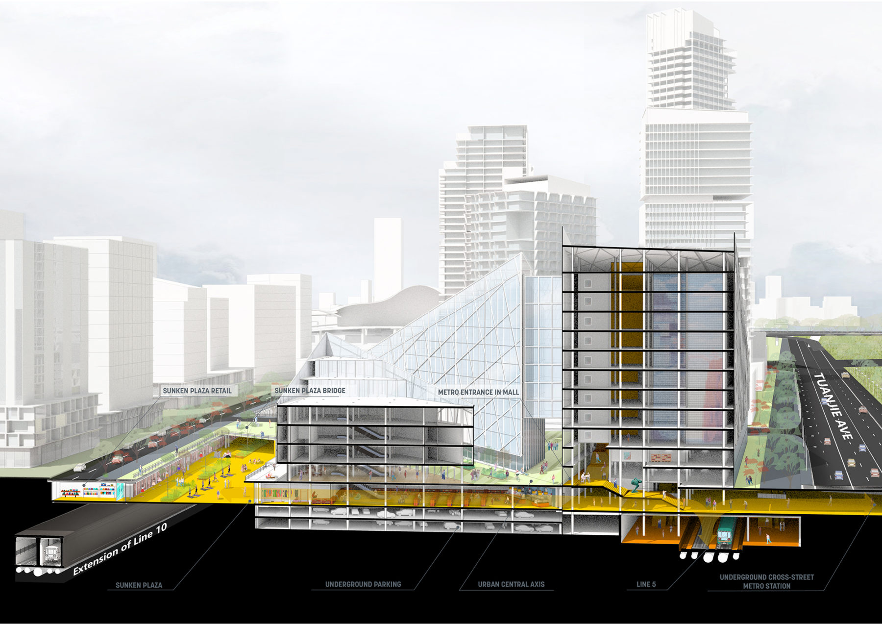
Interstitial space between subway tunnels and surface roadways are an opportunity for additional leasable space and pedestrian connections between urban blocks
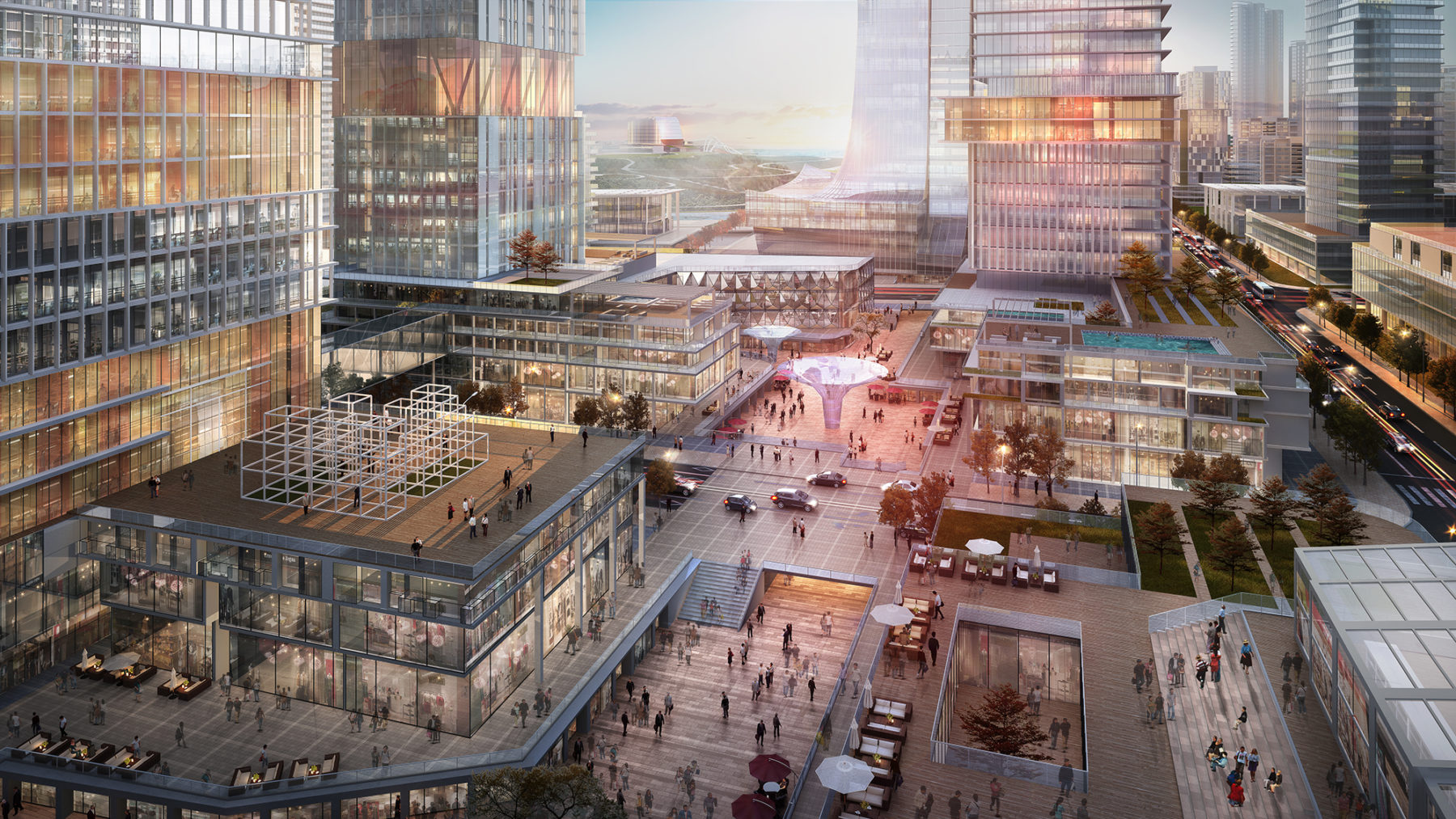
A layered public realm provides multiple spaces for people to interact with the outdoors ranging from sunken retail plazas to restaurant and café terraces to intimate pocket parks
Underground commercial space seamlessly link the subway stations to the activity above ground
Interstitial space between subway tunnels and surface roadways are an opportunity for additional leasable space and pedestrian connections between urban blocks
A layered public realm provides multiple spaces for people to interact with the outdoors ranging from sunken retail plazas to restaurant and café terraces to intimate pocket parks
Mid-rise buildings present opportunities to introduce podium landscapes, sky gardens, and green roofs that maximize the amount of public and semi-public landscapes throughout the district
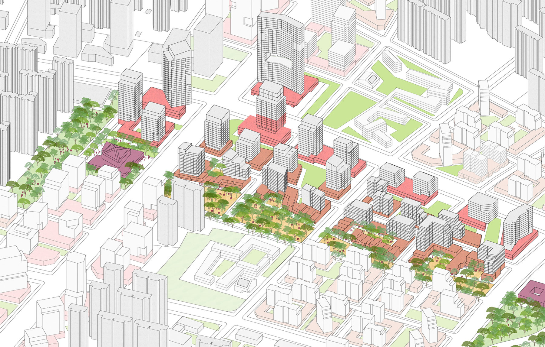
Most of the 368 hectares of open space are contiguous, linked by a network of pedestrian alleys, arcades, and linear parks
Densifying the street grid to create smaller blocks and accommodating autonomous vehicle routes completes the urban design interventions the district. The master plan thoughtfully retained existing neighborhoods to avoid disrupting social networks, while providing guidelines for diversifying land uses within parcels to foster new business opportunities for local residents and allowing for flexibility to accommodate future uses as the district evolves. The result is a landscape-forward urban blueprint that advances an environmentally progressive agenda and defines Wuhan’s next generation of growth.
A typical itinerary of a resident of the district
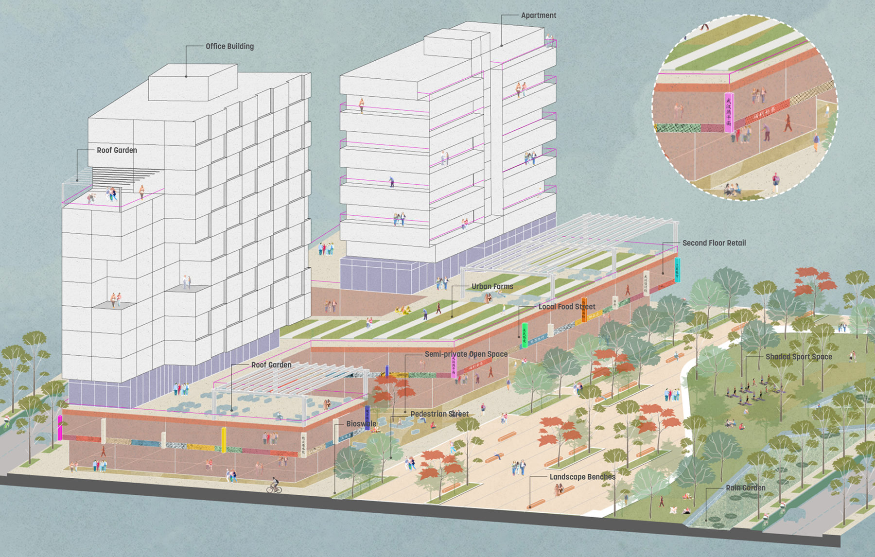
Diverse landscapes within the neighborhoods may include pedestrian food streets, shaded recreational spaces, rain gardens and bioswales, urban agriculture atop podiums, and community roof terraces
The landscapes throughout the district serve multiple purposes including pedestrian mobility, recreational amenity, stormwater storage and recharge, and wildlife habitat
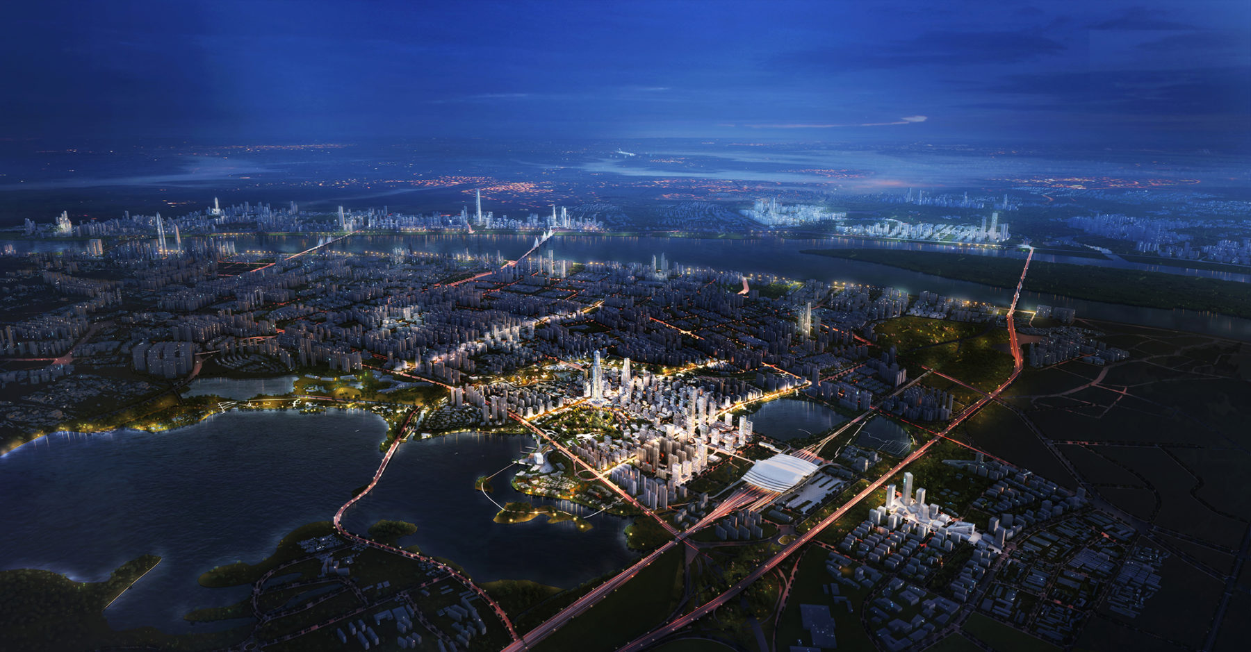
The Yangchun Lake Central Business District creates a new center of gravity in Wuhan and accentuates the city’s commitment to transit-oriented development and sustainable urbanism
For more information contact Michael Grove.