Center Street District
Broomfield, CO
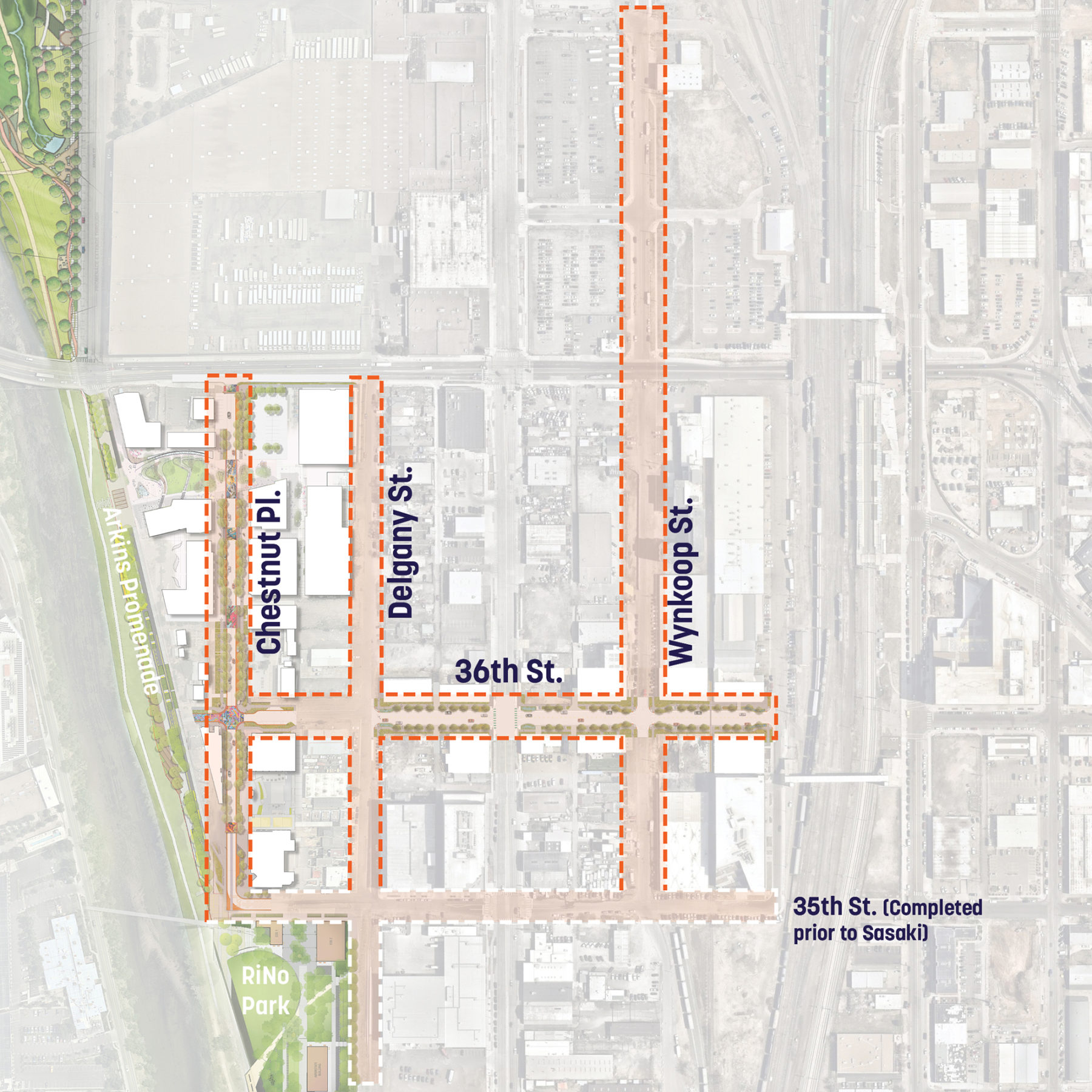
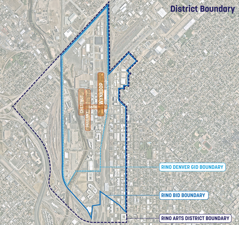
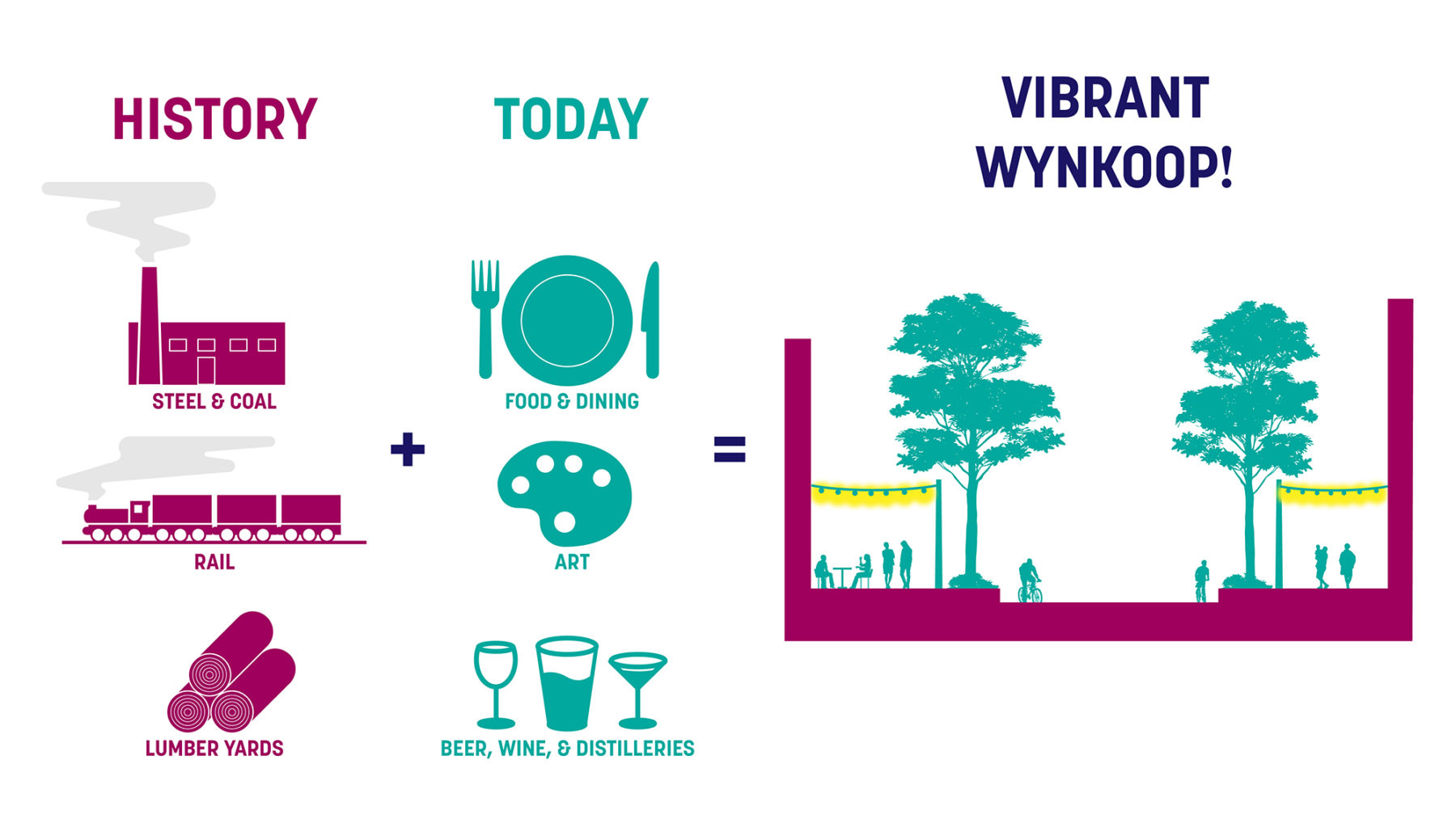
The River North Art District (RiNo) in Denver has transitioned from old industrial warehouses to one of the hottest neighborhoods in the country. RiNo started as a grassroots movement by local artists that wanted to connect the arts organizations in the area to “where art is made.” To balance the new development with the creativity that defines the district, the RiNo Art District hired Sasaki to conceptualize four critical streets in the western portion of its GID and BID boundaries.
Like many areas across the United States, a railroad bifurcated the district into the western and eastern sides. While unprecedented growth has already taken place on the eastern side, the western side of the district is quickly catching up to its eastern counterpart as new developments pop up daily. The RiNo Art District wanted to capitalize on this opportunity and create a vision for the streetscapes in the district to ensure a safe, walkable and cohesive vision was implemented instead of one-off developments.
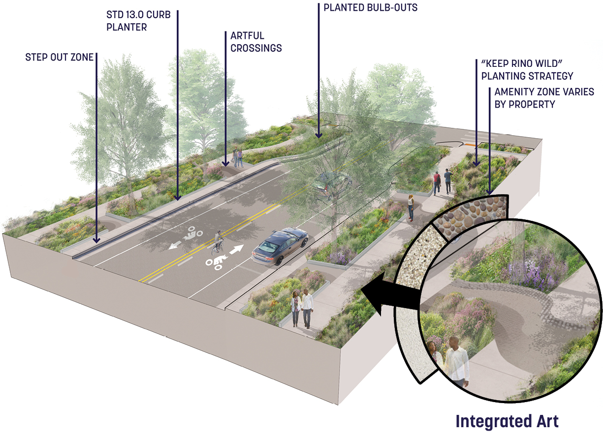
Over the past two years Sasaki has worked alongside the RiNo Art District, the NDCC, DPW, CPD, Denver Forestry, and numerous property owners to create an identity for each street that ties into the overall vision of the district. Unifying elements such as streetscape furniture, wide sidewalks, and a “Keep RiNo Wild” planting strategy have met City goals of increasing urban tree canopy as well as capturing the goals of the RiNo Design Guidelines for the public realm.
Wynkoop Street is a dynamic and critical connector in the Art District. Sasaki proposed a Streetscape Toolkit that broke the street into four main zones each with a focus on art experiences: Responsive, Interactive, Pedestrian and Educational.
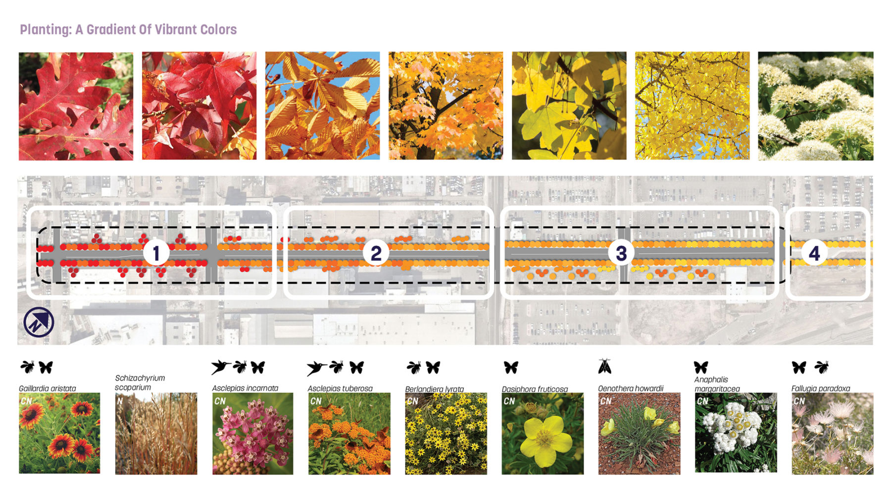
A series of diagrams showcased how dimensions, tree canopy, art, paving, lighting, seating and planting could create a cohesive street that embodies the RiNo identity. RiNo is also one of the hot spots in the city and lacks any significant urban tree canopy. The team conceived of a new planting strategy that tied the whole street together with a color gradient while maximizing the future canopy.
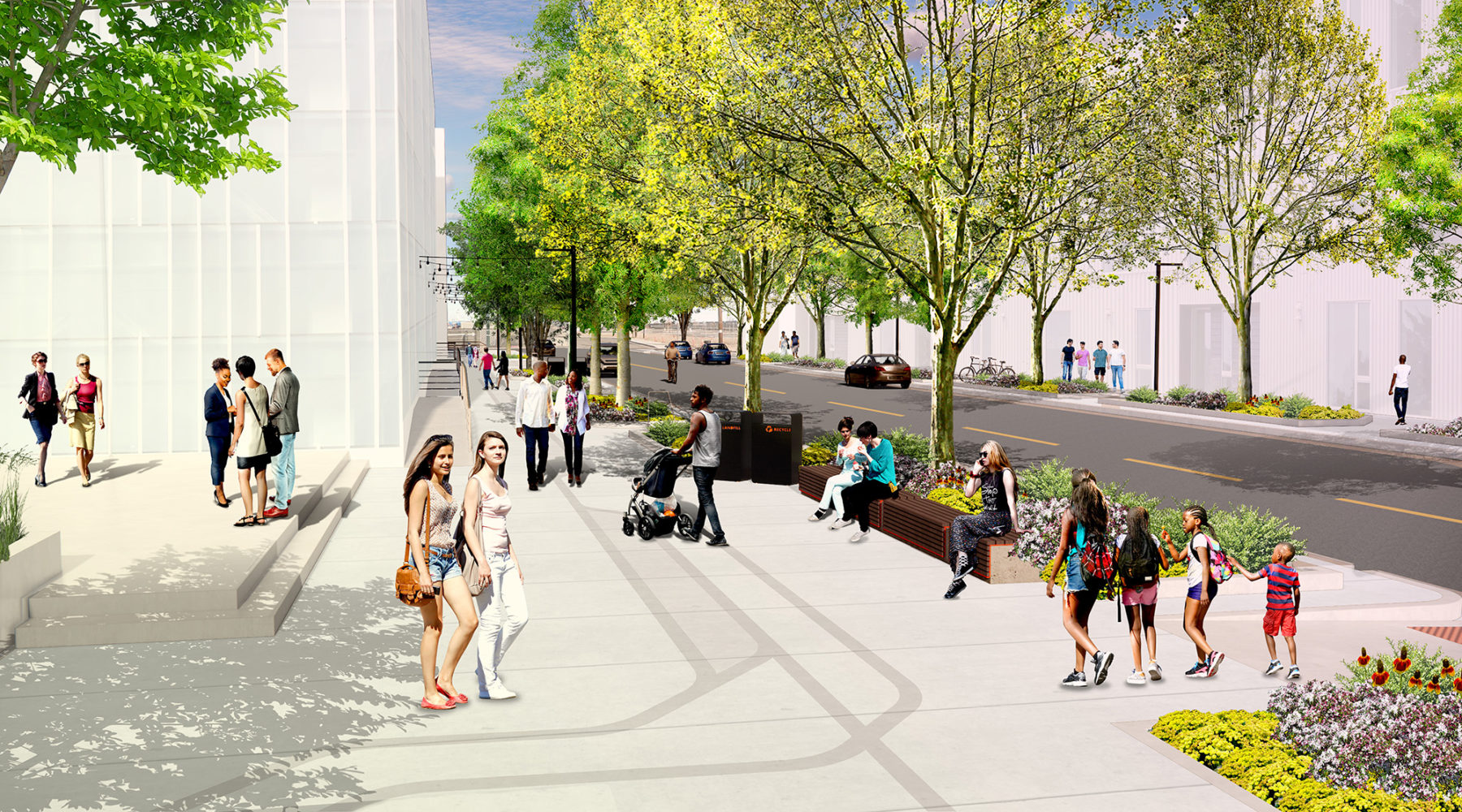
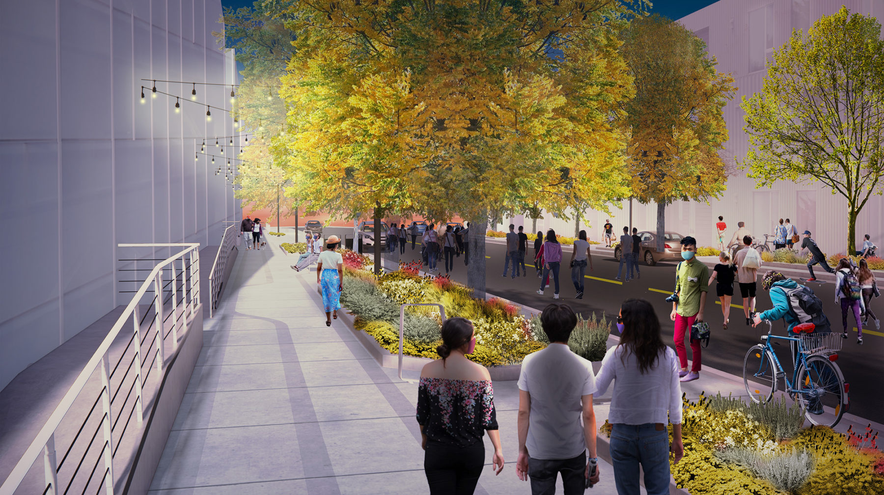
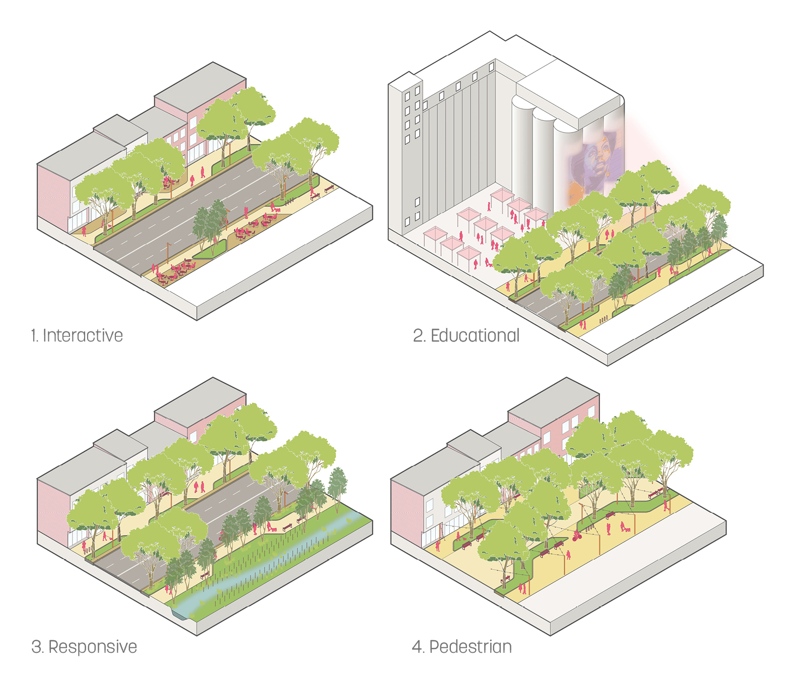
Early concepts for Wynkoop Street revolved around creating a dynamic and varied experience along the length of the street. To achieve this, Sasaki established four zones for the street that each have a unique character. The Interactive Zone would focus on “spill-out spaces” that allow dining and art to extend into the street right-of-way. The Educational Zone would include art and pop-up activities that could engage the community about the culture and ecology of the area. The Responsive Zone would focus especially on storm-water with interactive art that tracks and responds to water collection in swales and bioretention areas. Finally, the Pedestrian Zone would be a shared street, where people walking and cycling would be prioritized over vehicular traffic.
To tie the street together, the design focuses on a continuous planting strategy, consistent planters with chamfered edges, and sandblasted concrete patterning that would extend the full length of Wynkoop Street.
The Chestnut Place project, a two-block street that terminates at the new Arkins Promenade, started with a kick-off with all the property owners along Chestnut to better understand their individual visions and how they tie into a pedestrian-focused street.
The kick-off resulted in guiding principles to help define the project as the Sasaki team advanced the design: Preserve the industrial character, support the local art community, encourage diverse housing solutions, and enhance public open spaces. This was accomplished by the following design interventions:
Through extensive workshops with the property owners and meetings with CCD, a 30% Design submission through ERA was approved in October 2019.
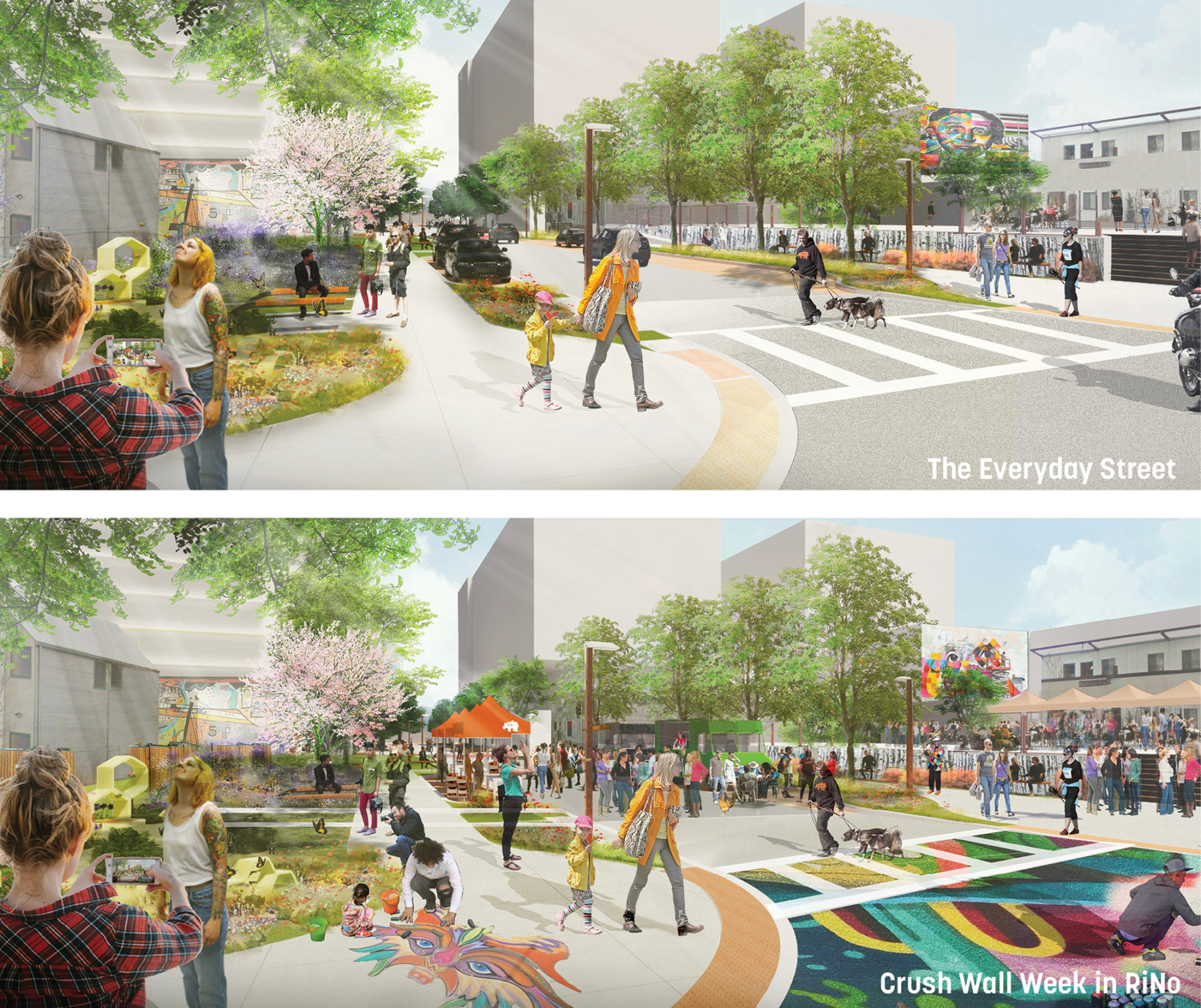
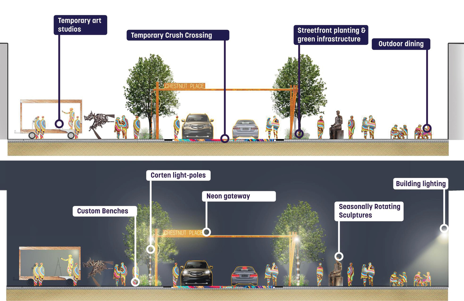
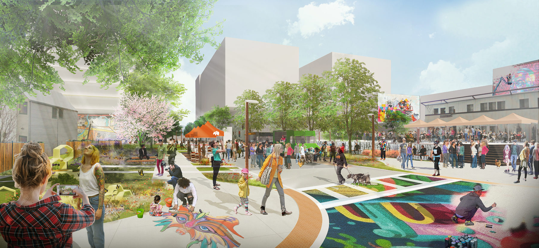
As a festival street, Chestnut Place needed to have it’s own unique character specific to the area. Historically, steelworking, extrusion, and neon manufacturing took place along Chestnut. These character influences were rolled into the custom furnishings proposed for the street. Corten gateways, light poles with water-jetted RiNo logos, and custom extruded benches were proposed as part of the this package. In a addition to the custom furnishings, seasonally rotating sculptures, rolling art studios, flexible cafe spaces, and temporary street murals were proposed to give Chestnut Place the most energetic and RiNo-centric vibe possible.
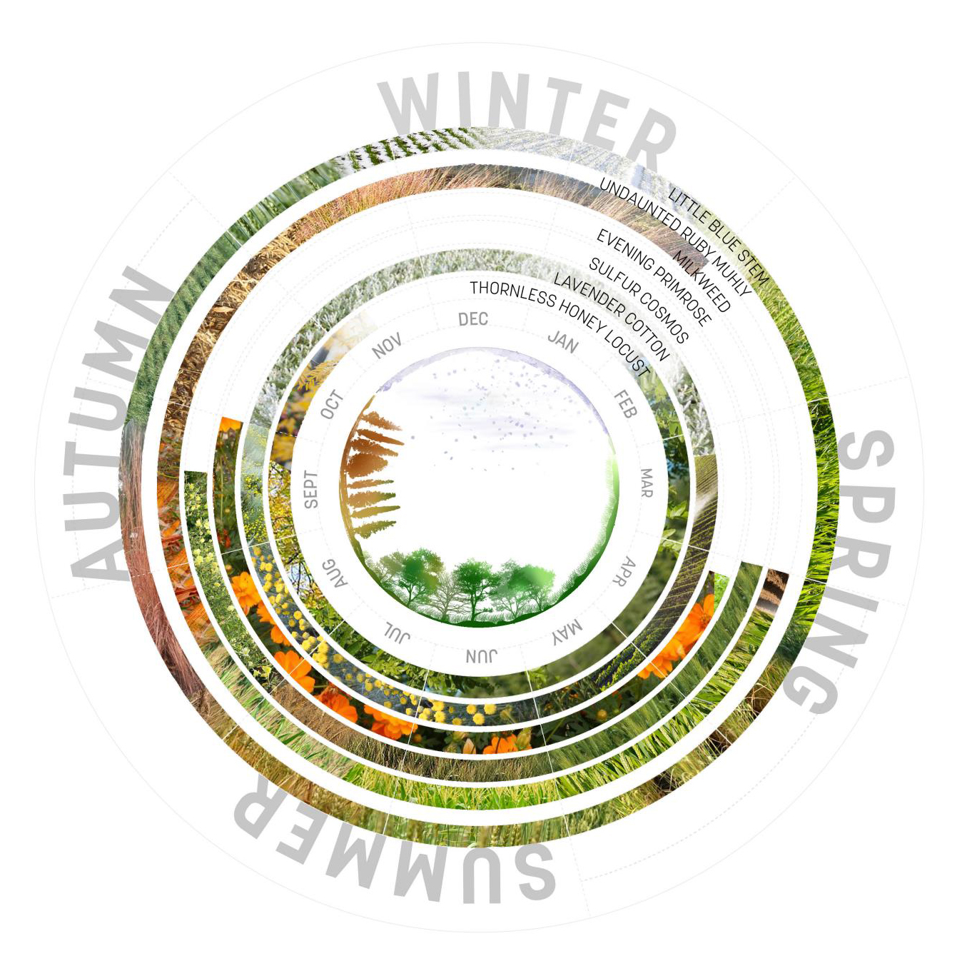
A key part of the strategy for both Chestnut Place, and RiNo as a whole is to incorporate pollinator-friendly, native species. With it’s proximity to the South Platte River, establishing an appropriate canopy and groundcover palette was particularly important to begin blending the boundary between revitalized riverfront and urbanizing festival street.
This historically one to two story industrial street is rapidly transforming with ambitious projects up to 12 stories underway. With this in mind a thorough shade analysis was required and the planting strategy was based around water needs, bloom times, and looking at the future anticipated shade along the street after a full-buildout.
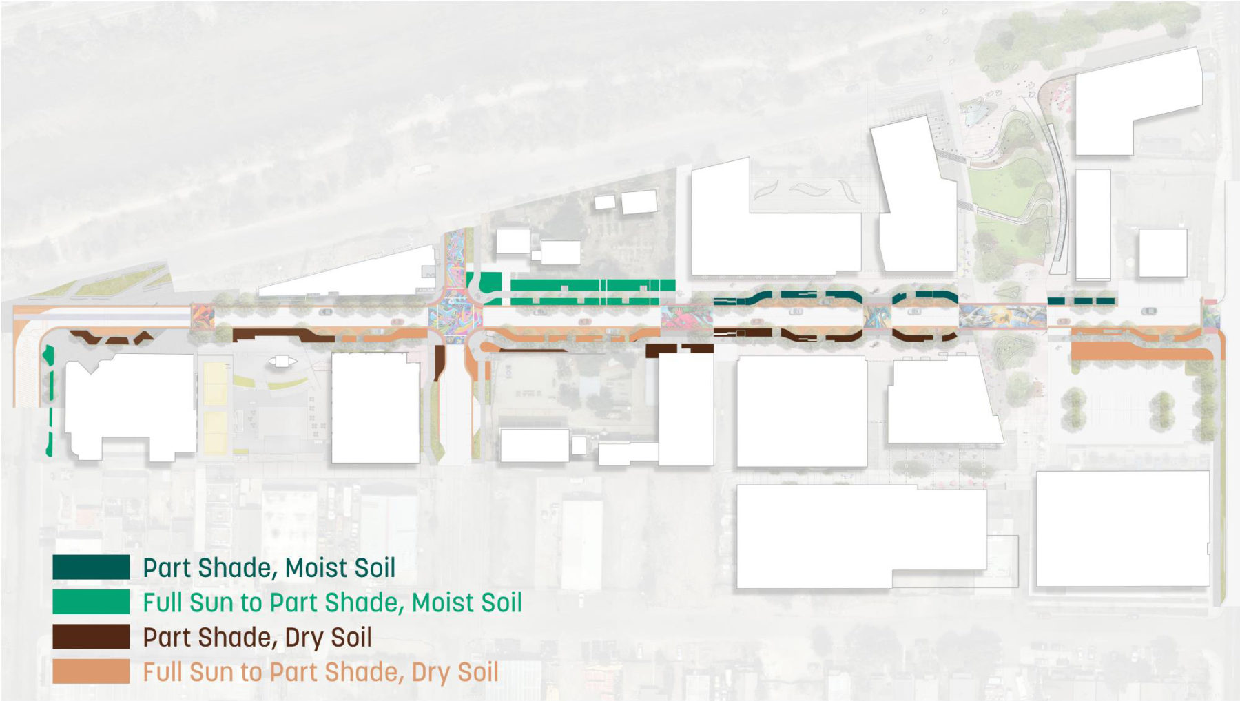
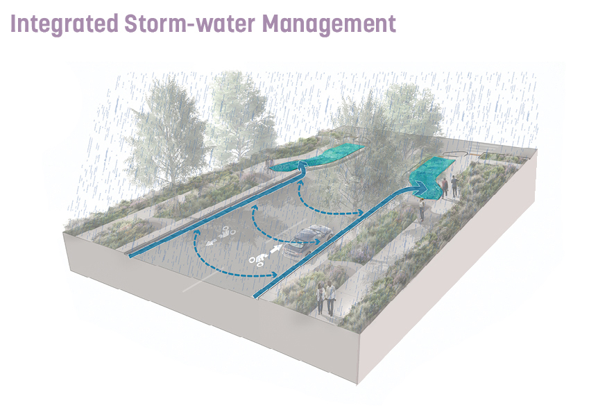
Seen as one of the secondary streets in the RiNo Art District, the design team based the street’s design off of the concept of being a tributary street both for people and water. All water flowing down 36th will end up in the South Platte and 36th aims to capture as much runoff in the open planters. The planting design keeps “RiNo Wild” with a diverse palette which are all approved through Denver’s Ultra Urban Green Infrastructure Guidelines. Art is incorporated into the streetscape with a subtle ribbon of exposed aggregate CIP concrete.
Integral to the success of 36th street was the coordination with 15 different property owners along the street. Similar to 21st street, it was critical to understand what phase of design each property owner was in and tie their design into the overall vision of the streetscape. This resulted in a design that creates a cohesive identity while still letting property owners move forward with development.
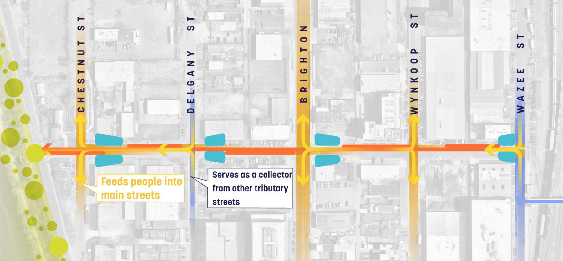
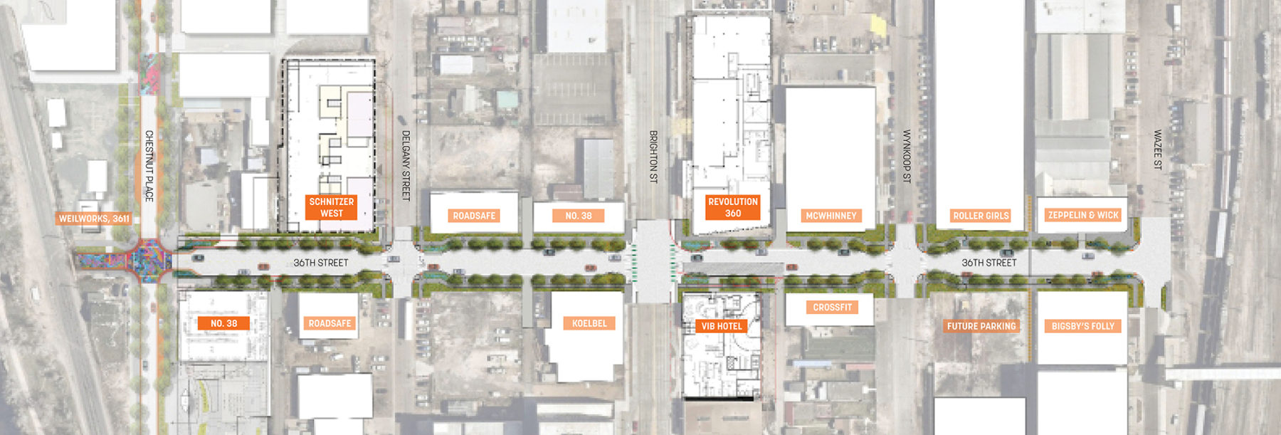
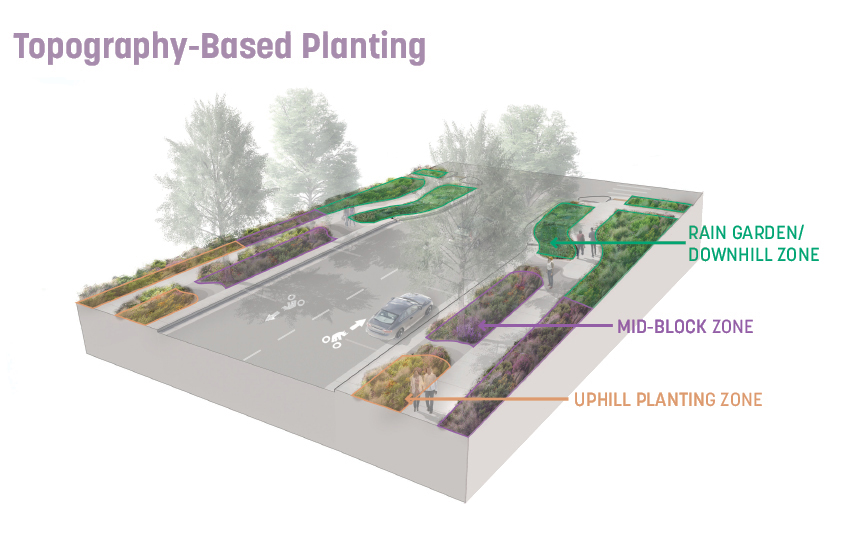
While 36th is intended as more of a feeder street than a festival street, the district was still interested in pushing for enhancing functionality and subtle character building. To this end Sasaki proposed integrated stormwater management on a block by block basis, which also led to a topography-based planting strategy, essentially creating hilltop, plains, and lowland environments on each block. The integrated lighting system and aggregate sandblasted concrete cut throughs begin telling a story of the filtration process while providing visual interest and a well-lit environment.
For more information contact Anna Cawrse.