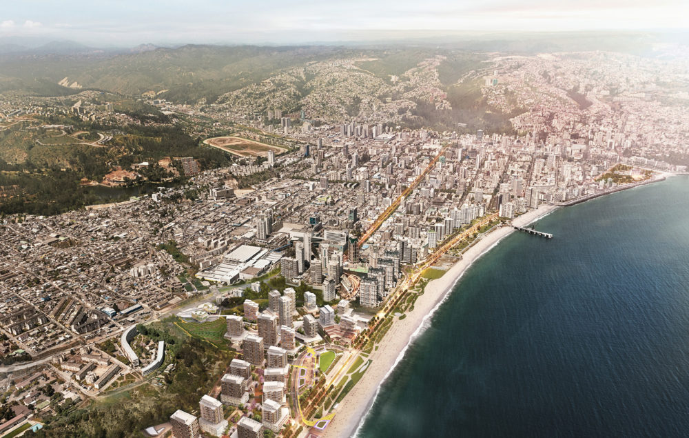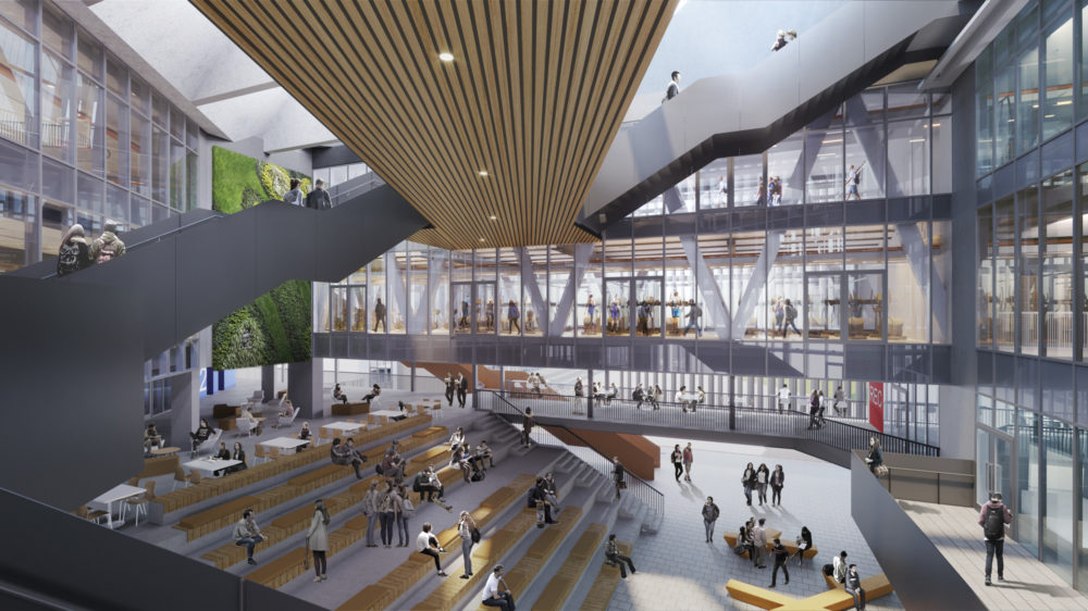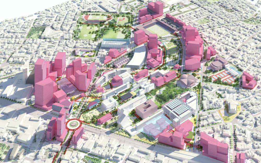
Tecnológico de Monterrey Urban Regeneration Plan
Monterrey, Nuevo Leon, Mexico
Urban planning in Culiacán and in the State of Sinaloa in Mexico has been limited for years to a land use-centric organization of the territory that has slowly promoted the suburbanization of former rural and industrial areas in favor of an ever expanding city footprint. The last 30 years of growth of the city are a testimony to this process that has challenged the urban periphery’s hydrology and ecosystem with local developers creating large dormitory neighborhoods with minimal urban infrastructure.
The Distrito Sur Master Plan provides a bold new vision for urban living, a program, and a framework for the creation of a new centrality in the City of Culiacán. The Master Plan for the 130 hectares of land in the fast growing area of the South of the city is driven by the sustainable development of the property as part of a 25-year planning horizon.
The Distrito Sur Master Plan (“Plan”) provides a vision, a program, and an urban, landscape and architecture framework for the growth and development of Distrito Sur. The Plan identifies a new strategy for the District’s land use, circulation, and the creation of development and open space parcels intended to support the highest and best use for the land as part of a bold new vision for urban living in Culiacán.
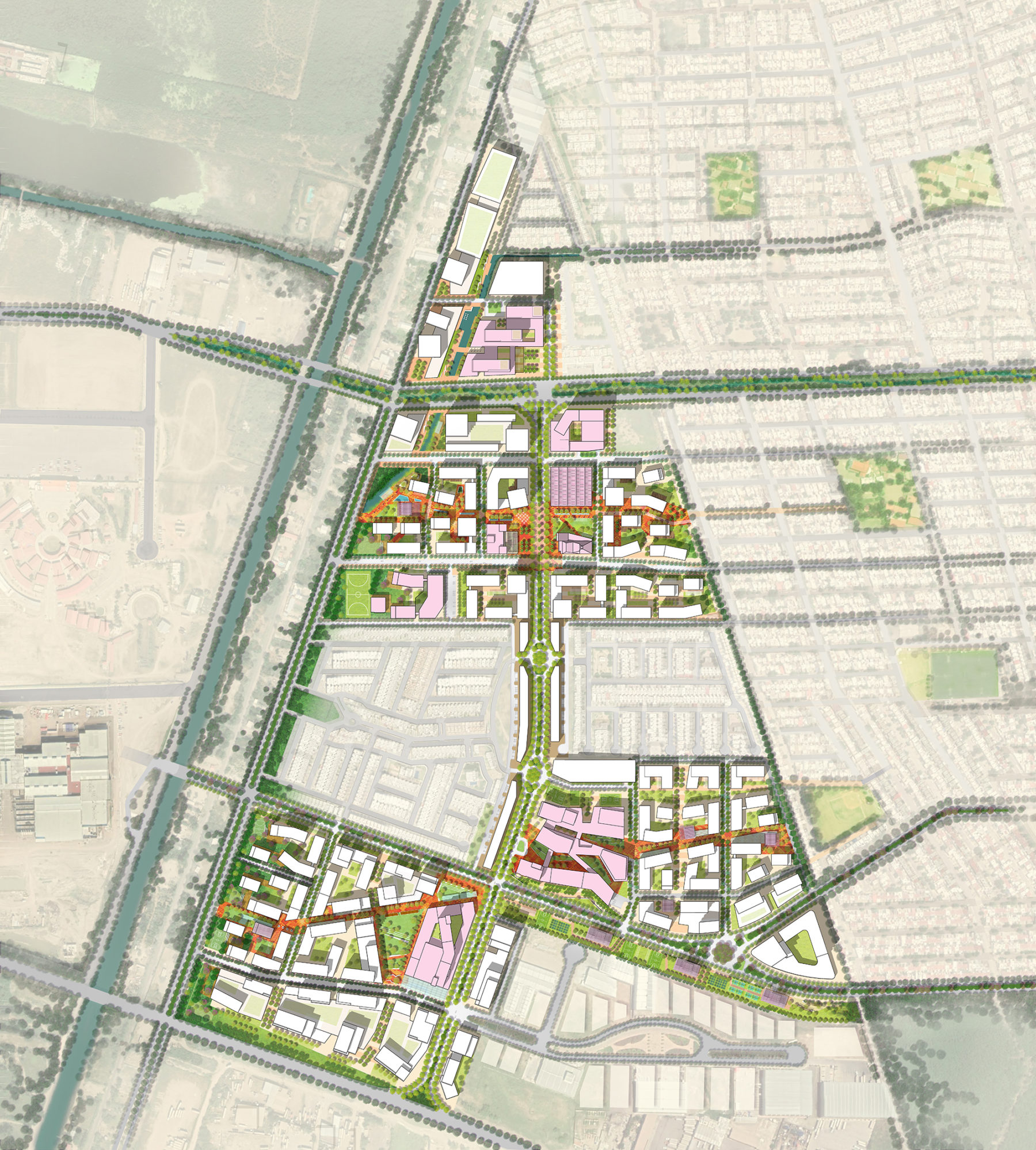
The Master Plan identifies a new urban district for the southwest sector of Culiacán
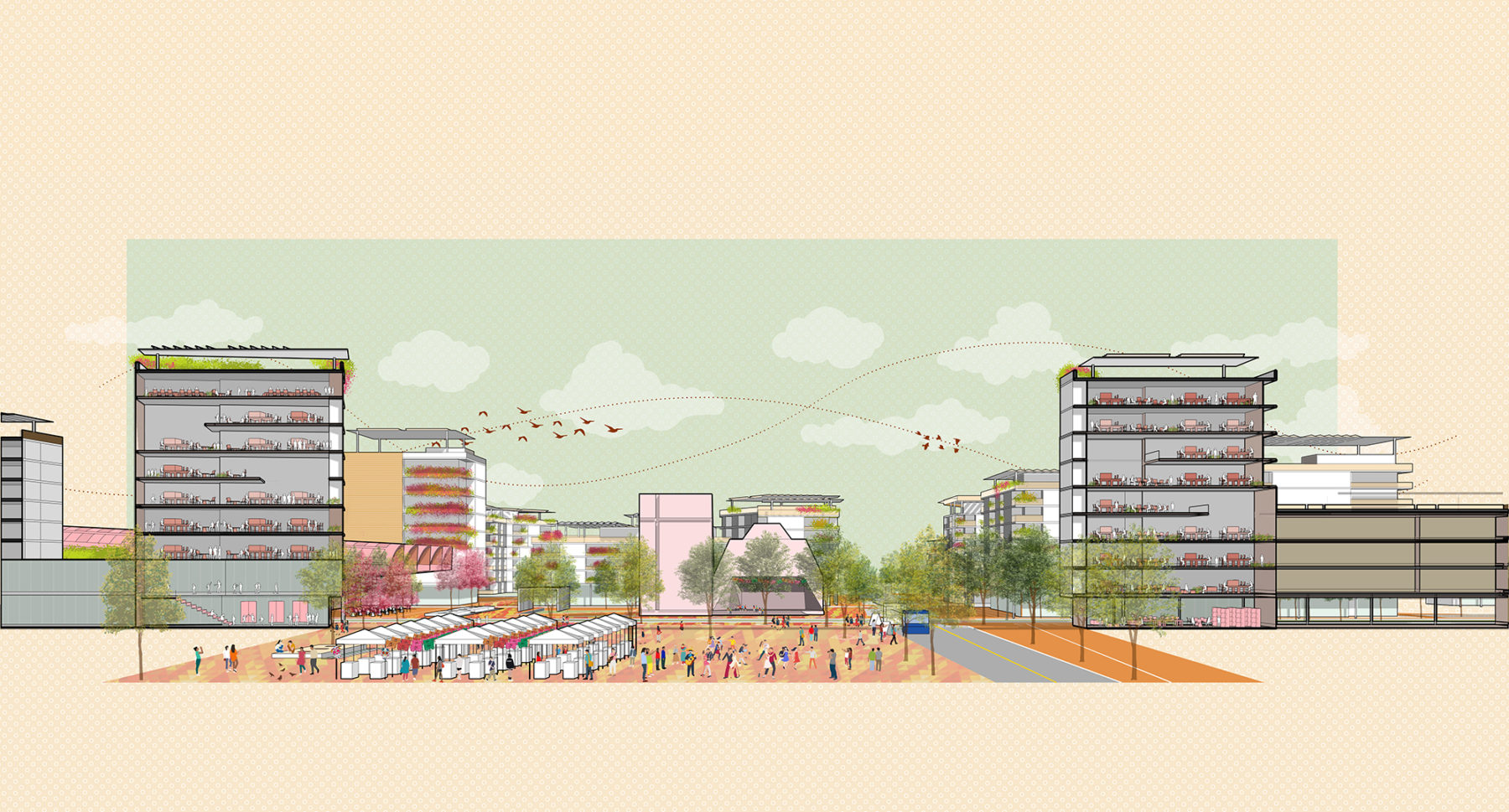
Distrito Sur will serve as a new urban district and mixed use destination for the city, as well as a model community for the Sinaloa region and the larger nation through its inclusive and climate resilient design, diversity of uses, and true integration of open space. The Plan will build on the momentum in this emerging part of the city and provide a range of complementary and in-demand uses for its local residents, workers, and visitors. Boulevard Las Flores will be a distinctive feature of the District serving as an active and welcoming space that unifies the multiple neighborhoods into one cohesive district.
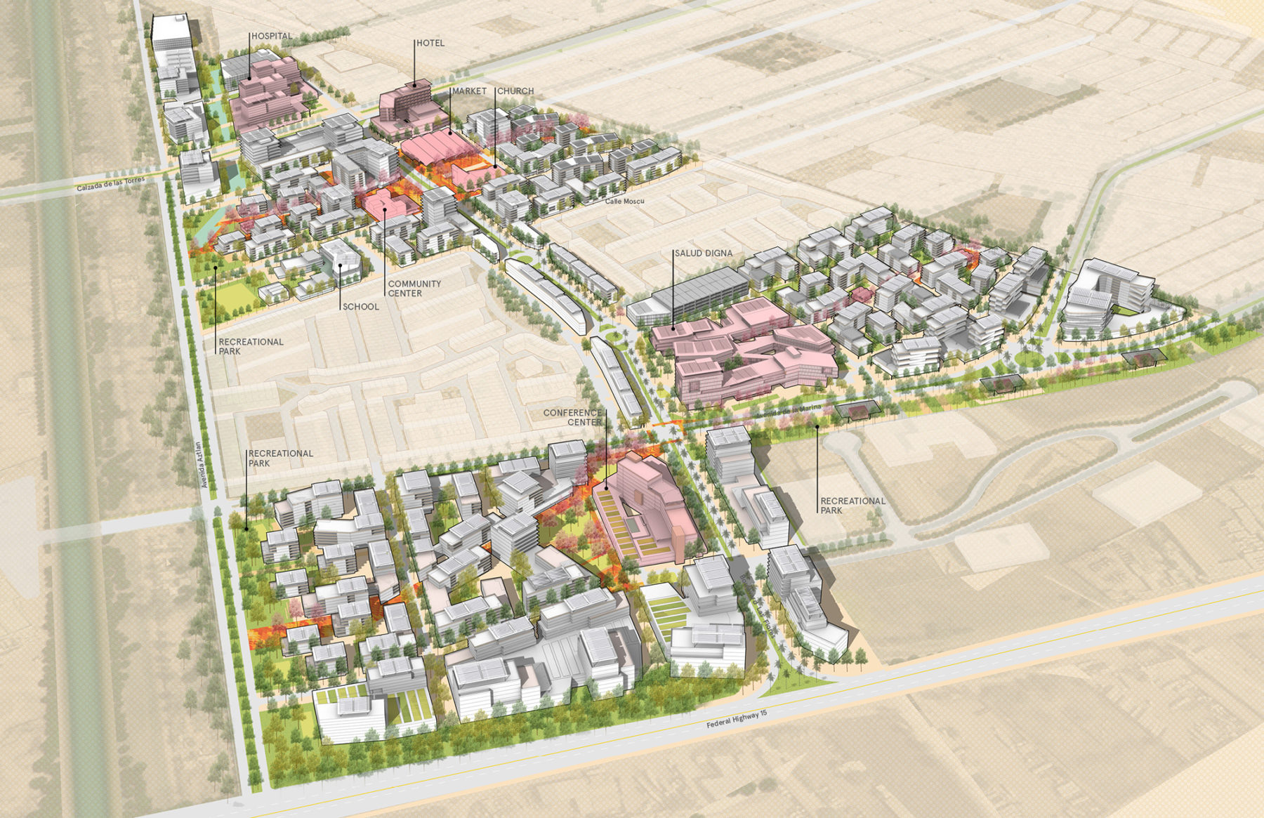
25-year district buildout looking northeast
The Plan’s physical, programmatic, and landscape design intent is captured through the following principles:
A network of community hearts: The District is structured around a series of community
hearts that provide neighborhood amenities and space for social gathering, while also creating a sense of community cohesion.
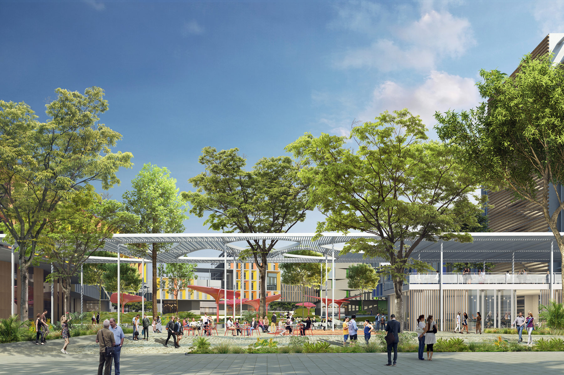
Open space connectivity: The District is defined by a network of open spaces that form the connective tissue for the built form and integrate with the existing neighborhood context. The network includes several public plazas, a linear open space along the district’s western edge, and key pedestrian connections internal to the block structure.
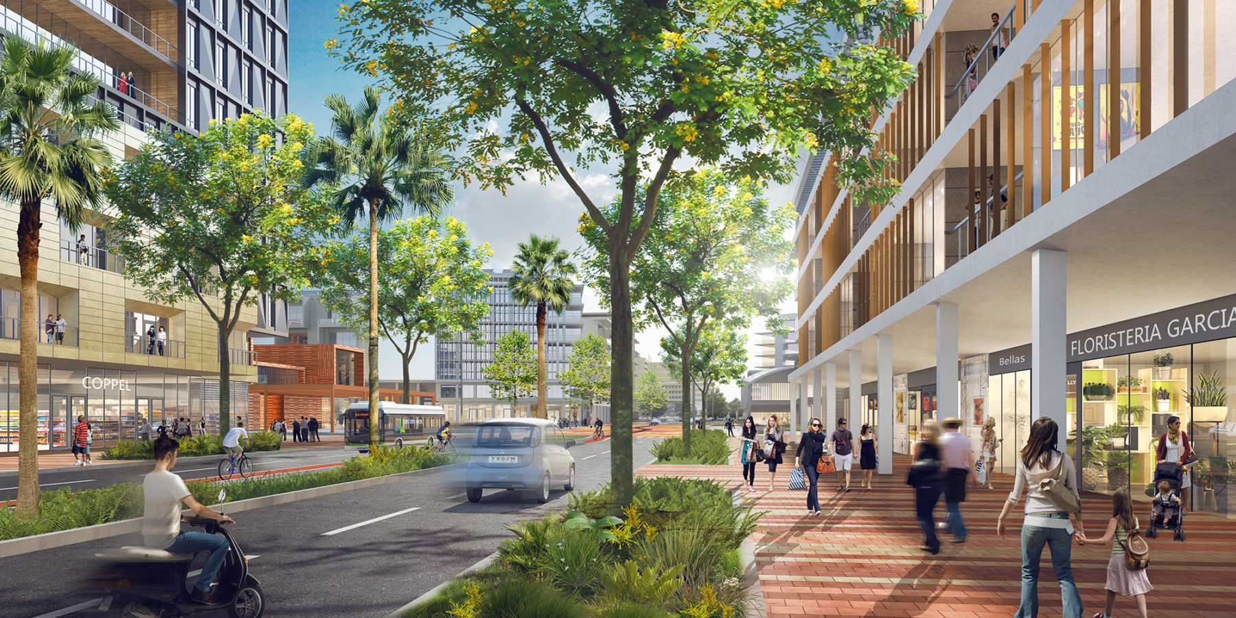
A vibrant district: A diverse mix of uses will be strategically located across the district to create a vibrant environment for the community and its visitors. The District will also benefit from active ground floor uses along the main corridors and pedestrian plazas.
Climate-responsive design: The District’s design accounts for the region’s extreme weather conditions by promoting well-shaded landscape design, solar optimal building orientation, and a range of district-wide stormwater strategies.
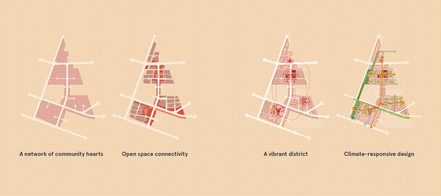
Four key principles capture the overall physical, programmatic, and landscape design intent of the District
View of Boulevard Las Flores looking north to the District Center Plaza
Distrito Sur is organized around four major neighborhoods: North Neighborhood, the District Center, East Neighborhood, and South Neighborhood. All four contain a unique combination of anchor programs and open spaces that define their individual character.
North Neighborhood – Tech and Health
The North Neighborhood is characterized by a combination of tech, healthcare, and light industrial uses. Located along the major corridor Calzada de las Torres, this neighborhood is physically separated from the rest of the District, but will be anchored by a future hospital serving both District residents and the greater southwest sector of the city. The neighborhood’s western edge will include warehouse and flexible office space for tech and light industrial uses given the nearby industrial uses. The existing onsite canal will separate the two areas of this neighborhood and serve as an open space amenity for both employees and visiting hospital patients.
The District Center – Civic and Community
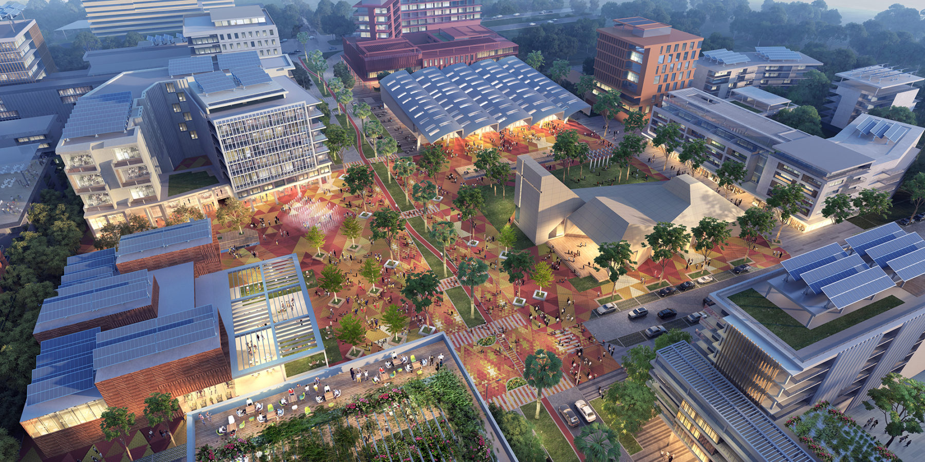
The District Center will serve as the northern gateway to the District from Calzada de las Torres and include a range of civic and community amenities, together with significant residential communities at the eastern and western edges and commercial amenities along the interior urban edges. This neighborhood’s central plaza will serve as one of the District’s iconic public spaces with a public market, church, and community center framing the space. The plaza will span across Boulevard Las Flores creating a flexible space for a range of community programming and events. An elementary school will be located along the western edge abutting the linear park and will serve both the District’s residential population as well as the surrounding areas.
View looking down at the District Center Plaza with the proposed church, market and community center
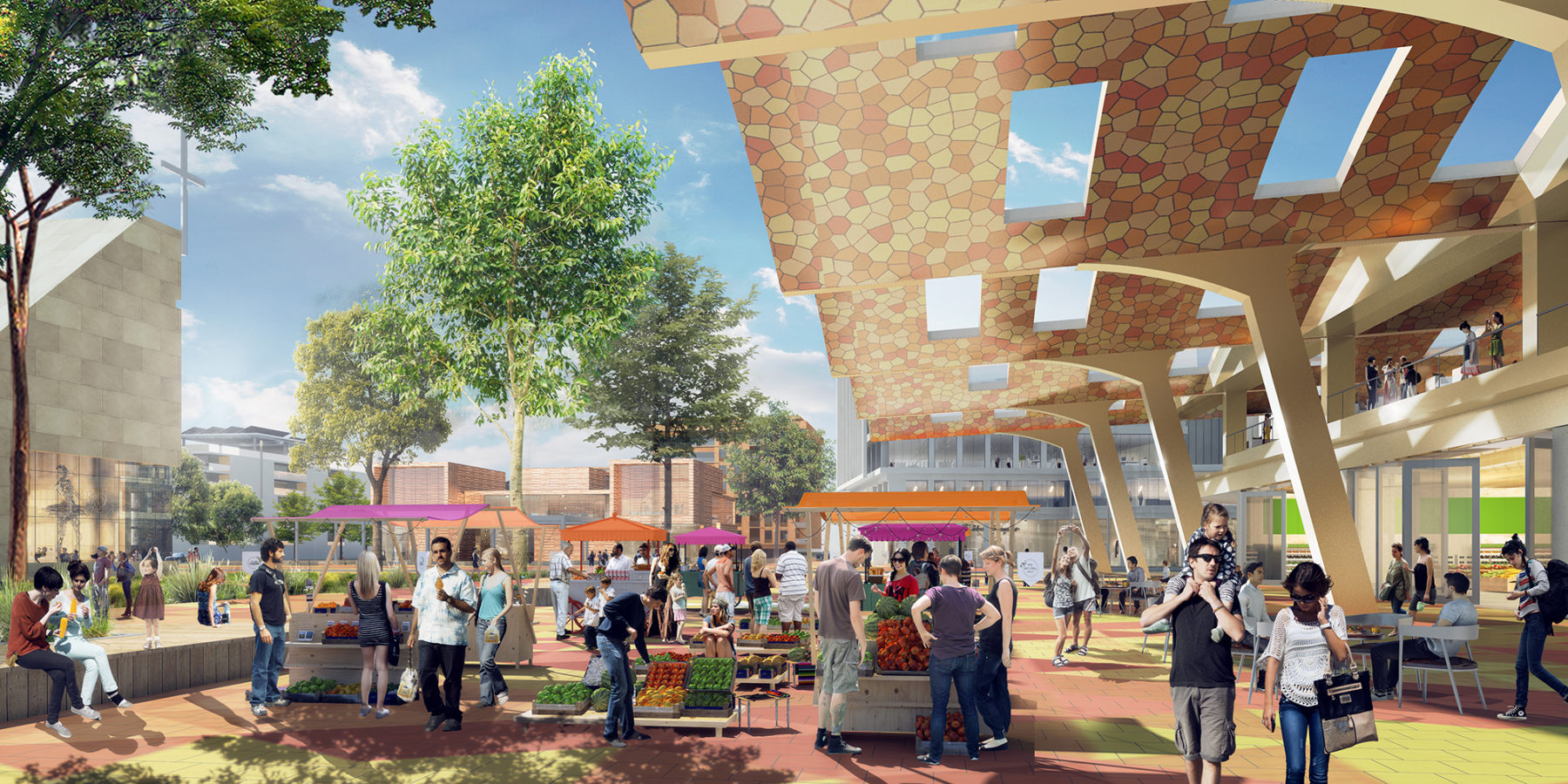
The public market will serve as a key destination for residents and visitors activating the District Center Plaza
View of the District Center Plaza looking north
East Neighborhood – Campus and Live/Work
The East Neighborhood will include the new Salud Digna campus at the crossroads of Boulevard Las Flores and Avenida de la Marina and a mix of residential, retail, and office uses. Salud Digna will serve as an early anchor and employment center that activates the District’s southern end. At full buildout, the campus will include a combination of corporate office, research, and university space, and several open space amenities accessible to the greater District community. Boulevard Las Flores will connect the campus to the northern District Center with a mixed use live/work typology including professional offices on the ground floor and residential above.
This neighborhood will also serve as the District’s eastern gateway from the adjacent residential community. As one of the District’s main urban corridors, Avenida de la Marina will include ground floor retail with residential units above on the northern side, and both office and retail uses to the south along the triangular parcel. A linear park with a range of community activities and destinations will also extend along Avenida de la Marina serving as a buffer between Quazar Industrial Park and the community.
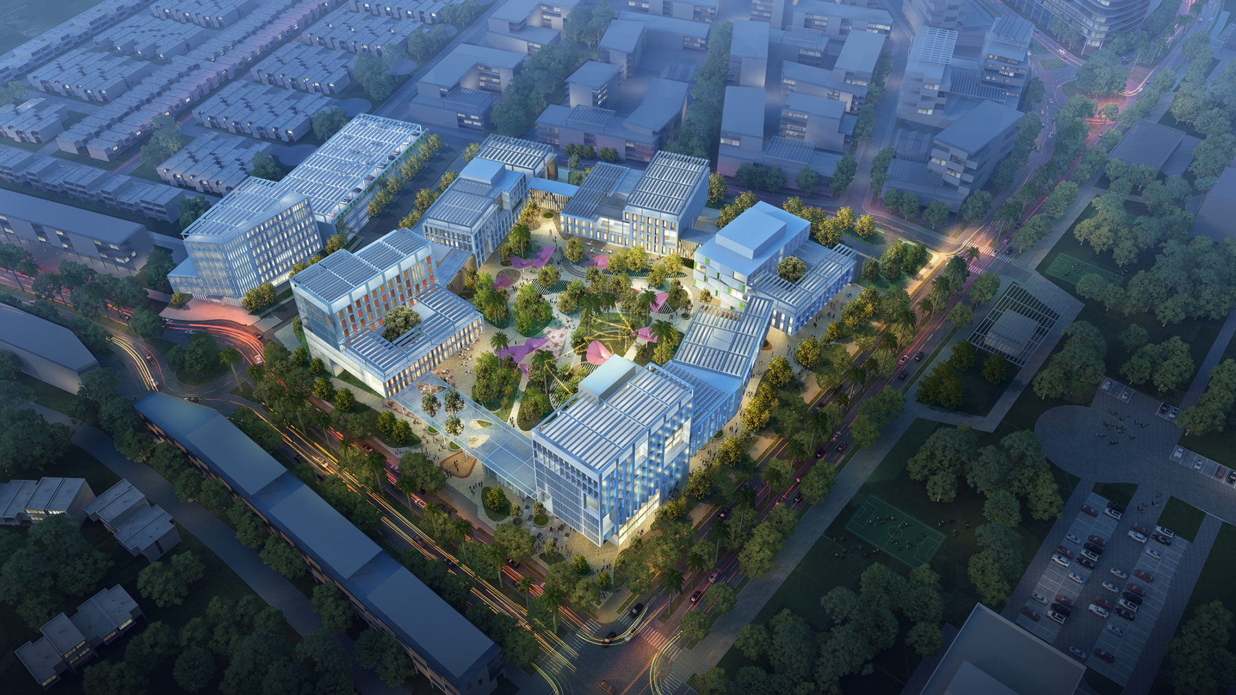
Aerial view of the future Salud Digna Campus Headquarters
Primary Salud Digna Campus entrance from Boulevard Las Flores
South Neighborhood – Commercial and Hospitality
The South Neighborhood serves as the District’s southern gateway along Federal Highway 15 and includes a mix of commercial, hospitality, office, and residential uses. A convention center and hotel will anchor the neighborhood along Boulevard Las Flores and serve as key visitor destinations for the District, while office buildings will line the neighborhood’s southern edge capitalizing on the visibility from Federal Highway 15. With only a 10-minute drive to the Culiacan International Airport, this neighborhood is one of the District’s most accessible areas for visitors.
Multifamily units with ground floor retail will line Avenida de la Marina, activating the urban corridor and primary connection to the nearby Explanada Culiacán. The neighborhood’s residential communities will be concentrated in the interior and along the western edge abutting the linear remediation and recreational park.

View of the South Neighborhood Plaza looking northeast towards the intersection of Boulevard Las Flores and Avenida de la Marina
The new Salud Digna campus will serve as an early anchor for the overall development of Distrito Sur, attracting company staff, partner companies, and future students to the area, and generating demand for additional residential and commercial uses. One of the primary goals of the Distrito Sur Master Plan effort is to capitalize on the potential of anchor uses like Salud Digna and the neighboring Explanada Culiacán Mall to create a new mixed use center for the city that can be both a business center and a living and commercial destination unlike others in the metropolitan context. The development and implementation of this plan will provide Salud Digna with an ideal context and community setting for its future development where institution and neighborhood can grow together.
Distrito Sur’s open space network will serve as an iconic feature of the new community. The Plan allocates 40 percent of all district land to open space and proposes the following distinct open space typologies: plazas, green corridors, amenity parks, pedestrian promenades, remediation zones, and residential courtyards.
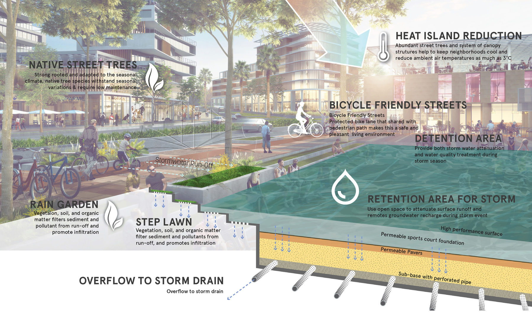
Stormwater strategies in the context of a recreational park
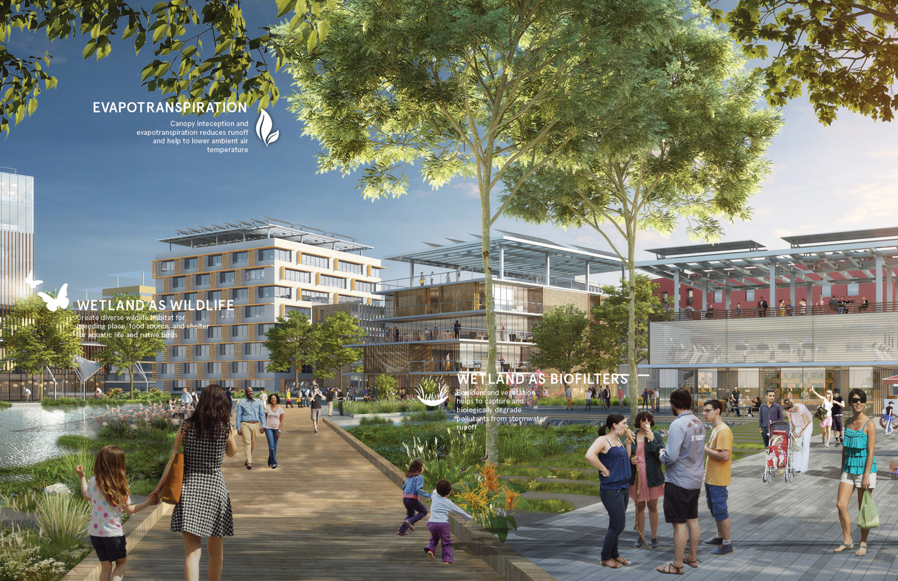
Stormwater strategies in the context of the canal in the District Center
For more information contact Pablo Savid-Buteler.