Introducing a vision for Dublin's investment and revitalization.
City of Dublin Metro Area Strategic Plan
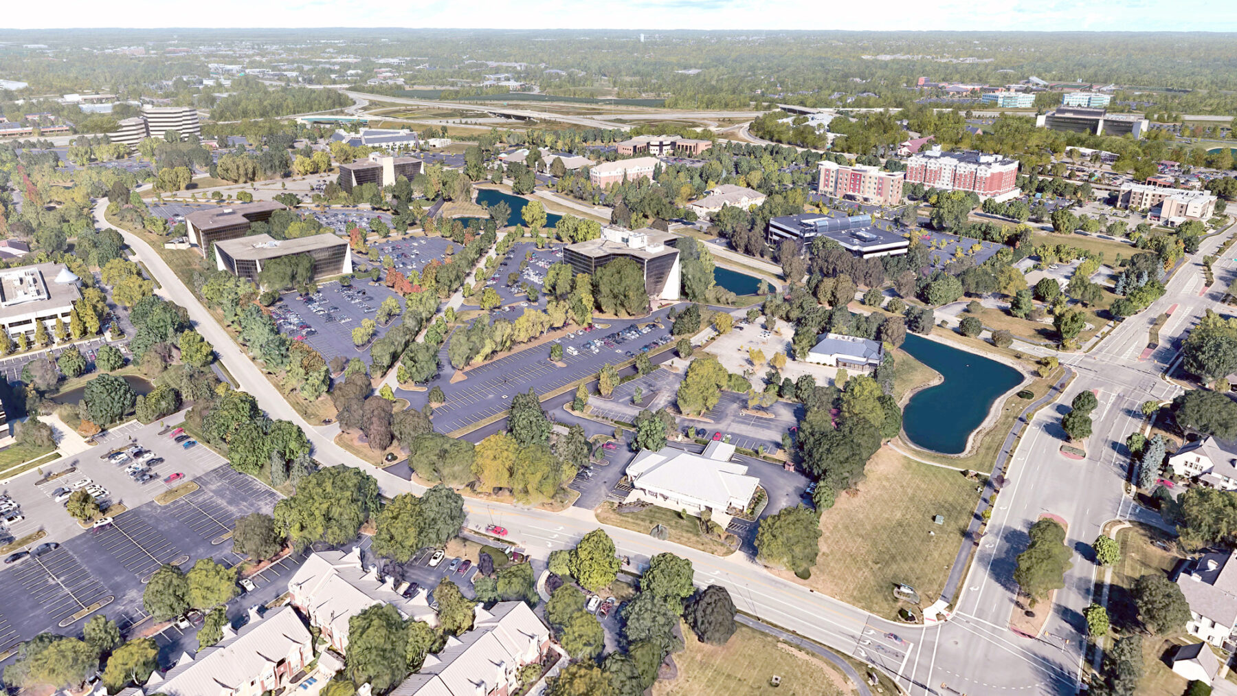
Located approximately 17 miles northwest of Columbus, Metro Center is a suburban office park in the heart of Dublin, Ohio. As one of many suburban communities on the periphery of Columbus, Dublin and its Metro Center have undergone significant economic, environmental, and cultural changes over the last three decades. Building upon recent plans undertaken by the Dublin community, Sasaki, in collaboration with the City of Dublin, has set forth a visionary plan to guide the urban district’s transformation.
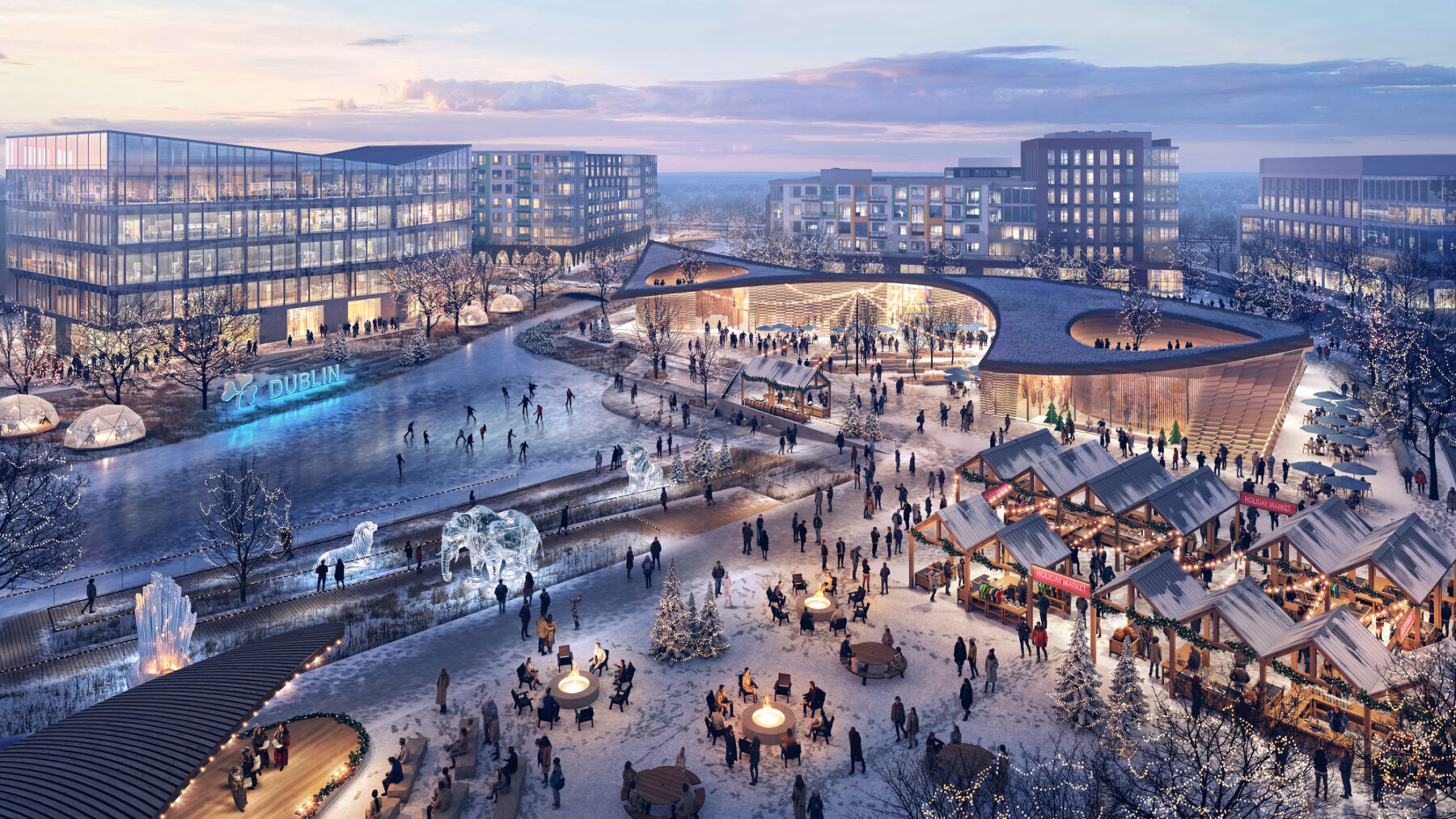
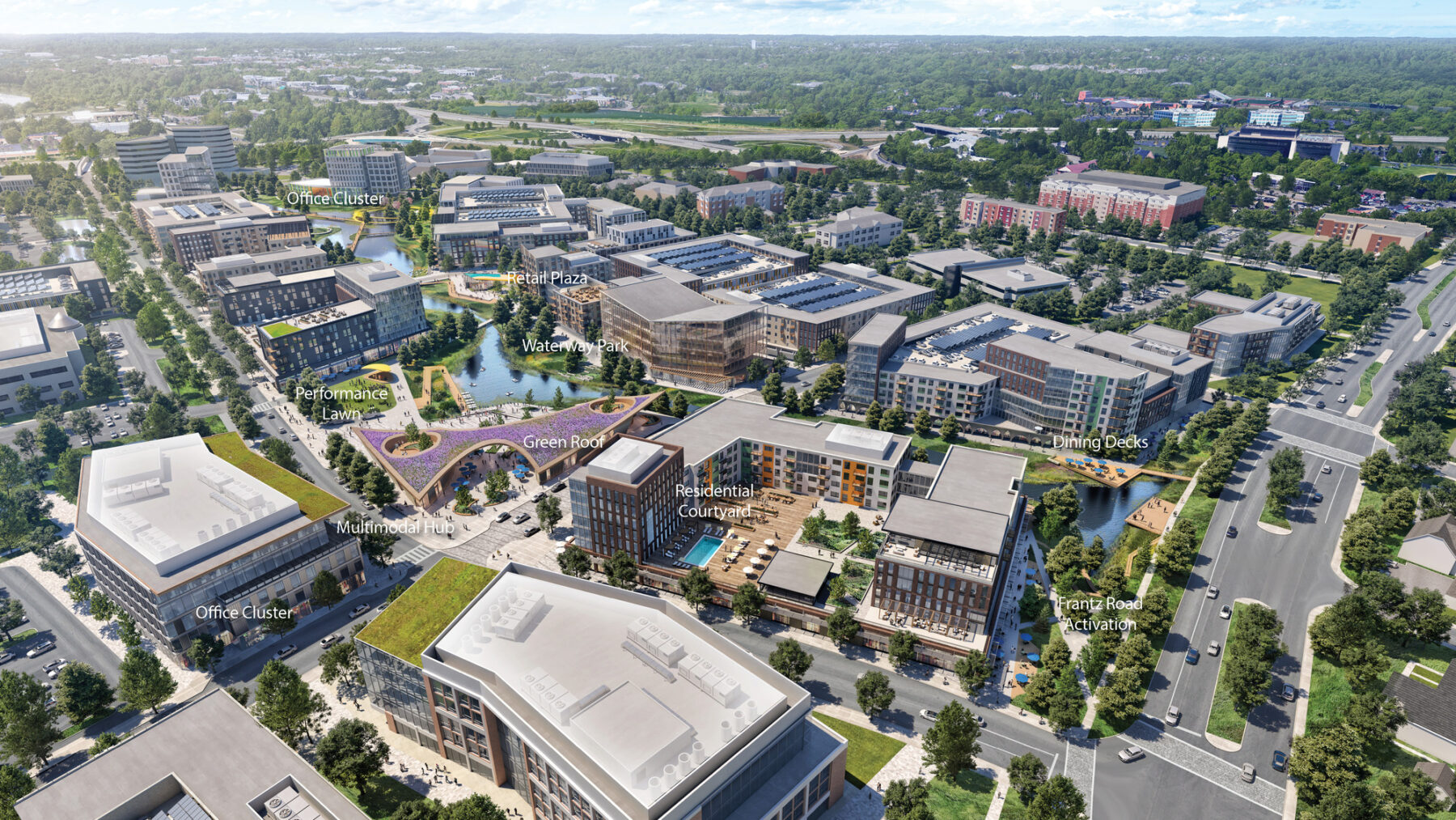
The Metro Center Revitalization Plan positions the district for transformation from a single-use employment center into a vibrant mixed-use destination, characterized by high-quality employment and residential uses, food and beverage options, retail services, cultural and entertainment venues and recreational amenities. The plan creates a distinct identity and sense of place and identifies public infrastructure and mobility improvements which will enable the district’s transformation.
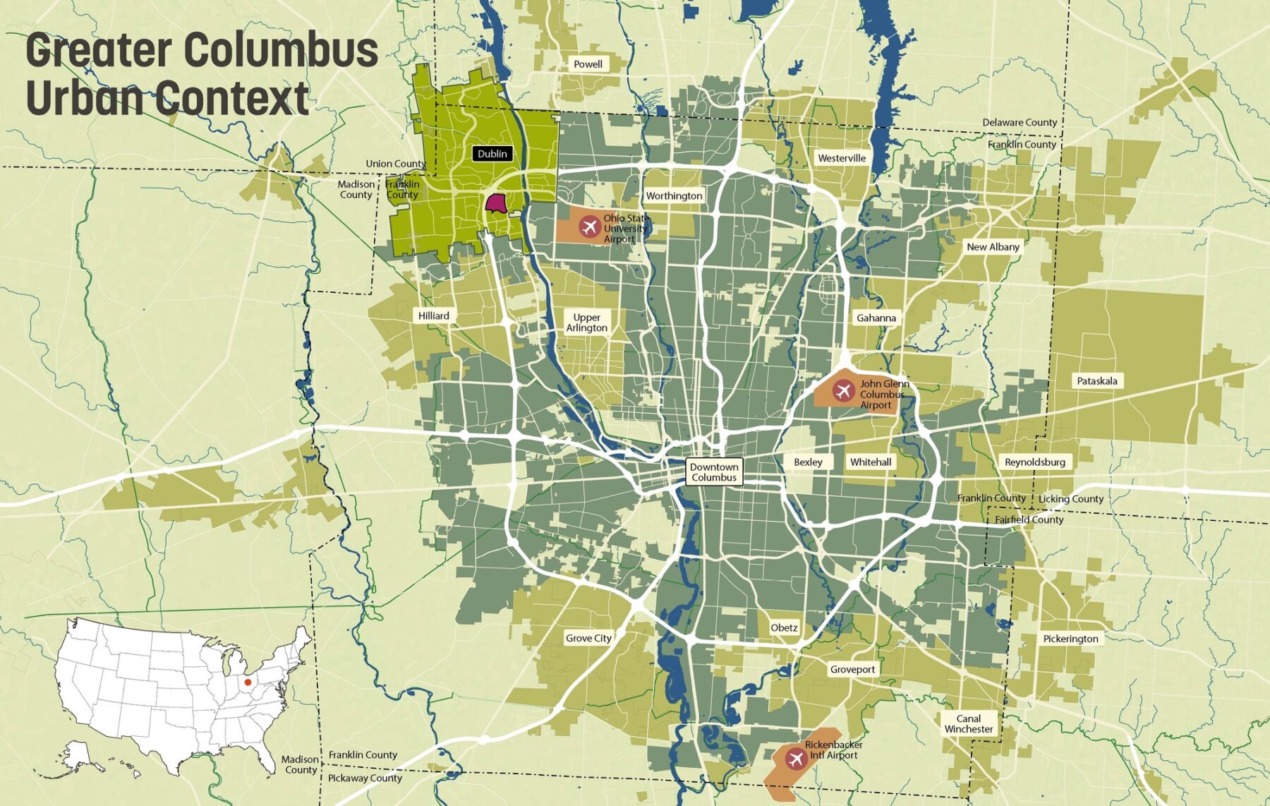
Greater Columbus Urban Context
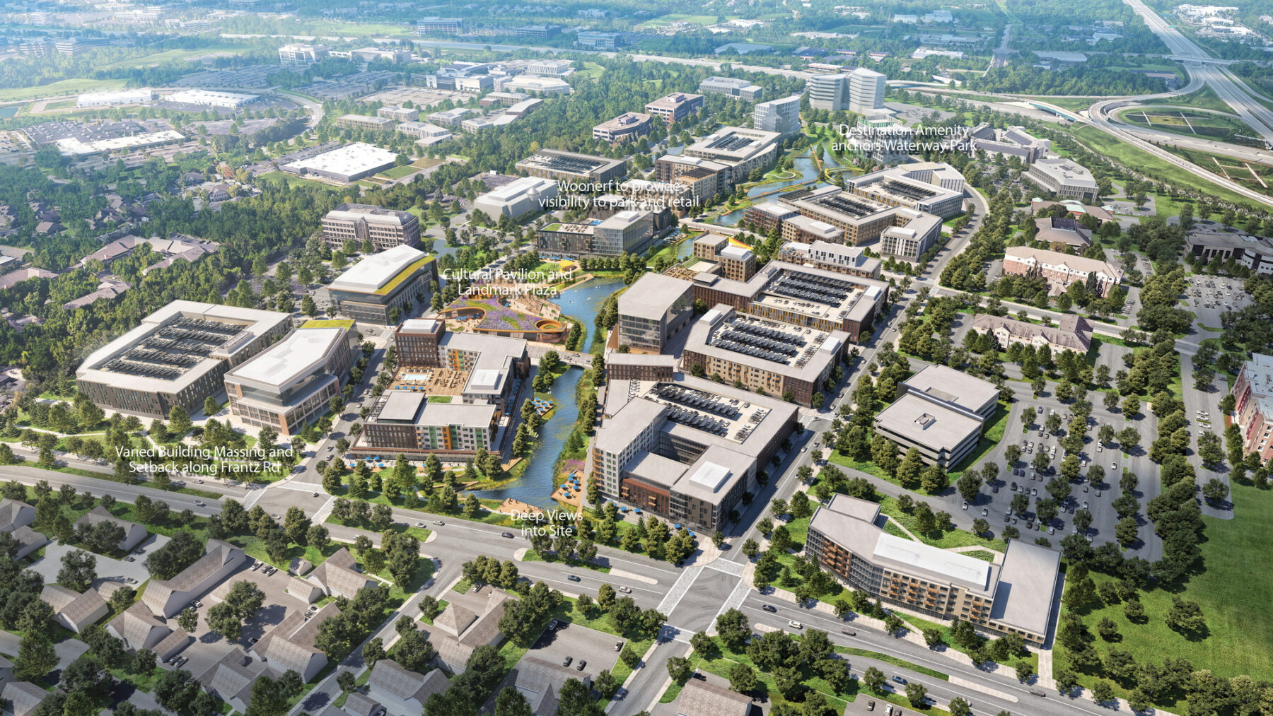
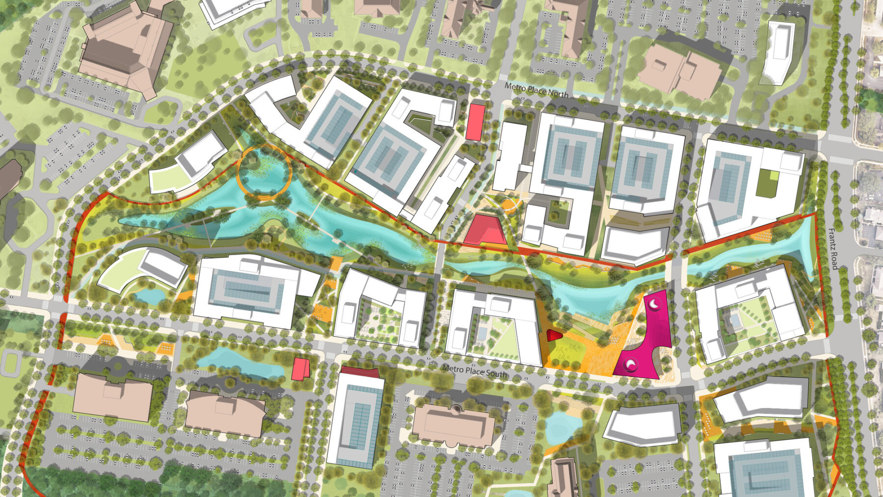
By consolidating parking and relocating the detention ponds, the Metro Center Revitalization Plan creates a series of unique experiences.
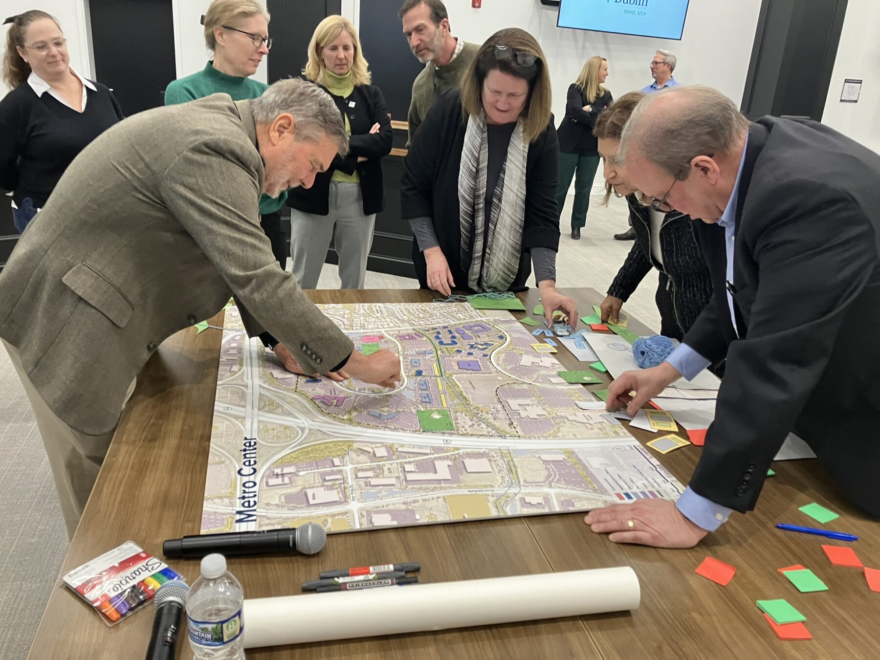
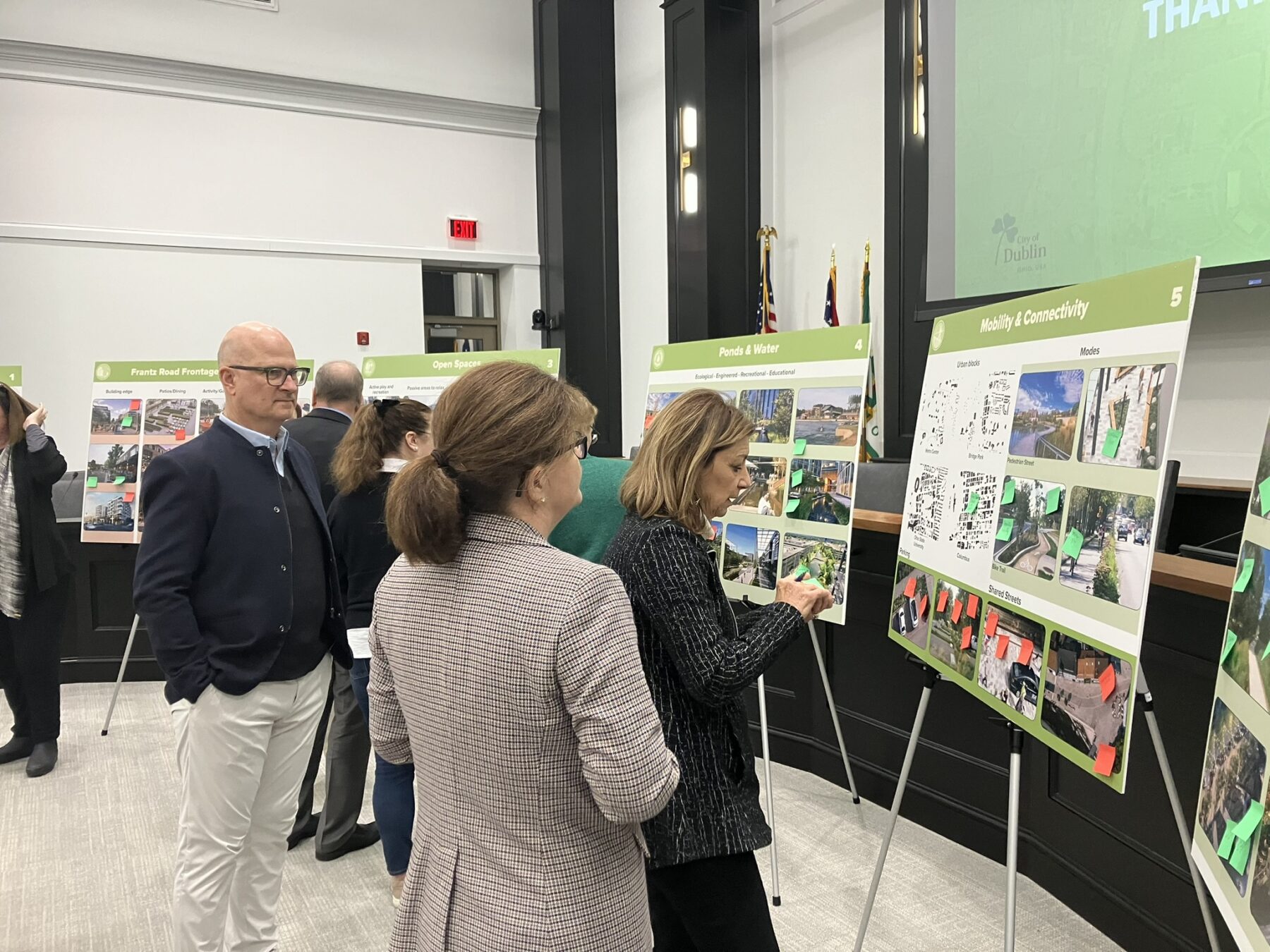
The revitalization of Metro Place has been among Dublin’s top priorities for over a decade. City Council has been involved directly in the planning process through numerous workshops; each of the City Councilors were interviewed about their ambitions and ideas for Metro Center to help the Sasaki team better understand how it relates to its surrounding neighborhoods and regional transportation systems, and what a successful redevelopment would look like.
Based on the input from the City, the design team introduced the following four guiding principles as a framework to guide the plan:
Sasaki collaborated with the City of Dublin to develop a design and implementation framework that creates a distinctive identity, encourages dynamic investment, and promotes sustainable design principles.
Shaping a Unique Sense of Place
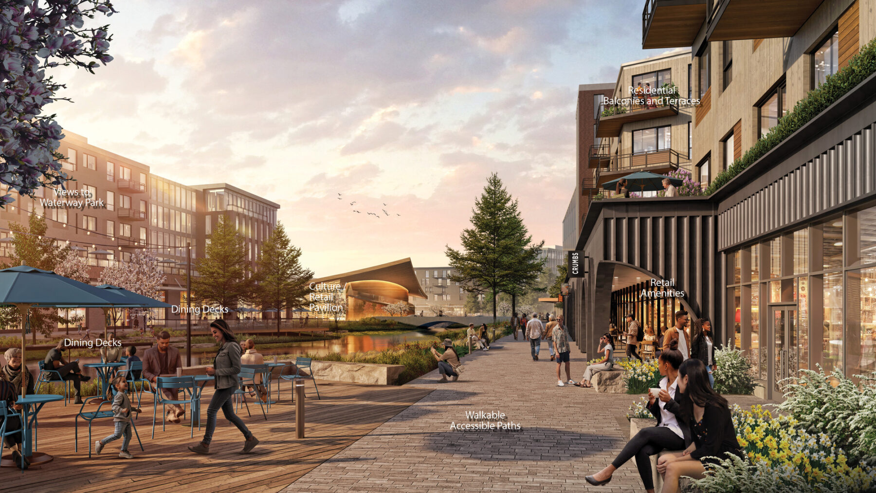
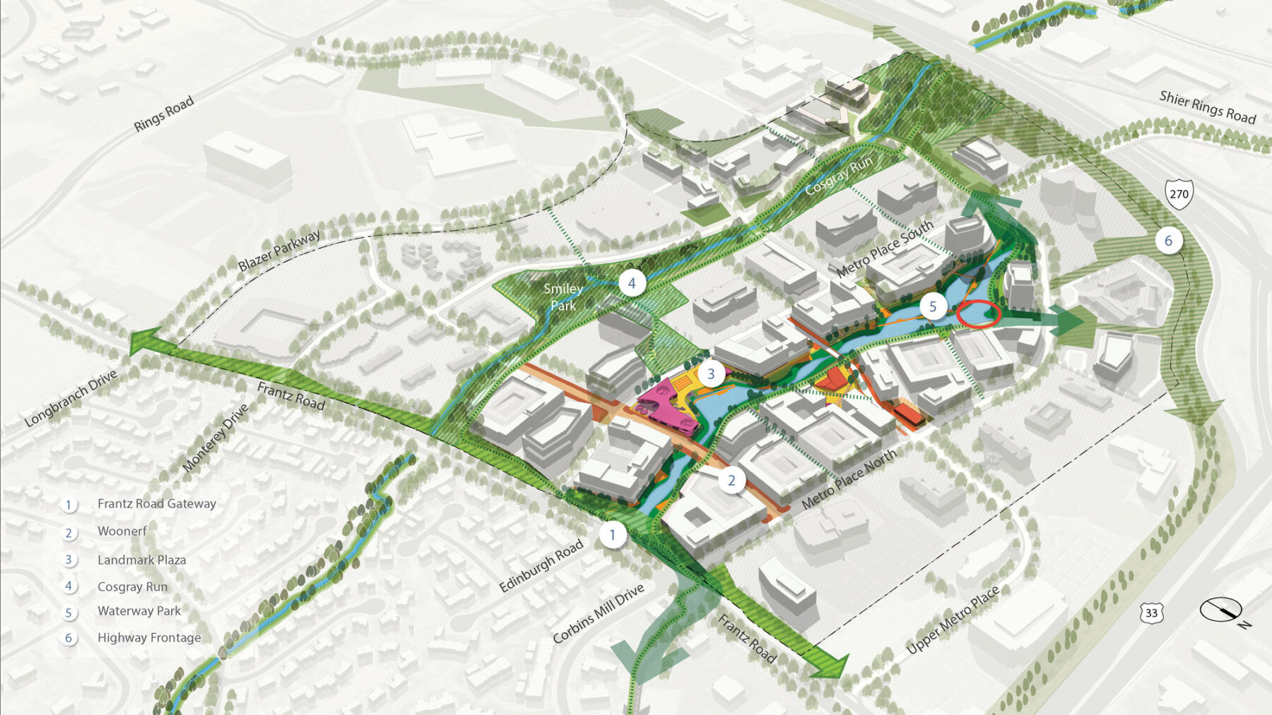
The vision for revitalization starts with recognizing the site’s greatest asset– a wealth of open space that can be unlocked by the reallocation of surface parking and the enhancement of the natural landscape. A series of green, open spaces along the central water feature provides a variety of vistas, social settings, and recreational opportunities. Existing infrastructure investment is efficiently repurposed through retaining the basic Metro Place loop while connecting it to the west and south through new roadways. The formerly sterile office-only environment will be transformed into a living community offering retail, restaurant, housing, and civic land uses.
The open-space plan introduces 36% more usable open space, 33% more pervious surfaces, and 12,000 linear feet of walking trails.
The plan takes into account community concerns regarding the scale and visual impact of development along Frantz Road, currently perceived as the site’s “front door.” To accomplish this, the design team chose to sensitively integrate new buildings with existing ones and to greatly enhance the site’s natural surroundings. The plan utilizes the I-270 edge as both a view corridor and a buffer, avoiding residential development along this edge. The framework serves as a model to demonstrate the potential for substantive improvement of other properties within the Dublin corporate area, and provides an actionable vision for the creation of Dublin’s next great place.
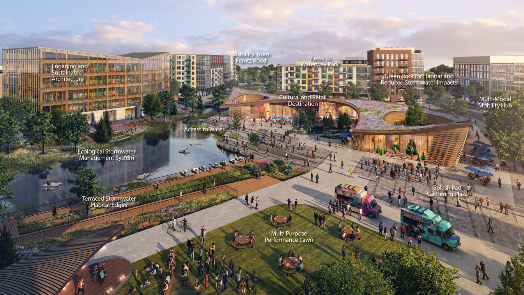
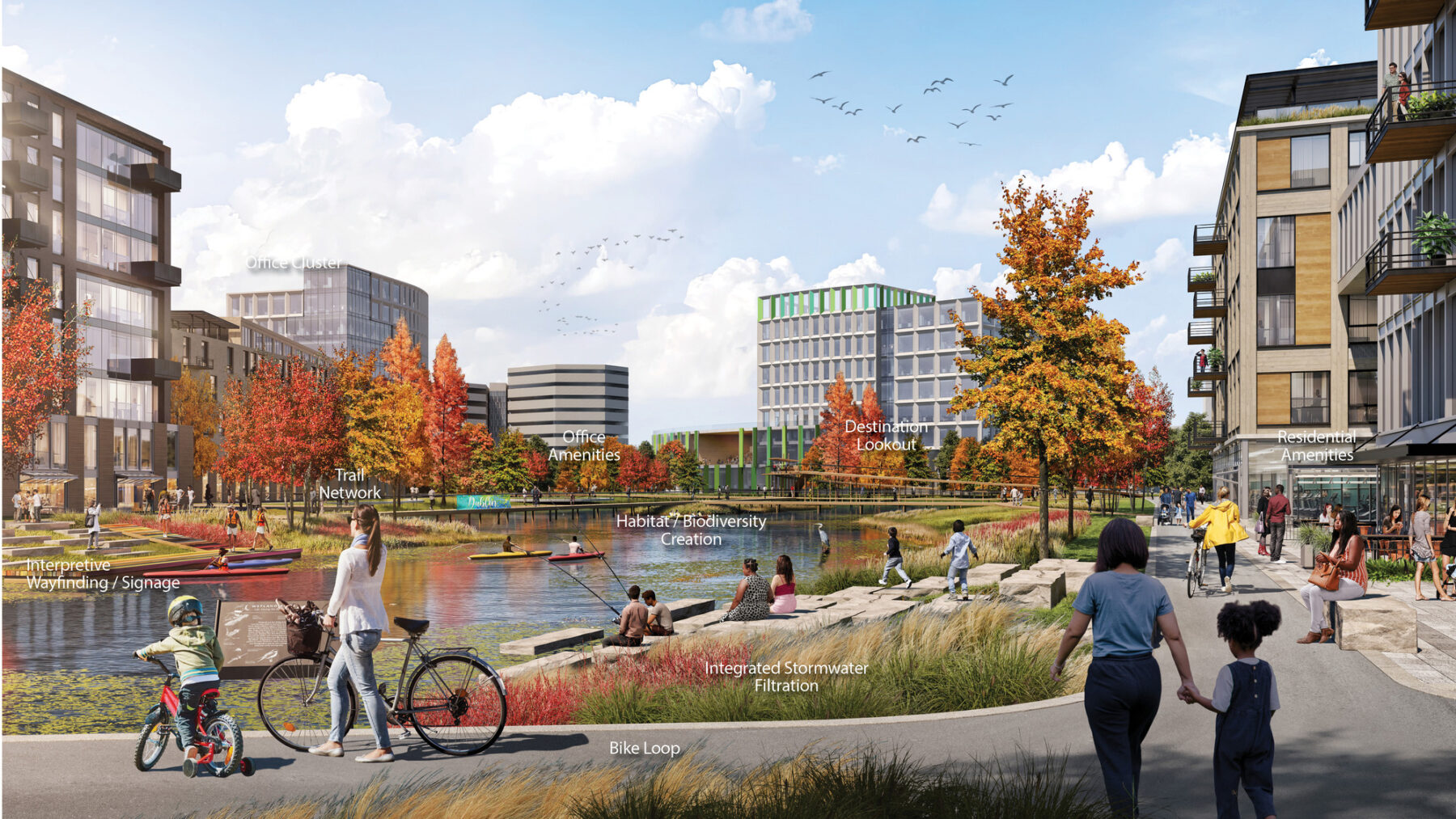
The revitalized Metro Center will be a mixed-use neighborhood that celebrates landscape and natural beauty in an urban context.
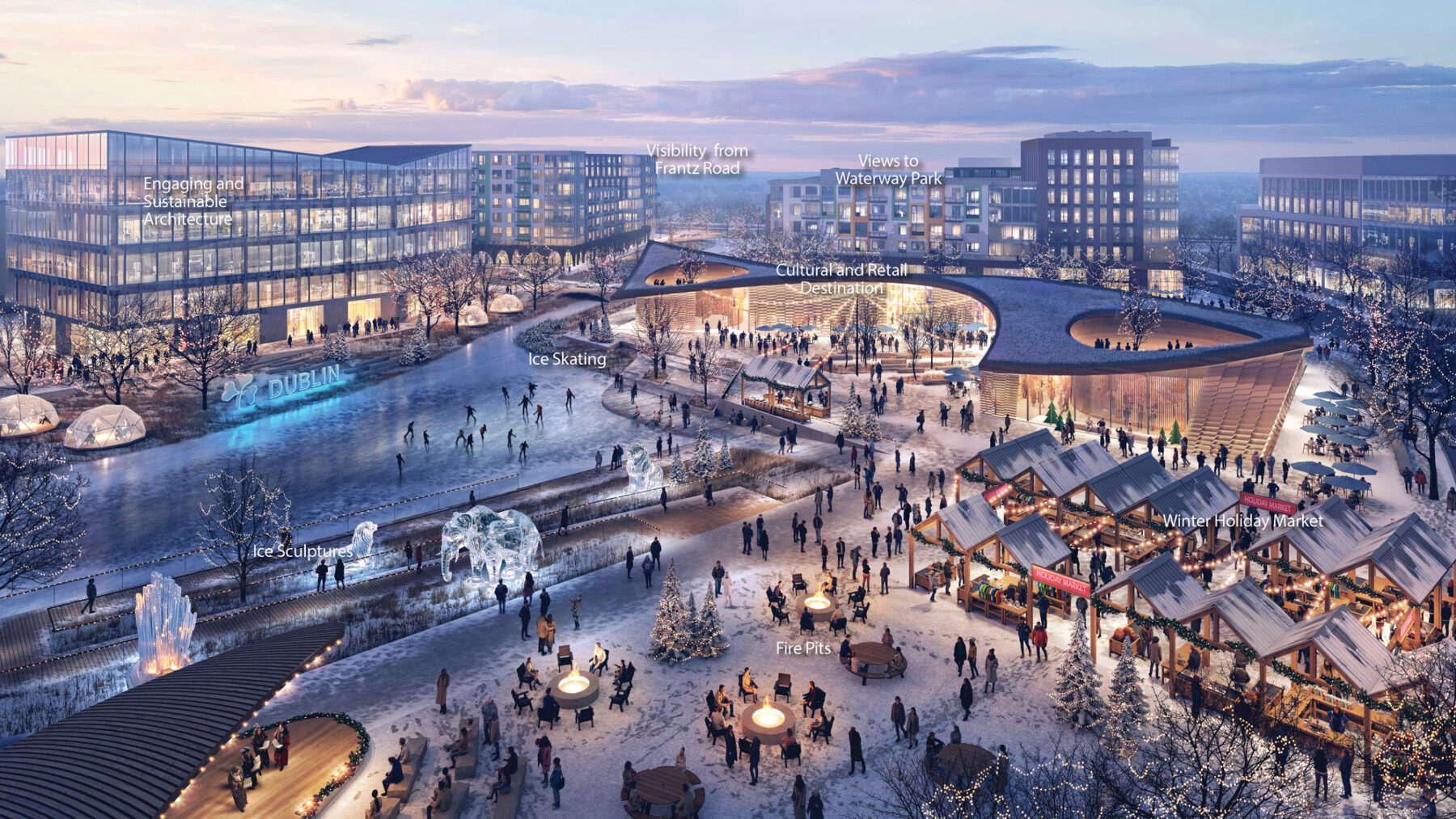
The district will become an enjoyable destination year round, providing needed amenities and comfortable activities for all.
Metro Center will be a new model for streets and open space.
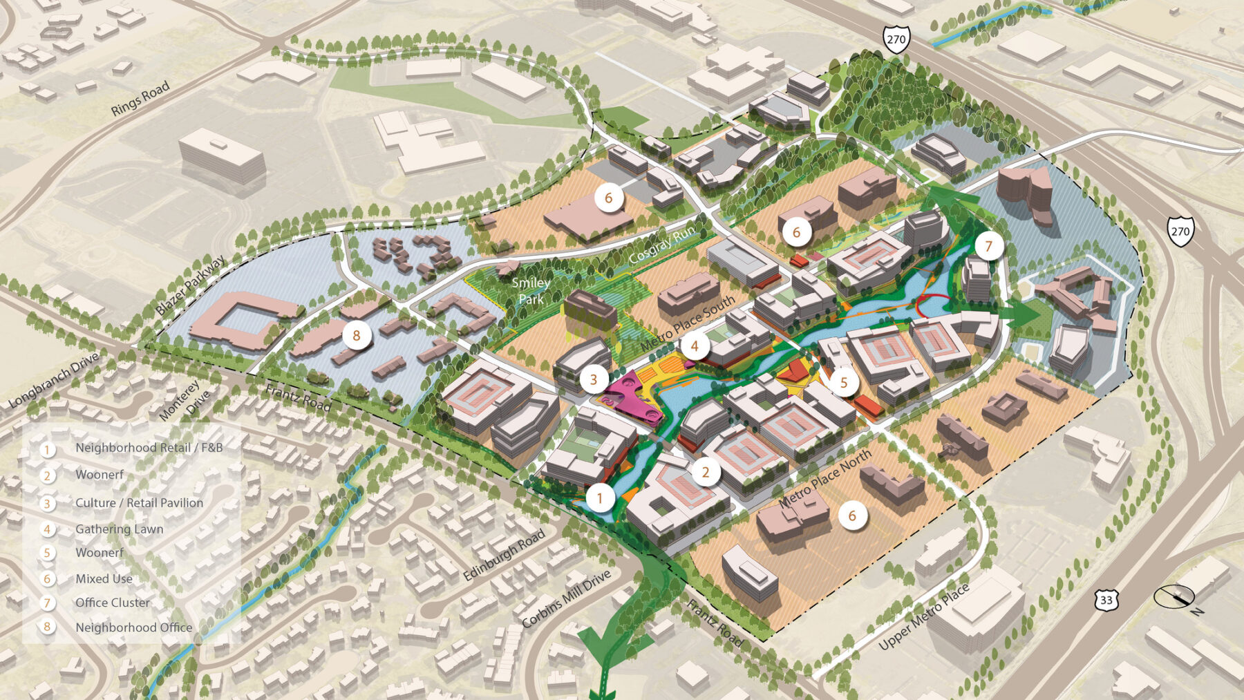
Rebalancing the District
The framework plan shapes the future development of Metro Center by identifying infrastructure strategies, stormwater reconfiguration, and a new road network– all within an open space framework that is designed to enhance the site’s ecology and provide amenities for the public, nearby office workers and local residents.
The revitalized Metro Center will be a mixed-use neighborhood that celebrates landscape and natural beauty throughout the year. Office and employment centers will share space with housing, retail destinations, and cultural facilities, organized along a vibrant network of paths, ponds, and trees.
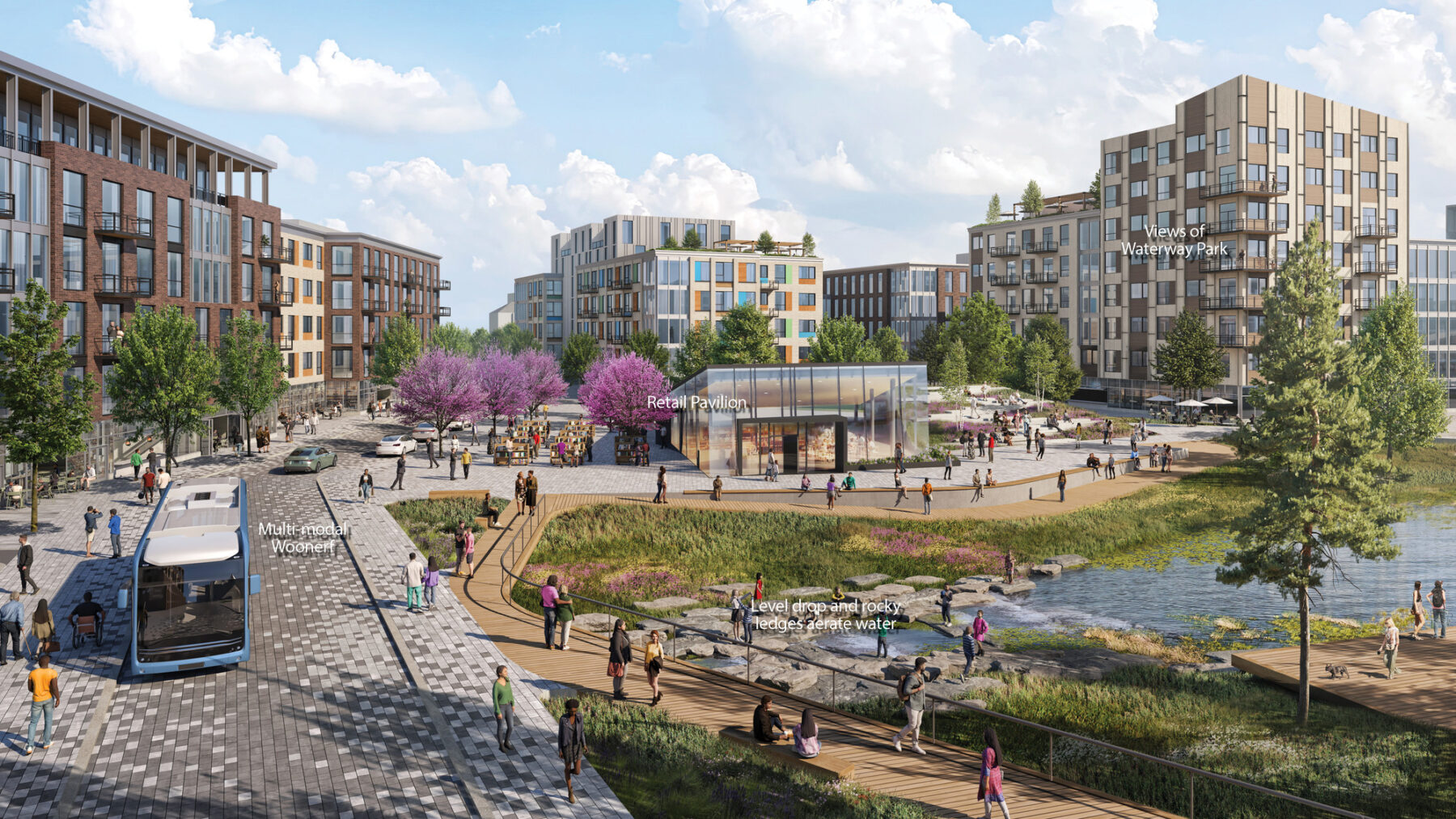
The heart of Metro Center will be where the waterway landscape and new development come together. Road crossings will be pedestrian-oriented, with limited and slow vehicular traffic. Visitors, workers, and residents will have access to a combination of nature-oriented activities and green spaces, while encountering opportunities for public art to create a dynamic and visually engaging environment throughout the year.
The existing overflow of parking will be replaced with an environment built for people, connected by walkable paths and sidewalks that creates community and interaction.
Reimagining Water Systems and Introducing Purposeful Open Spaces
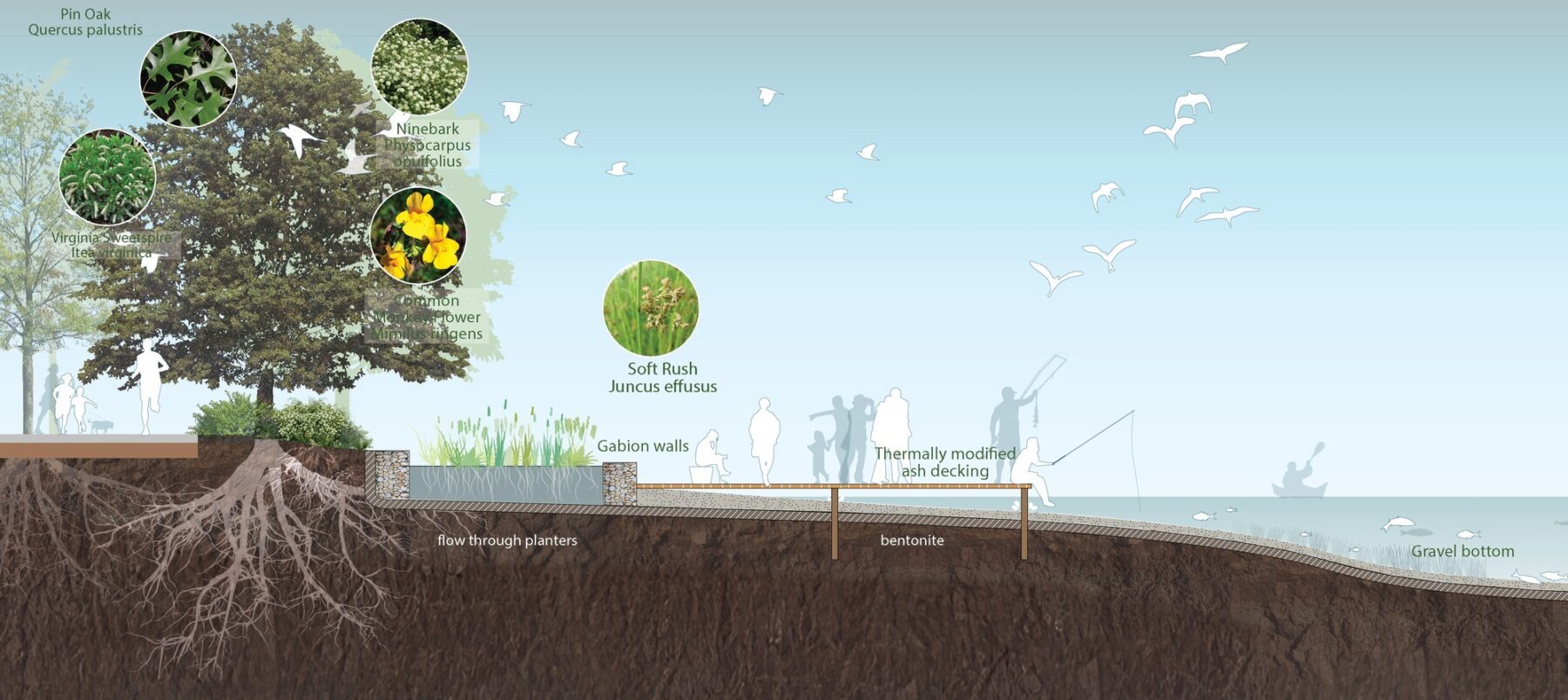
To address the City’s current design standards for stormwater management systems, the framework plan introduces a new stormwater plan that applies progressive measures to enhance the usability of detention ponds. This will serve as an integral part of the open space portion of the land use plan, and will create an amenity to be enjoyed by the entire community through connection with the City’s pedestrian trail system.
The plan promotes biodiversity and nature-based solutions while reducing impervious surfaces and adopting low-embodied-carbon materials.
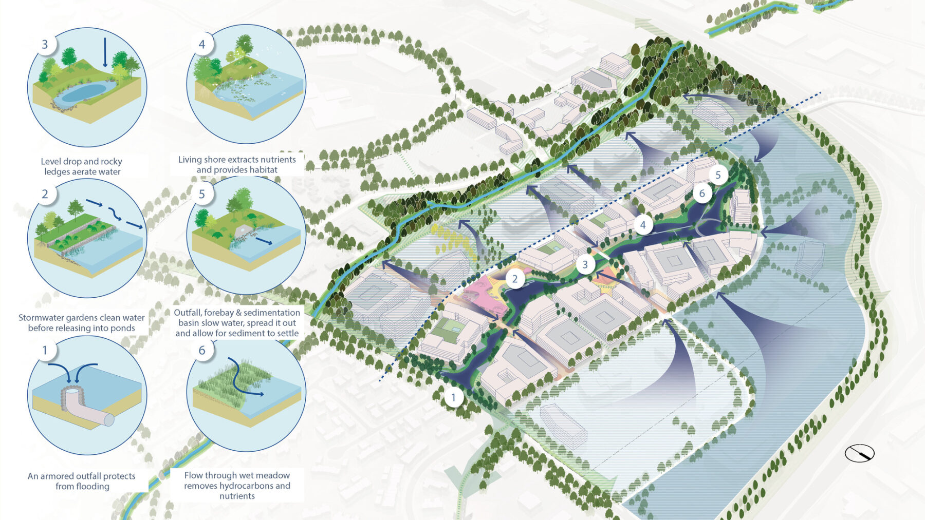
New stormwater management system
At the heart of Metro Center, an ecologically-driven landscape will create a continuous waterway across the site. Large gathering spaces and intimate areas of retreat will animate the open space network to provide beauty and respite. Detention ponds are redesigned as landscape amenities, taking on different characteristics at each stage of the park, moving from the edges of the site as quieter, naturalistic settings, to the more vibrant urban core at the landmark plaza. On the western end, stormwater from existing development areas passes through filtration plantings that expand into the largest pond, with islands and crenulated edges.
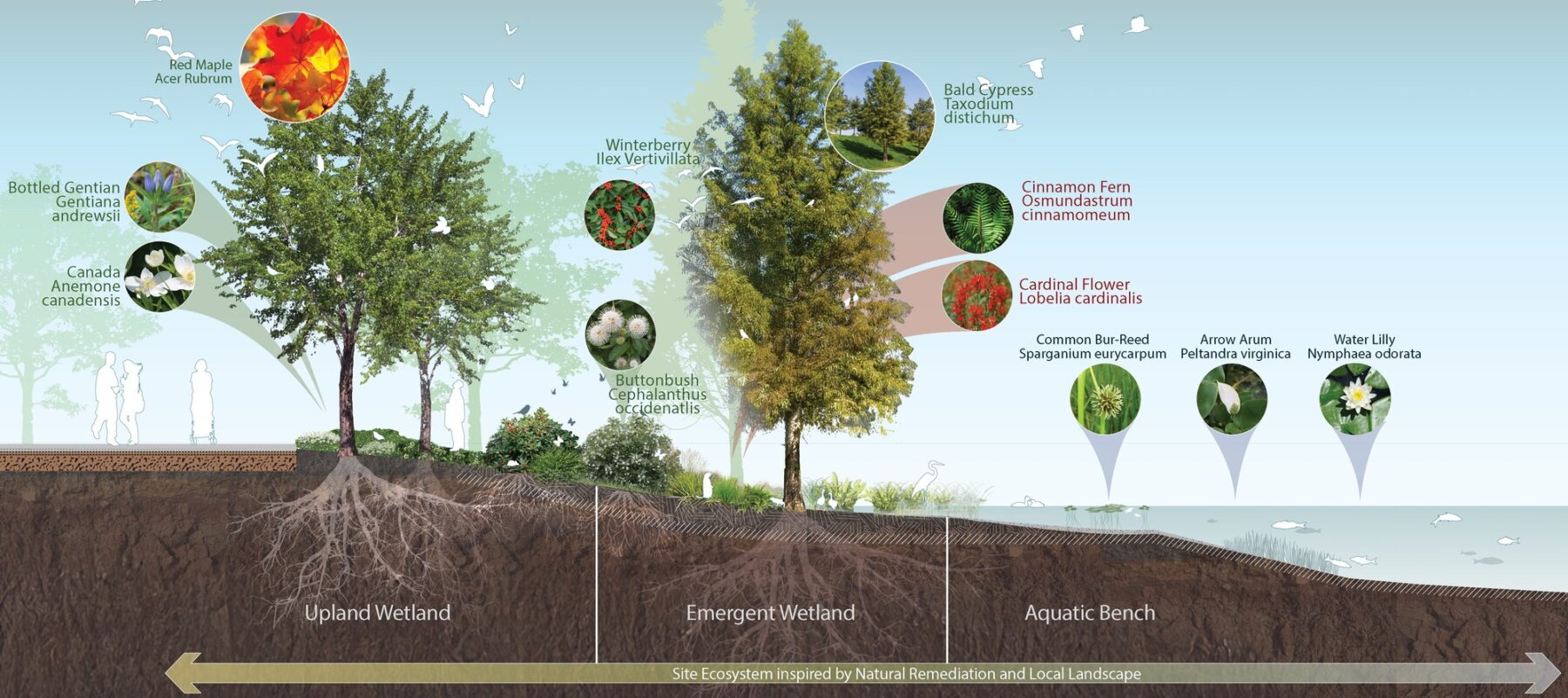
The park design draws inspiration from the diverse regional ecosystems of central Ohio, integrating forested areas, grasslands, uplands, and emergent wetlands. This approach also provides on-site ecosystem services such as water filtration, flood mitigation, and soil stabilization. By incorporating native plant species throughout these habitats, the park will support biodiversity, attract pollinators, and provide essential habitats for local wildlife.
The green heart of the new Metro Center will greatly enhance bio-diversity, habitat restoration, and the presence of pollinators, birds and aquatic life.
The ecologically-focused design creates a resilient landscape that manages stormwater effectively and enriches the surrounding natural environment.
Reprioritizing Mobility and Strengthening Connectivity
At present, Metro Center is disconnected from adjacent areas, with a loop road that allows access only from Frantz Road. The proposed mobility framework corrects this deficiency by defining alignments for an I-270 crossing and a Metro-Blazer connector, which will provide a new, lower-volume neighborhood collector street leading south.
The revitalization plan also presents a new model to approach mobility, consistent with the sustainable transportation paradigm adopted in the Envision Dublin plan. Pedestrians, bicycles, and public transportation will have priority within the site, and the public right-of-way will be allocated to better meet this need. The existing loop road will be redesigned to be pedestrian and bicycle friendly, with safe crossings, enhanced plantings and furnishings, and on-street parking where appropriate.
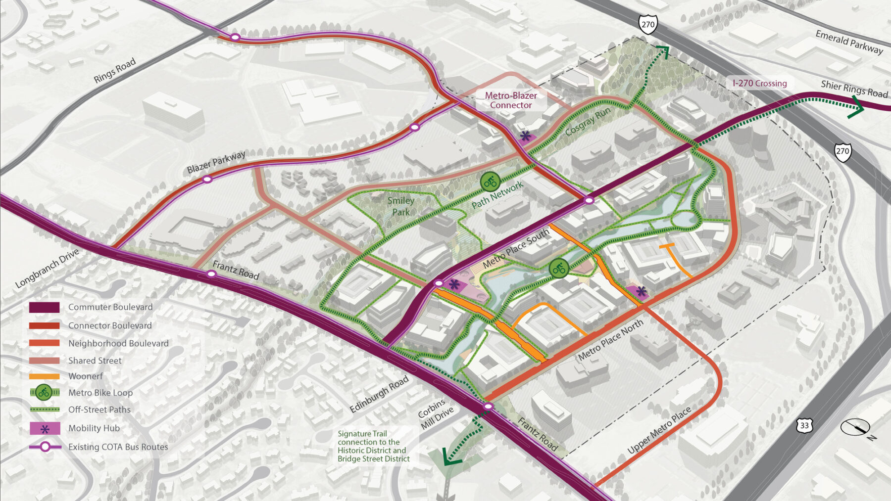
Connections to Blazer Parkway and across I-270 will better integrate Metro Center to its surroundings.
New streets, paths and trails will prioritize pedestrians, bikes and other active transportation modes.
The Metro Center Revitalization Plan is a tool to guide the future development of the district, illustrating the urban design principles that support the vision. Social, environmental, and economic analysis have guided the design of a new district which builds on its strengths, while transforming its identity for the future.
For more information contact Martin Zogran.