A new plan designed to support the growing local economy of Vietnam’s largest island in the Gulf of Thailand
Phu Quoc Master Plan
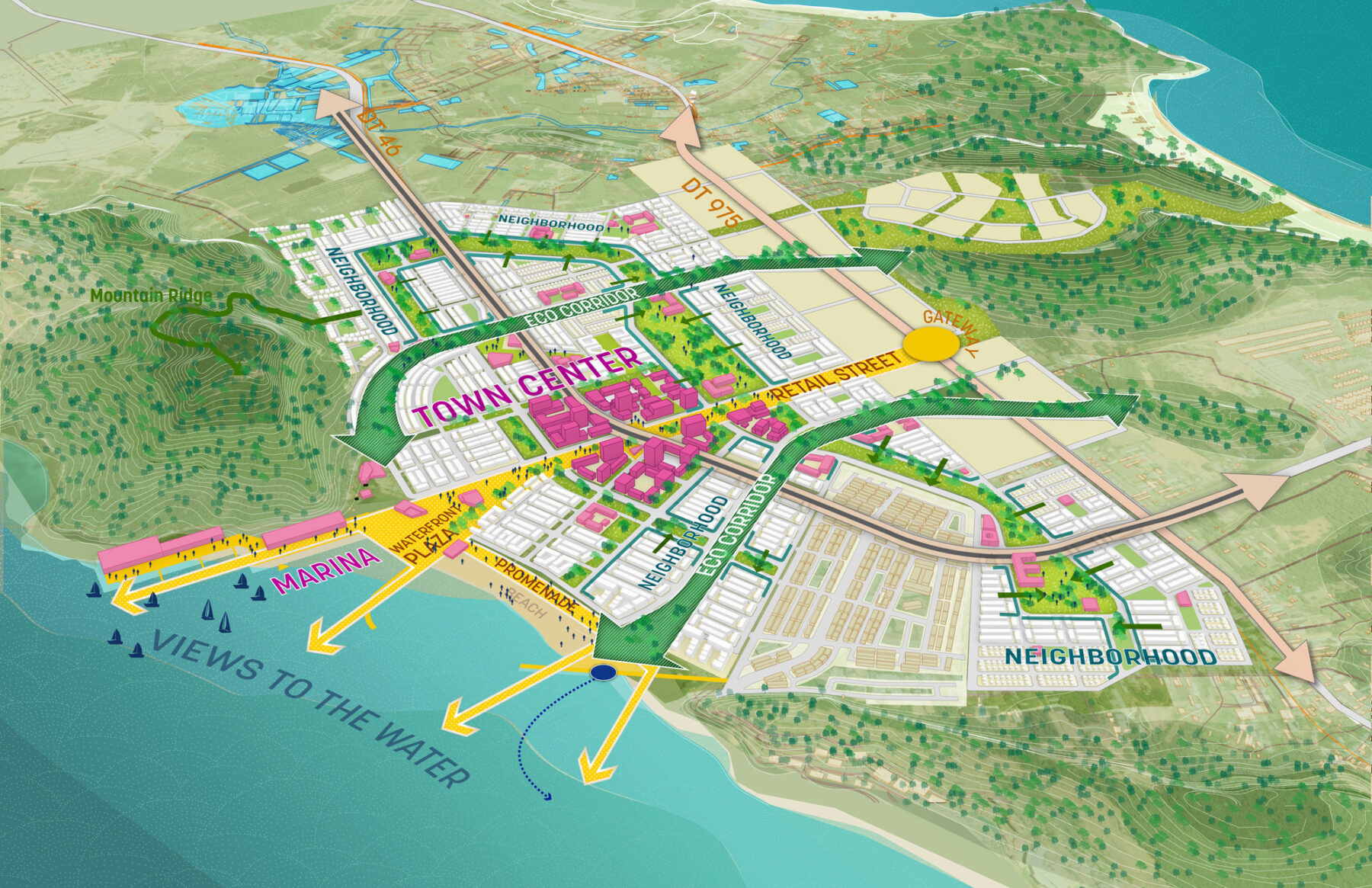
The overall conceptual framework has a vibrant, high-density heart at its core, anchored by a pedestrian spine and waterfront plaza
Phu Quoc island is renowned as a hub of marine activity with an array of coastal ecosystems. As an emerging international tourist destination, the island is undergoing significant transformation. Sasaki’s Phu Quoc Master Plan supports the island’s future development by proposing a mixed-use district that accommodates growth in population and tourism while addressing the area’s social, cultural, housing and civic needs.
Sasaki’s plan for a new waterfront mixed-district focuses on carefully identifying and mapping existing ecological, cultural and hydrological systems to develop a robust flexible mixed-use framework to accommodate over 80,000 residents.
The site is located between the Hotel Zone and Ann Thoi Village, catering to both the locals and the tourists. A diverse range of uses from residential neighborhoods to an employment zone with offices and research, to community and public life amenities, to university campus and student housing, hotels and beachfront resorts, creates a new integrated working and recreational experience in Phu Quoc. The new district will become the social heart with its new civic center, a retail hub, an economic hub and a recreational waterfront for the whole of Phu Quoc Island.
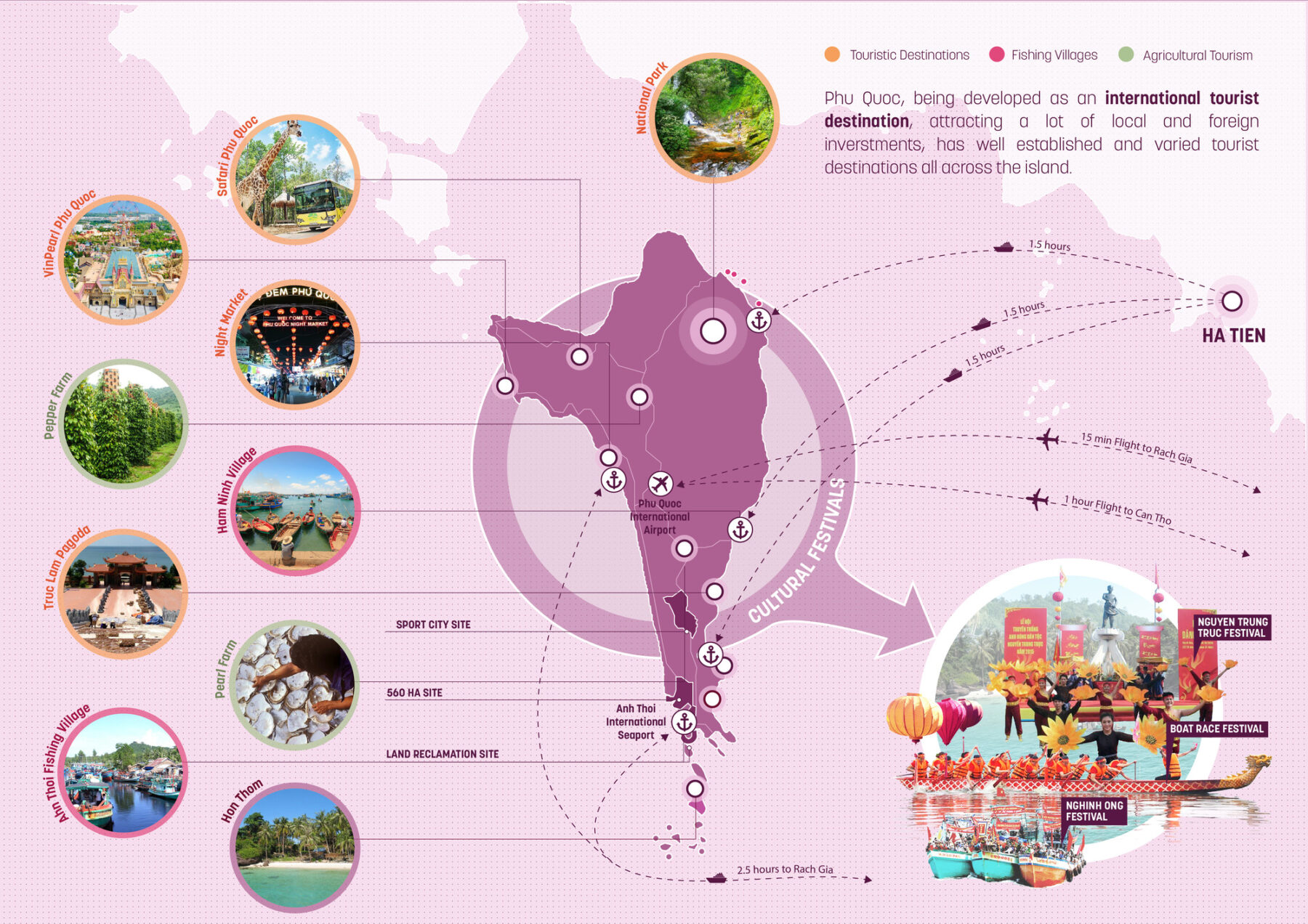
Creating a world-class tourist destination on the coast of Thailand, on Phu Quoc Island
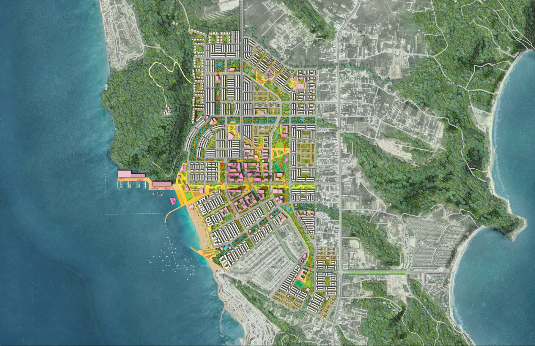
Overall illustrative masterplan featuring the central heart, waterfront, and various neighborhoods
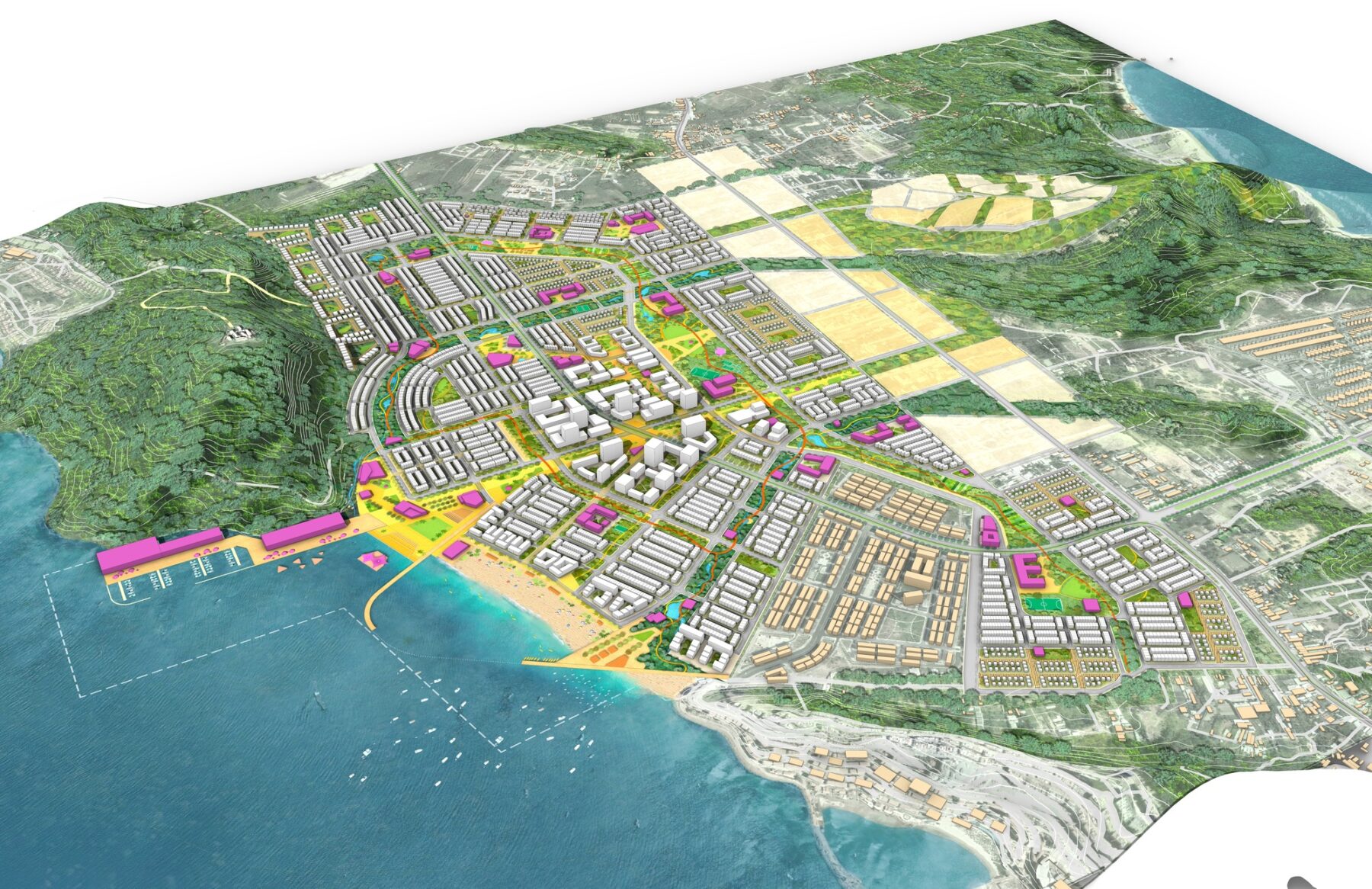
Highly integrated mixed-use programming within the New District
Framework of Design Principles
The plan adopts a framework made up of 7 key design principles, which focus on stewardship and leveraging the natural assets to promote the local economy and introduce new mixed-use zones of development.
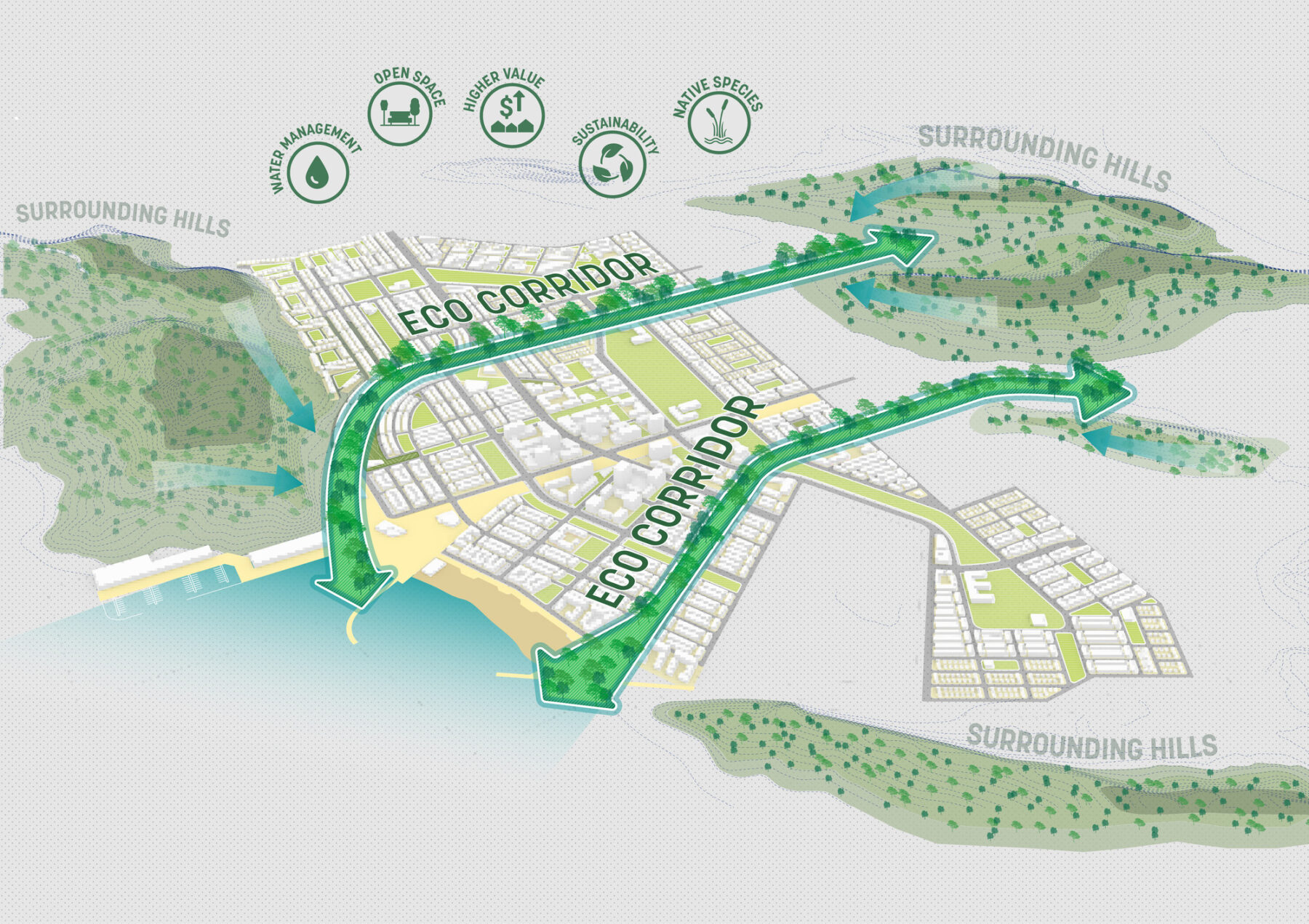
The natural drainage corridors function as a stormwater management system for the site, enhancing habitats for biodiversity.
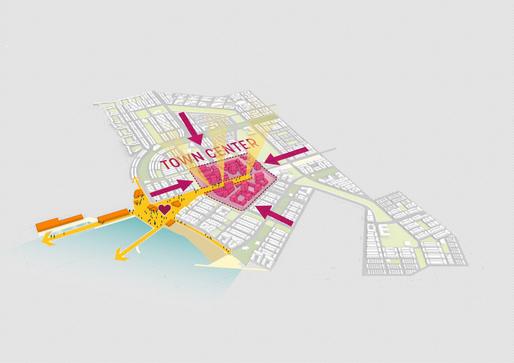
The building densities, at their maximum, unfold at the town center and the waterfront plaza to create a vibrant mixed use landmark with seasonal year-round programming and a transit hub.

The marina and central plaza form a continuous public plaza, giving people great access to the waterfront.
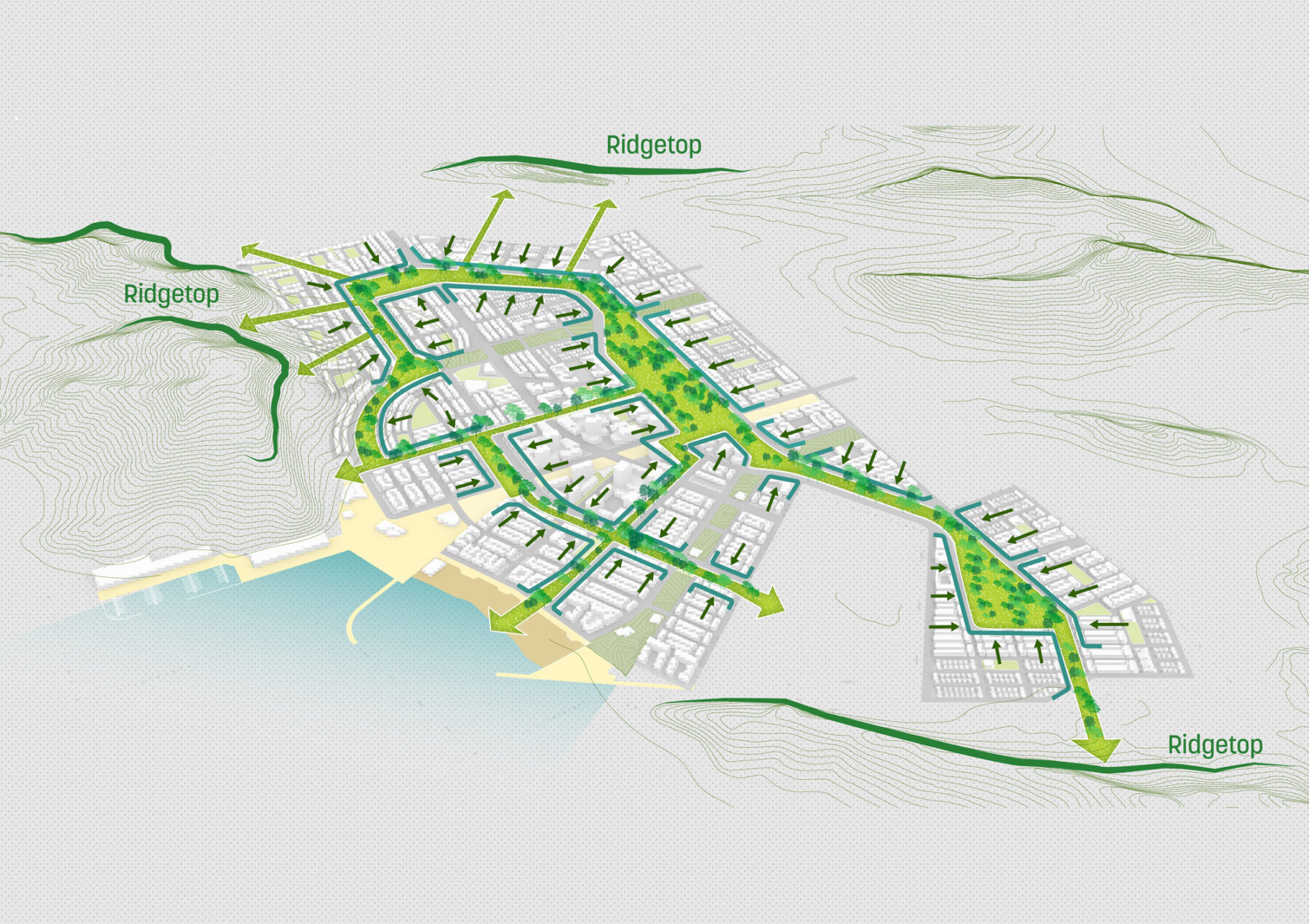
The continuous open space system weaves through various neighborhoods, university campus, the civic cluster, the employment zone. Each neighborhood offers its own unique public space programming, enhancing the daily life of residents.
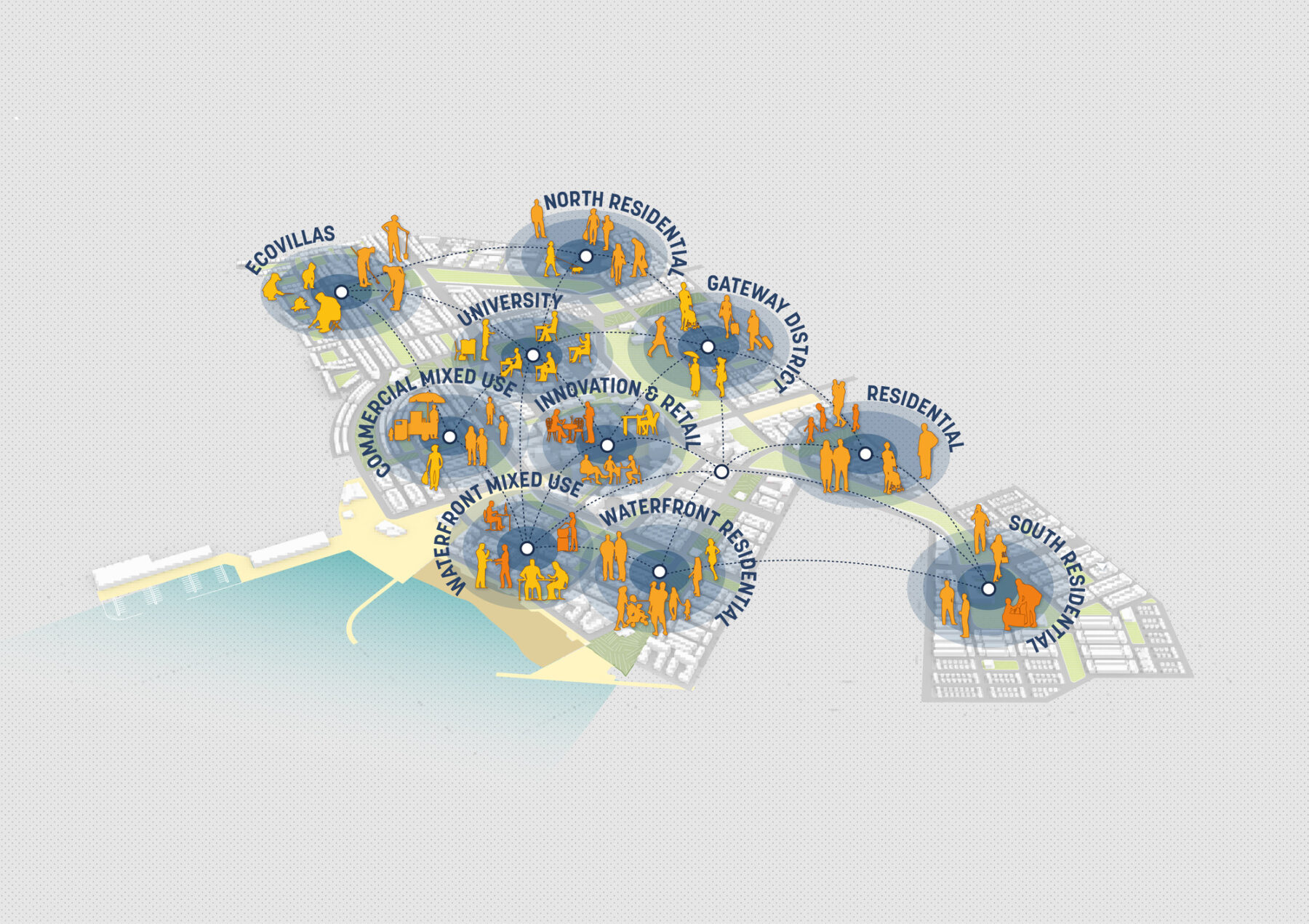
Diverse housing typologies in each neighborhood cater to varied demographics.
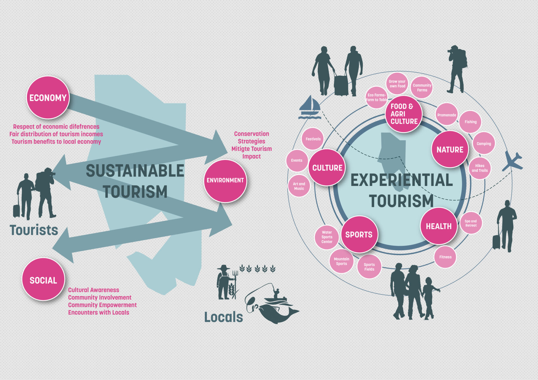
Local economy is supported through job opportunities, innovation, and eco-agro-tourism.
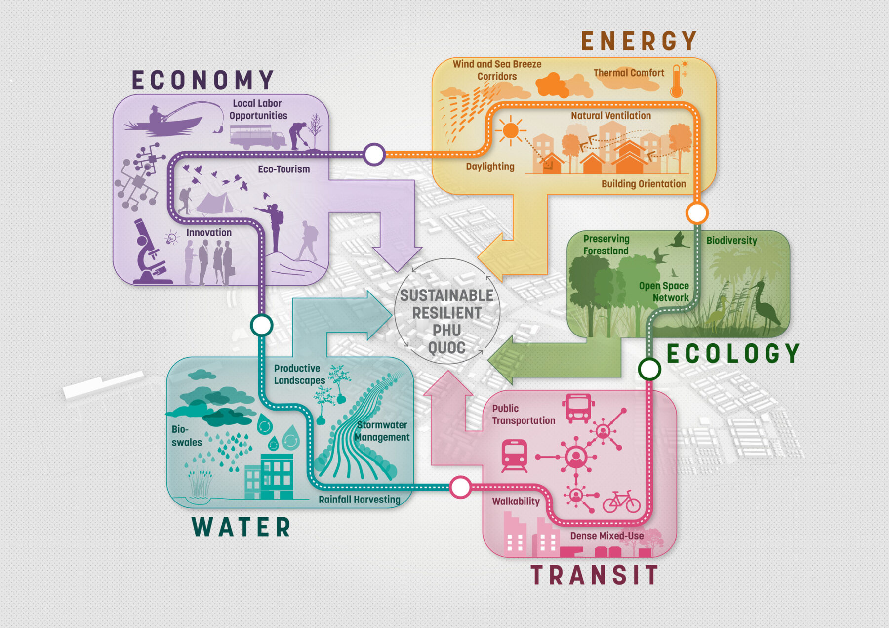
Sustainability is integrated in the development through various measures, like water management strategies to provide connectivity through transit hubs and street networks, and passive strategies for light and ventilation for buildings.
The natural drainage corridors function as a stormwater management system for the site, enhancing habitats for biodiversity.
The building densities, at their maximum, unfold at the town center and the waterfront plaza to create a vibrant mixed use landmark with seasonal year-round programming and a transit hub.
The marina and central plaza form a continuous public plaza, giving people great access to the waterfront.
The continuous open space system weaves through various neighborhoods, university campus, the civic cluster, the employment zone. Each neighborhood offers its own unique public space programming, enhancing the daily life of residents.
Diverse housing typologies in each neighborhood cater to varied demographics.
Local economy is supported through job opportunities, innovation, and eco-agro-tourism.
Sustainability is integrated in the development through various measures, like water management strategies to provide connectivity through transit hubs and street networks, and passive strategies for light and ventilation for buildings.
A Mixed-Use Network of Transit and Community Amenities
The major highways of DT46 and DT975 that run North-South connect the main areas of the Island, and the Phu Quoc International Airport provides connections to the mainland. A proposed transit line along DT46 featuring three transit nodes provides greater connectivity within the site, maximizing access to hundreds of residents. With numerous amenities proposed within each neighborhood, they are each made distinct in use and character.
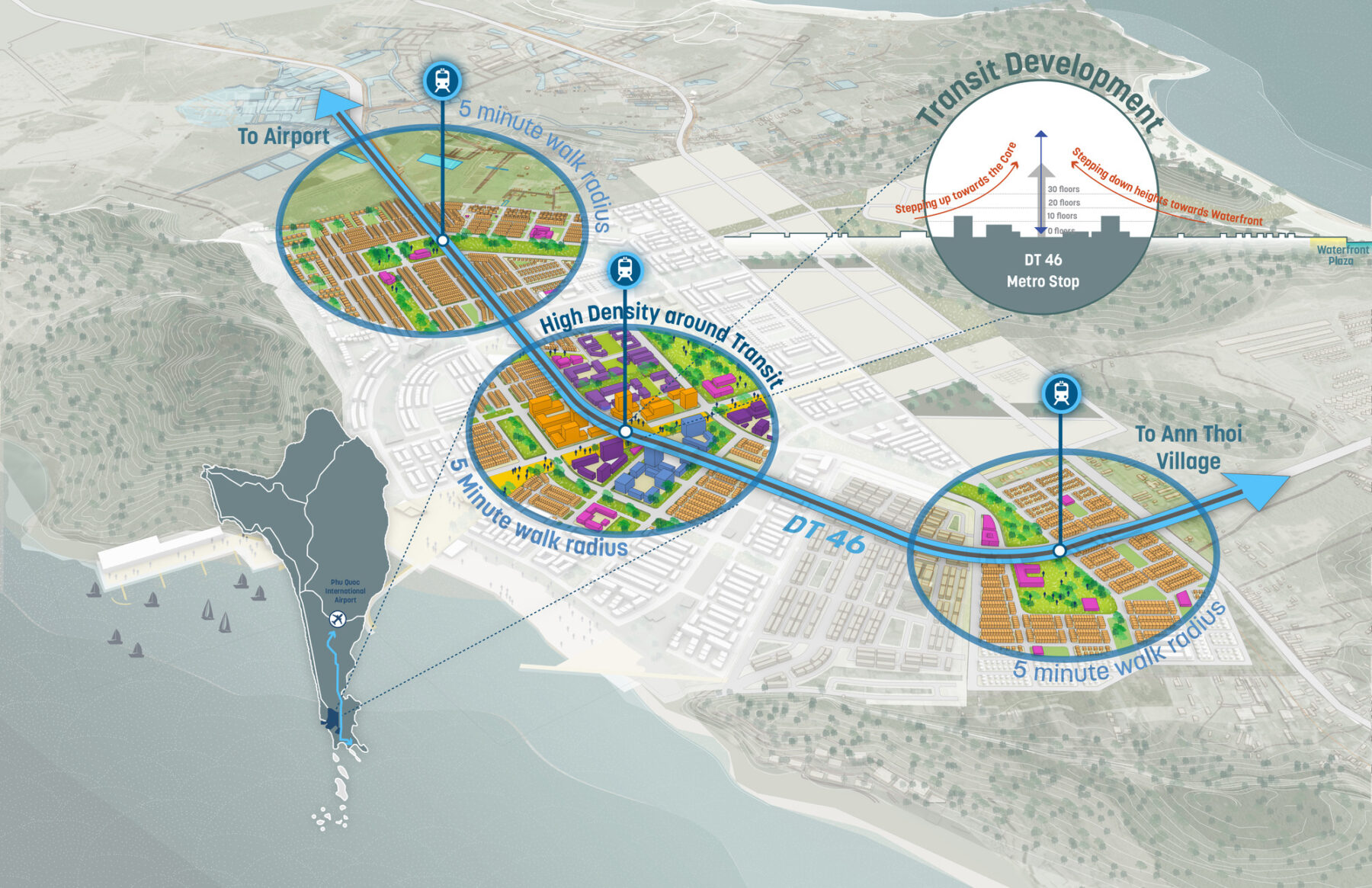
A proposed transit line along DT46 features three transit nodes within the site
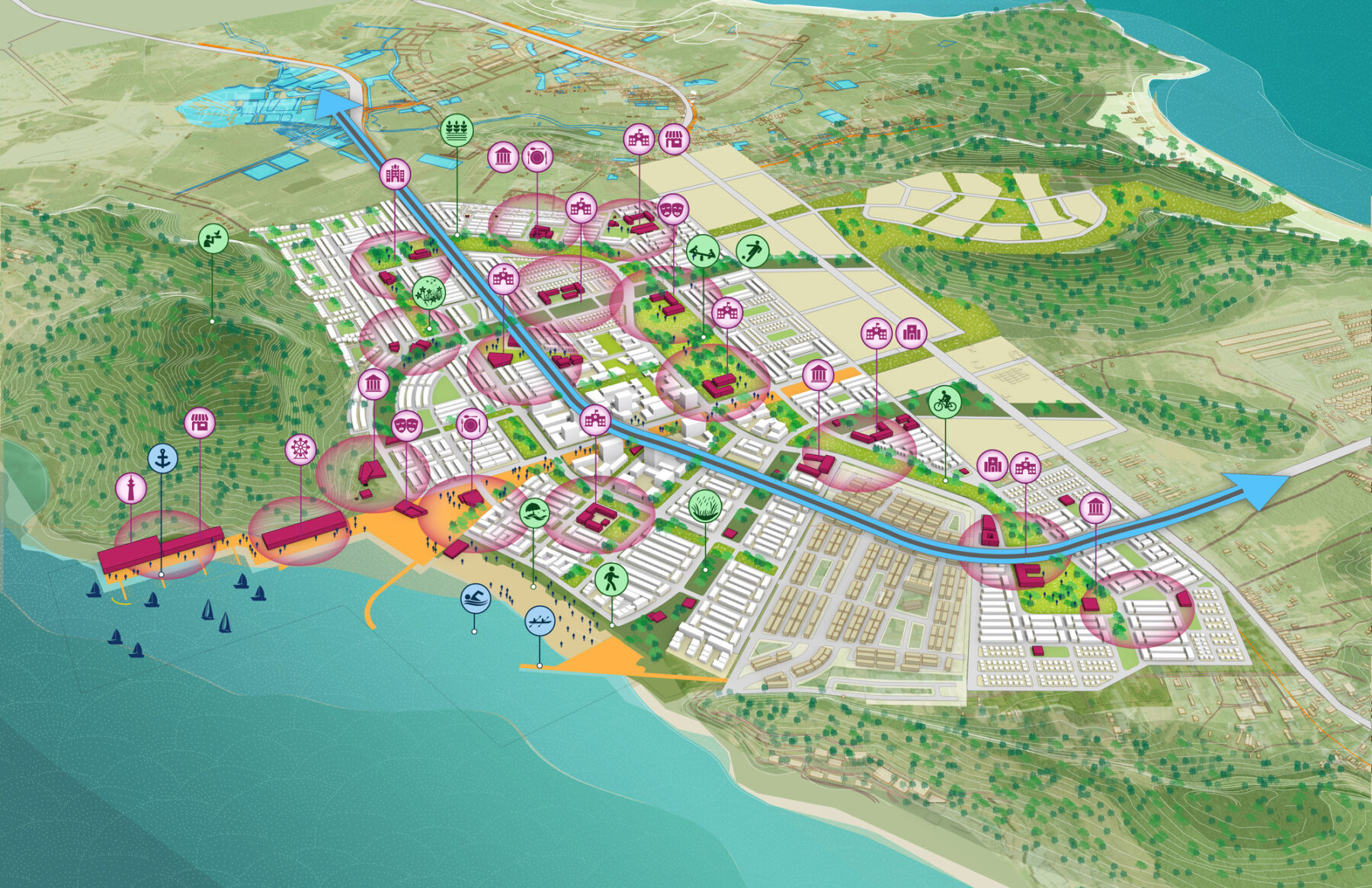
Transit network / community amenities
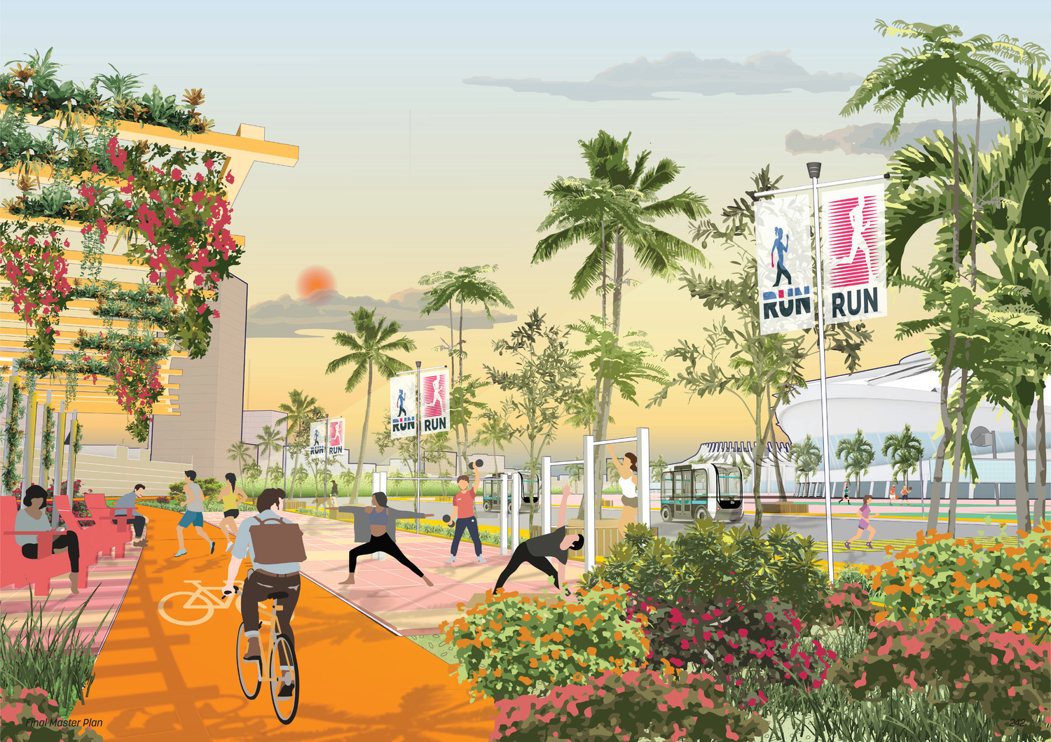
A neighborhood center with community programs around health, wellness and recreation
In addition to multiple schools and community centers within proposed neighborhoods, the plan proposes special community programs like the Wellness Hub within the Ecozone Neighborhood, a theater and a museum as cultural anchors within the civic core, hospitals, and local markets embedded within various neighborhoods for easy access.
Open Space Network
The proposed open space system responds to the region’s tropical climate, providing shade and relief from the heat, while implementing spaces for gatherings, events and recreation. The central pedestrian spine is the primary open space at the urban core, terminating at the waterfront plaza that extends to the marina and the beach. It is programmed for year-round seasonal activities and events. The beachfront promenade is lined with hotels, retail, food, and beverages. The two ecological corridors running east to west through the site serve both water management and bio-diverse habitat function.
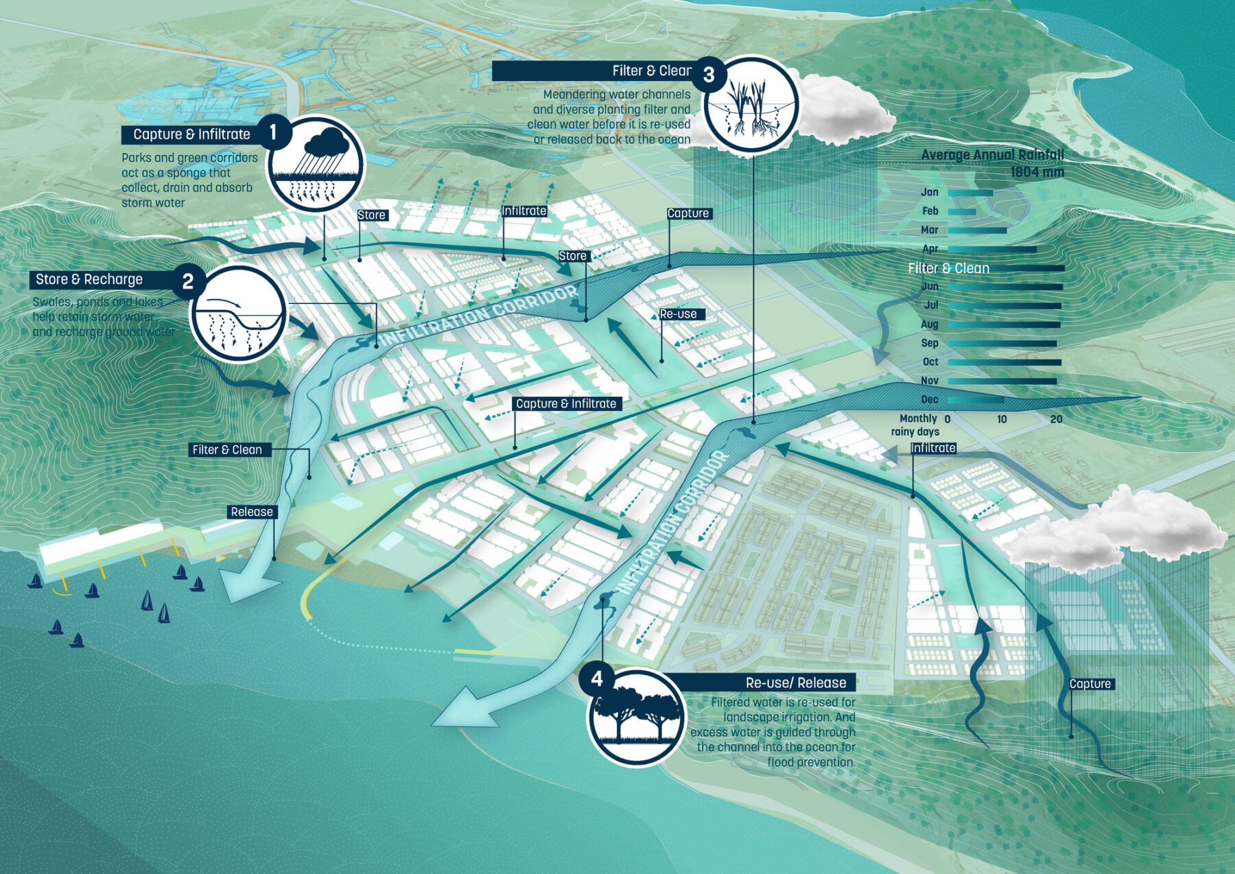
There is a continuous community park system that weaves through the development and connects all the neighborhoods together while providing access to open space. The hydrological strategy of the site respects the existing topography, with two ecological corridors functioning as infiltration corridors. The open space system also serves as a water management system, capturing and infiltrating the rainwater, storing, recharging through productive landscape, filtering, cleaning through bioswales, and recycling for various purposes like irrigation.
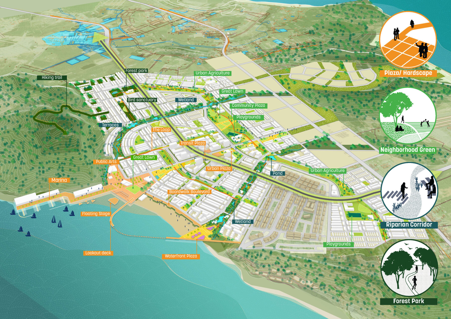
Open space framework / detailed open space typology
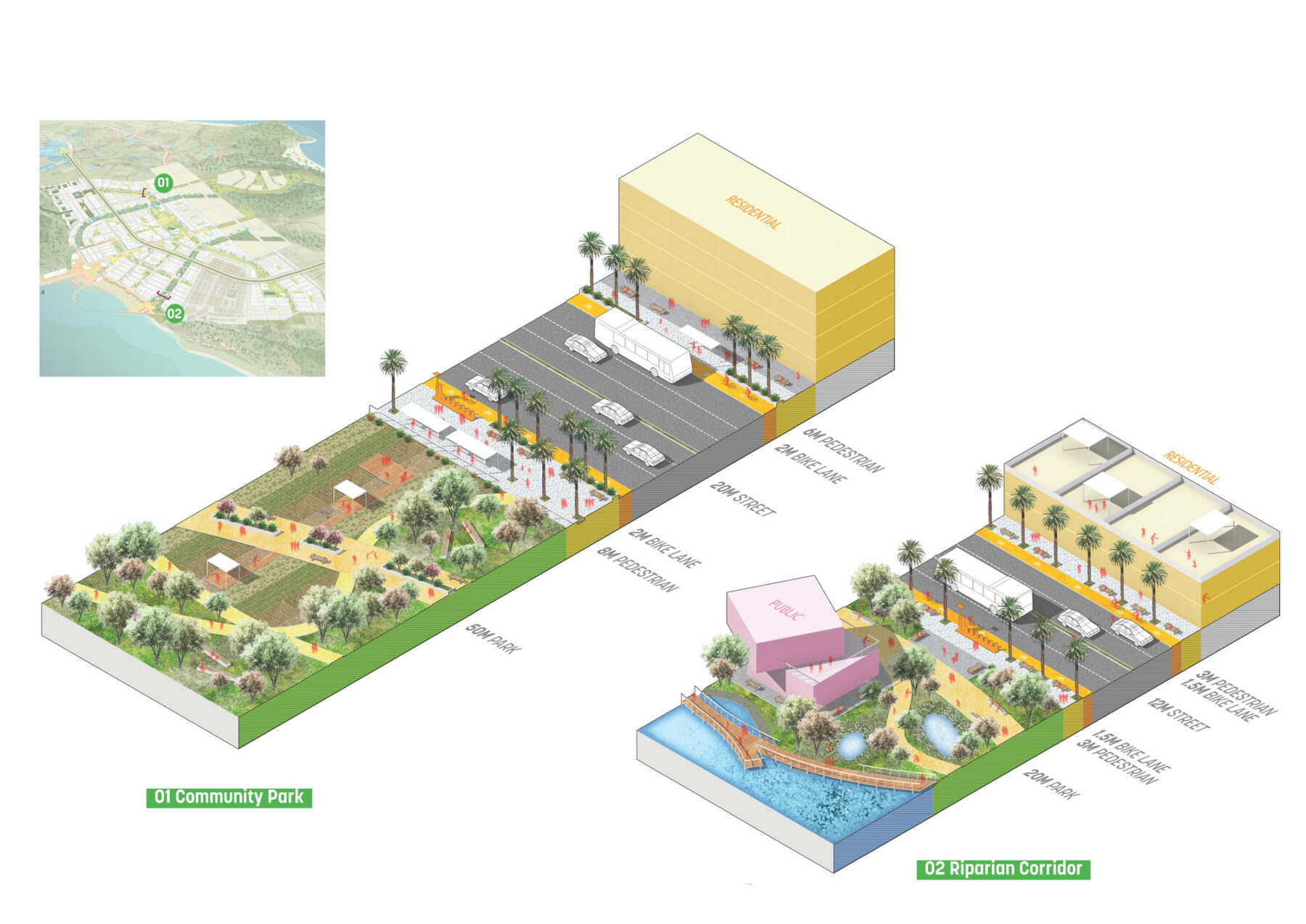
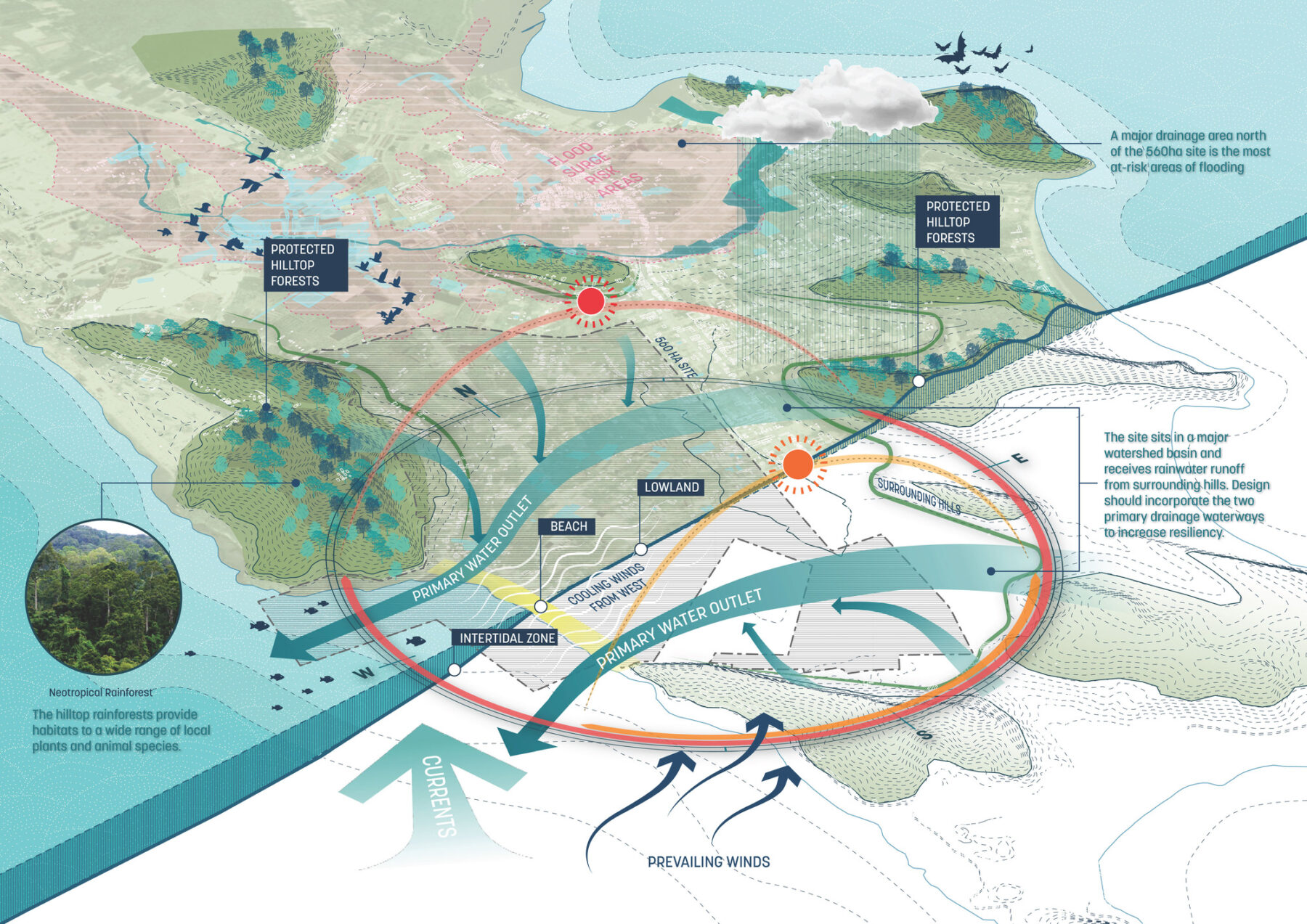
Ecological and climatic design considers hydrological strategies and features
A New Waterfront Neighborhood and Ecozone
At the heart of the development is a waterfront neighborhood, a town center, that forms a gateway from the east end and connects all the way to the shore through a linear plaza. The plaza is lined with retail, food, and shade on both sides, and terminates at a large waterfront plaza, home to the marina and public beach. The core of the neighborhood is framed with highest density tapering down to mid to low rise residential neighborhoods on the periphery.
The Innovation Hub, offices, hotels, and a university campus are also integrated together at the Town Center to create a vibrant center that is also served by a transit hub.
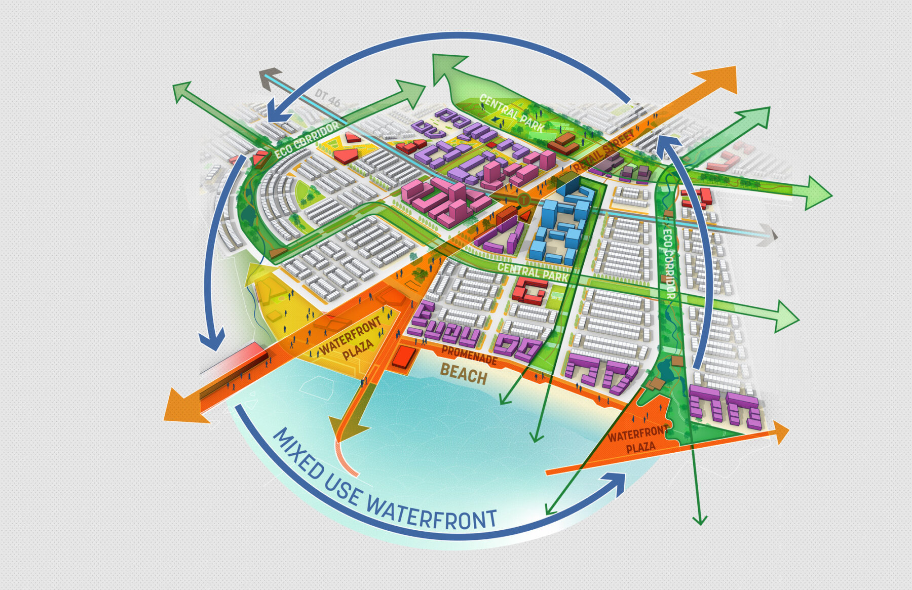
The waterfront neighborhood at the heart of the development
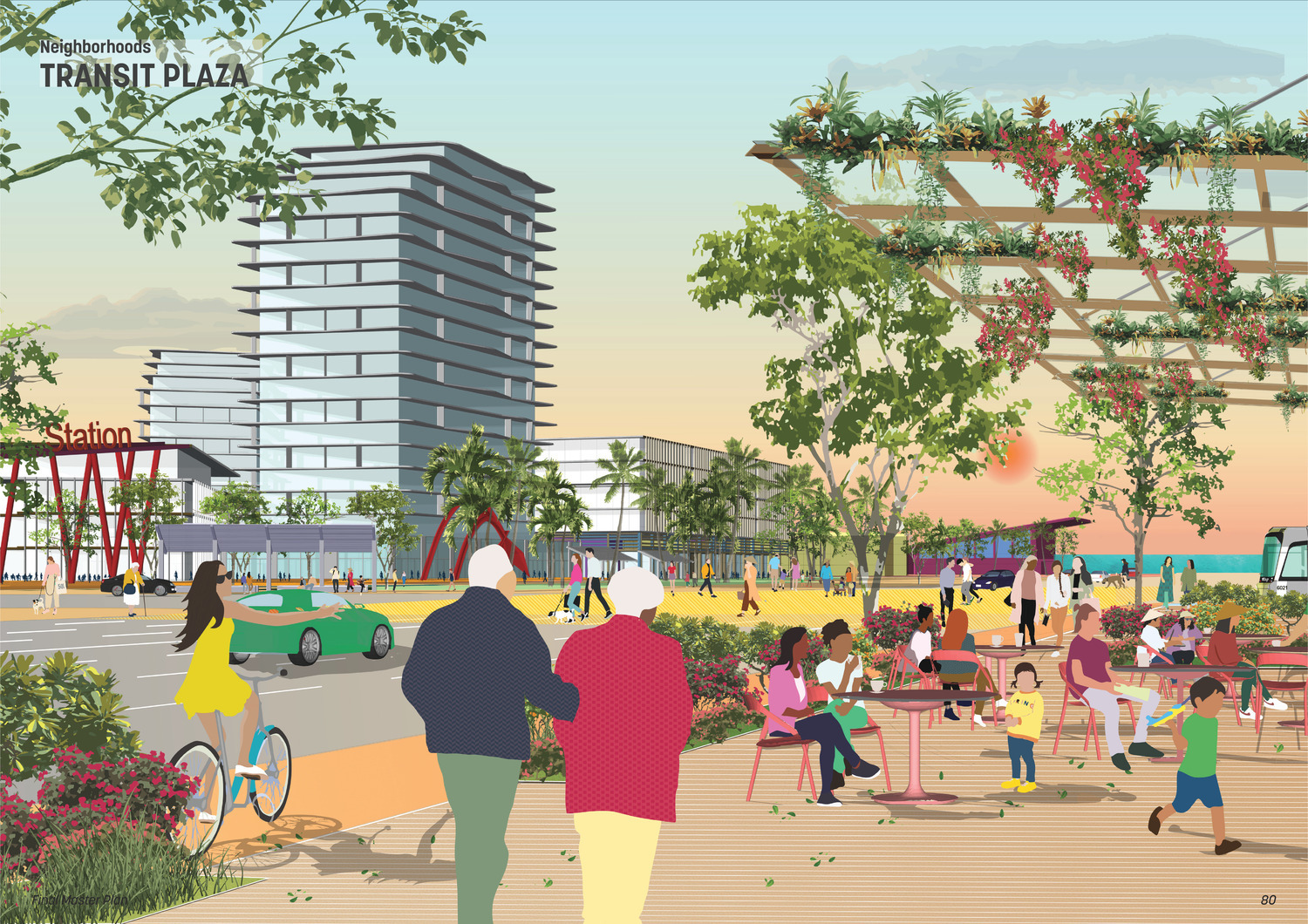
View of the central plaza
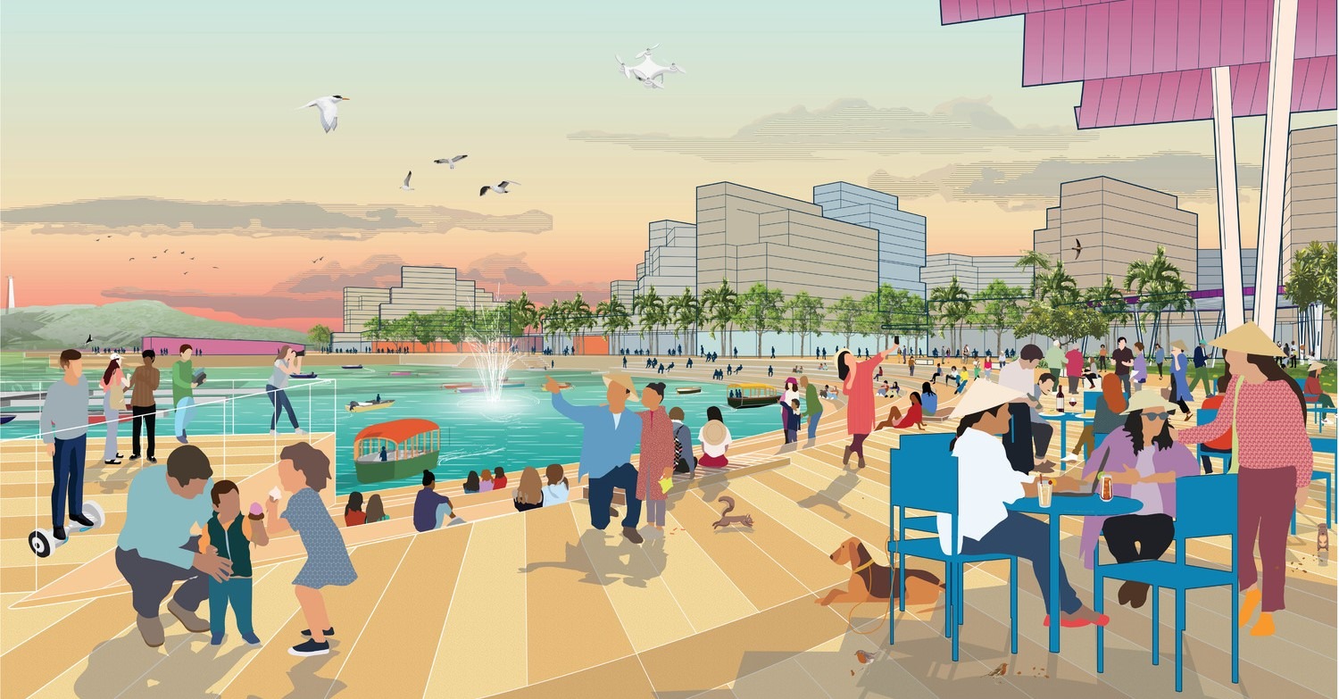
View of the beachfront promenade
The Ecozone neighborhood is located on the foothills of Mount Rui Na Da, home to an ecologically sensitive zone that will be preserved along the Ecozone neighborhood’s edge. The neighborhood consists of a series of villas embedded within the topography. It is a low-density neighborhood with a central park anchored by an ecological tourism center, a wellness center, and a series of shophouses, honoring the traditional housing typology in Vietnam built around shared streets.
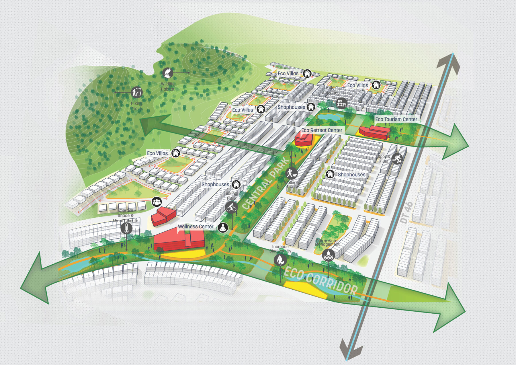
The Ecozone neighborhood on the foothills of the mountains connects to the Heritage Temple on the top of the mountain via a pedestrian trail
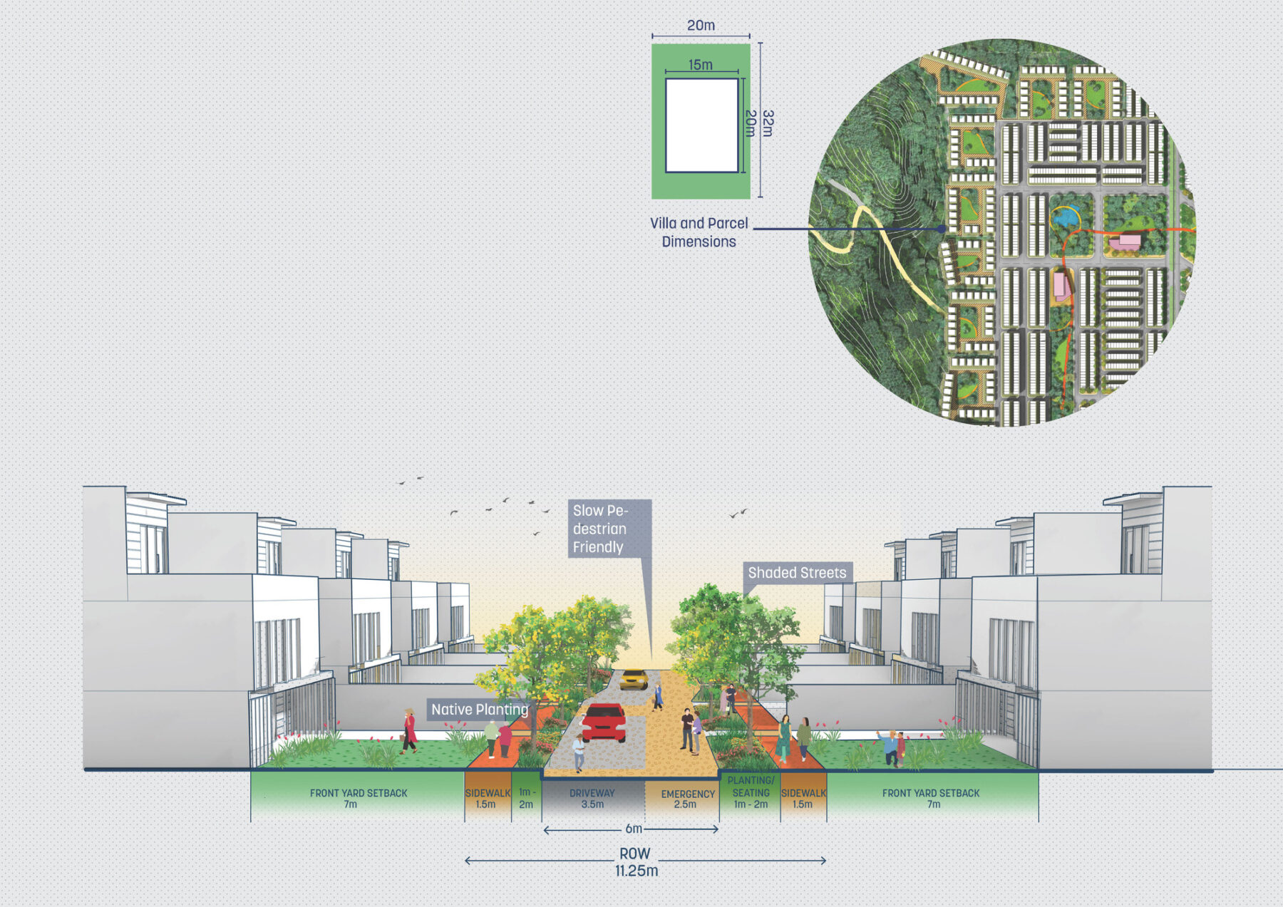
Section of a typical shared street
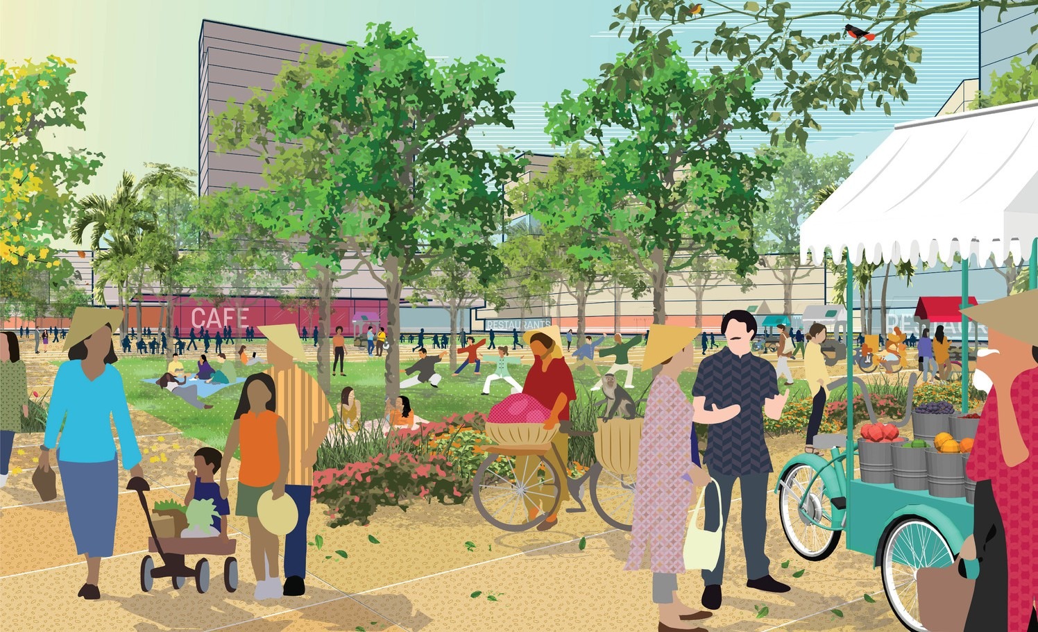
Mixed-Use central heart neighborhood
Completed in 2024, the master plan cultivates connectivity and a sense of community on an island undergoing immense transformation as a global tourist destination. The new district introduces a mixed-use social heart to the region, with a civic center, a commercial hub, and a recreational waterfront for the whole of Phu Quoc Island.
For more information contact Romil Sheth or Sejal Agrawal.
