Evansville Region Embraces the Ohio River in Sasaki’s final planning report
Sasaki's final report for the Ohio River Vision and Strategic Plan was unveiled on May 21.
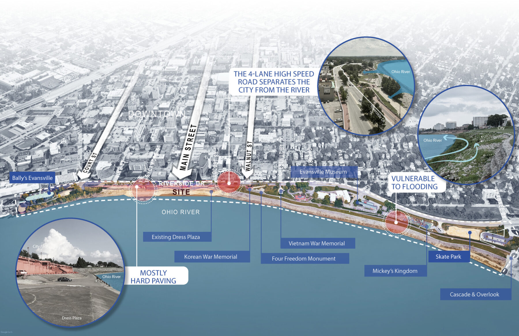
For nearly a century—since the city’s first master plan in 1928—Evansville residents have sought stronger, more accessible connections to the Ohio River. However, protective walls, levees, and raised roadbeds built to prevent flooding severed community access to the river. The Ohio Riverfront Visioning and Strategic Plan marks the first regional effort to revitalize the Ohio River frontage and reverses that separation. The plan creates a multi-generational, well-programmed riverfront designed to reconnect the city to its riverfront for the long-term prosperity of the surrounding communities.
Engaging closely with the communities and stakeholders, Sasaki developed the Ohio River Vision and Strategic Plan to invigorate the Evansville Region with new investment and stronger connections to the river, including a new riverfront park, an updated downtown plan for the City of Evansville, and the catalyst site identification along 50 miles of the Ohio River.
The regional framework provides strategic direction and urban design guidance for growth and change anticipated over the next several decades
The Ohio River Vision and Strategic Plan was developed through a collaborative process that engaged stakeholders and community members in visioning, workshopping concepts, and refining recommendations through various engagement tools – including the project website, online and paper surveys, mobile workshops, focus groups, and open houses.
In partnership with the clients, the Evansville Regional Economic Partnership (E-REP) and local municipalities, the planning and design team spent the last year conducting extensive public engagement with the residents of southwest Indiana to fully understand the priorities and hopes they have for their communities. This engagement included two multilingual surveys that garnered over 3,400 responses, over 150 in-person attendees at a July open house, and over 9,850 total points of engagement across several outreach methods.
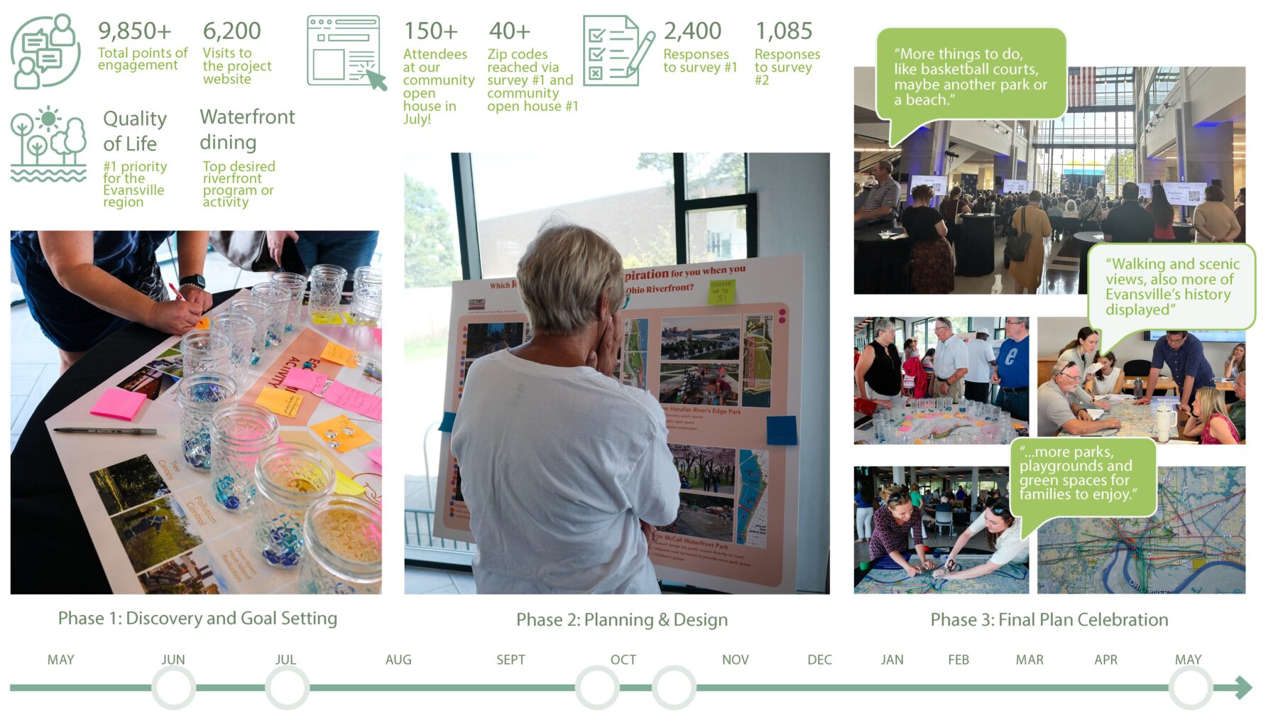
The community engagement process empowered residents and stakeholders to shape a collective future vision
The tremendous power of the Ohio River nourishes the vast farmland along the river and connects the region to the globe via shipping. But this power also brings severe natural flooding hazards. In the Evansville Region, the Ohio River can fluctuate 40 feet or more throughout the year, with a low level at around 13 feet and a major flood stage at 52 feet. The Evansville city area is protected from flooding with levee systems, a heavy investment after the catastrophic flood of 1937. Any future efforts to improve and invest in the riverfront must address the realities of flood risk. Understanding the flooding and the fluctuating river is a main driver for the planning and design.
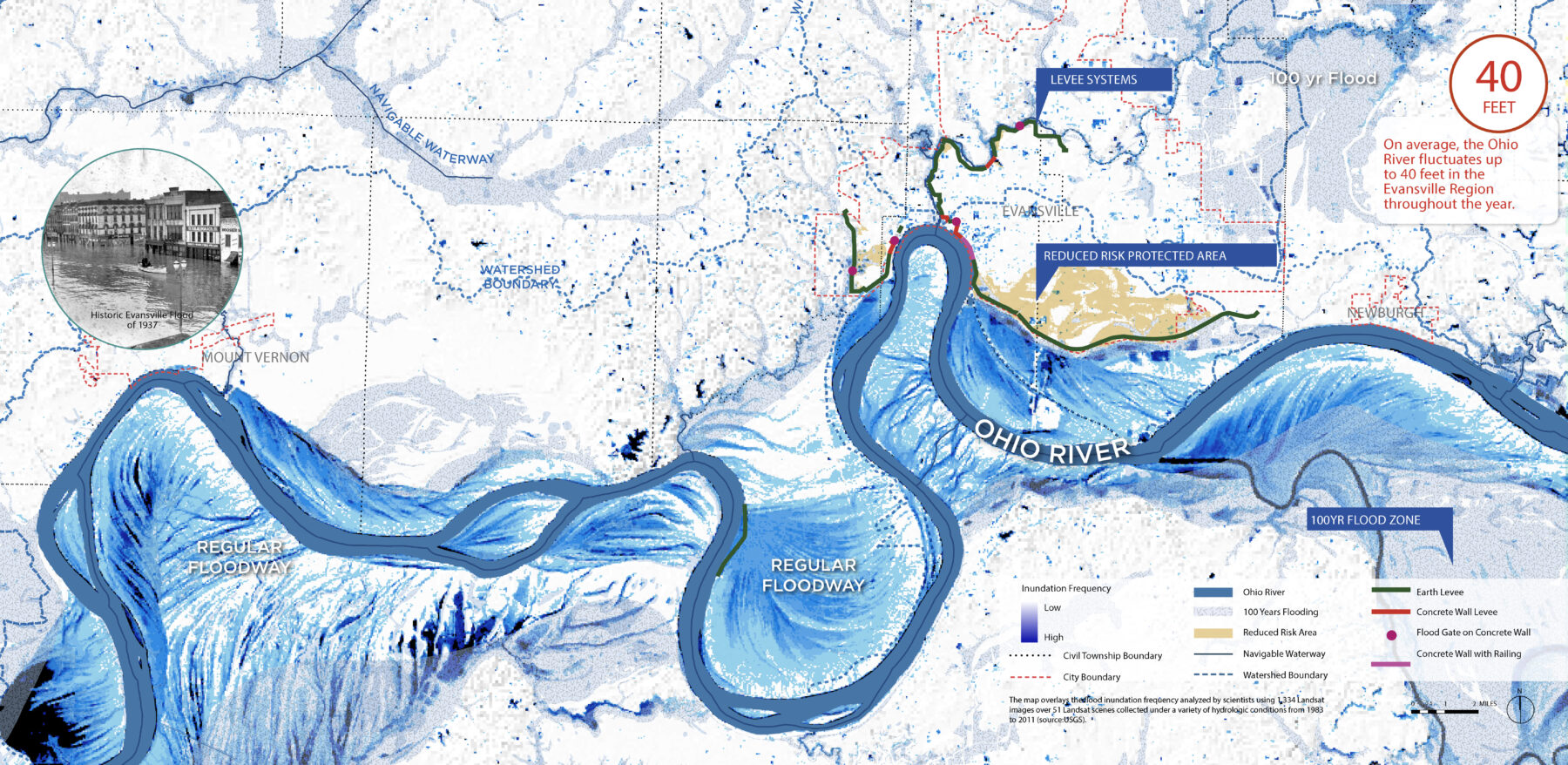
This map overlays the flood inundation frequency using data analyzed by scientists from 1983 to 2011 collected under a variety of hydrological conditions
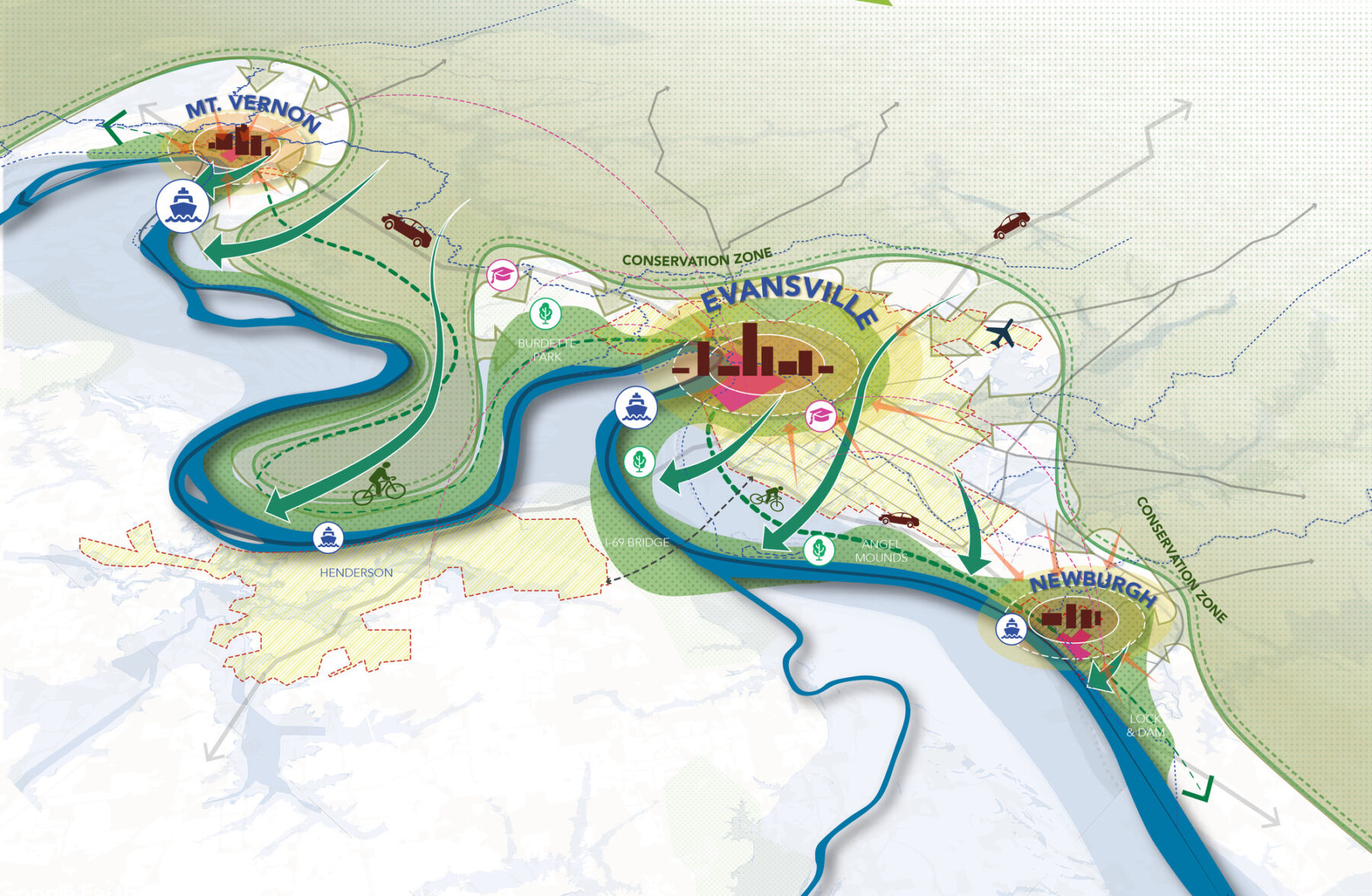
Centered around three big ideas, the plan envisions an enlivened 50-mile stretch of interconnected riverfront communities anchored by Mount Vernon, Evansville, and Newburgh counties. It lays out a bold redesign and expansion of the park spaces and plazas along the riverfront, and introduces new uses to support a diverse array of public activities and community events. The three big ideas include:
Embrace the River is about the multi-layered ways in which the city can embrace the riverfront as an engine of commerce, ecological health, resilience, tourism, and community vibrancy.
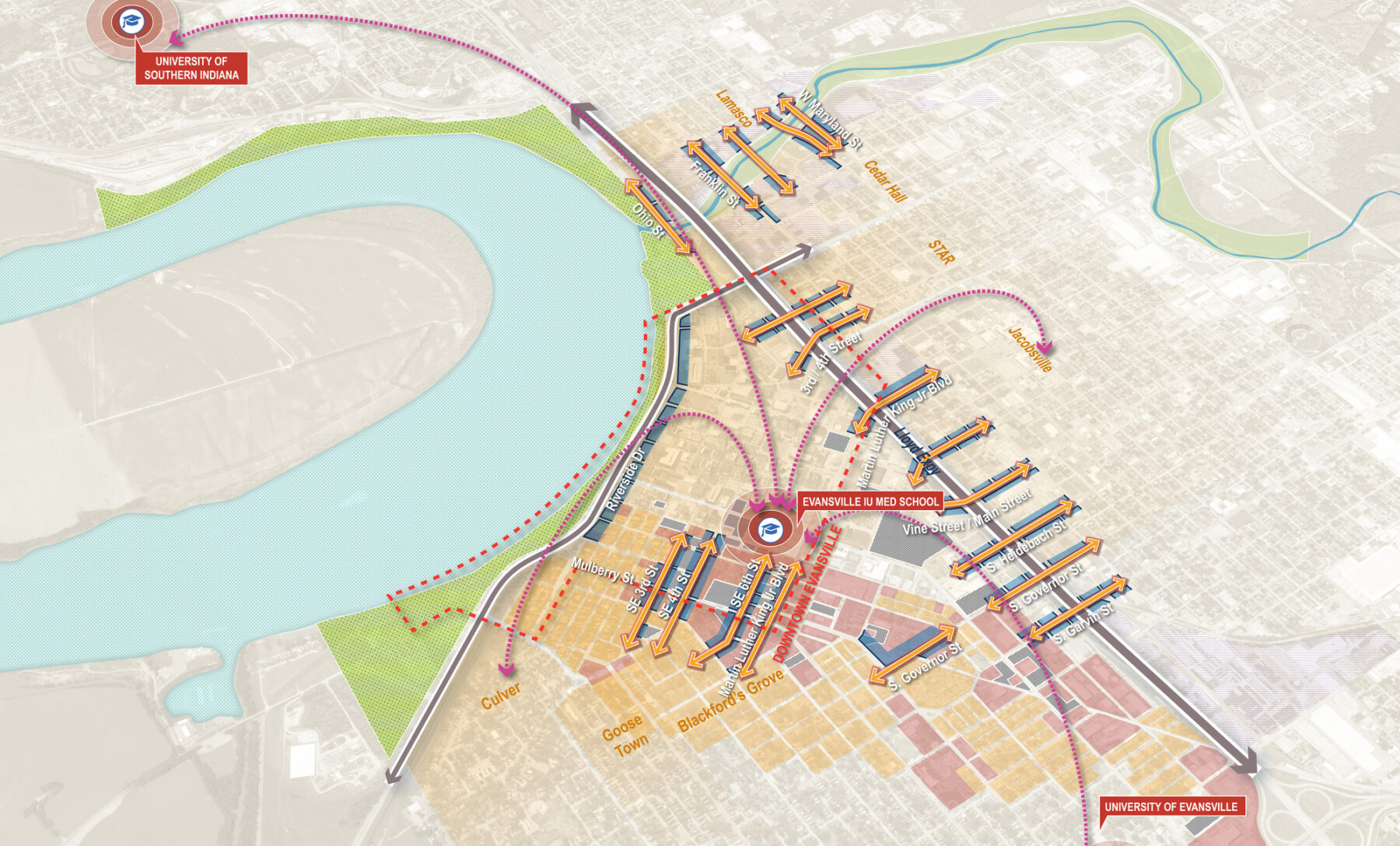
Stitch the City organizes ideas related to enhancing connections to, from, and through Downtown Evansville to create safer and more comfortable access to and from Evansville’s neighborhoods.
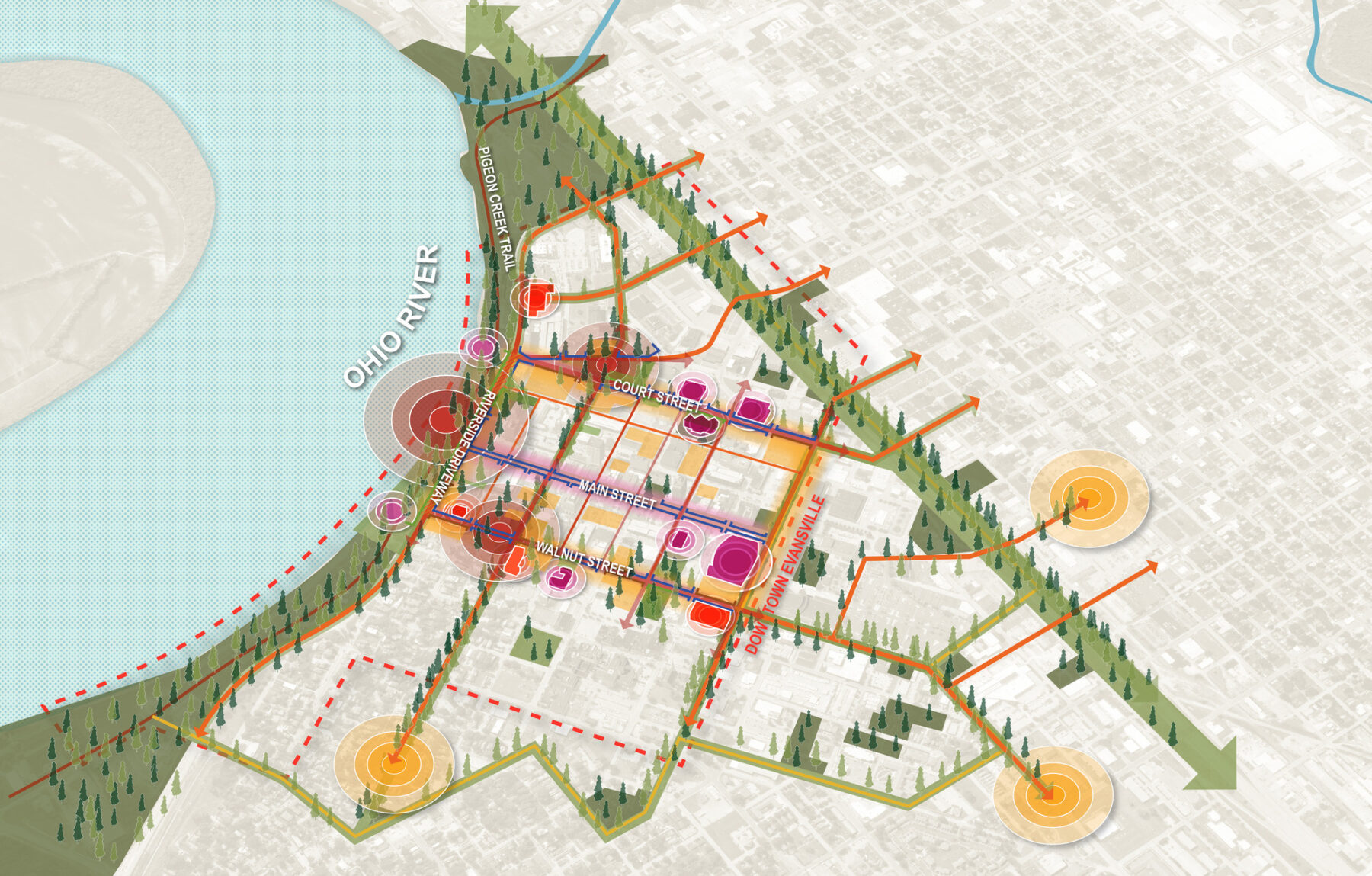
Main Street and More aims to expand the public realm to create a richer experience of downtown and new centers of activity that complement Main Street.
Embrace the River is about the multi-layered ways in which the city can embrace the riverfront as an engine of commerce, ecological health, resilience, tourism, and community vibrancy.
Stitch the City organizes ideas related to enhancing connections to, from, and through Downtown Evansville to create safer and more comfortable access to and from Evansville’s neighborhoods.
Main Street and More aims to expand the public realm to create a richer experience of downtown and new centers of activity that complement Main Street.
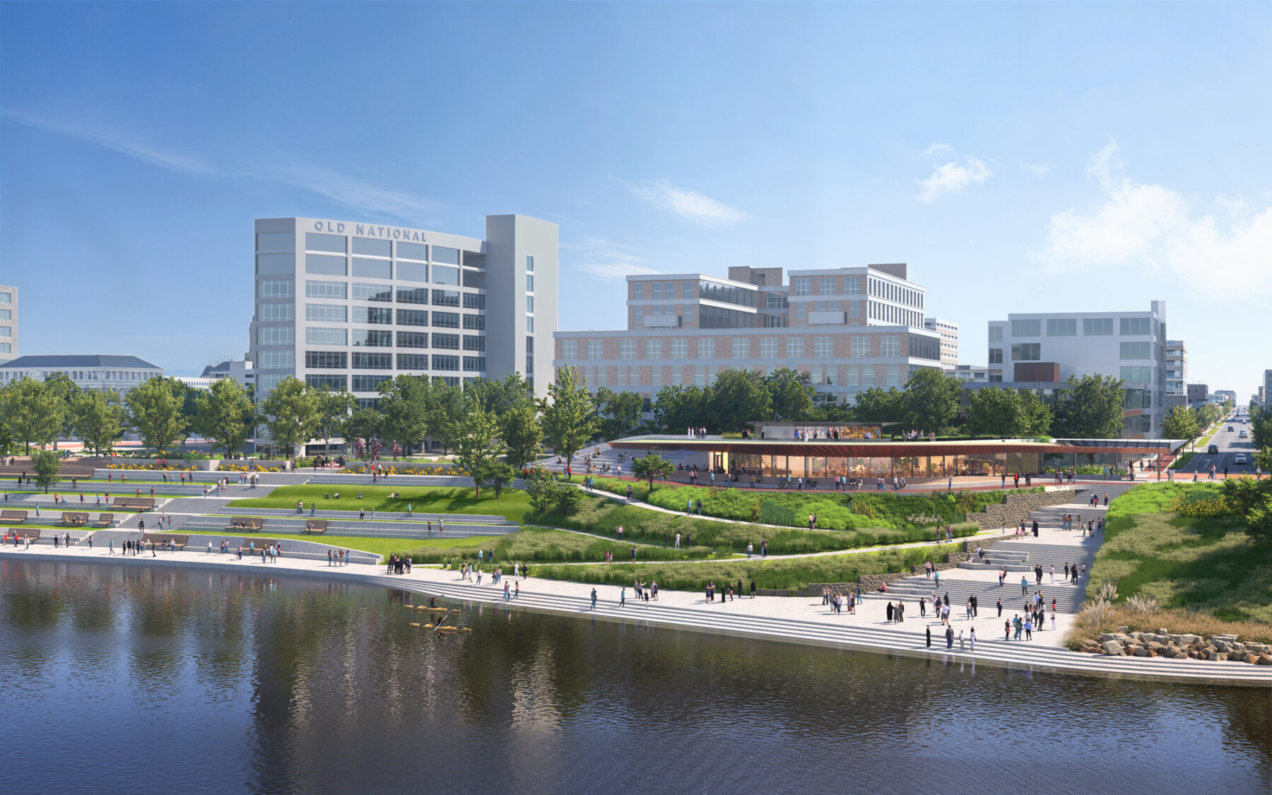
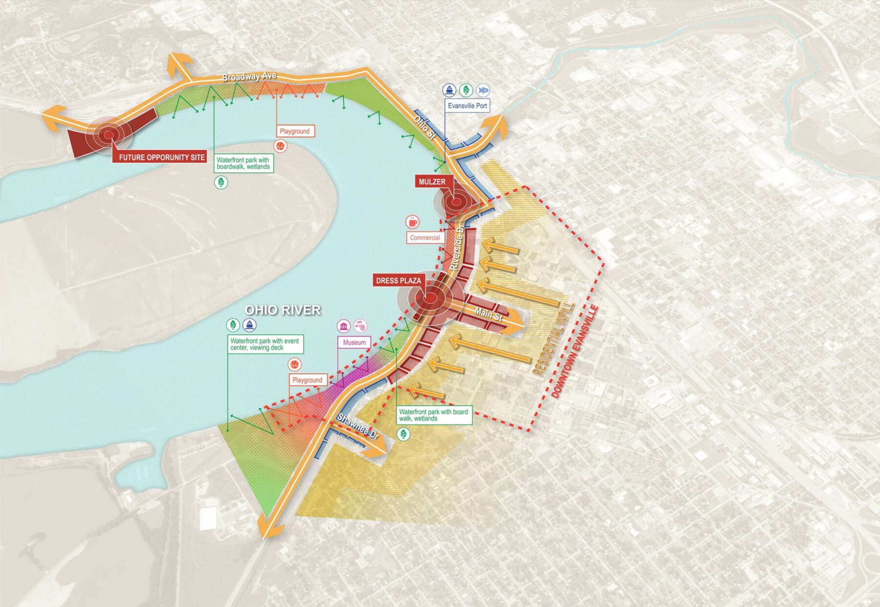
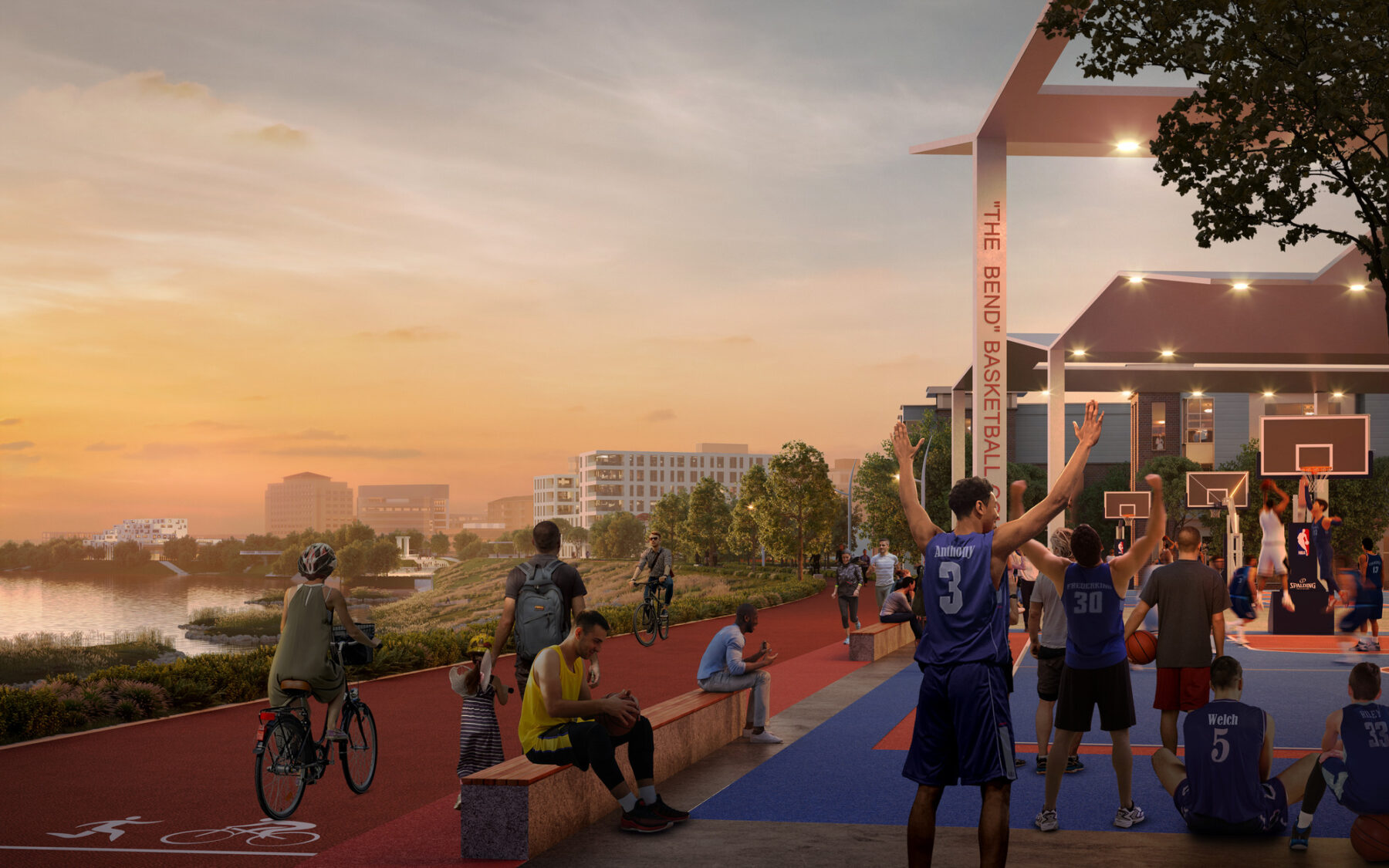
The plan is regionally centered on Great Bend Park, a reimagined riverfront for Downtown Evansville. Great Bend Park recognizes the riverfront park space situated between Evansville and the Ohio River as a significant opportunity and a catalyst for downtown growth and development. Shifting away from a separation from the river, the park emerges as a new iconic destination that seamlessly connects the entire riverfront.
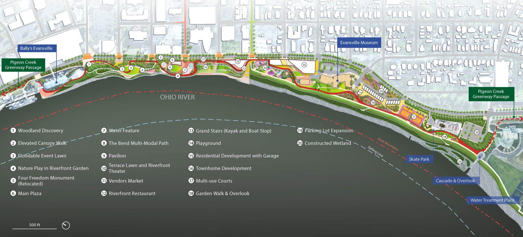
Great Bend Park brings the river to the city and the city to the river, making it a celebrated element of the downtown experience
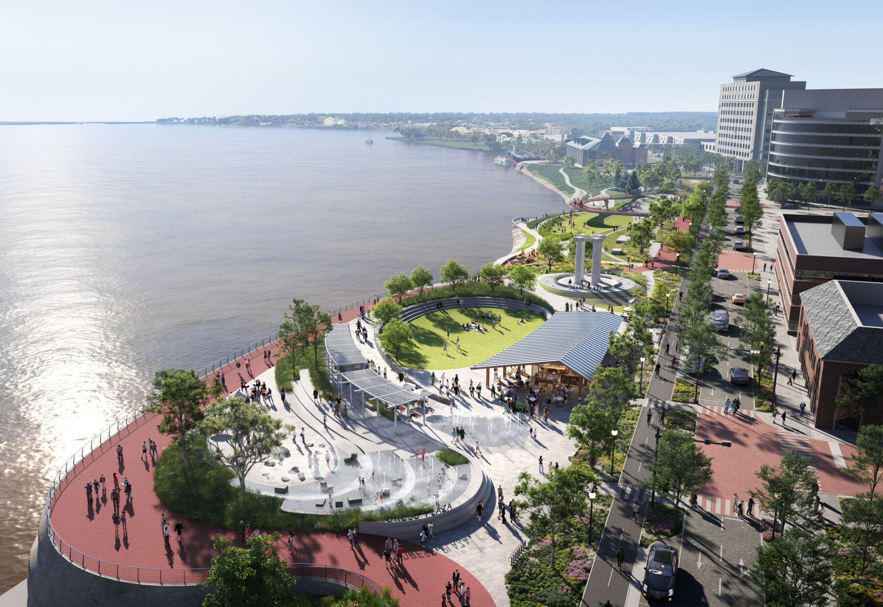
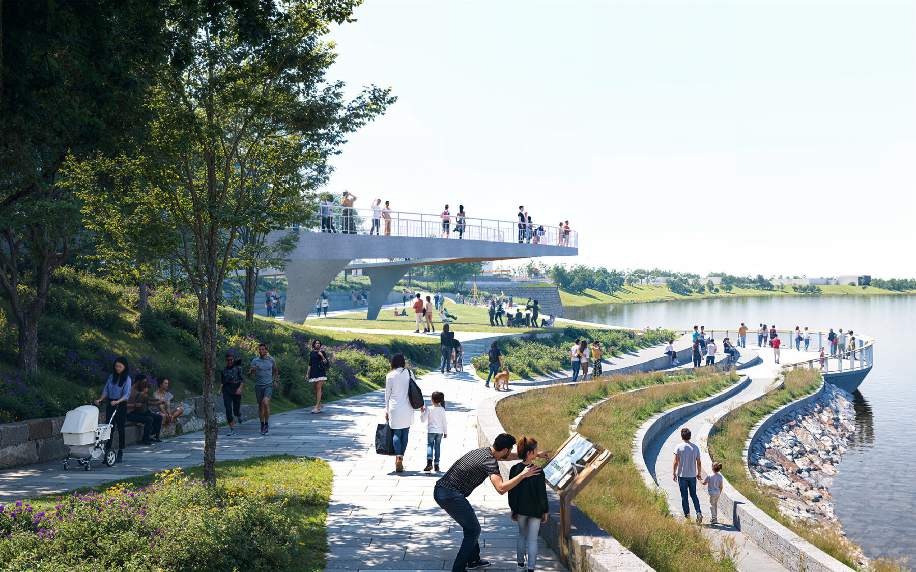
An iconic pathway, referred to as “The Bend”, serves multiple purposes: functional flood control infrastructure and an experiential path for pedestrians, runners, and cyclists. The Bend intricately weaves through iconic spaces at various levels, catering to everyday activities as well as special occasions, making it a versatile and integral feature of the riverfront. Situated strategically on the bend of the Ohio River, this new riverfront experience encapsulates the essence of the city’s riverfront experience, signifying a distinctive identity for this vibrant local destination.
The design team and the larger team of consultants supplemented this vision with transportation studies, hydrological analysis, phasing timelines, and financial modeling. Potential future grant funding from the State of Indiana’s READI program, along with other funding sources, prepare the region for timely implementation with the next phase of work on Riverside Drive and Great Bend Park already underway. The regional cooperation at the heart of this plan is a decades-long goal, and E-REP, IEDC, and the design team are committed to their collaboration to see it through together.
For more information contact Anna Cawrse.
Sasaki's final report for the Ohio River Vision and Strategic Plan was unveiled on May 21.
The plan will reconnect downtown Evansville, Indiana to its waterfront and draw new investment to the region