Zidell Yards Master Plan
Portland, OR
Boston's Seaport has developed rapidly over the last decade, but activation of the urban realm at ground level remains a challenge
Boston’s Seaport is one of the fastest developing areas of Boston. While its rapid transformation from industrial warehouses and parking lots to premier innovation district has certainly drawn new residents and businesses to the area in impressive numbers, many Bostonians have called for future development to create a more active, human-scaled public realm.
The 23-acre Seaport Square project was originally conceived of a decade ago. In assuming stewardship of the remaining 13 acres of undeveloped blocks, WS Development sees the opportunity and the responsibility to elevate the neighborhood to standing among those of other world-class cities—by cultivating activity, vitality, and a strong neighborhood identity. As a passionate advocate for urban design as a critical lever in vibrant long-term city development, Sasaki is proud to be a part of the team of planning and design experts engaged by WS Development. Sasaki joins James Corner Field Operations and NADAAA, in creating a transformative new vision for the remaining parcels at Seaport Square and the District as a whole.
Given it’s prime location—a stone’s throw from the Financial District and the Rose Fitzgerald Kennedy Greenway—the site seems like a natural locus for density
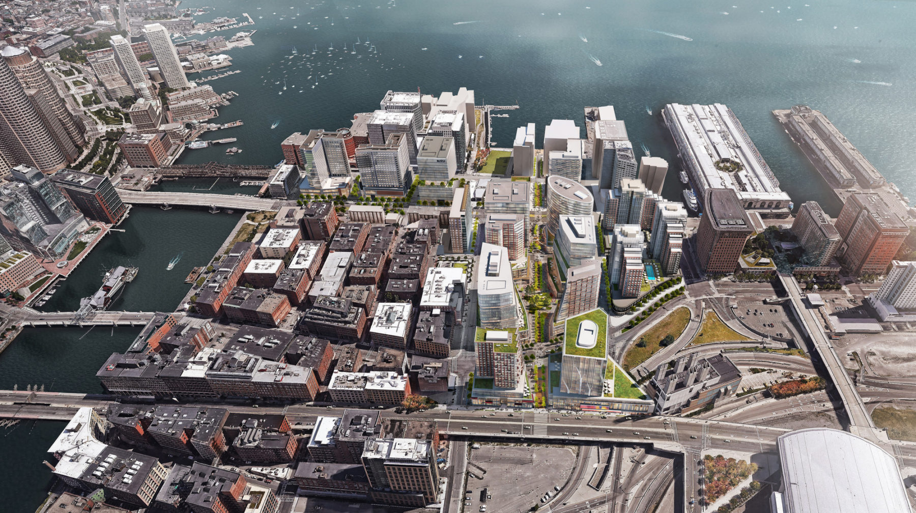
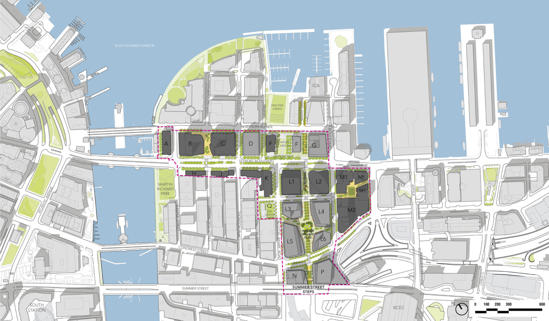
The re-envisioned master plan comprises 7.7 million square feet of development and brings a diverse mix of uses, pedestrian-oriented public space, and greater coherence and connectivity to the Seaport. An expansive public realm program weaves together a unique fabric of residences, offices, shops, restaurants, civic uses, and hotels. The district’s building massing unfolds at Harbor Square, right at the heart of the Seaport, to create a landmark “urban room” and a 21st-century neighborhood experience.
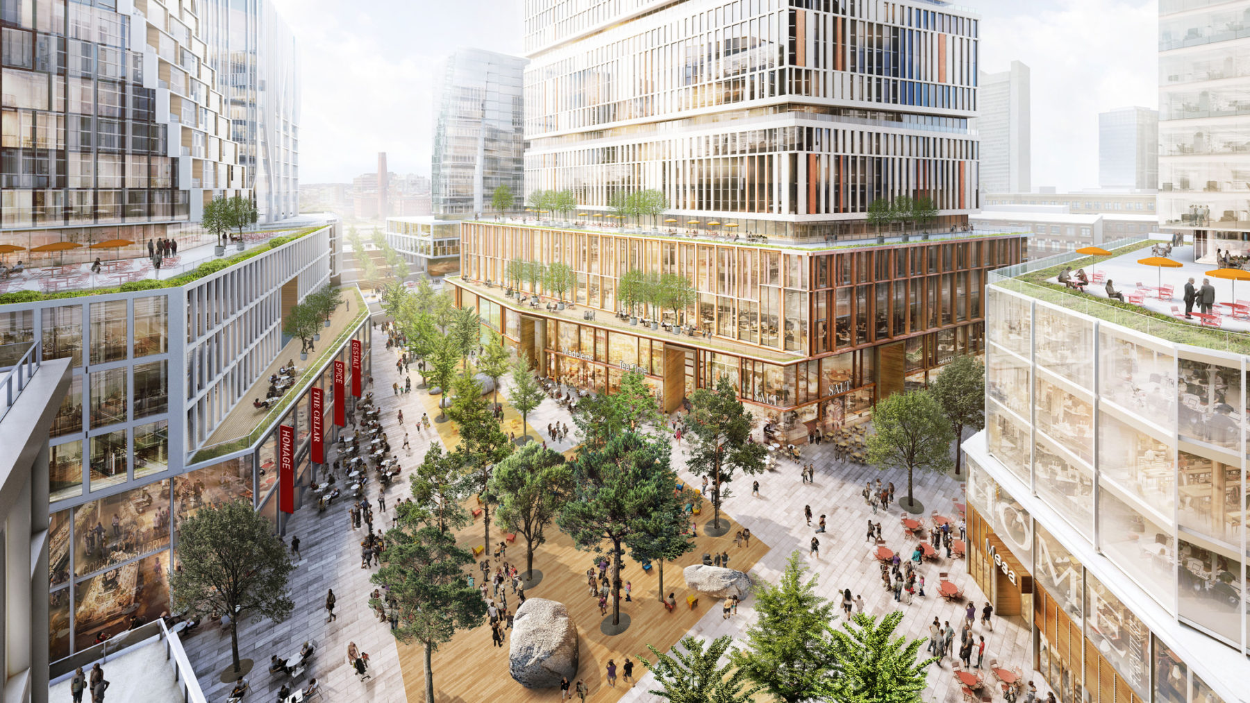
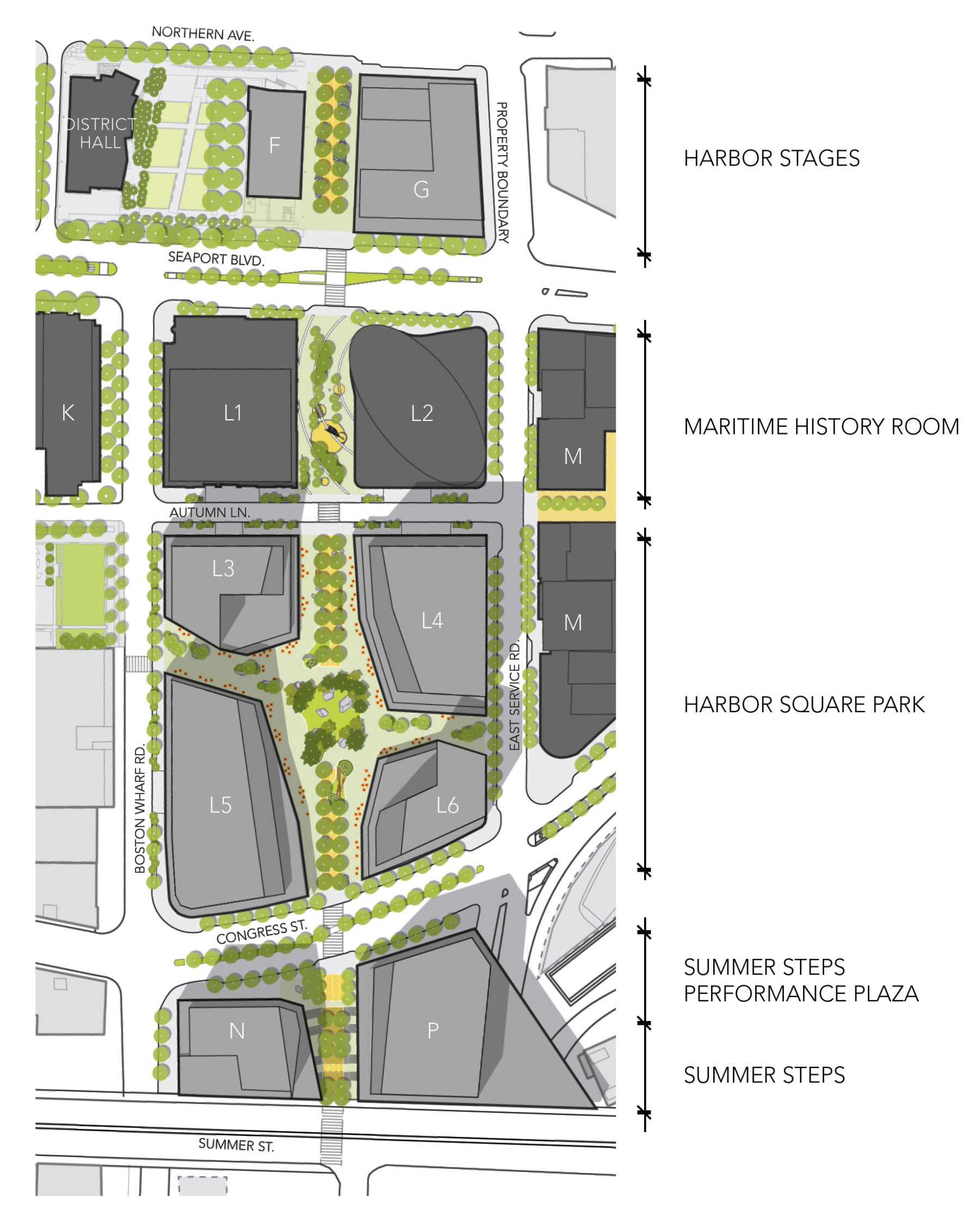
A bird’s-eye view of Harbor Square, an urban piazza which is envisioned as “a hub of year-round activity” and an active public space
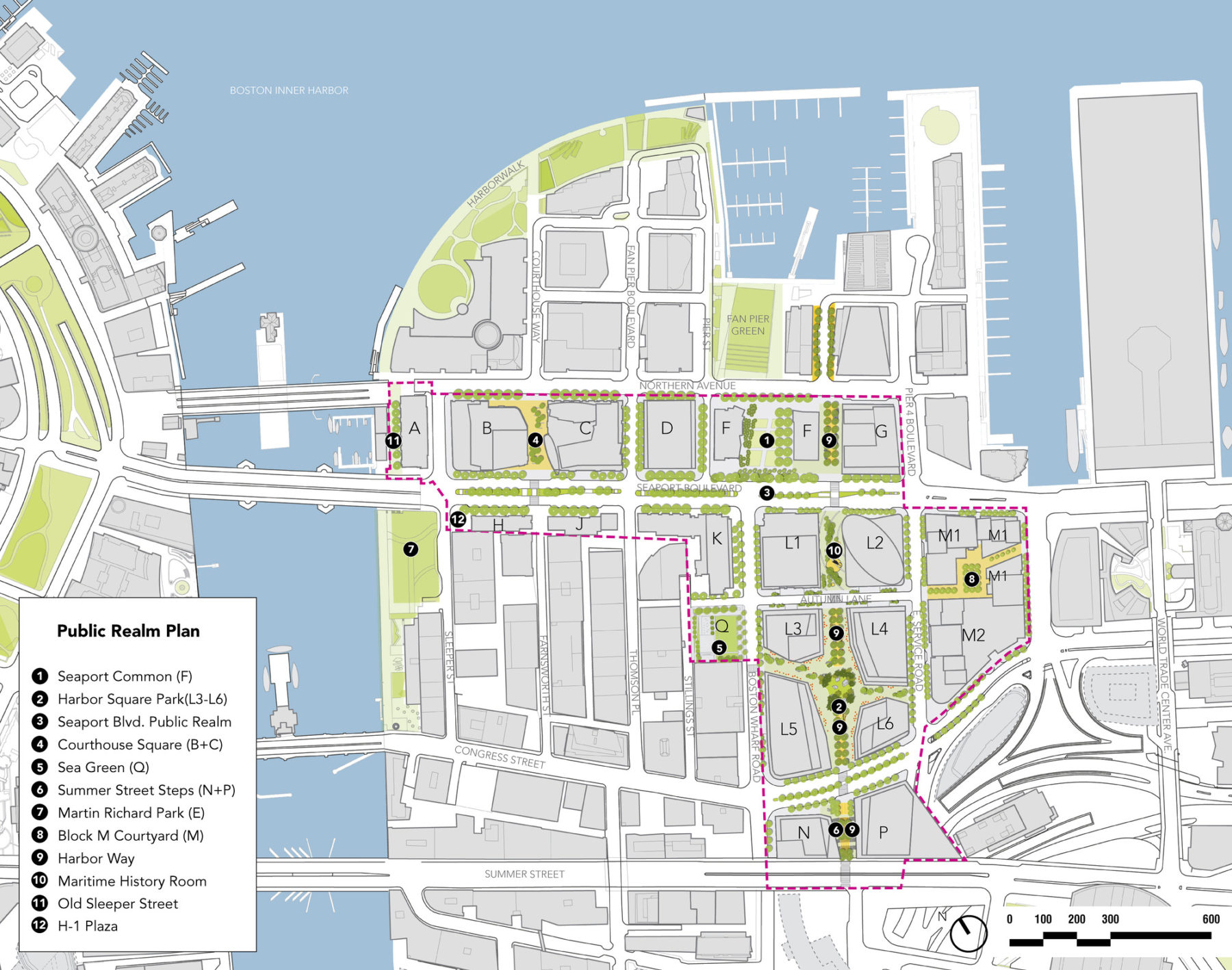
The public realm plan demonstrates both program variety and cohesion across the entire Seaport district
Central to the master planning effort was unfolding the district’s full potential at the heart of the Seaport by creating a landmark “urban room” and a 21st century neighborhood experience
“Central Green,” a large swathe of grass, will sit at the center of Harbor Way Square Park
This grand stair will link Harbor Way to Summer Street and the convention center beyond
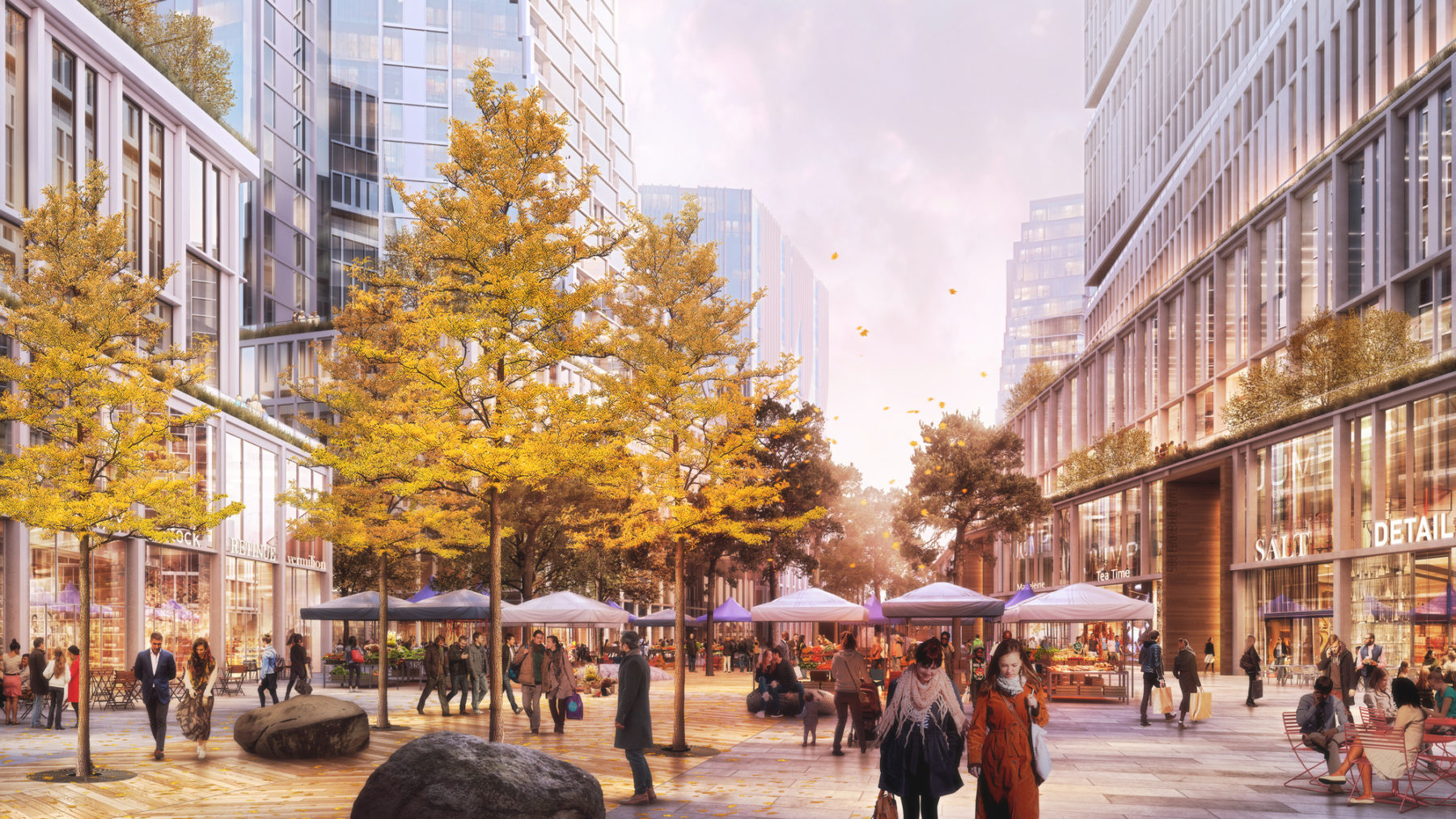
The JCFO, NADAAA, and Sasaki team aimed to create intimacy and warmth in the Seaport’s public spaces; that feeling would soften the development’s otherwise glassy architecture
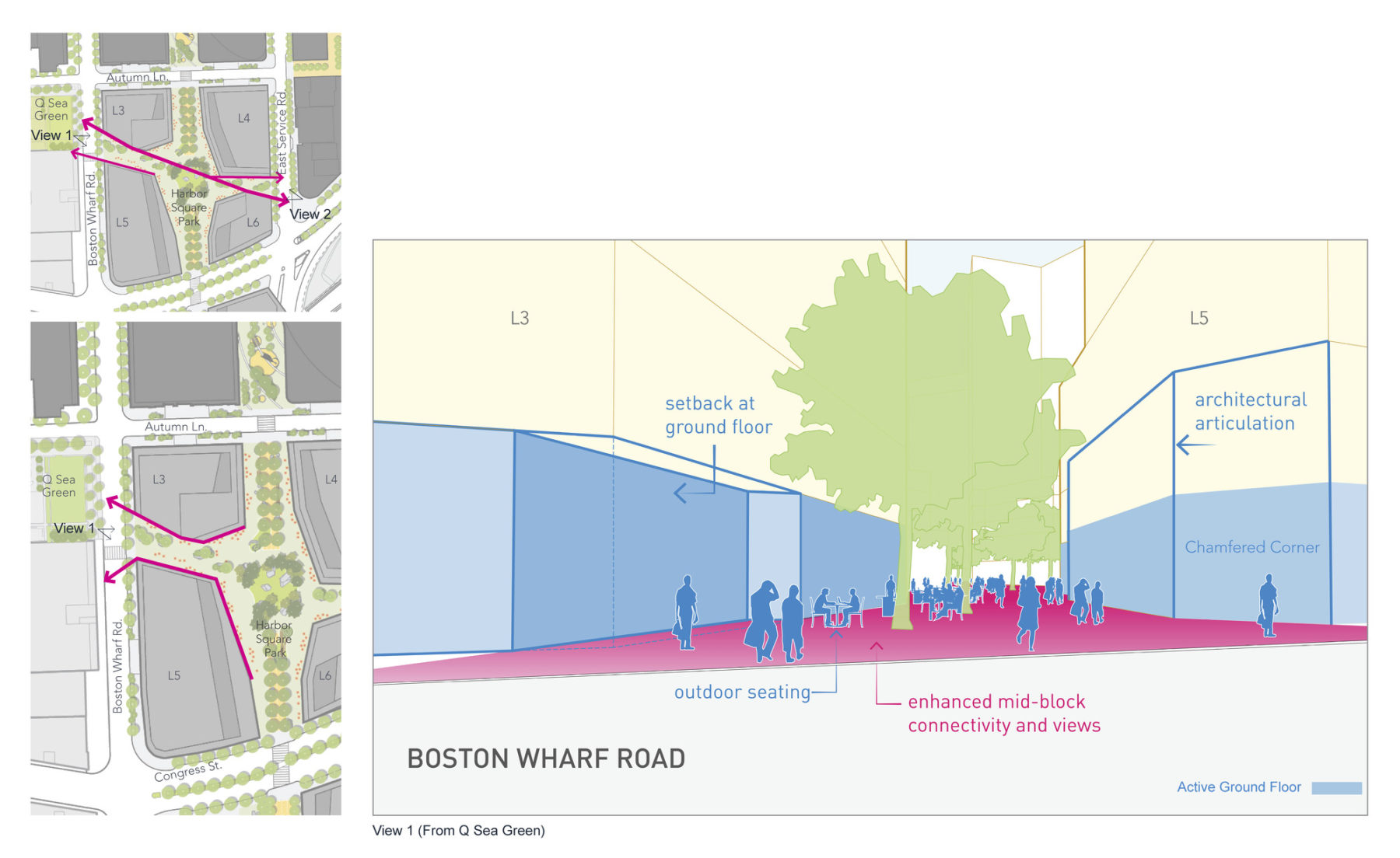
Interaction between ground floor architecture and public realm shaped the urban design interventions
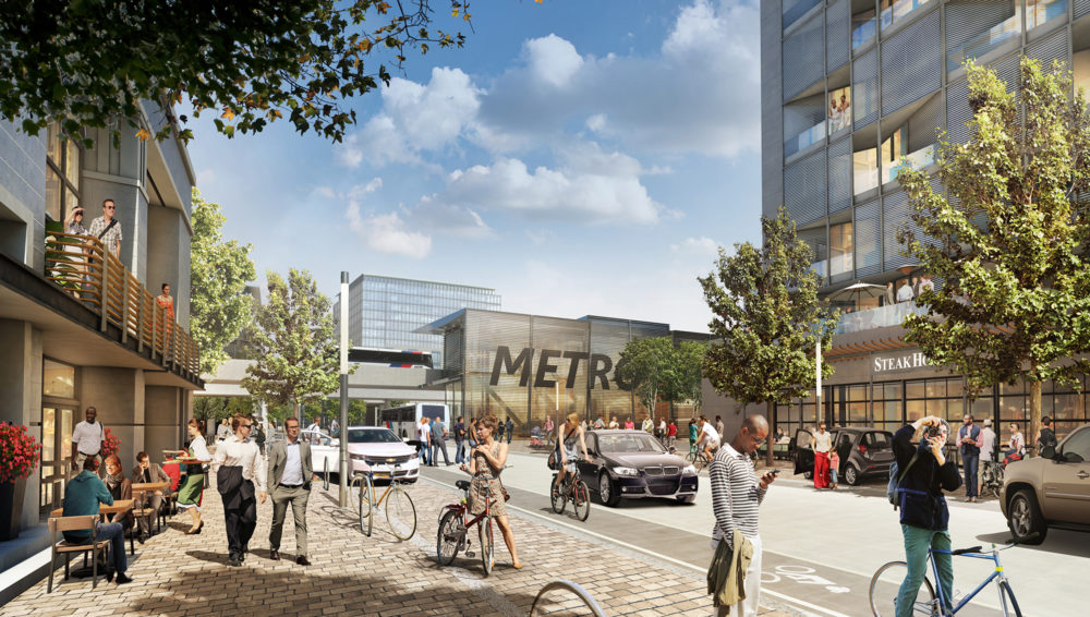
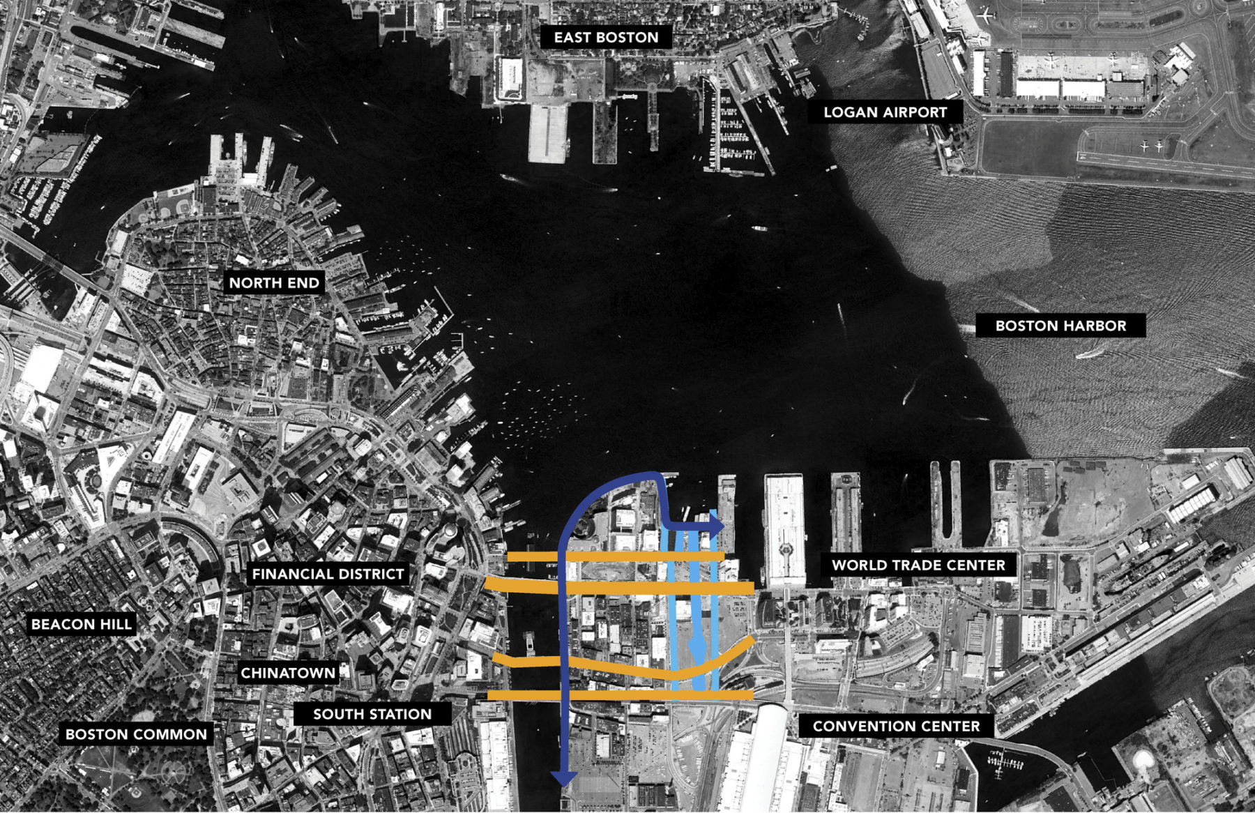
Strategically located near South Station, the MBTA Silver Line, and thoroughfares I-90 and I-93, the master plan is designed to encourage walkability and alternative mobility options with 39% of the total project area being exclusively devoted to pedestrian-only open space. Aiming to fill the existing urban void and link together separate clusters of diverse activity and urban fabric, the master plan establishes a series of connections between the Financial District, the waterfront area, the Fort Point Channel Landmark District and Fan Pier. A tree-lined pedestrian path, Harbor Way, punctuated by plazas and amenity spaces serves as the district’s cultural corridor and north-south connector between the Institute of Contemporary Art (ICA) and the Boston Convention and Exhibition Center (BCEC).

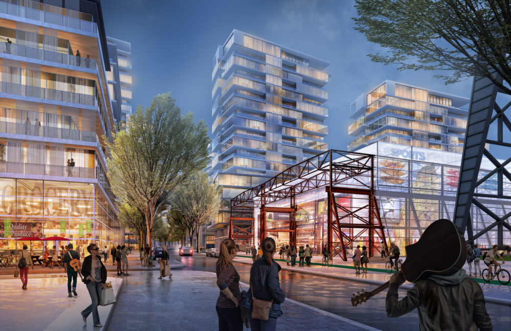
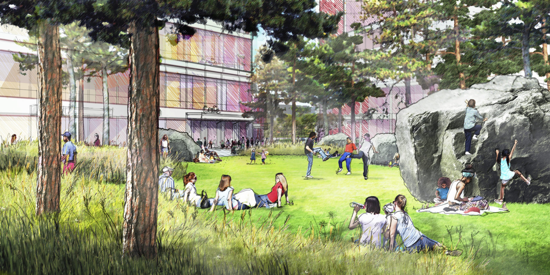
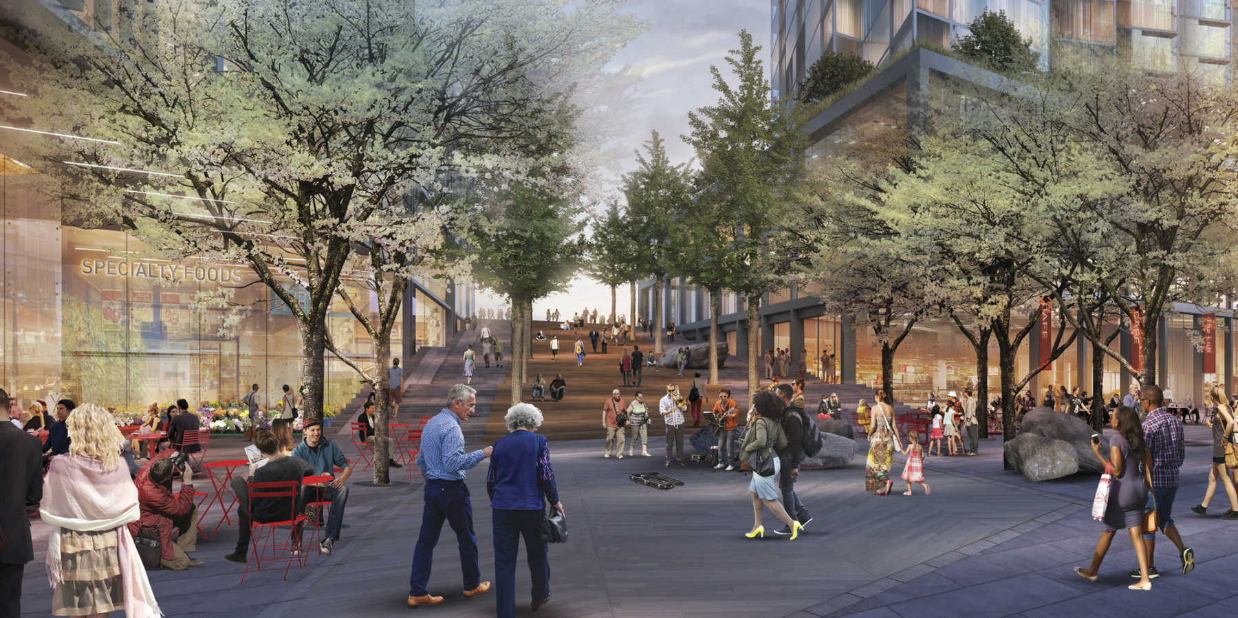
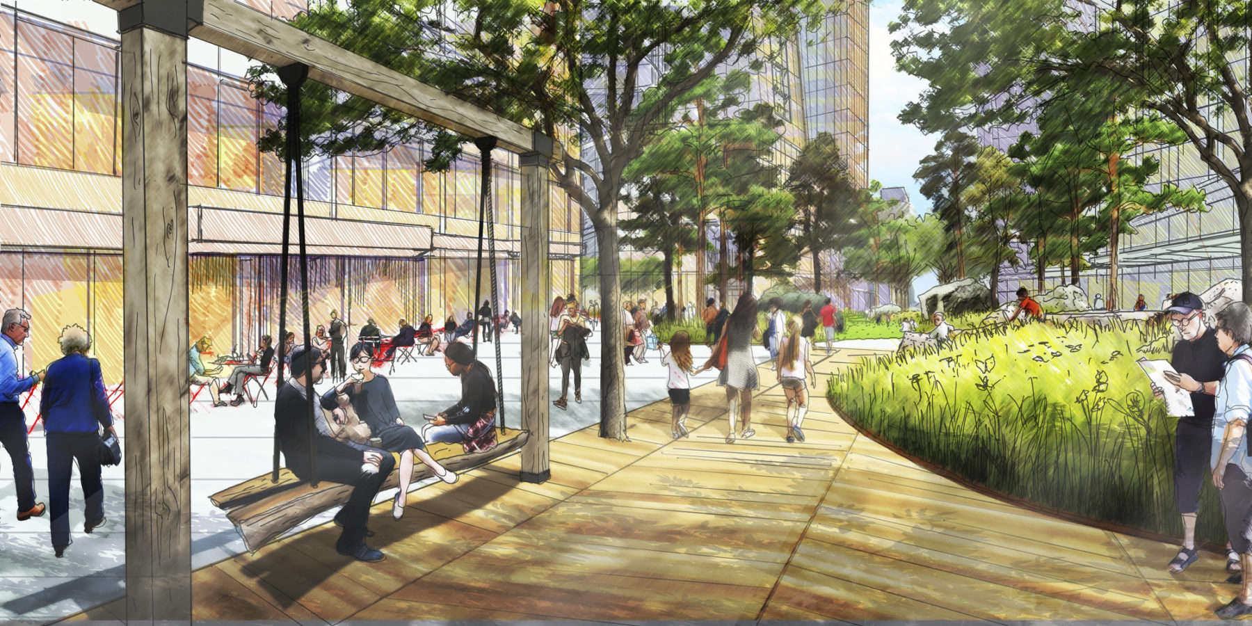
Year-round programming will play a significant role in keeping the area active and lively
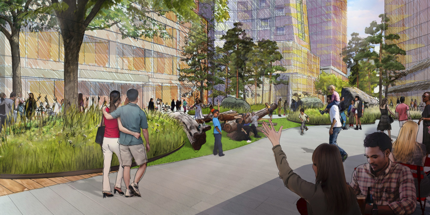
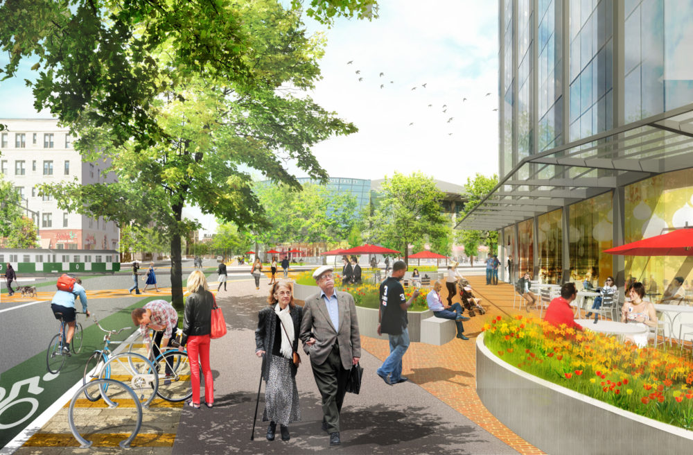
Pedestrian experience factors significantly into the plans
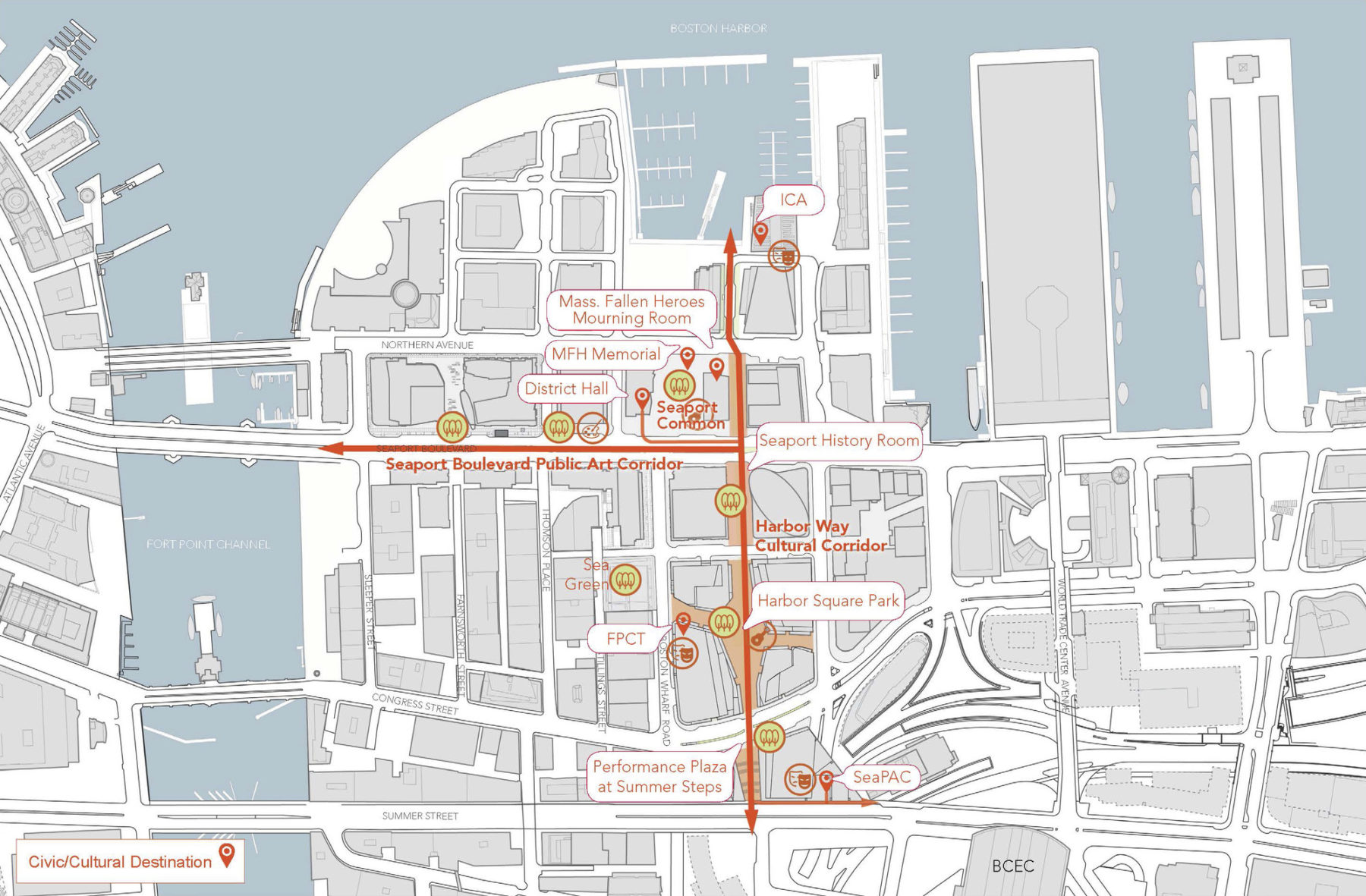
Cultural destinations punctuate the district and with greater urban realm connection and activity visitors will have greater reason to stay and explore
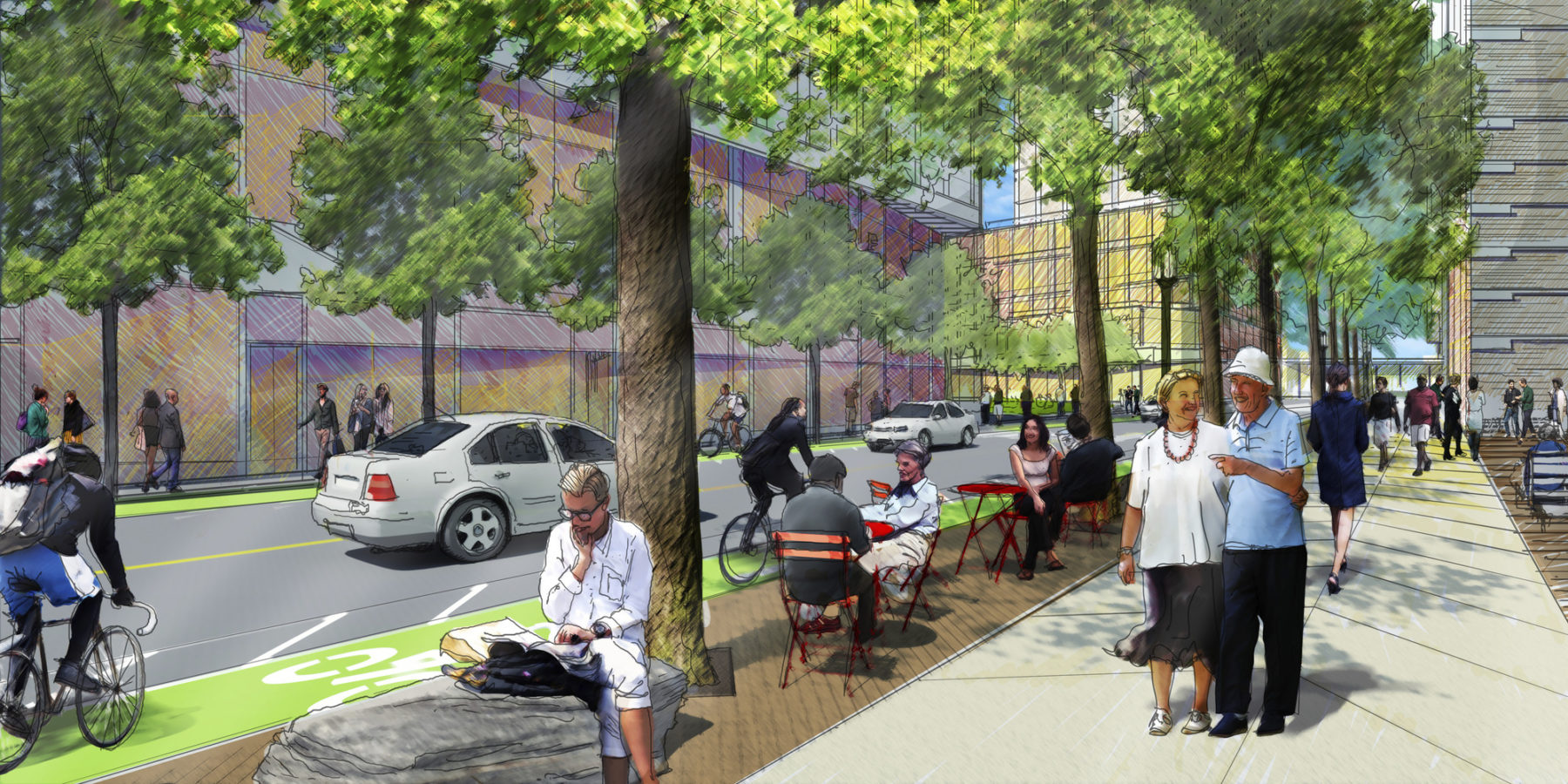
Bike lanes, pedestrian paths, and new seating create a flexible streetlevel experience
Connections to Boston’s downtown and Harbor in Seaport Square
Year-round programming will play a significant role in keeping the area active and lively
Pedestrian experience factors significantly into the plans
Cultural destinations punctuate the district and with greater urban realm connection and activity visitors will have greater reason to stay and explore
Bike lanes, pedestrian paths, and new seating create a flexible streetlevel experience
Connections to Boston’s downtown and Harbor in Seaport Square
A closer look at the layout of the site
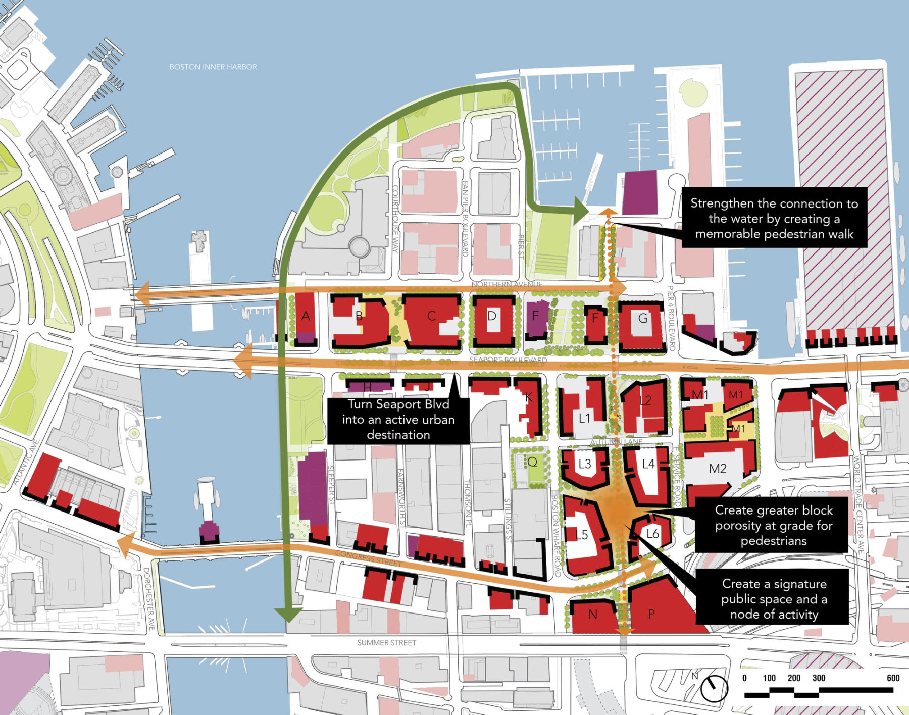
A number of goals guided the plan and urban design
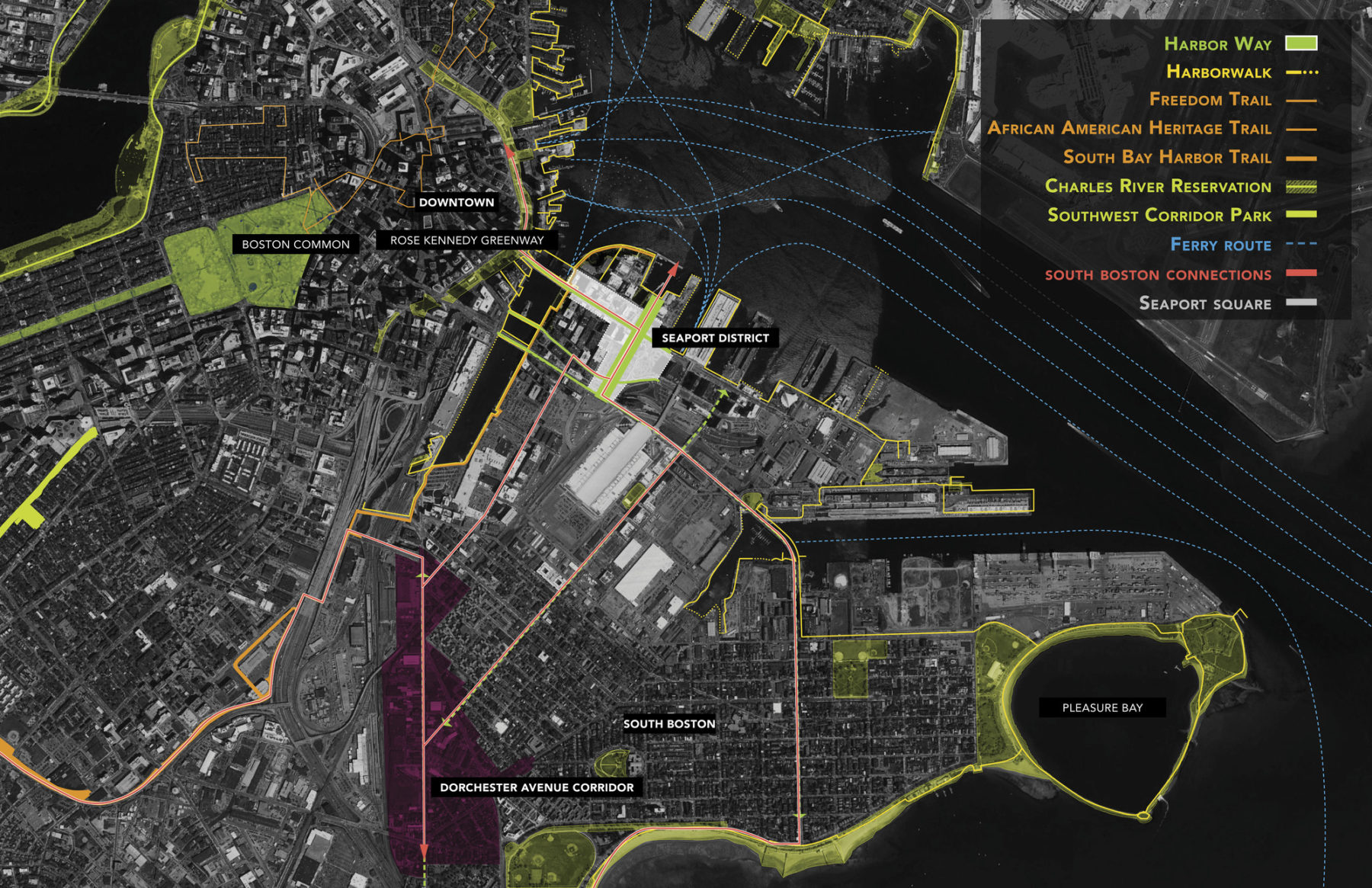
Water and land connections
For more information contact Martin Zogran.