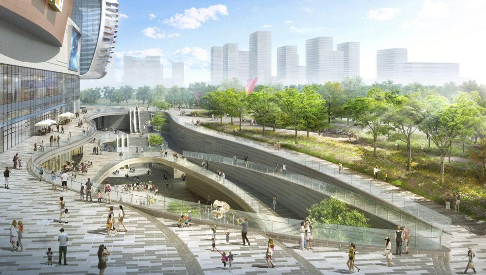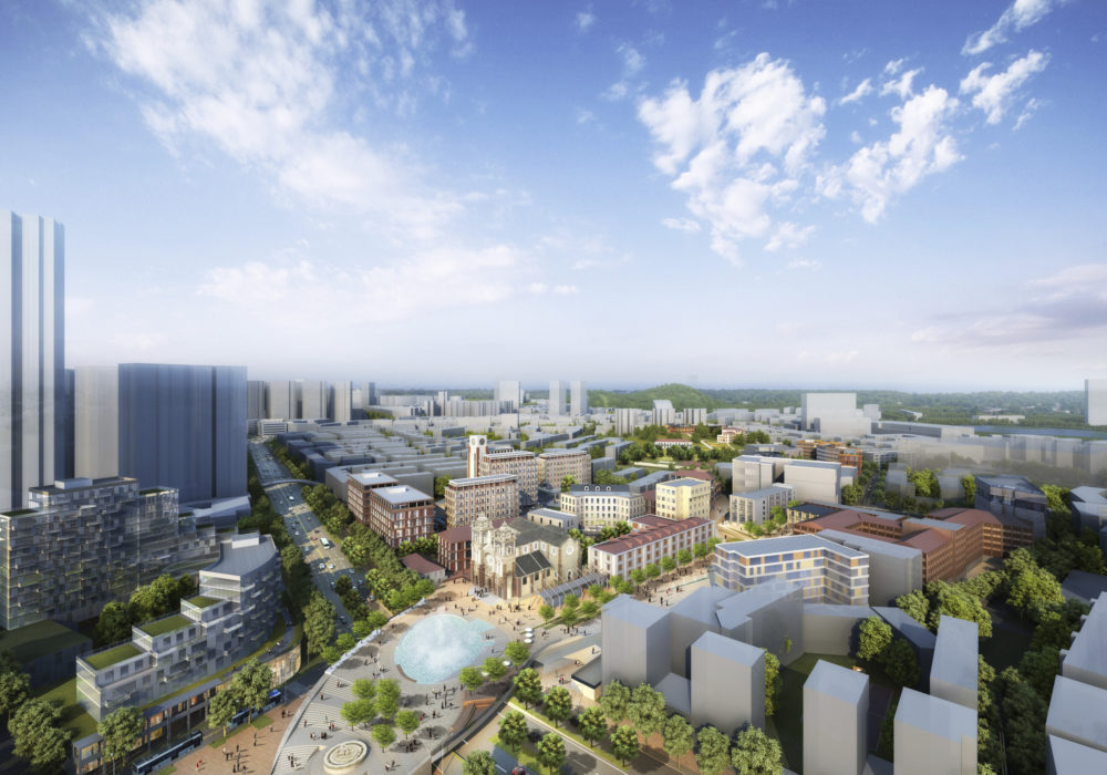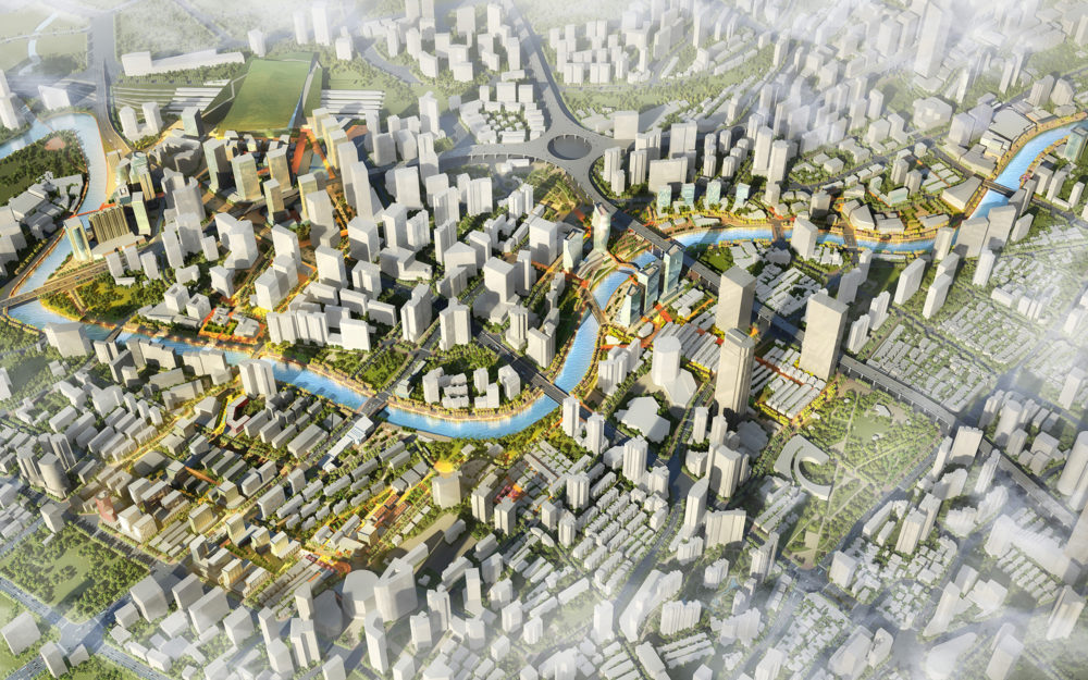
Suzhou Creek
Shanghai, China
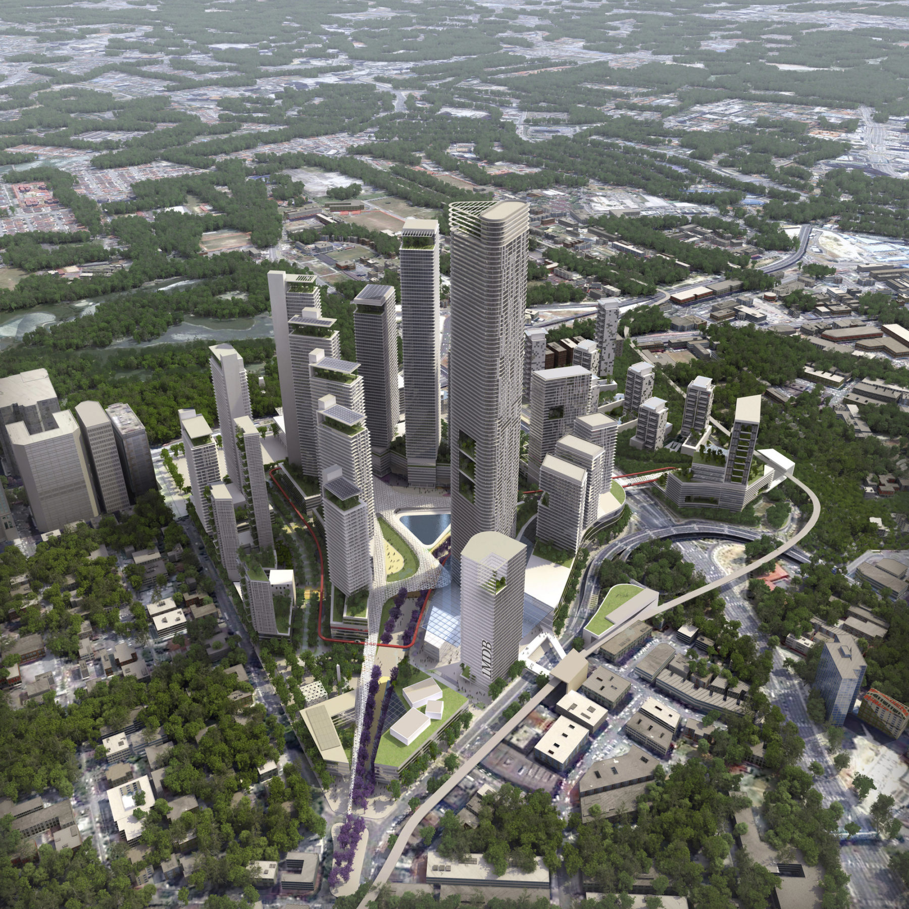
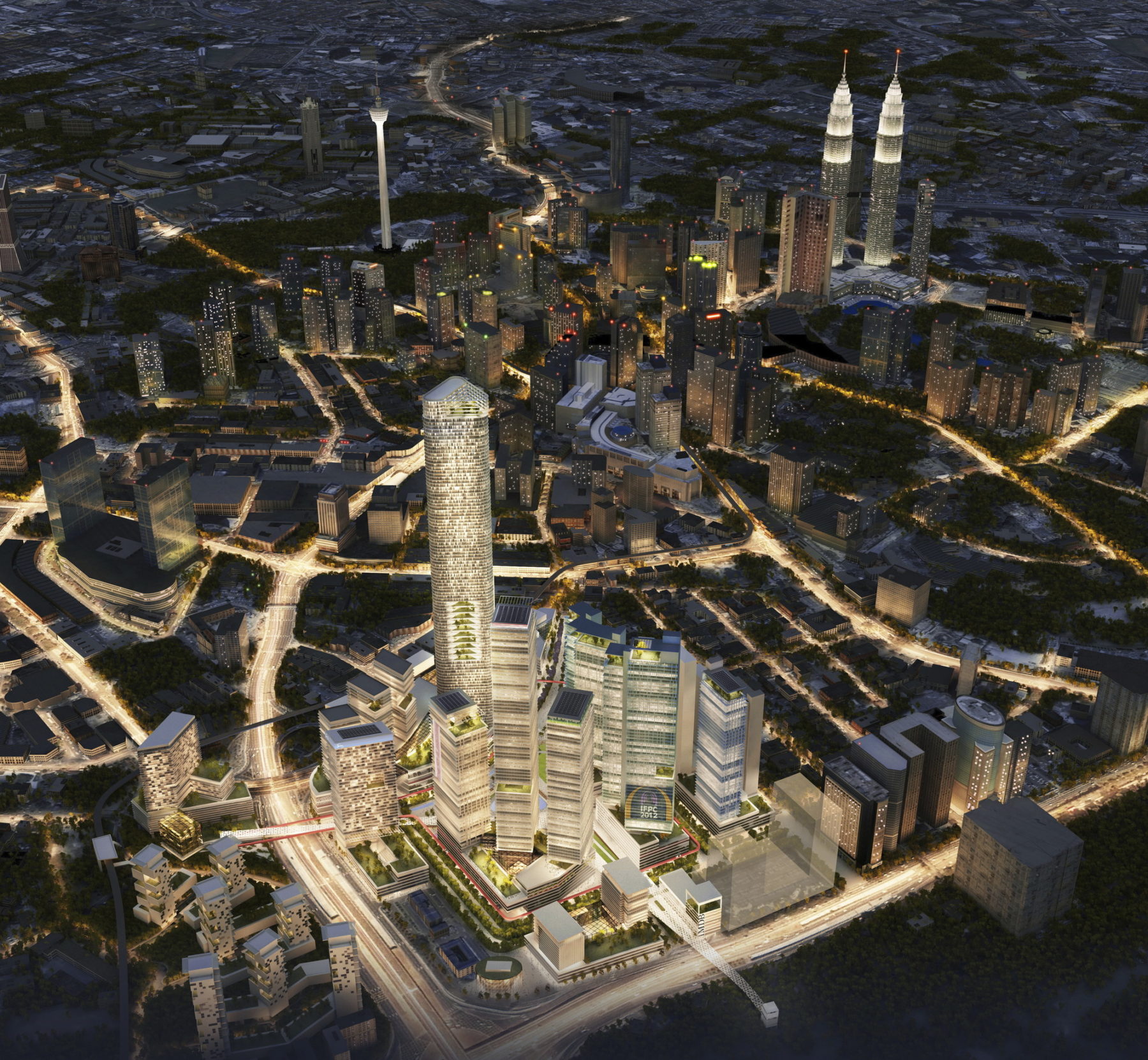
The vision for the Kuala Lumpur International Financial District project is to create a vibrant mixed-use urban destination by integrating various programmatic elements with natural systems and sustainability strategies. Sasaki’s master plan harnesses the various assets of the surrounding context—landscape areas, program hubs, pedestrian and transportation infrastructure networks—to create a heart of the development and the city of Kuala Lumpur.
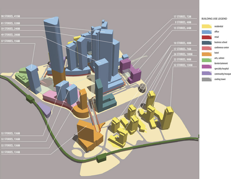
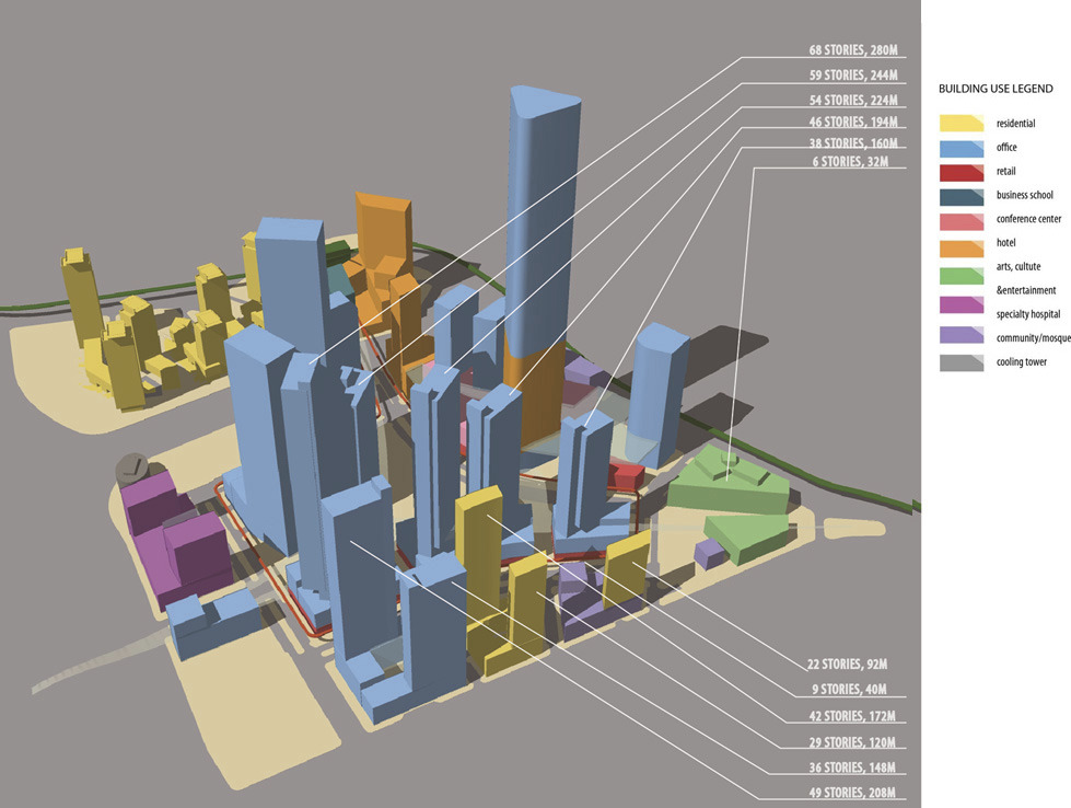
The 37.5-acre site is a large, unencumbered land parcel divided into two by an elevated highway. There are few existing buildings, landscape, or site infrastructure except for a large vegetated area on its southern parcel and a central monsoon drainage channel. The development program calls for a variety of synergistic uses in high density form. Uses include cultural and community-oriented buildings, a mosque, a conference center, a transit hub, a hotel, an office tower complex, banks and office towers with commercial uses at the ground levels, live-work buildings, retail, a specialty hospital, an executive education complex with dedicated MBA hotel accommodations, and resort-style luxury apartments.
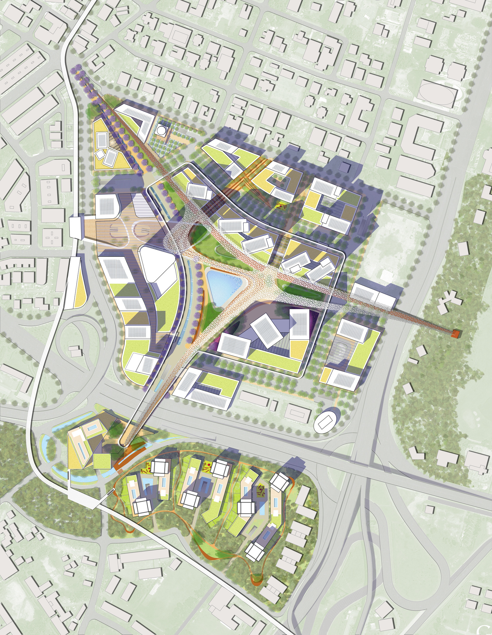
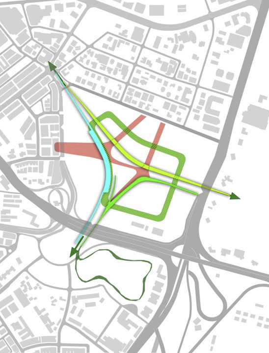
The development takes the form of a crescent with buildings that shelter a public open space, which in turn ties both parcels to significant urban nodes around the site. The landscape crescent can be identified from the air as a unique mark of Kuala Lumpur’s International Financial District. A series of macro development parcels form a series of programmatic islands around the park, connecting the development’s core to the surrounding neighborhood fabric. Banks, offices, and financial institutions define the skyline, ascending from the site’s northern entrance to the district center. A landmark building crowns the development at its center, marking one of the site’s major access points at the confluence of the proposed public transit systems.
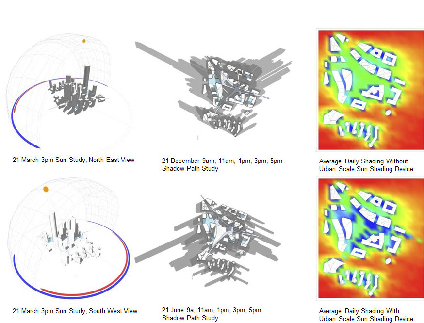
The public park at the district’s heart is envisioned as a rainforest. It is partially covered by an architectural canopy sheltering segments of the park to protect users from the weather. The park around and underneath the canopy becomes the uppermost layer of the site’s bio filter, contributing to the overall stormwater absorption, collection, and reuse strategy. Building podiums line the central garden and rooftop garden spaces create another accessible landscaped level overlooking the park.
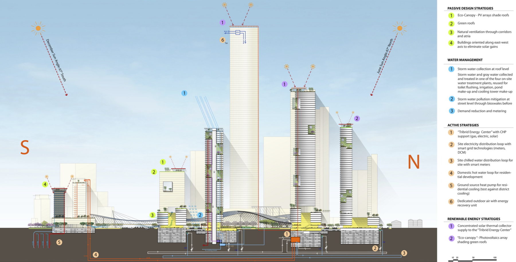
Sasaki’s design integrates the built and natural environment with sustainable design strategies at every level. The project manages the site’s stormwater footprint by combining green roofs, building and hardscape area drains, and green spaces to slow down and harvest water runoff. Stormwater collection tanks are distributed under each macro development parcel, which then recycle the water for reuse in the catchment area. Building footprints are designed to maximize optimum solar orientation and minimize energy consumption. North and south facades are sheltered by horizontal overhangs to protect building facades from the sun’s incidence angles, while east- and west-facing facades are screened to minimize building heat gain and preserve views to the surrounding district and city environments.
For more information contact Dennis Pieprz.