Downtown Raleigh Experience Plan
Raleigh, NC
The Houston Energy Corridor District positions the Energy Corridor District west of Houston as a high-quality place in which to work, live, and invest
Sasaki and a team of consultant partners have developed a long-range master plan that positions Houston’s Energy Corridor to accelerate its evolution into a multi-dimensional, urbanistic, world-class place to work, live, and invest. The master plan envisions The Energy Corridor as a vibrant place that provides walk- and bike-to-work opportunities in a mixed-use, transit-served, ecologically-rich community. A long-range framework and targeted strategies are designed to coalesce investment around this vision over the next 20 years, enhancing the district’s competitive position in the Houston metropolitan market.
The Energy Corridor District is one of the nation’s premier employment centers, containing the headquarters and regional offices of prominent international energy companies, energy services firms, and many other significant organizations. Comprised of 2,000 acres situated 15 miles west of downtown Houston along I-10, the district is distinguished by its exceptional location within the metropolitan area, a large and growing population of office workers and residents, and adjacency to some of the region’s great natural assets, including Buffalo Bayou and the Addicks and Barker Reservoirs.
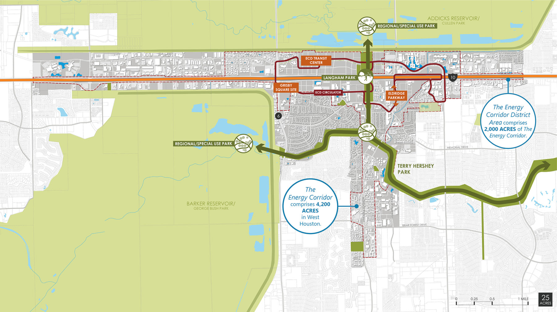
Straddling I-10, the Energy Corridor District is comprised of 2,000 acres west of downtown Houston
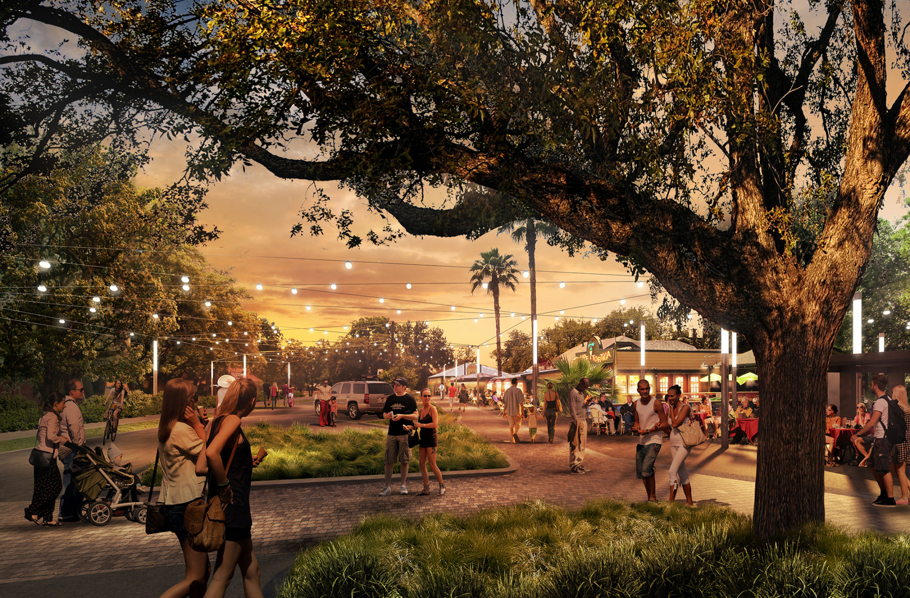
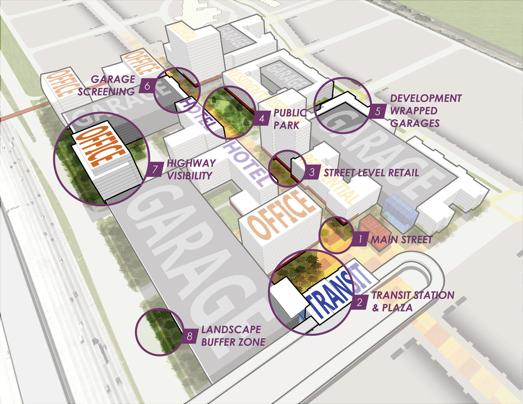
The plan creates a destination environment by promoting the development of several mixed use centers
The district considered one of the nation’s premier employment centers containing the headquarters and regional offices of prominent international energy companies
The master plan provides strategies for The Energy Corridor District—in cooperation with its private, public, and non-profit sector partners—to build upon these existing assets. Recommendations of the plan include:
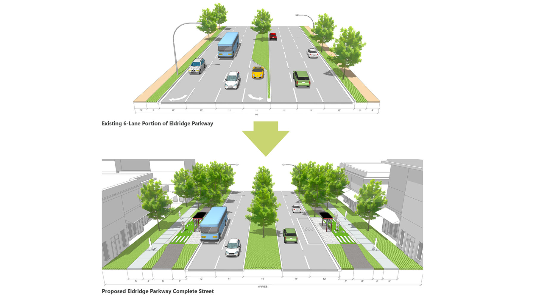
Central to the plan were strategies to establish a more pedestrian, bicycle, and transit supportive mobility network
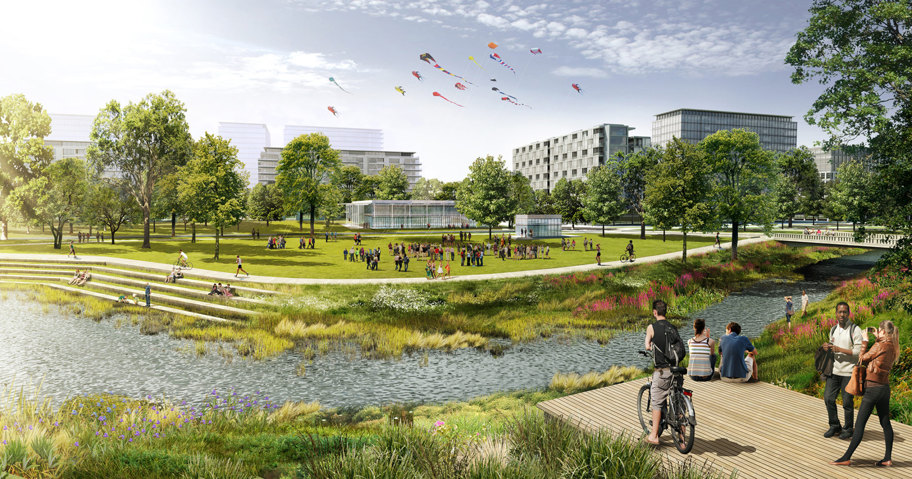
The plan aims to build great public spaces within an integrated park network, including a diverse range of open spaces from pocket parks to regional parks
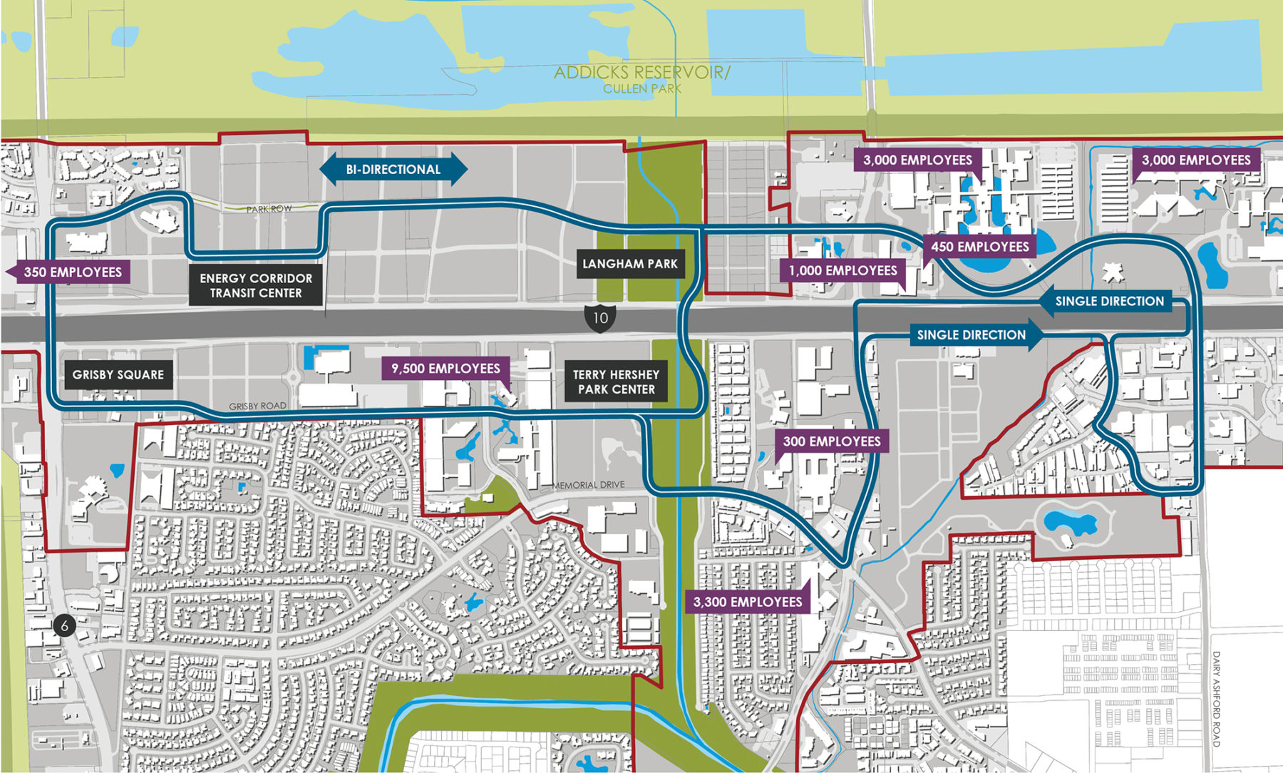
Circulation routes throughout the district allow for easy access to all amenities
Central to the plan were strategies to establish a more pedestrian, bicycle, and transit supportive mobility network
The plan aims to build great public spaces within an integrated park network, including a diverse range of open spaces from pocket parks to regional parks
Circulation routes throughout the district allow for easy access to all amenities
Master plan strategies to address placemaking, connectivity, and livability are designed to raise underlying market values and stimulate higher quality and more diversified land uses for employers, employees, residents, and visitors seeking a distinctive urban environment with the convenience of transit.
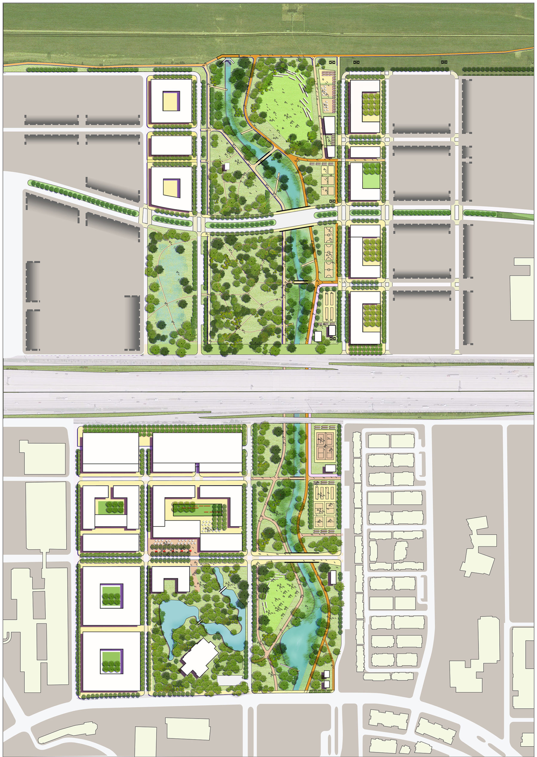
Integration of greenspace and commercial buildings create destination environment
The planning process engaged a broad spectrum of community stakeholders, including district leadership, property and business owners, neighborhood associations, the City of Houston, Harris County, METRO, and the US Army Corps of Engineers. Sasaki Associates collaborated with Toole Design Group and The Office of James Burnett to develop the master plan, which was adopted in May 2015.
Click here to view the final report.
For more information contact Fred Merrill.