Lulu Island Neighborhood 3
Abu Dhabi, United Arab Emirates
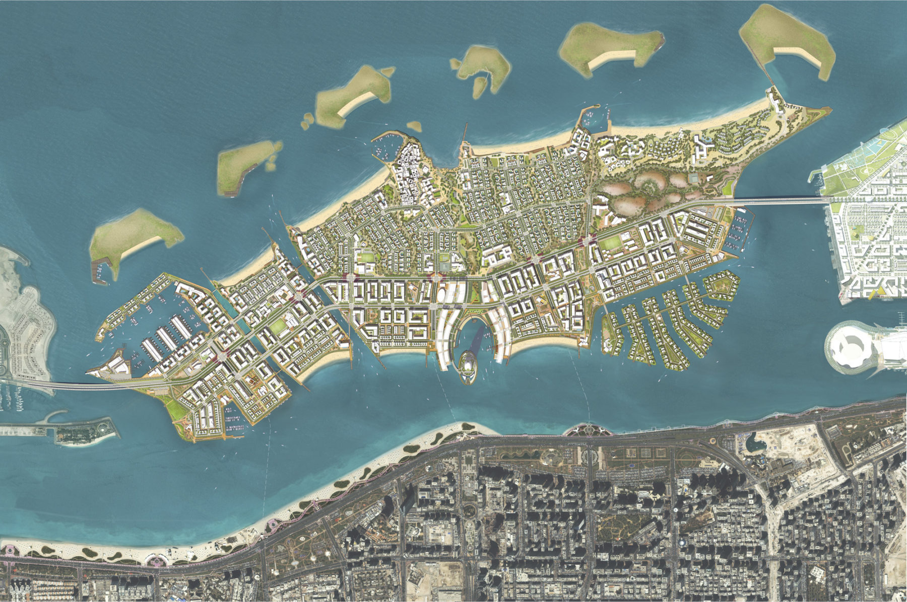
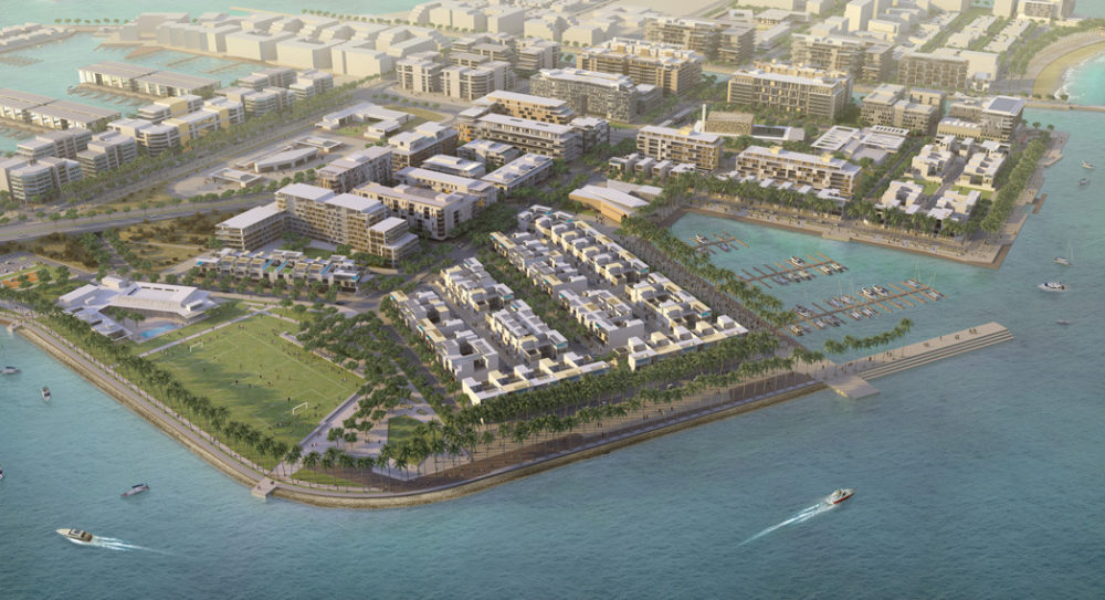
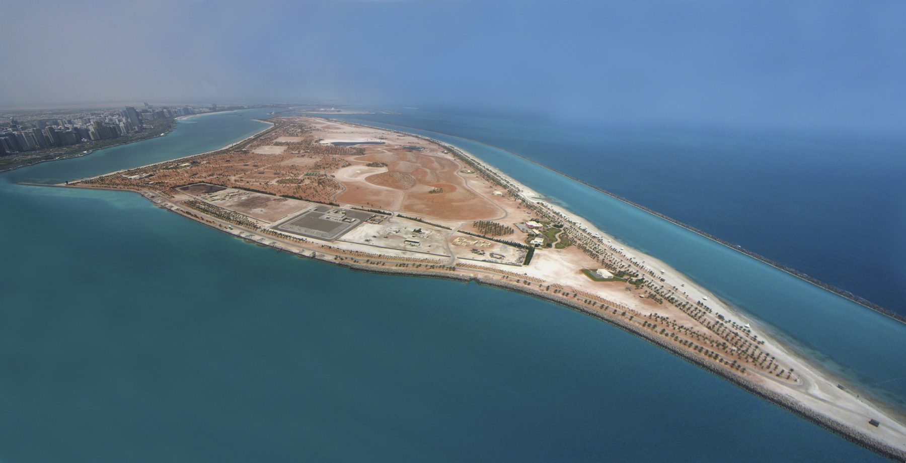
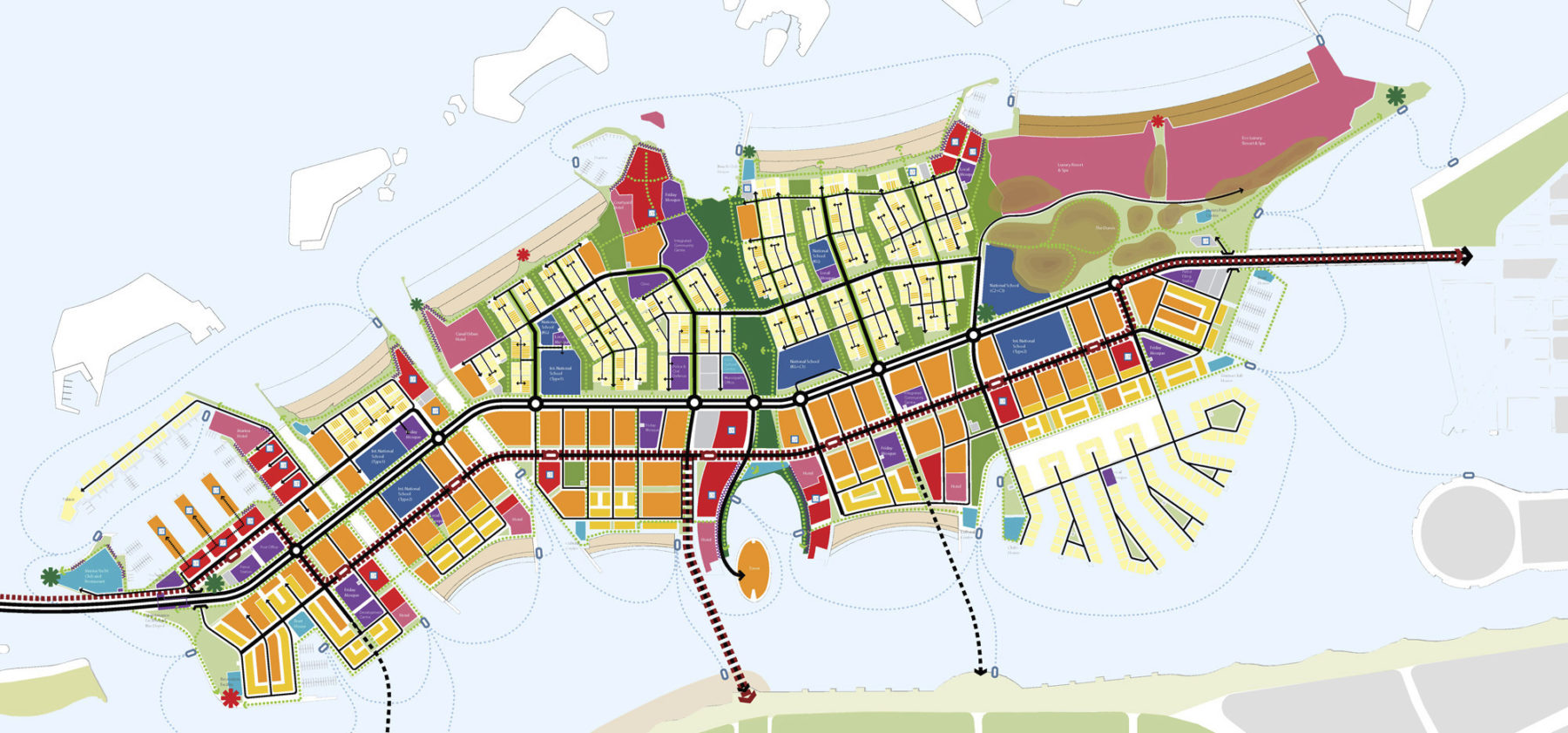
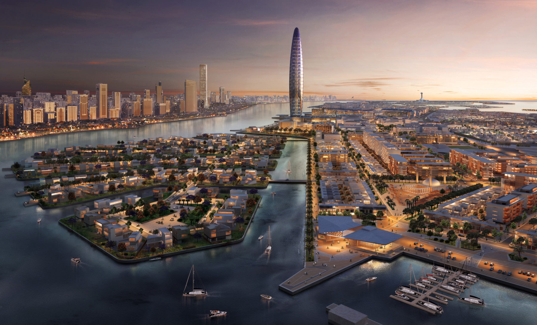
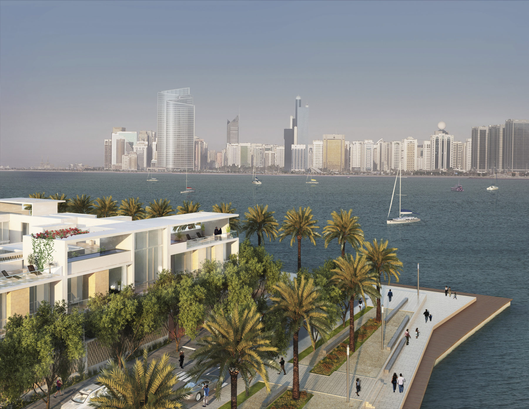
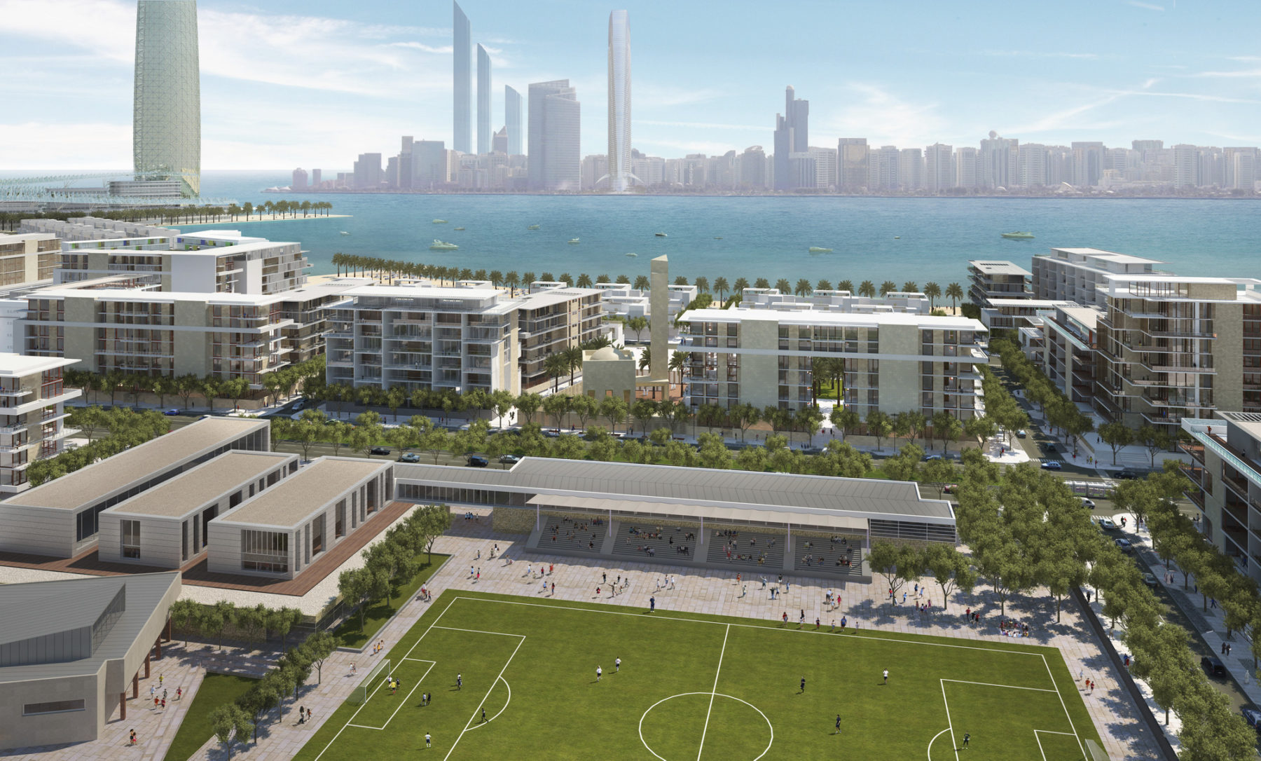
Lulu Island is a 469 hectare man-made island constructed of reclaimed sand. The site was envisioned as a keystone of Abu Dhabi’s growth by the late Sheikh Zayed bin Sultan Al Nahyan. Sasaki’s master plan fulfills that vision, delineating a low-rise, open island with world-class resorts and meeting facilities as well as a mix of residential, commercial, and office development. The island is considered a shared resource—part of the wealth of the entire nation—and is designed to be open and inviting to all. The plan features a robust sustainability management strategy to ensure the environmental, economic, and social sustainability of the island for the next 20 years, and beyond. Lulu Island is positioned to become the most significant residential mixed-use development in the ongoing evolution of Abu Dhabi, if not the entire UAE.
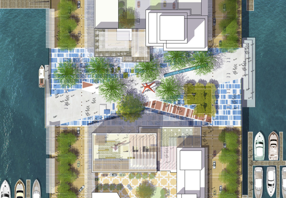
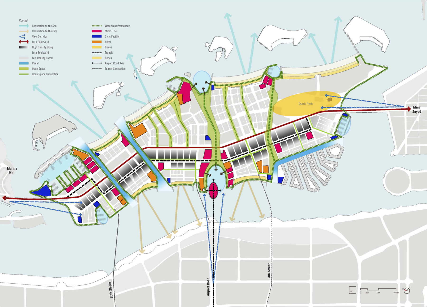
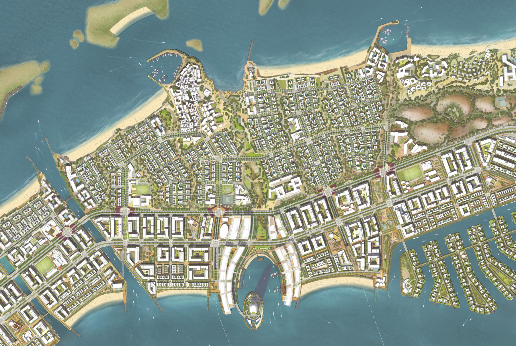
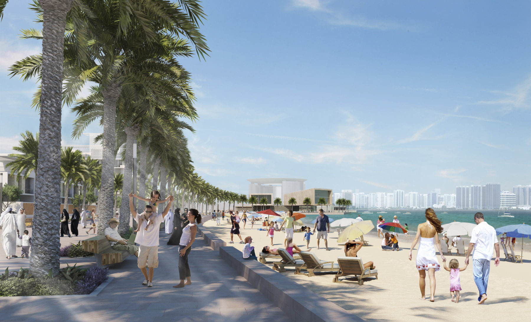
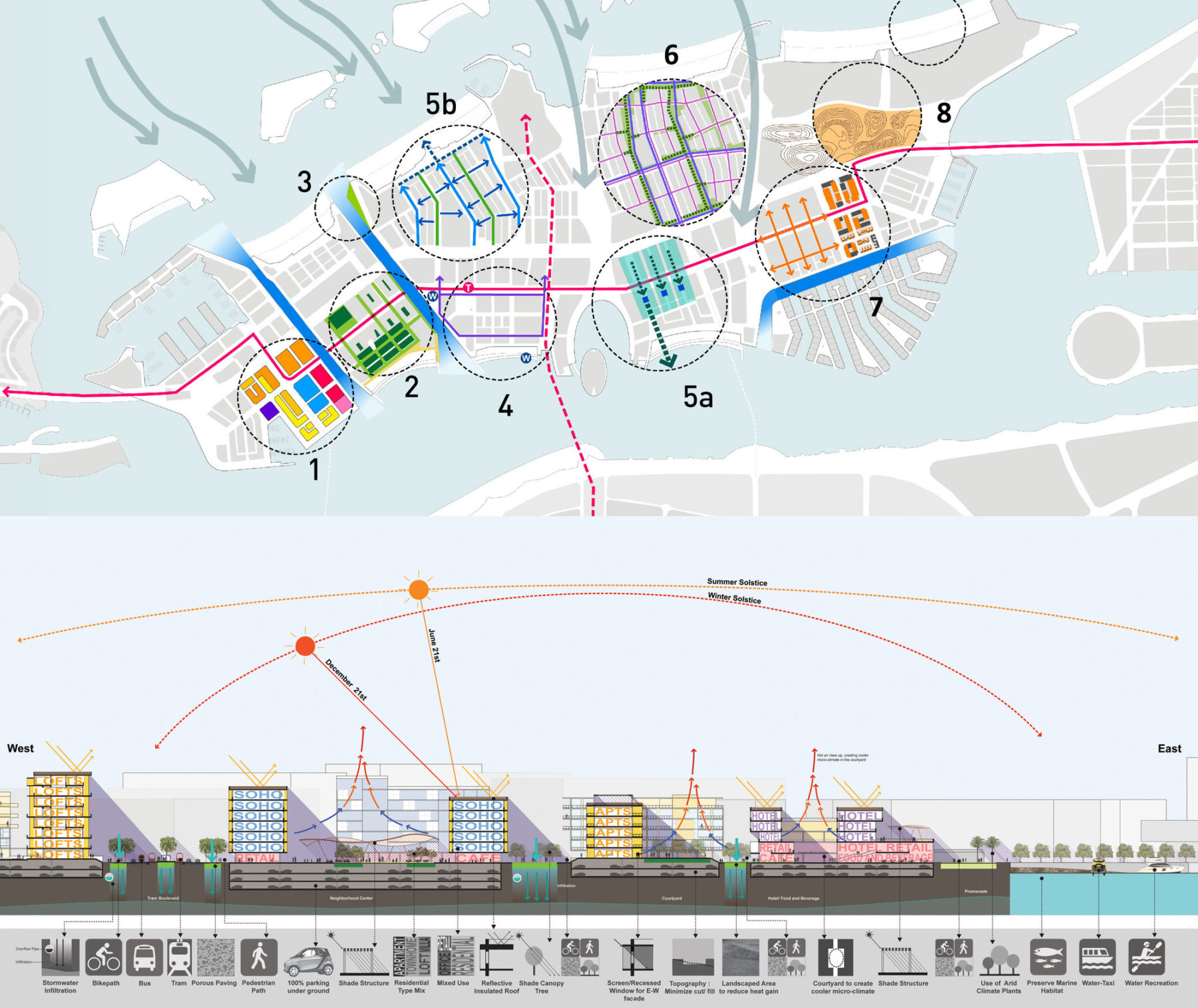
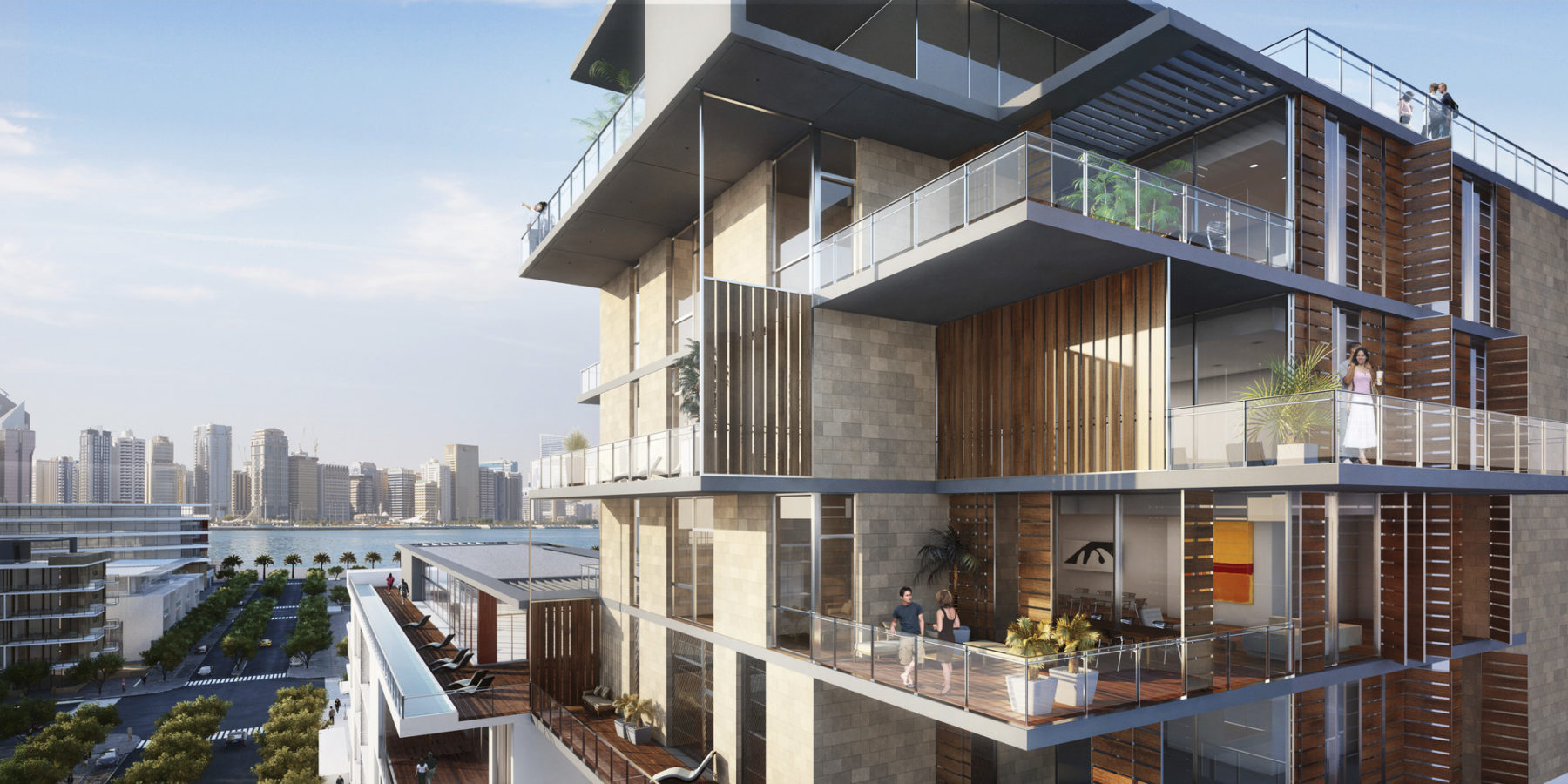
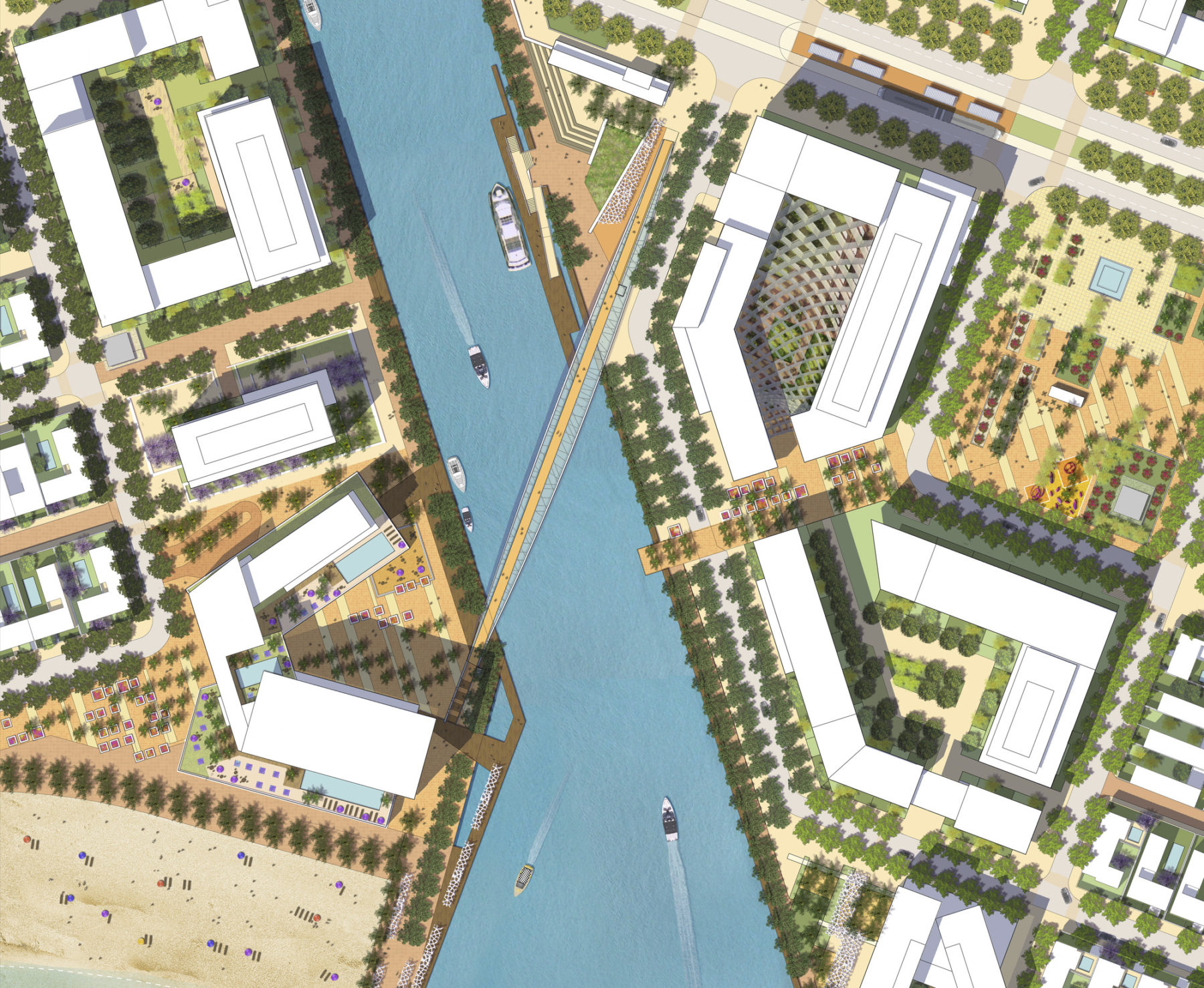
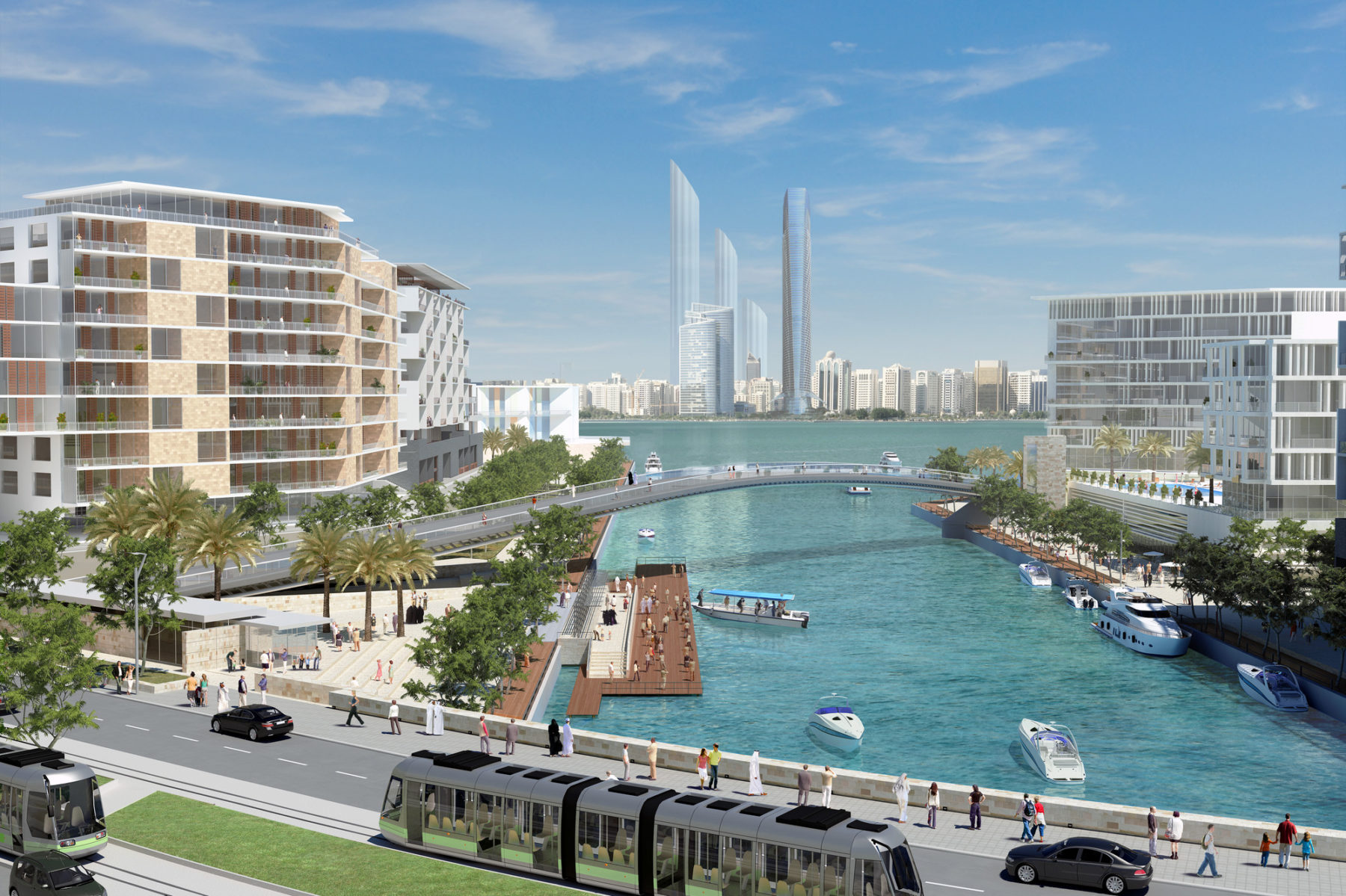
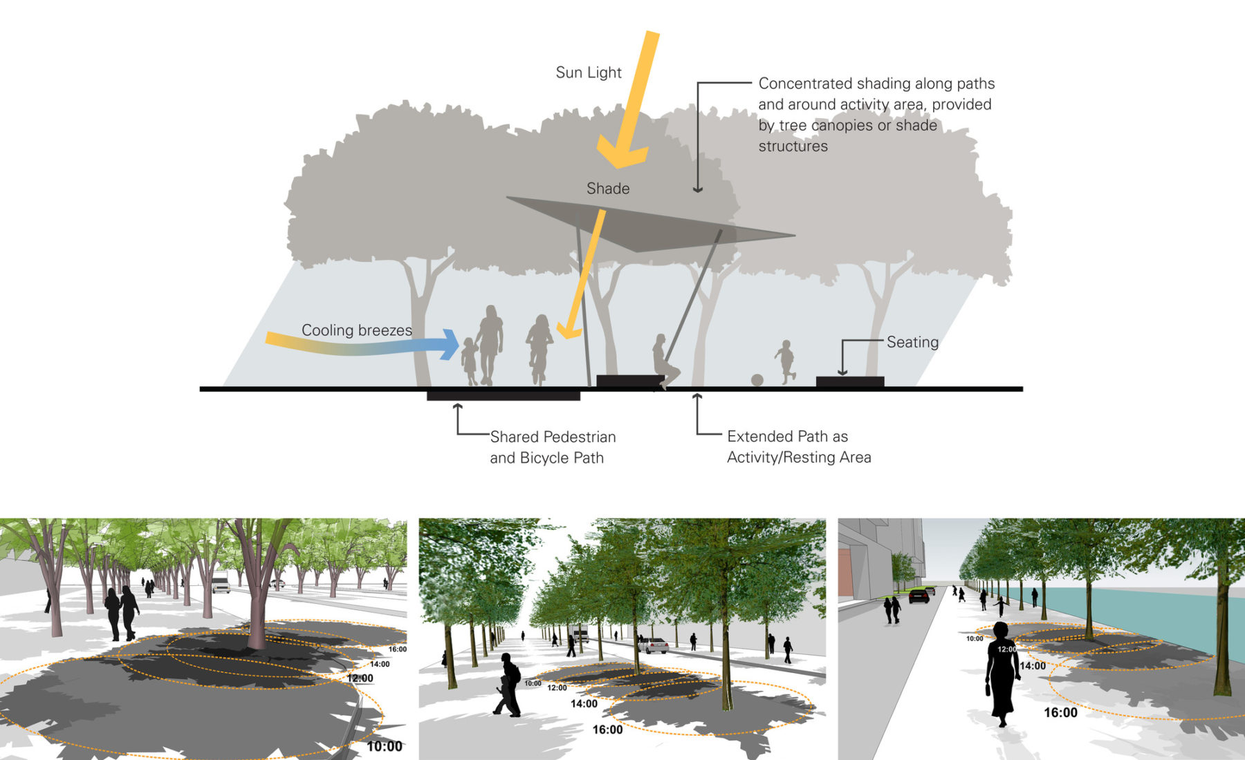
The diverse districts proposed in the Sasaki master plan are connected through a varied and sustainable public realm network that is climate appropriate. All residential areas are located within a five minute walk of a waterfront, canal, or pleasant public park. Since Lulu Island is situated in the waters of the Arabian Gulf and only 500 meters off the coast of Abu Dhabi, the public realm is organized around several linear green corridors that allow views to and through the new development, stretching from the cityside (facing Abu Dhabi) to the gulfside (facing the Arabian Gulf). This strategic move maintains critical views Abu Dhabi’s identity as a waterfront city. This aspect of the plan acknowledges the island’s pivotal position between the land and the Gulf, and its important role in Abu Dhabi’s ongoing development. Lulu Island is at once a destination in itself, an extension of the existing city, and a gateway to the ocean beyond.
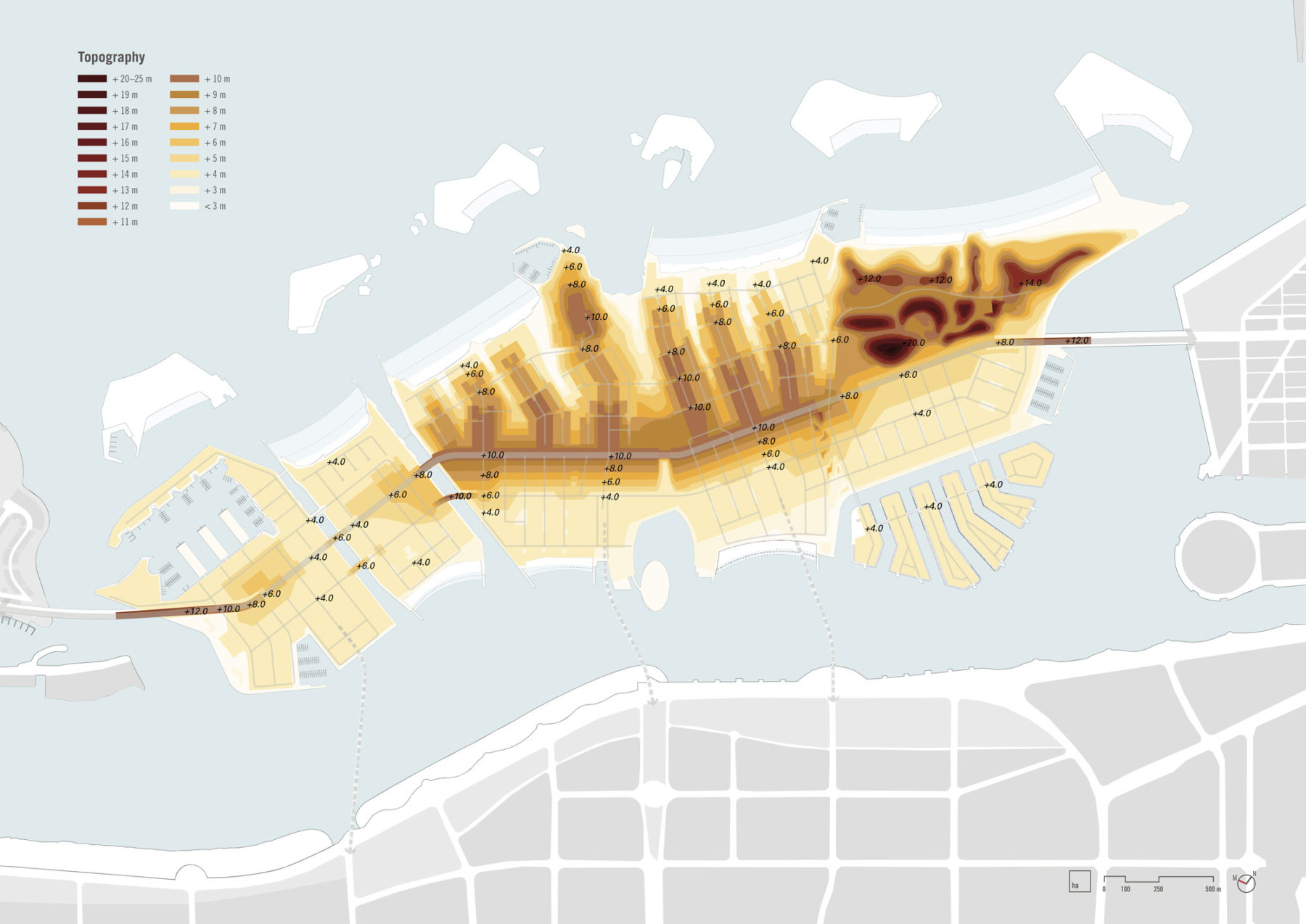
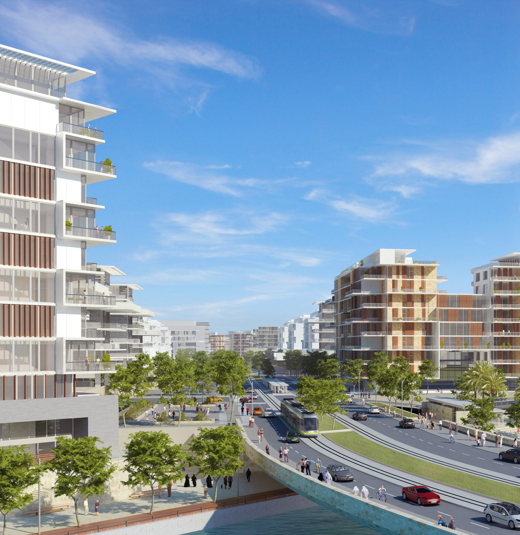
Sasaki instituted a Sustainability Appraisal Framework (SAF), which identifies clear overarching objectives supported by a series of key indicators and targets to measure each objective. The SAF is designed as a living document, which remains relevant throughout the lifecycle of Lulu Island. The master plan also reflects the Urban Planning Council of Abu Dhabi’s Estidama integrated design program, focusing on living systems, energy, water, and healthy materials. The majority of streets are oriented northwest to southeast to minimize heat gain and buildings are designed to mitigate harsh weather conditions and create microclimates and areas of shade and comfort. The plan identifies new canals to improve water flow and water quality and calibrates irrigation intensity to conserve water use. Sasaki also integrated pedestrian routes and bike networks into the street right of ways and the public space system.
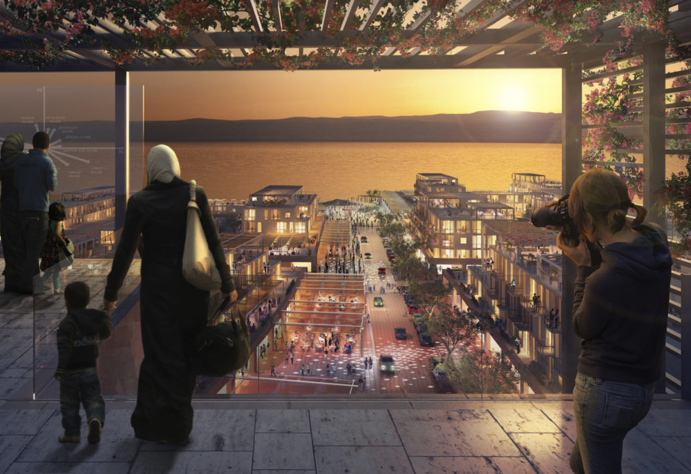
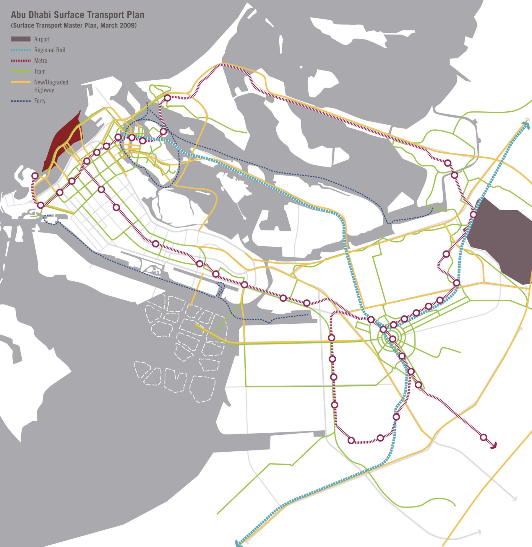
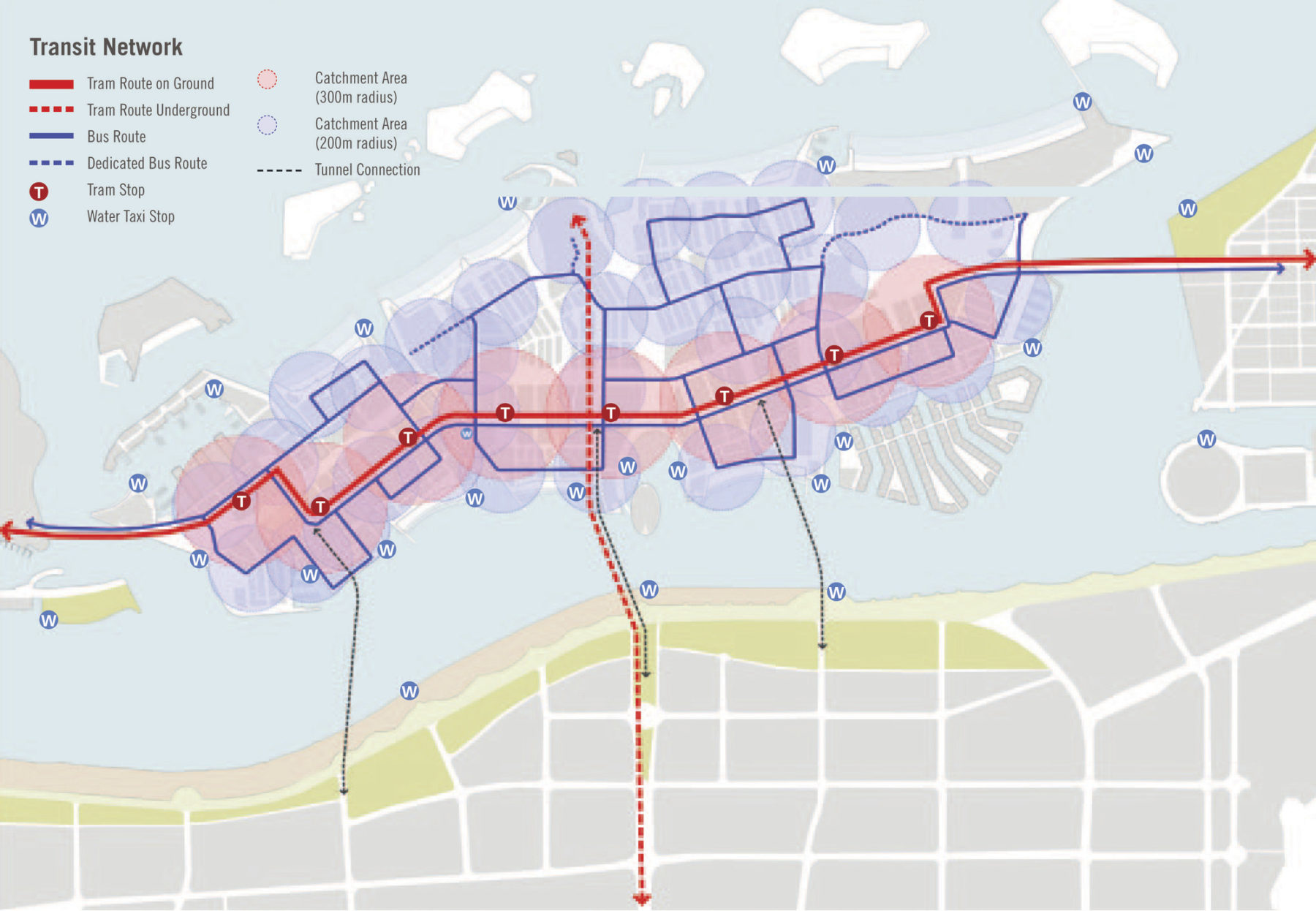
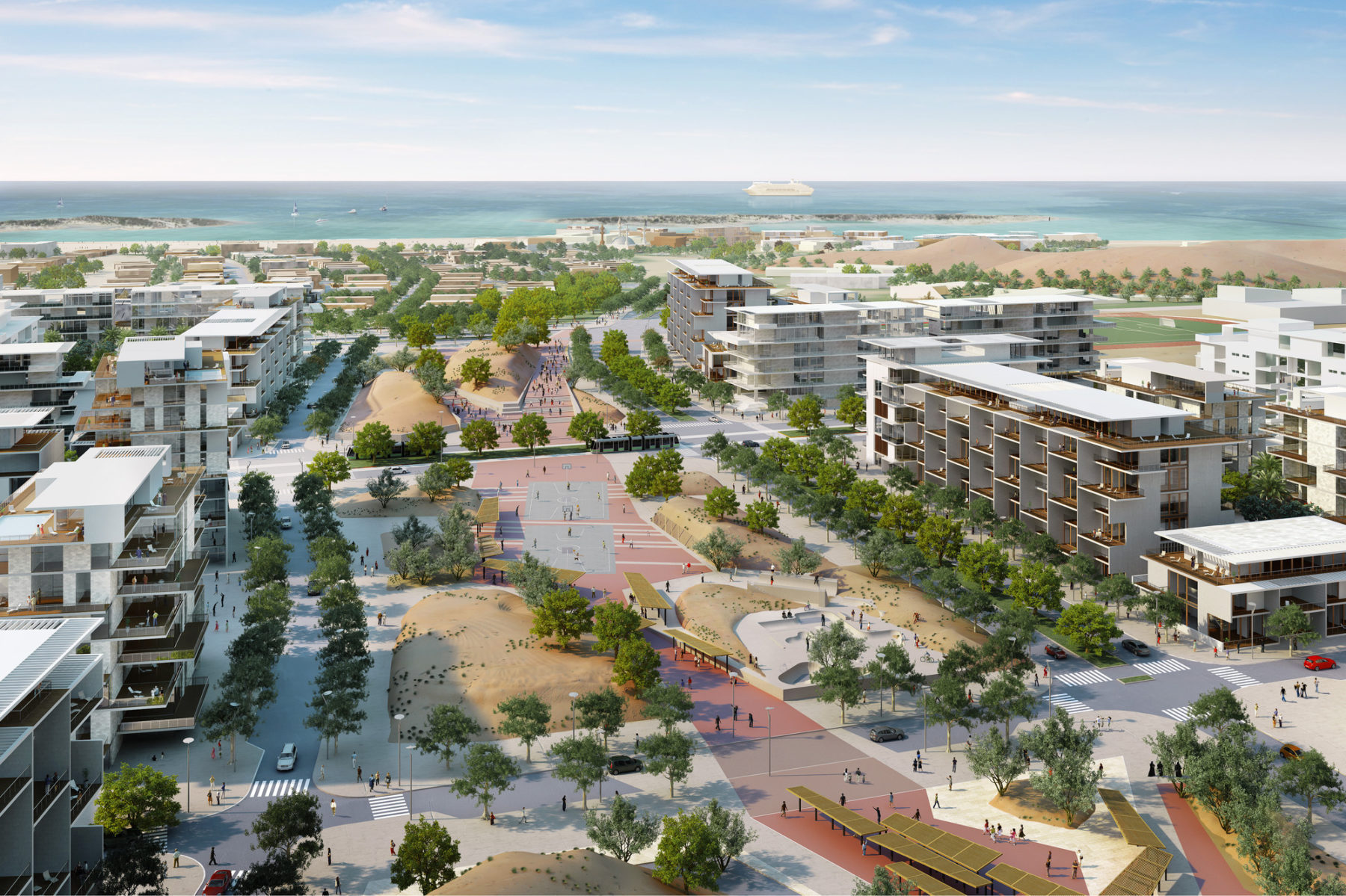
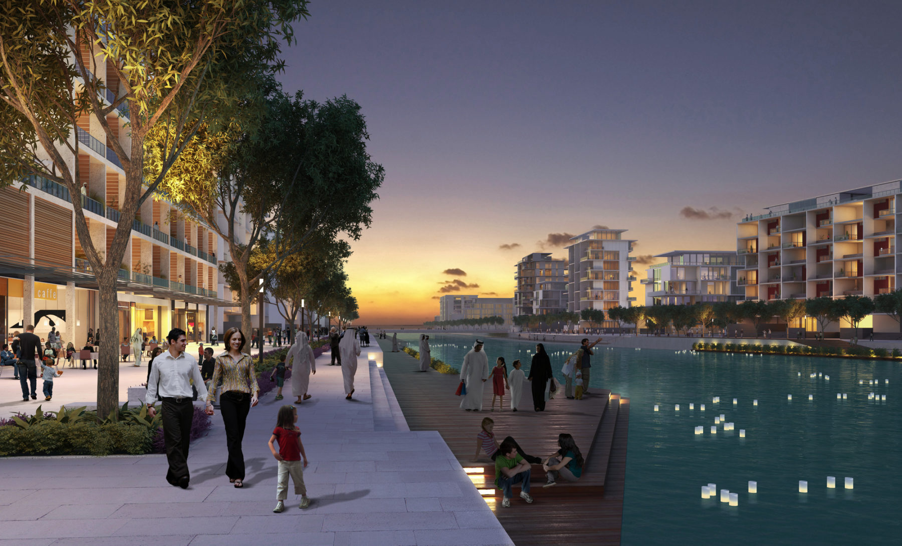
When completed, Lulu Island will sustain a permanent population of up to 30,000 people housed in 16,000 residential units distributed across a diverse array of vibrant, mixed-use neighborhoods. Complemented by a mix of commemorative, commercial, institutional, marina, and resort land uses, Lulu Island is pedestrian- and bike-friendly. The island features significant open spaces and waterfront access, including a Central Park, Dunes Park, and Marina Park, as well as numerous public beaches. Buildings cover an estimated 25% of the island, with the remaining land comprised of parks, walkable streets, waterways, and cultural landscapes. The island is served by a multitude of public transportation options, including light rail, buses, and water taxi.
For more information contact Dennis Pieprz.